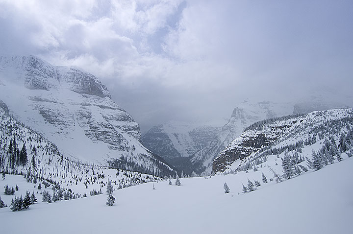
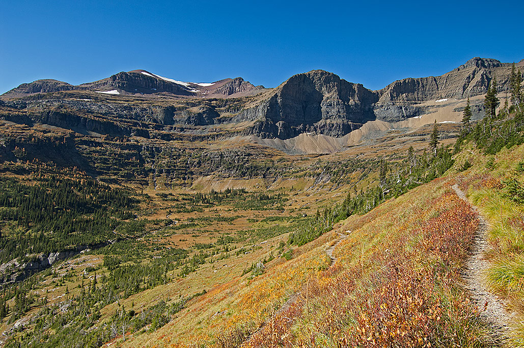
During a seven-day winter trip, the view of Bowman Canyon from Brown Pass bench in Glacier National Park.
During the winter of 2011, I completed the smallest of four trips into Glacier National Park’s backcountry, seven days. With my average daily travel at approximately six miles, I thought I had done well on my snowshoes and said as much on my website.
Less than a day later, I got an email with the subject being “Breaking the myth”. Accusing me of doing pathetic mileage, some fellow, his name is unimportant, informed me that on cross-country skis, he could do 20 miles per day. I think he may have missed the part about the ascent of a steep slope while I was carrying over 90 pounds.
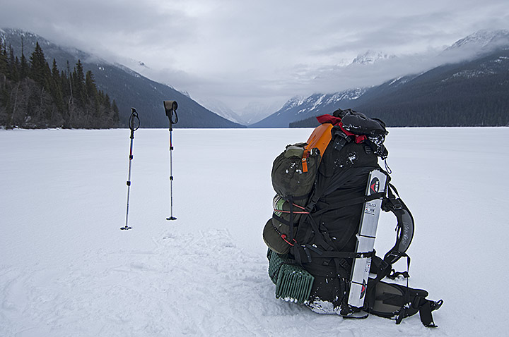
At the low end of Bowman Lake in Glacier National Park with a 90-pound backpack.
Going back a little further, in 1976, during the autumn, I watched a man pull a steelhead trout out of the Snake River in Washington. He was teaching his approximately eight-year-old son how to catch a steelhead using 3-pound test line. It took him 20 minutes to land the behemoth fish. As he was removing the hook, I made the comment that the joke was on him, that he had caught a rainbow trout.
On one knee, he stared up at me for a few moments then glanced at his son. I watched as their facial expressions quietly noted that there was a goddamned fool in their midst. I slunk away and a short time later did some research. I found out that among some other things, rainbow trout are landlocked steelhead who do not have the ability to live in the sea.
In 2011, I deleted the fool’s email without responding.
Today, I suspect there are more than a few who believe my half-mile to three miles per day winter travel on the Continental Divide is pathetic. My reads of the doomed Scott Antarctic Expedition of 104 years ago say otherwise.
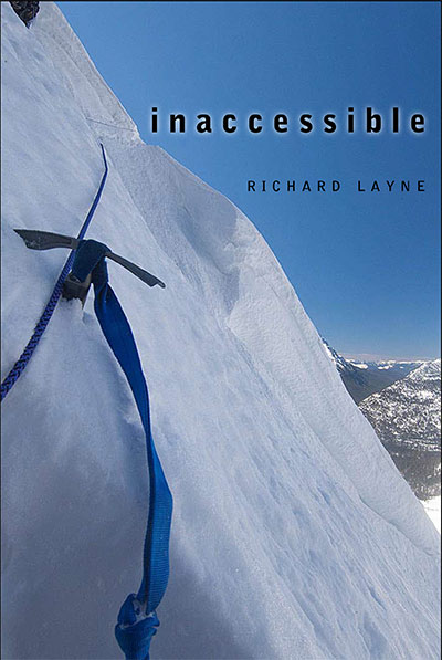
This is the two part interview on KTVH concerning the book Inaccessible. The book concerns 47 days in four trips during the winter in the backcountry of Glacier National Park. In addition the upcoming 90-day winter trip along the Continental Divide is discussed.
May 15, 2011, had turned into a warm and beautiful spring day, the kind that stokes the fires of spring fever. Lying on my back, I stared at the deep blue sky and billowing white clouds. After all the storms I had endured in the three trips since February, the clear weather was wonderful. Today was the sixth day of my fourth and final trip in the northwest region of Glacier National Park during the winter of 2010 to 2011. The mid-afternoon sunlight was bright, with the temperature easily above 50 degrees F. My face was sunburned, even though for at least half the day my direction of travel had put the sun at my back.
Memories of this slope were still fresh from a month earlier. It had been storming for three days, with two more of the same waiting in the wings. I had plowed through three feet of fresh powder on top of a snowpack that was already 200 percent above average. On that April day, I stood inside a scattering of trees on the southern edge of this 60-degree slope. Through the clouds, winds, and snowstorm, I inspected the steep mountainside from the safety of the trees. With clarity, I had seen two things. The first was the avalanche that would have started if I stepped onto the plunging, treeless slope. The second was the verification I needed that, with the right gear and conditions, it was reasonable to approach Hole in the Wall across this same slope. Intent on accomplishing that goal in better conditions, I backed off the slope and backtracked the 20 miles out of the park.
According to the National Park Service, no one had ever traversed this approach and accessed Hole in the Wall in winter conditions. They declared the route impassable. One employee dissented with the park service view, but only after he learned I would be using technical climbing gear.
Now I was 500 feet and four hours into the three-quarter-mile traverse. For every 100 feet of progress, there was 700 feet of traveling back and forth ferrying gear. At the end of each relay, I had dug a small flat into the snowpack for the two ferried loads. It was progress, but at a price.
Lying on the slope, as I began to relax and catch my breath, I realized how tired I was. I really should have taken a 10- or 15-minute break two hours earlier. I would have done so, except there had been no safe spot to rest on the steep slope. Shortly after I began the traverse, chunks of snow, ice, rocks, and even some mud started to fall intermittently off the cliffs that towered above the naked slope, compliments of the rapidly warming sunlight. It had only been in the last 100 feet that I had entered an area relatively safe from the falling bombs.
I reflected on how quickly my thinking could change. Just minutes earlier, I had planned to continue across the traverse for another couple hours before making camp. Accomplishing that would have given me a total of 700 or 800 feet traveled for the day, about one-third of the total distance across the technical portion of the approach. Now I decided that if I ever stood up again I was going to dig out a large flat nearby and make camp. For the second time since March, I was in complete agreement with the park service about this mountainside. I looked beyond my left leg, buried to the knee in the snowpack, and stared longingly at the rope nine feet away and out of reach. If only I had clipped into the rope, I would not now be lying upside down on a near-vertical slope, left foot stuck in the once-hidden hole that had felled me in the first place.
As near as I could tell, that hole was the only reason I had not shot down the slope 300 feet and over the cliff to my death. I expected the hole to lose its grip on my leg at any moment. Still resting but getting ready to move, I decided that if I survived this, come tomorrow I would pack my gear and go home. The decision sounded suspiciously like the scoundrel’s bargaining prayer, “God, if you get me out of this one…I will never do this again.”
It was a lesson well learned. Some 68 hours later, still on the approach, my next fall was much worse, except this time I was clipped to the rope.
An Introduction to the Park
My winter trips of 2011 had their beginnings in December 2005, when I was in the process of planning a winter route to cross Glacier National Park. One crisp December morning I approached a neighbor, who was a regular backcountry visitor of the park. Since I had never been in Glacier, I thought I would talk to him about a possible route. His first recommendation was a strong statement to stay out during the winter. Seeing that I intended to go anyway, he soon pointed a finger at 7,100-foot Ahern Pass.
Later, in my office, I found the pass on the topographic map software on my computer. I also spotted a much tamer looking Stoney Indian Pass that topped out at 6,908 feet several miles north of Ahern. I immediately went against my neighbor’s second recommendation and pointed myself toward Stoney. During the ensuing two months, I continued to prep for the trips, which included studying the maps. It was during that time that I spotted Hole in the Wall several miles west of Stoney Indian Pass. The name was immediately captivating and odd, like something from a bad B Western movie. More intriguing were the contour lines on the topographic map showing one helluva bowl in treeless avalanche terrain, with the eastern trail into it traversing a wall 2,000 feet above the canyon floor.
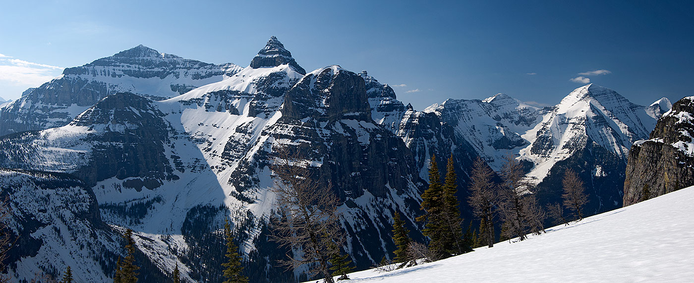
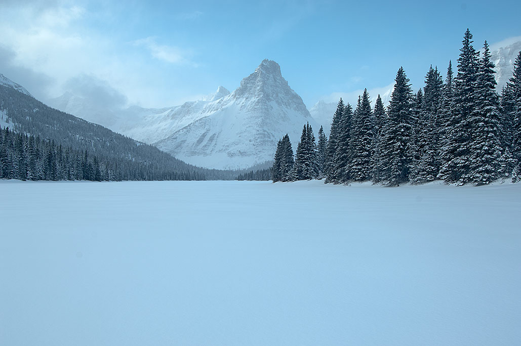
Glenns Lake, Glacier National Park
In February 2006, during my second trip into the Belly and Mokowanis River canyons, I almost froze to death. Too intimidated to continue the route, my next four trips were aimed at Ahern Pass. After successfully crossing Ahern’s lethal, exposed cliffs and frequent avalanches, I again approached my neighbor, this time inquiring about Hole in the Wall. He instantly pointed out that dynamite had been a major ingredient for building the trail in the near-cliff terrain. I left the conversation with the impression that I must never go near that location during the winter. I backed off, but never quite put that spot on the map out of my mind.
During the spring of 2009, I started working on the most difficult challenge I would ever face, one that said if I could complete it, then I should retire. It would involve snowshoeing 900 miles along the spine of the Rocky Mountains. While there were many dangerous bottlenecks along the entire journey—particularly within Glacier—by my reckoning, if only one location blocked me from successfully completing the trip it would be Hole in the Wall, just 30 miles from the finish line. For this reason, I knew at some point I would have to access the cirque prior to attempting the longer journey.
An Autumn Scouting Trip
In the latter days of August 2010, I decided to plan a second winter crossing of Glacier. The trip would begin at Belly River and end at Kintla Lake. Along this route, I would have to cross Stoney Indian, Brown, and Boulder passes. The real target, however, was Hole in the Wall. I wanted to cross the entire park, at the same time attempting to access this high-elevation cirque because I needed a genuine test of my endurance. And I harbored a strong desire to make it over Stoney Indian Pass. There were also some winter ghosts to exorcise from the near-fatal February 2006 trip in Belly and Mokowanis river canyons.
Unlike the first crossing four years earlier, this time I was determined to know what I was getting into before winter arrived. I had no doubt this route would be less forgiving than the one that had taken me from the Belly River on the east side to McDonald Creek on the west side of Glacier in 2006. I left during the last week of September. On the third day, I crossed 6,908-foot Stoney Indian Pass and arrived at the backcountry campground at Stoney Indian Lake west of the pass. My neighbor back in Helena had been right that this area was one big avalanche chute, though I noted it was less dangerous than Ahern Pass. While timing would be critical, travel through the area was doable. I moved on—so far, so good.
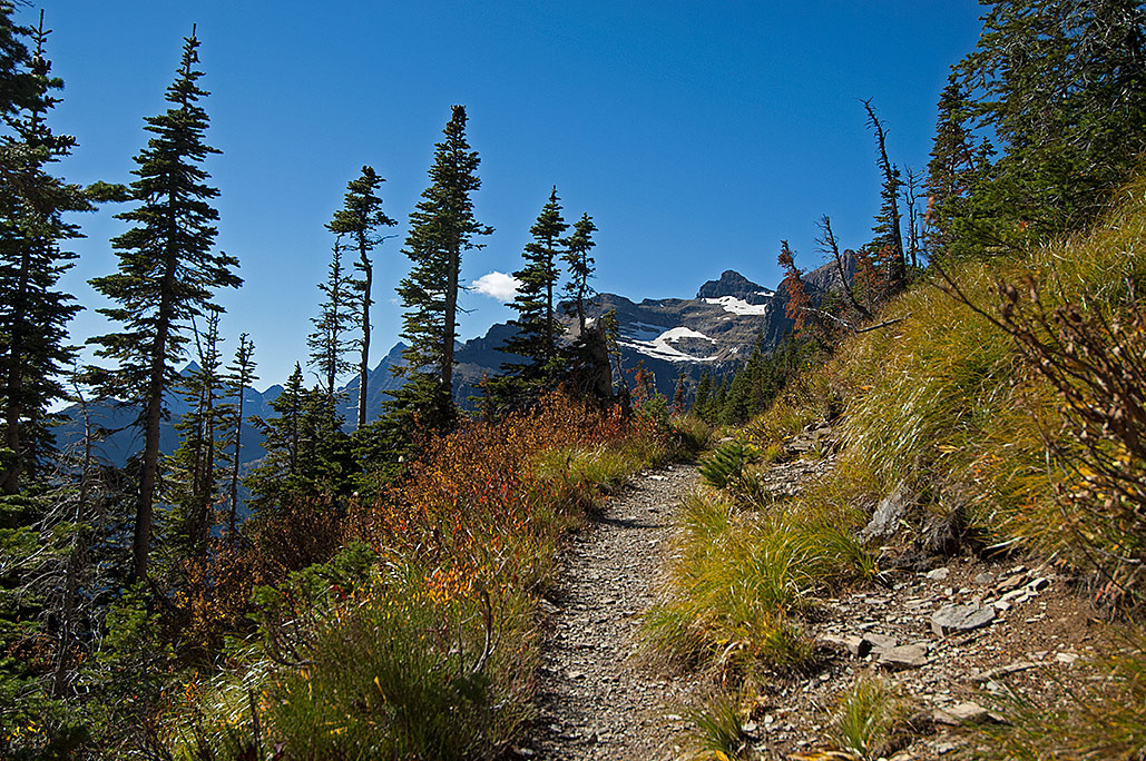
The route zigzagged north and west along upper Waterton Valley and Olson Creek, both broad enough to present minimal avalanche hazard. At the summit of 6,255-foot Brown Pass, the Boulder Pass Trail intersected with the Bowman Lake Trail. To the right, Boulder Pass Trail cut across the huge and almost treeless south face of 9,406-foot Chapman Peak. Below the trail and extending west from the pass, a mile-long bench of small rolling hills and stunted pine trees suggested that most of the area was repeatedly hammered by avalanches. Though still hidden around the curve on the trail one mile ahead, Hole in the Wall was less than one and three-quarter miles distant. Beyond that, the Boulder Pass Trail threaded cliffs to the pass itself just north of 8,528-foot Boulder Peak. Even this late in the season, its ragged wall, 4,000 feet above the canyon floor, held shimmering snow and ice fields reflecting the autumn sun. The scene was both breathtaking and discouraging.
My topographic map indicated that beyond the steep ridgeline that hid Hole in the Wall the terrain was far steeper than the area around the Brown Pass bench. Decades of using this type of map, whose contour lines were in 40-foot increments, was difficult to unlearn, which was precisely what the Glacier National Park maps required. The contour lines on the park map were in 80-foot increments, deceptive for someone accustomed to the more finely detailed maps. The 40-foot increments would have shown the steep angles of the slopes. By doubling the footage between the lines, the park map hid 70-foot cliffs and distorted my ability to discern the true angle of the slopes. I couldn’t read the terrain while sitting in my office back in Helena; I needed to see it firsthand. Before I left Brown Pass, as I compared the map to the view of Boulder Peak, my doubts grew about being able to access Hole in the Wall during winter. The first one-third mile of the bench was the most dangerous. In that area, Chapman Peak towered nearly 3,200 feet above the bench. As high and dangerous as the peaks were around Stoney Indian Pass, nothing over there compared to this. Just before I went around the curve of the ridgeline, I turned around and looked once more at Brown Pass and the bench. I could not know that the incoming winter’s powerful avalanches would alter that view for the next 50 years.
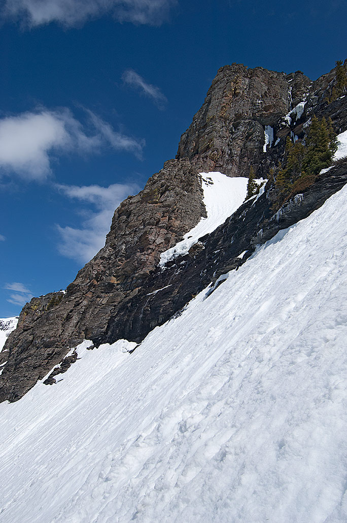
On the slope of Chapman Peak near the eastern approach to Hole in the Wall. Boulder Peak is in the background.
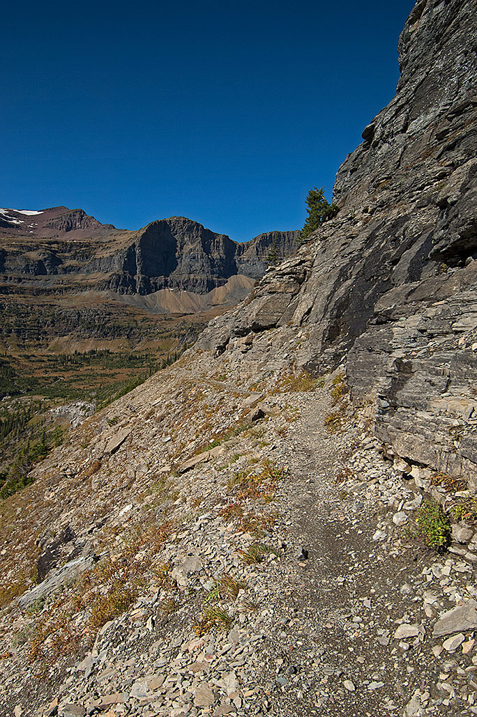
As I went around the bend, the angle of the slope was approximately 45 degrees. In spite of that, I was encouraged to see a scattering of 12- to 24-inch-thick trees. They would provide a safe launch point to begin the traverse. On the other side of the trees and bushes, my heart dropped, and all that fresh encouragement disappeared. The sedimentary rock and dirt face of the approach was a jumble of 60- to 80-degree angles with numerous cliffs, some hundreds of feet high. To have any hope of traversing the approach it was obvious that I would need more than an ice ax and crampons. How much more weight in climbing gear would I need to add to what would be an already heavy load?
On the approach to Hole in the Wall on September 29, 2010. The two trees on the cliff hold special significance during the winter attempt to access Hole in the Wall.
And how would I explain this to Carleen? She was a homegrown western Montanan and knew about Glacier’s shocking 100-foot deep snowdrifts and cliff-like mountainsides. The fatal mauling of backpackers by grizzly bears in 1967 had cured her of any desire to visit the park’s backcountry. Nor had Carleen’s fear of the park subsided with my reports from the trips I took in 2006. If anything, her disquiet increased, particularly after seeing the photographs. That same trepidation had her making phone calls to the park personnel when I went overdue by one day, something she had done only once when I went overdue in a wilderness. Now I needed to find a way to explain to her the ease of a route that had never been accomplished, which also happened to require technical gear if I was to have any chance to get across. While I could trivialize the details of the terrain, and neglect to show certain photographs, I would be unable to hide the equipment purchases.
I also got a first look at what the map was unable to show below the trail. If I fell, I would have 2,000 feet of tumbling drop space to contemplate where I had gone wrong. The beautiful autumn scenery was unable to hide a terrain that would show little forgiveness in a fall during the winter. I tried to shake the view by reminding myself that this was only a scouting trip.
Several minutes into the traverse, I came around a second and smaller ridgeline. The trail cut into a cliff and ravine 200 feet ahead, and then made a sharp left turn on the trail. Without a doubt, this elbow-like area was the most treacherous part of the approach. Up to here, as hazardous as it would be when covered in snow and ice, the approach seemed feasible. Yet even if the rest of the approach was passable, this nearly vertical ravine could be a death trap. The map showed that the indentation continued to nearly the top of the ridge a quarter mile away and 1,600 feet above me. The avalanches here would be powerful and frequent.
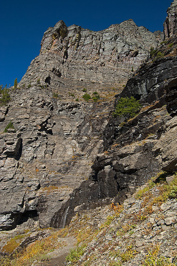
The “elbow” on the approach to Hole in the Wall.
I filled my water bottle from the small stream splashing onto the trail and continued up the trail. Several feet beyond the elbow the trail skirted a large overhang, forming a sizable cave 10 feet deep in the cliff face. If I could get this far, the cave might provide a safe haven for the night. The hollow in the cliff could spell the difference between living and dying. As I walked away, I wondered who I was fooling. To shelter in the cave meant that I would have to get there first.
Several minutes later and 1,000 feet beyond the elbow, I entered the sparsely treed, one-and-a-quarter-mile-wide bowl of Hole in the Wall. The scene was spectacular. Like a fortress wall, the peaks and scoured ridgelines loomed over the tiered cirque. High on the flank of 8,883-foot Mount Custer, snowfields fed meltwater into a crevice—the headwaters of Bowman Creek. The rivulet collected other runoff and meandered across the base of the bowl before spilling off the lip of the 1,600-foot cliff to the floor of Bowman Creek canyon far below. Perched so high above the canyon, the cirque felt cut off, orphaned. I recalled the somber tone of the park rangers when they said that, after some heavy snowpack years, the area remained inaccessible into August.
Hole in the Wall, Glacier National Park
I stopped at a fork in the trail. To the left, a dead-end spur trail dropped 300 feet into the main bowl to the backcountry campground a half mile away. On this scouting trip, I would follow the main trail to the right, staying high on the side of the bowl in a gradual ascent to Boulder Pass. As I continued to survey the cirque, I noticed the southwestern edge of the bowl held trees that were larger than saplings—a zone of relative safety from avalanches in this otherwise exposed terrain. I made a mental note: this is where I would ascend the 1,200 feet out of Hole in the Wall to Boulder Pass.
My attitude about the route had clearly changed. Just minutes ago back on Brown Pass, I was fairly convinced that the traverse to Hole in the Wall would be too dangerous in winter. Yet as soon as I entered the beautiful autumn bowl, I began to make a mental inventory of what equipment I would need to make the traverse. Over the next several months, I felt pangs of hesitation and even dread about the pending attempt. From that day in the bow forward, however, I never had a doubt that I would do all I could to return in the snowpack.
A La Niña Winter
Before I left on the scouting trip, the National Oceanic and Atmospheric Administration (NOAA) announced that another La Niña weather pattern would dominate through the winter. For Western Montana that normally meant more storms and moisture interspersed with brief but intense cold spells. In September, NOAA was yet unable to predict how strong or long the La Niña would be.
By the end of October, 20 inches of snow blanketed the ground at 6,400-foot Flattop Mountain 11 miles southeast of Hole in the Wall. On December 1, the snowpack had grown to 49 inches. Though somewhat alarmed, I knew the weather could change. Many times I had seen winter start strong and then ease off after December 1. Later that month, NOAA declared that the La Niña event was strengthening. The winter storms continued unabated through December and January.
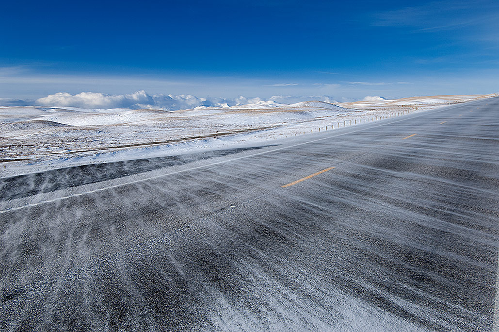
On December 11, I headed for the park with a 12-day supply of food and fuel and a plan to be gone for nine days on the route to Stoney Indian Pass. As I drove north, the thick and low-hanging clouds of the latest storm clung to the peaks along the Rocky Mountain Front while above me was winter’s fierce blue sky. There was a gusting crosswind, which dared me to be a sightseer as I drove.
December 11, 2010, on Highway 287, south of Augusta, Montana, a crosswind demanded I pay attention to my driving.
Being the weekend, there was no one at Glacier’s Hudson Bay Ranger Station in St. Mary on the east side of the park. A few days earlier, I had called for a permit, which was supposed to be in the permit box located next to the main office door. The box was empty. Although I had been vague with the park employee about my timing, I blamed the park service anyway. With grinding teeth, I continued north past Babb and then on the Chief Mountain Highway. Alone inside the van, I threatened aloud to head into the backcountry without the permit. I knew however, I would eventually go to Apgar on the west side of Glacier and get one issued.
Before I headed west though, I wanted to check the condition of the snowpack at the winter trailhead for the Belly River canyon. At the closed gate, which was also the border between the Blackfeet Indian Reservation and the park, the snow was approximately three feet deep with at least one foot of fresh powder on top, perfect for having a damned miserable trip.
There was also something wrong with my nasal passage and throat. As I drove away from the gate I decided that rather than go to Apgar, I had better head the 240 miles back home. As it turned out, I had the beginnings of a nasty cold.
The storms kept coming and building the snowpack. With every storm, my worry inched upward as the already above-average snowpack grew. By mid January, I wondered if the trip had become an impossible venture. I briefly considered a postponement until the following year. Then I shrugged the thought off. There was more riding on this than a mere crossing.
With the snowpack continuing to pile up and no new information to alter my thinking, I kept coming back to the same ending: the possibility of abandoning Hole in the Wall when I arrived there from Belly River, except that meant I would be abandoning the real reason for the route. Without the cirque, the trip would be worthless.
Near the end of January, a small window opened beginning February 2 when there would be two days of travel before more weather set in. There would also be a five-day window before subzero temperatures arrived. That ought to be enough days to prepare my body for the intense cold. Carrying a load of over 90 pounds, I would be returning to Belly and Mokowanis river canyons, and if conditions permitted, Stoney Indian Pass.
Chapter 3: Old Man and the Winter
February 2: A Tough Beginning
I drove away from Helena in the dark, just after 4 A.M. with the temperature 11 degrees below zero. The forecast called for a mostly sunny day with a high of 33 F. in Belly River canyon. A high-pressure ridge accompanied by subzero temperatures had shoved the latest storm out a few days before, but not before it dropped another foot of snow. I was certain I would be pushing powder from the trailhead. Since part of the reason for this trip was mental and physical training, I was looking forward to the challenge the fresh powder would likely provide. I could only hope it wouldn’t prevent me from scouting the route over Stoney Indian Pass. While I knew the chances were slim, , I was also hoping the snowpack would soften today and then harden into a crust overnight. Wearing the large Atlas backcountry snowshoes, and given the heavy load I would be packing, a firm crust would allow me to travel 6 to 10 miles per day.
I had been driving north for 30 minutes, dictating notes into my audio recorder when the machine went dead, the result of two depleted lithium AAA batteries I had forgotten to replace. To compound the problem, the spare batteries were also dead, depleted during a trip in October. While there were alkaline spares inside the van, they would last only a short time in the cold. I also had five untouched lithium batteries stored in my more than 90-pound backpack, although three were spares reserved for the head lantern. Another forgotten item was the latest avalanche report. That was less concerning, because by the time I arrived in avalanche terrain, the report would likely be obsolete.
In preparing for each trip, I would pack and repack the load. This trip had been no exception. I had added some items missed on the previous outing and removed a few, such as the weighty tripod and head. In the darkness of my warm vehicle, I now wondered what else I had forgotten.
I drove for an hour under a star-filled sky and was on the plains of the Rocky Mountain Front when the chinook crosswinds arrived. Within minutes the temperature increased by 30 degrees. I arrived at Hudson Bay Ranger Station on the east side of the park four hours after leaving Helena.
Although the park employees more loosely enforced the park’s permit system during the winter, they were still insistent about having dates and locations for each night I spent in the backcountry. I told the permit writer I would try to make it the 21 miles to Stoney Indian Pass in five days. I knew that such a distance would be impossible in unconsolidated powder snow. Even with a good crust to walk on, I wondered if I was strong enough to complete the 42-mile round-trip—and 2,800-foot elevation gain—in the nine days allotted.
If I did make it though, I would achieve my goal of seeing first-hand almost one-third of my planned route across Glacier in winter. The next step would be to inspect the western third of the route, scouting the approach to Hole in the Wall, entering from the west side of the park at Bowman Lake. If I succeeded as well on that western leg—reaching Brown’s Pass and a clear view of the cliffs and avalanche paths guarding the inner approach to Hole in the Wall—then I would finally have the knowledge necessary to attempt crossing Glacier National Park in winter conditions. To be possible though, these first two trips would each have to work with almost no hitches. Frankly, I had never had a series of trips without encountering problems. Yet I remained hopeful.
Winter weather was a critical factor in my decisions about when, where, and how far I would travel on any given trip into Glacier’s backcountry. Temperature extremes, high winds, and heavy snowfall all could conspire against my plans. As it turned out, I could have picked a better year than the La Niña winter of 2011 to attempt the crossing. A steady stream of storms battered the park, continually adding to the already above-average snowpack. More importantly, the lengthier a trip, the less I could count on predictable forecasts. The longer I ventured into the backcountry, the more exposed I would be to the fast-moving La Niña storms and potentially lethal weather. Nevertheless, based on my previous two winter trips in the area, I placed the first camp on the permit at Belly River Ranger Station, 9.4 miles from the trailhead. Accomplishing that, I would enter Mokowanis River canyon and try to get to the upper end of Glenns Lake, another 7.6 miles, by the second or third day. Beyond Glenns Lake was where I would encounter avalanche terrain as I attempted to summit Stoney Indian Pass four miles beyond the lake.
The winter trailhead for Belly River canyon, three miles south of the summer trailhead.
Just before 11 A.M., at the closed gate on Chief Mountain Highway two miles east of Chief Mountain, I hefted my backpack and started walking toward Chief Mountain Customs Station three miles ahead. The customs station marks the Canadian border and also the location of the summer trailhead for the Belly River Trail. Fittingly, for the start of such an audacious plan as mine, the Belly River trailhead is also one of two locations that through-hikers on the Continental Divide Trail use as the beginning or end of their route, the other being Goat Haunt on the southern end of Upper Waterton Lake. Just to reach the summer trailhead, I first had to cover three miles in the rolling hills separating Glacier’s jagged peaks from the eastern prairies. Like a winding white snake, the snow-covered road gently ascended and descended north through aspen and pine forest.
With approximately three feet of snowpack, which included at least one foot of fresh snow, the first day of my less-than-realistic clockwork plan immediately began to unravel. At each step, the 300-pound combined weight of my backpack and myself shoved the snowshoes through the powder, and then partially broke through the crust beneath. Within minutes, the warm sun in the open areas combined with plowing through the snow had me drenched in sweat. I soon shed the jacket and fleece vest. It took an hour to travel the three-quarter-mile, 100-foot descent from my van into the draw of Jule Creek.
The huge, heavy backpack was torturous. A few minutes after beginning the climb out of Jule Creek, I began to think that, in these conditions, 20 pounds less on my back would have been ample for a strength and endurance trip, and never mind trying to get to Stoney Indian Pass. To make things worse, the sciatic nerve that had plagued me for a year and a half on my left side had flared up. I had little doubt that the heavy load combined with my inconsistent exercise since October had plenty to do with the problem.
Nearly two hours and barely over a mile from where I started, I halted at Lee Creek Bridge, removed the backpack, and sat on it. An hour’s rest later and still tired, I left the backpack behind and packed a trail two miles through the powder, arriving at the summer trailhead at the customs station one hour later. During the return trip to my backpack, I decided to hold off using the trail until the next morning.
With thin clouds now covering the western sky, I set up camp a third of a mile beyond Lee Creek Bridge, 50 feet off the road and on the edge of a meadow. Disgusted, tired, in pain, and discouraged, the thought of abandoning the trip came strongly. In five and a half hours of travel, I was little more than a mile from the van. Was I too old and out of shape for such a trip?
Shortly after crawling into the tent, my anger emerged and I caustically recalled the part of the trip that concerned physical and mental training.
“If that’s what this trip is all about,” I howled, “then the first day has been one helluva good day.”
Too tired to cook and with no appetite, I nevertheless crammed down a cold supper. Regardless of how the food got into me, within a short time its effect was soothing and soon had me thinking more rationally.
Later I gave a more serious consideration of the effect my age had on the day’s travel. Three years earlier on a winter trip in the Selway-Bitterroot Wilderness, by the end of each day and into the following morning, I had felt this same weakness. Discouraged with the daily experience, I nevertheless groused at growing old gracefully, and completed the trip. Although I covered a distance of 150 miles and spent 40 days in the Selway-Bitterroot that winter, the experience left me indelibly marked by the signs of old age.
Now at the end of my first day back in Glacier National Park, fed and warm in my sleeping bag, I balked at the thought of quitting. With a packed trail through the powder to the trailhead, I told myself aloud that the next day would be easier, and gave friendly counsel that the first day was always the most difficult.
As if on cue, I was jolted back into the moment by severe leg cramps. I had let myself get dehydrated. Now each time I got rid of a cramp, I gulped down a couple mouthfuls of water. Sometime after midnight, a headache arrived as a final reminder to drink more water.
February 3: Belly River Canyon
The forecast for the night and following day called for breezy weather. That turned out to be understated. Through the night, the wind drifted snow into the trail I had built, filling much of it. The next morning, it took me an hour and forty minutes to arrive at the Chief Mountain Customs Station and Belly River trailhead. During that time, I decided that besides Stoney Indian Pass, even Cosley and Glenns lakes were out of reach. Getting to the Belly River Ranger Station in the canyon below would have to be enough. This also meant I would have to make an additional trip at a later date to get a look at Stoney Indian Pass. Disheartened, I refused to turn around and go home, I still held out for a possible improvement in snowpack conditions. Besides, slogging through the soft snow was certainly providing the strength and endurance training I was after.
I rested for 25 minutes before I stepped into the snowpack that covered the Belly River trail. The valley floor was less than two miles away and 760 feet below the parking lot at the trailhead. I immediately began to plow through powder in a forest that still had snow on the Douglas-fir and lodgepole pine tree branches. Less than an hour later, I emerged out of the thick forest of the upper portion of the canyon wall and into small clearings—and deeper snowdrifts. I dropped the backpack, and started packing a trail.
As the day wore on, the opaque clouds of that morning thickened in the west. Now able to see the Belly and Mokowanis river canyons, I watched the storm build. By 3 P.M., it had consumed everything behind 7,933-foot Pyramid Peak, which was only one mile west of the Belly River Ranger Station. Hidden inside the storm were Cosley and Glenns lakes. Behind Glenns Lake and 2,000 feet higher was Stoney Indian Pass. Already traveling in at least two feet of old snow with a foot of fresh powder on top, I wondered how much deeper the snowpack would be inside the Mokowanis River canyon, not to mention atop Stoney Indian Pass? Knowing the forecast and seeing what was happening six miles away further convinced me that the forecast might have fallen short.
The wind continued its relentless blowing; intermittent raindrops began to smack my face. If the temperature dropped, soaked gear that froze would be dangerous. In the meantime, the warmer temperature converted the powder into a wet, clingy, and heavy snowpack. Back to being discouraged, I again thought about turning back. I dropped the backpack for the second and final time that day where I would build the second camp. Before setting up camp, though, I finished packing a trail to the canyon floor.
This camp was 150 feet up the canyon wall inside a semi-open stand of aspen trees. My disgust at the location was worse than the previous night. On my first winter trip into Glacier five years earlier, I had camped 100 feet from this same spot. On that occasion, I had traveled five hours to arrive here from the vehicle at the gate on Chief Mountain Highway. Now, on this day, I traveled for six hours and covered only three miles. Later, inside the sleeping bag, I recalled that on that first trip in 2006 there had been so little snow the snowshoes went unused for the entire trip.
February 4: Belly River Canyon Floor
Morning arrived with no let up in the wind or warm temperatures. Half an hour after leaving camp, I entered a cluster of large cottonwood trees on the canyon floor four miles north of the Belly River Ranger Station at the foot of 9,762-foot Gable Mountain. This river valley at some points was half a mile wide and nearly level to just past the ranger station. Though I knew it was a stretch, I was hoping by the end of the day to be at Belly River Ranger Station.
The wind and spring-like temperatures created another day of wet snowpack to push through. I dropped the backpack twice and packed trail. During the first leg, the weather careened from sunshine, to rain, snow, and snow pellets, all in a nonstop wind. Oddly, yesterday’s storm on the peaks looked no closer, while east of me on the plains and sometimes over my head was a cloudless sky.
Belly River canyon on February 4, 2011
The barometric pressure continued to drop. My altimeter eventually showed an elevation 250 feet higher than the topographic map for the same location. With the inevitable storm coming, I thought I was ready. Snowfall I could live with, but I was less confident about my ability to survive in colder temperatures.
In spite of the storm buildup, I continued to hope there would be a crust to walk on the next day. For three days, I had either pushed through powder or slugged it out with wet snow, while much of the trail I packed was a foot deep trough.
On the second leg, returning to my backpack, I ran out of steam. As I passed a small stream near the former Threemile Campsite, I decided to retrieve my backpack and set up the night’s camp at the edge of a grove of aspen trees. With the creek flowing through a thick stand of Douglas-fir trees 100 feet away, tonight I would have water without having to melt snow.
At one and a half miles beyond the previous night’s camp and less than six and a half miles from my van back on the highway, the distance was disgraceful. Now, almost certain that even the Belly River Ranger Station was out of reach, I decided to press on one more day before I turned back.
Four months earlier, I had made a late autumn trip on this same trail. Two families, including two toddlers, had trekked in behind me. We spent the night at Gable Campground near the ranger station. They had needed part of a day to travel the six miles from the parking lot and summer trailhead. Now with the Gable Campground still three miles away, I gloomily reflected on that autumn day, and thought about how old and fat I was. If conditions remained unchanged by the next morning, I would be unable to get there in four days. Tired, I fell into a restless sleep at 6:30 P.M.
Glacier National Park personnel repeatedly stated that during the winter the high mountain cirque, Hole in the Wall was inaccessible. They were almost right.
This is the story and photos of four trips that almost took the author’s life twice.