In 2016, my wife and I agreed that if I failed to make 100 miles of forward progress through the winter of 2017, I would abandon the Continental Divide winter trip altogether. That failure indeed happened. However, because of the circumstances, I was able to convince Carleen to let me have another year.
Here are those circumstances.
· The first part of December coming off a training trip, I fell and cracked some ribs, which stopped me in my tracks for the next eight weeks. Even then, I knew taking the trip would be untenable if not outright impossible.
· Near the end of January, I caught a virus that cut me down for nearly 3 weeks. More loss of physical conditioning.
· I agreed to stay put until the end of February. With two ailing dogs, one within days or weeks from the end of his life, Carleen was going to be gone for most of February. The dog did pass the middle of that month.
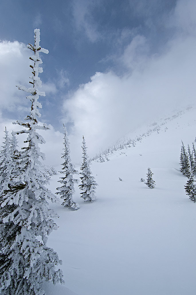
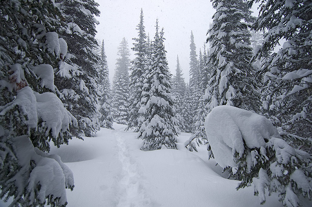
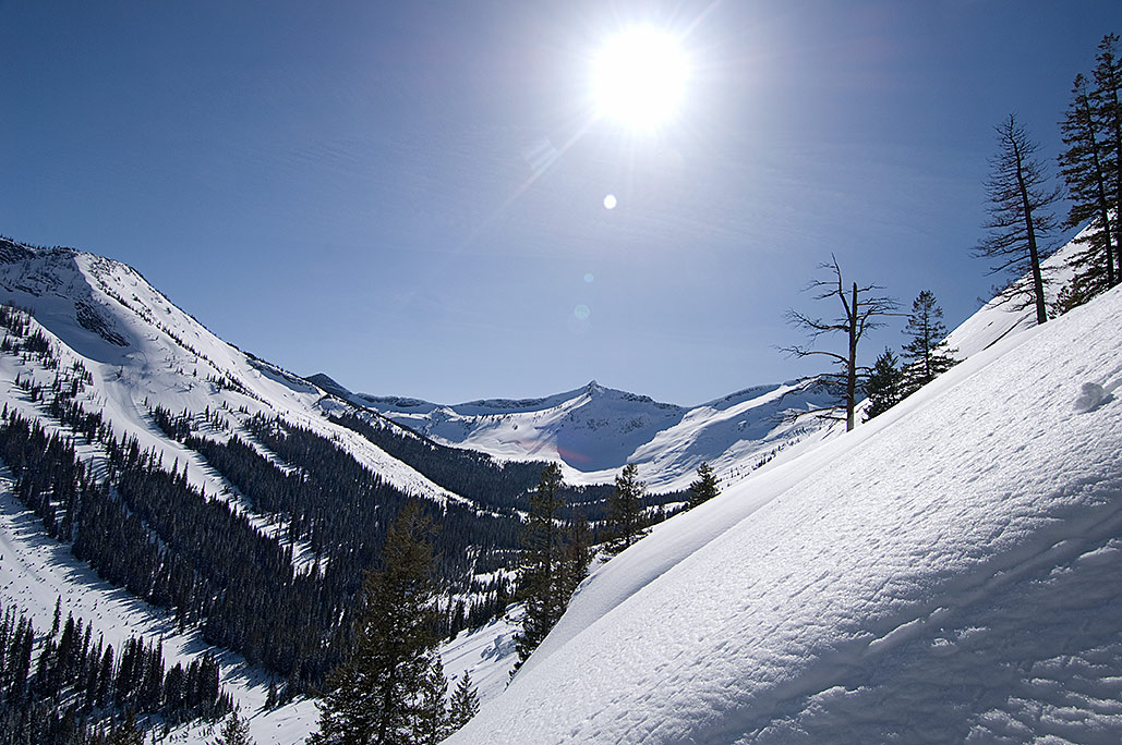
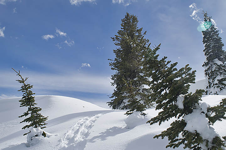
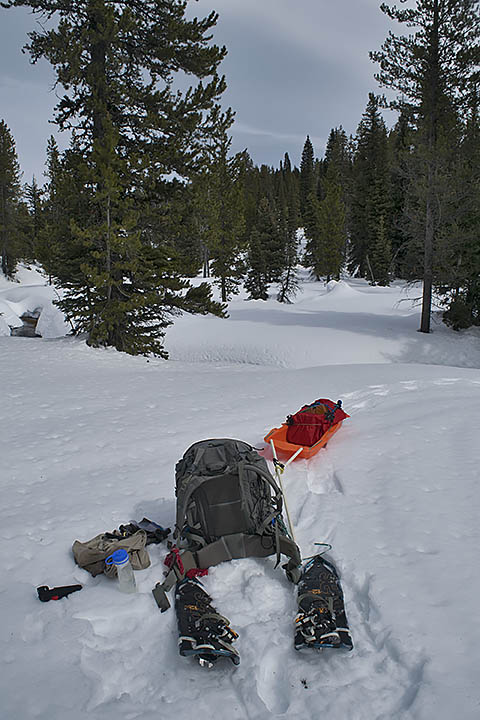
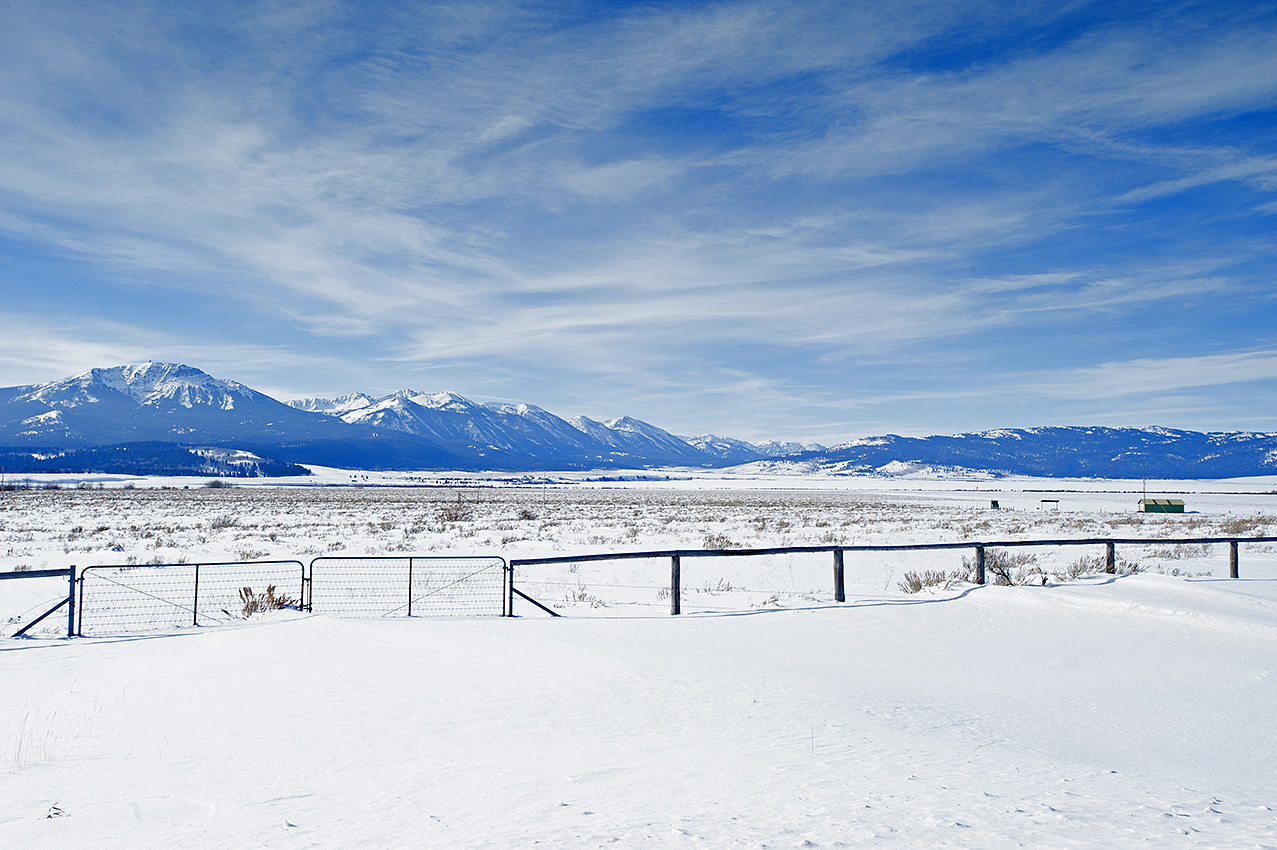
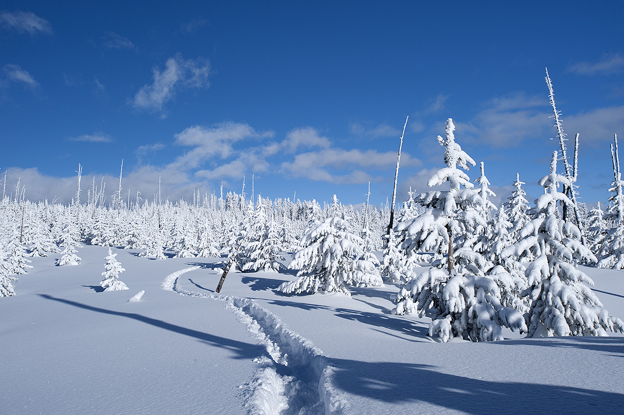
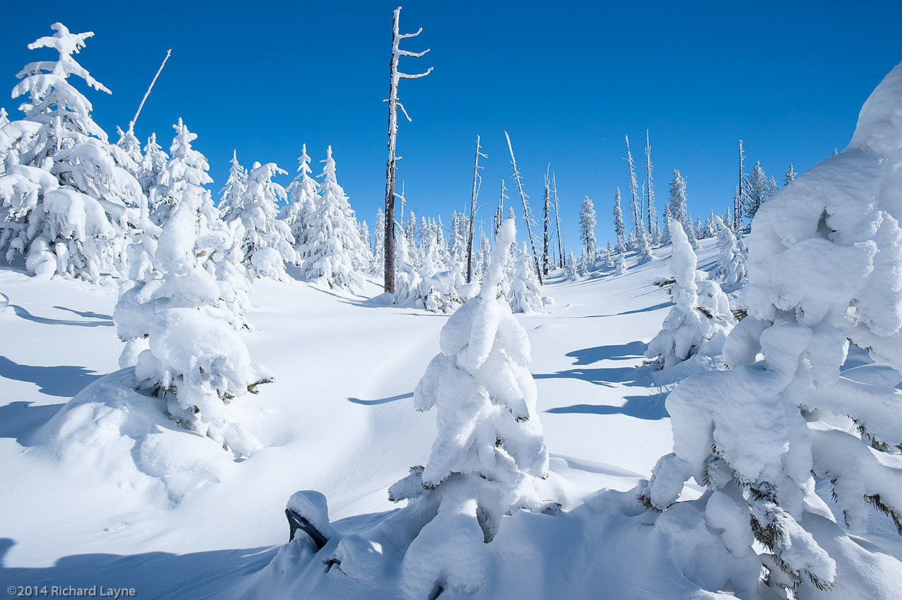
Snowshoes, backpack, and an expedition sled are used to travel on an eight-foot deep snowpack. Location was on a tributary of Odell Creek in the Centennial Mountains.
Now beyond the point where I could physically prepare for the trip, I nevertheless prepared to go anyway. My hope was that pulling a sled would make the trip possible. Without a training trip, something that is a necessity, I left a few days after March 1. It was a failure. I left again one week later. I exited this final trip after 12 days. I claimed that a mushy snowpack combined with the stolen resupplies stopped me. While those reasons were true, they were also not the complete story. Being ill prepared physically carried at least one third of the reason I failed.
What did come out of the winter of 2017 was the realization that with some exceptions, I would be able to use the expedition sled throughout the future trips.
Besides the sled use during most of the upcoming winter trips, another change will be the incorporation of a large summer trip, which will include my wife going with me. The trip will be in the Selway-Bitterroot Wilderness of Idaho and Montana. The distance will be approximately 160 miles, which will take approximately one month to complete. More on this trip later.
In the meantime, the physical training has begun afresh. What I have to mention about that is nothing, considering all it would be is under my breath groaning and grumbling.
On the Continental Divide, Bald Peak (10,200 ft) in Henrys Lake Mountains, Idaho and MontanaBitterroot Range-Continental Divide in the Big Hole Valley
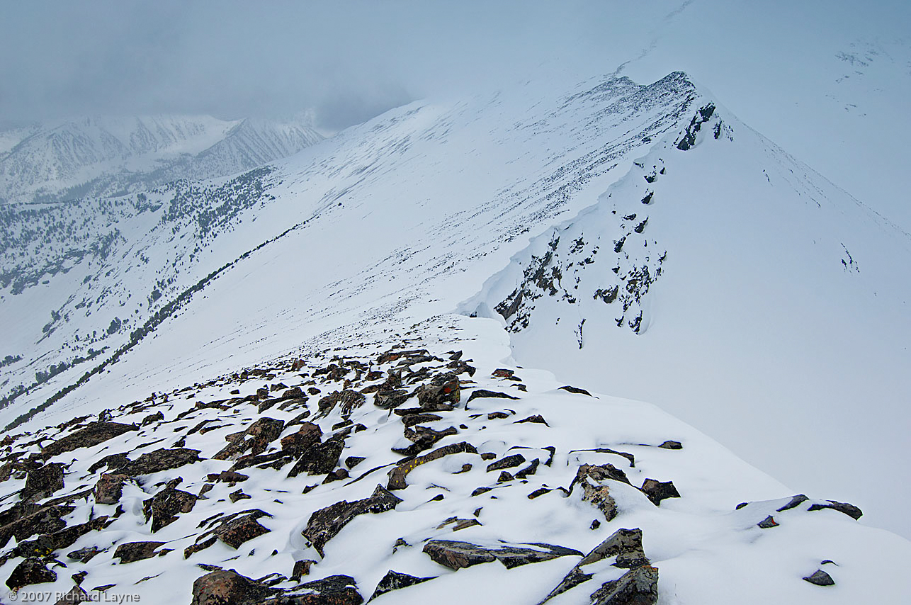
One of the main issues I am grappling with on the Continental Divide route, one that is only going to be behind me when I travel through the area, is the steep avalanche slopes in Henrys Lake Mountains (HLM), near West Yellowstone, Montana and Island Park, Idaho. One might expect that the Bitterroot Range, due to its much larger size of hundreds rather than 20 miles, would be far more vicious, which it would but for the powder prone snow of February when I will be in HLM. I will enter the Bitterroots in March and April, a time when the snowpack will likely have a crust to snowshoe on and a stable snowpack that is less prone to avalanche.
Traveling with a load of 90 and more pounds is no longer a viable alternative for this aging traveler.
Getting my load weight down is part of the key to a successful undertaking of HLM in February. However, if I remove too much food, fuel, or equipment, more than jeopardizing the trip with another failure, the question of survivability might arise. On the other hand, too much weight with backup supplies and equipment could make the already difficult ascents and descents impossible to get through in the deep powder of the higher elevations. In addition, the heavier the load the more prone I will be to injury during descents.
I love the challenge, to use what God has given me, the practiced brain, fit body, the incredible equipment, and afterwards should I fail, not blame God or anyone else. The challenge is to get it right before the trip begins, or close enough where I will only need to make small adjustments on the route to be successful.
In spite of my concern, the reality is that this area is only a sub-challenge, part of a series of confrontations that together make up the main event, over 300 miles of snowshoe travel, #WinterOnTheDivide.
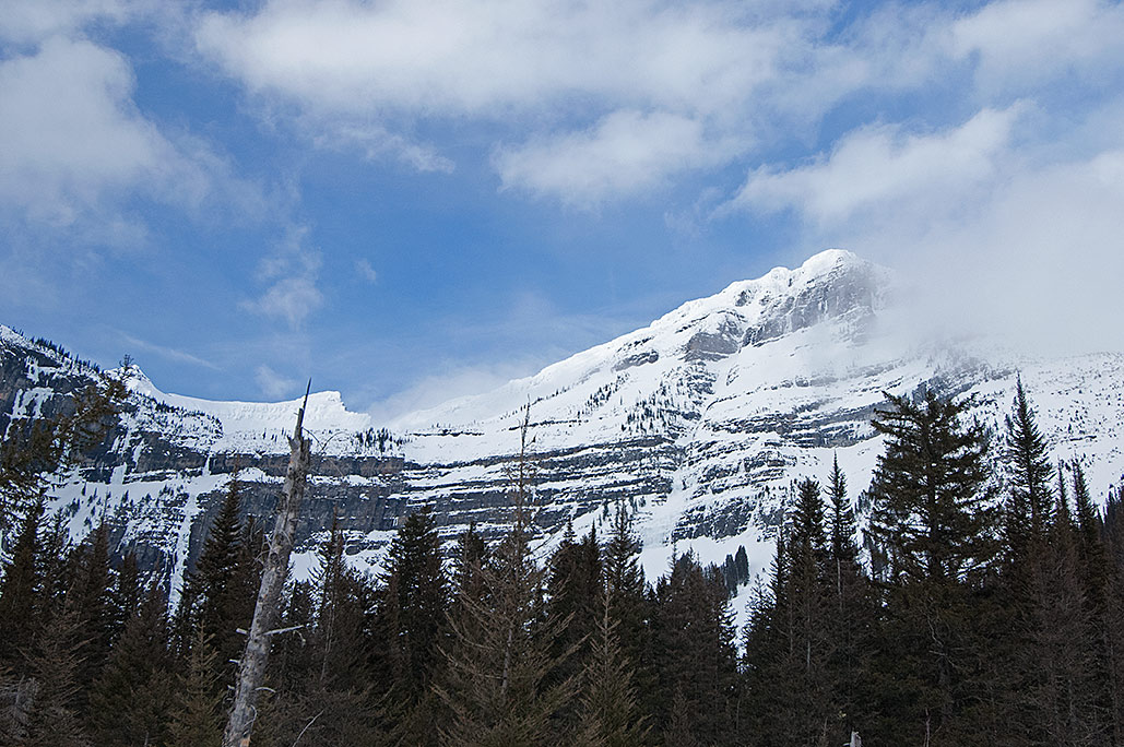
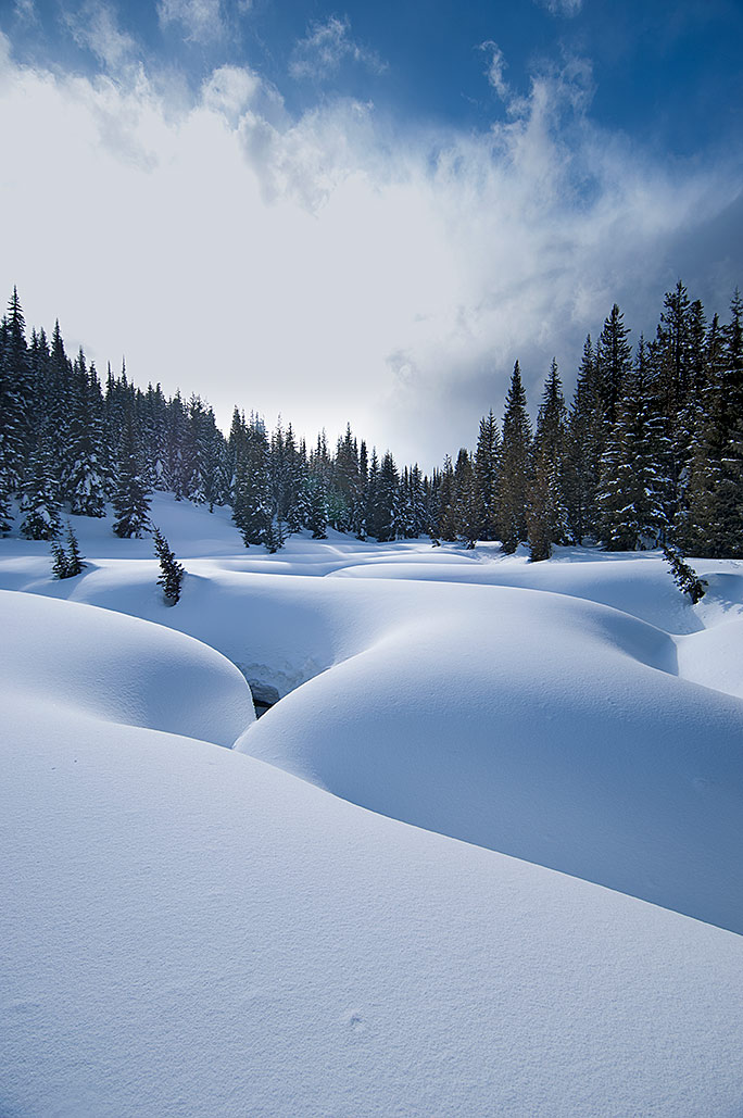
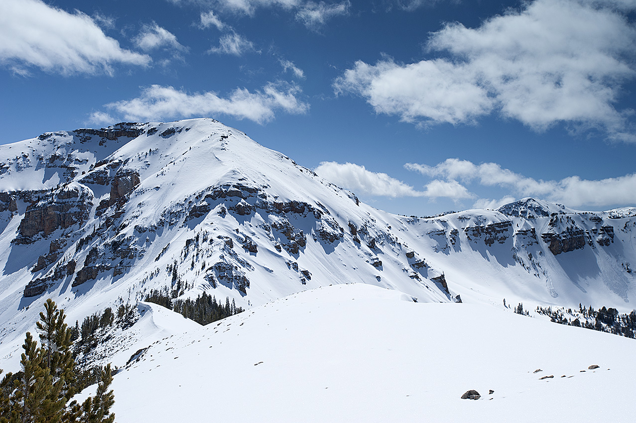
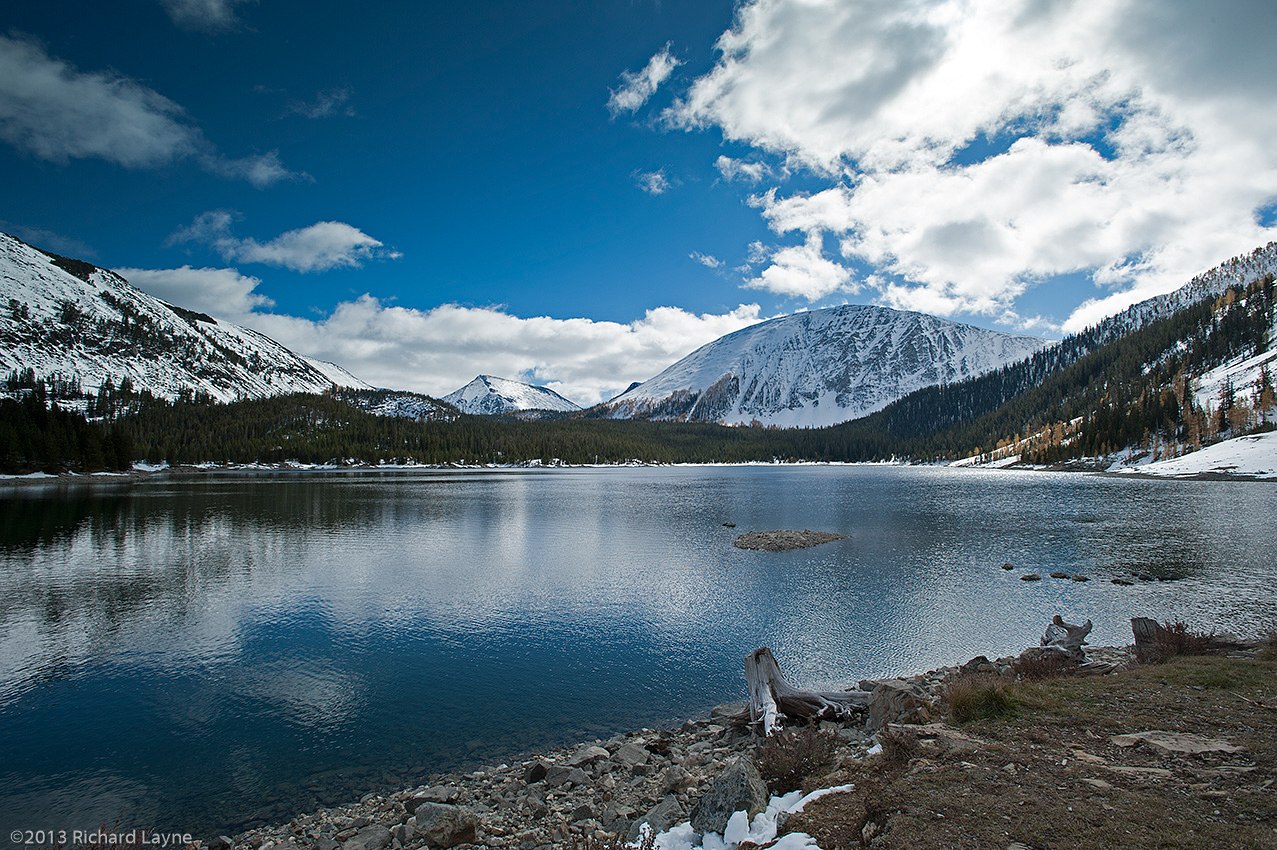
The Centennial Mountains, located on the Continental Divide, 10 miles beyond Henrys Lake Mountains in Idaho and Montana.
Now down to mere days from venturing into Montana’s backcountry and beginning the winter training trips, which will eventually transpire into the actual Continental Divide trip, I am worried. Because of the sheer length of the trip, 418 miles, I will begin the trip 30 to 60 days earlier than the previous winter trips normal beginning near the end of February or beginning of March. For that reason, a crust on most of the snowpack is unlikely. Although wearing snowshoes, I may find myself pushing through powder snow for at least the first month and a half.
That is a problem. I will have to build a trail through the powder sans backpack, which interprets into three miles of travel for every mile of forward progress. I have plenty of experience that says under those conditions I will average one mile of forward progress every 2 ½ hours.
With only a 91-day supply for the entire trip, I have to average a minimum of 4.59 miles per day. In powder conditions that interprets into having to travel approximately 11 ½ hours per day, which is not going to happen.
Here is why. I have 6200 calories available per day. In a 12-hour camp, I will need at least 1200 calories. On the trail, I will consume a minimum of 800 calories per hour, which restricts me to traveling six hours per day. That interprets into 2.5 miles of forward progress each day while traveling in powder. Nor does this include the slower pace of the ascents inherent to mountain travel.
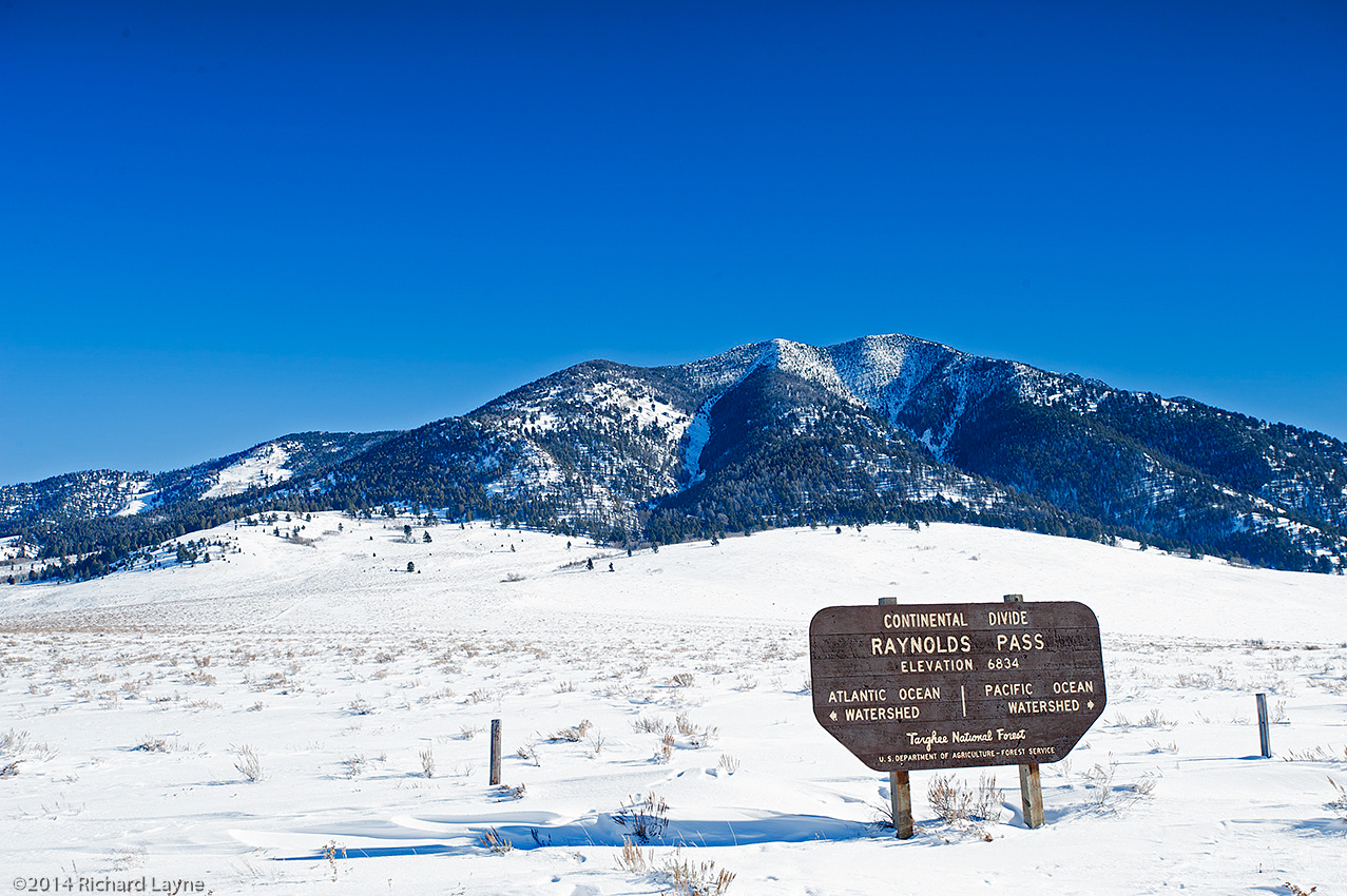
The distance between Raynolds and Monida Passes is 66 miles, which encompasses most of the Centennial Mountains, an area I will enter near Yellowstone National Park at the beginning of the trip. I will encounter powder snow throughout most if not all of these mountains. I have 18 days of food and fuel available for the area. For that reason, as I have already said, I am worried.
Last thing, this is a part of the adventure. I will need to find a way to overcome the problem, which by the way I am not waiting for God to solve. Without my cooperation, God does not perform miracles in the naked backcountry. The soon to begin 4 to 6 winter training trips, with a total of 29 days in the backcountry, will show me whether I have successfully surmounted the problem. There is no substitute for experience.
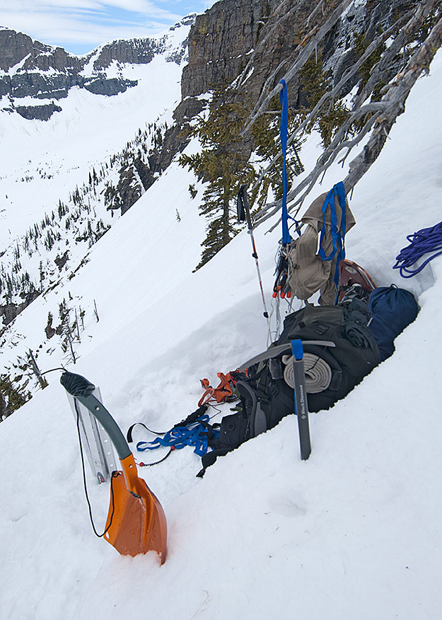
The ascent of Blodgett Pass in the Selway-Bitterroot Wilderness of Montana and Idaho.
I am a huge believer in healthy body and spirit by way of my own lifestyle. Now with that said, here comes a small dose of reality. The doctor called me on Sunday, yesterday. He said that one year ago my bad cholesterol level was in good shape, but not so today. In addition, he addressed my irregular heartbeat. These revelations came as the result of seeking medical help for the pain in my left leg one and one half weeks ago, which turned out to be a blood clot.
I am presently taking a wee little pill twice a day to thin my blood. The doctor wants to place a device on me for two days that will monitor my heartbeat, which I have agreed to. He acknowledges and appreciates my abhorrence of pills or anything else that goes into my mouth and identified as medication. He says my proactive actions in the last week and half with my diet and exercise may be all I need for the high cholesterol level.
The diet: no flour, no dairy products, no salt, plenty of sprouted wheat bread with peanut butter, whole-grain rice and beans, fruit, and small amounts of grass fed beef, organic roasted poultry, egg whites fried in olive oil, skin on potatoes, and plenty of olive oil. In addition, I can have no dark green vegetables because they have vitamin K in them, which coagulates blood, the opposite of what those pills are doing.
I have instructions to stay away from all stretches and exercises that could jar the clot loose, but I can continue my daily non-strenuous strolls on Mount Helena. During the minimum 2-mile walks, I am keeping my heart rate below 130 BPM, while ascending/descending 650 feet.
My website and Facebook pages concerns being an adventurer photographer, not a convalescing invalid. If you are following me, you’re getting a little more than what I originally had in mind. I have made some mistakes in my lifestyle, which at 63 years of age has come around to bite me on the butt.
I am in no way finished with backcountry adventure photography. Medical personnel have made it clear that I will be back on my feet in perhaps as little as 30 days. Clearly, I will have to be an integral and active part of the solution for that to happen. Now where in the hell did I put those teeny-tiny little pills?
The terrifying approach to Hole in the Wall in Glacier National Park. The Continental Divide is 1200 above the summer trail. The Canadian border is 2.5 miles north of this location.
It is Saturday morning January 24, 2015; the reality of what has happened is beginning to sink in. Almost 81 hours ago, I arrived back in Helena, Montana with the Continental Divide trip almost surely canceled. This morning for the first time, I felt the slam of what that really implies. A huge sense of loss is welling up inside of me, awful to bear, and seemingly with no relief to come from any direction.
On April 29, 2008, after 1.5 months I completed approximately 150 miles of travel in the Selway-Bitterroot Wilderness. Within days, I began to wonder what was next while realizing the trip had demonstrated that my days of winter expedition trips were numbered. My eyes soon fell upon the Continental Divide. By the end of May, I had penciled in the initial route to travel 990 miles along the Continental Divide between Yellowstone National Park and the Canadian border on the northern edge of Glacier National Park.
About 13 months later, I began writing about the Selway-Bitterroot experience. In another year, I had my freshly completed first manuscript and a realization that I needed to take action where the Continental Divide trip was concerned. I could only hope I was not too late. In the early days of September 2010, I began to make plans for a tough strength and endurance-training regimen during the following winter, coupled with the need to research an area of the Continental Divide inside Glacier National Park near the Canadian border, which was supposed to be undoable in winter conditions. I began with three autumn reconnaissance trips. In just over one month ending near the end of the second week of October, I traveled in the backcountry for 17 days.
A little more than 3 ½ months later, I began the first winter trip on the eastern side of Glacier National Park. The date was February 2, 2011, and a La Niña weather phenomenon was strangling the high country of Glacier, with huge snowstorms lining up behind each other. In another 3 ½ months, now near the end of May, I exited the park for the final time, successful at accessing the previously stated inaccessible Hole in the Wall area of the park. I did not realize at the time that I would be writing a book about the four trips, particularly the final trip, 16 days in length, which had nearly taken my life twice, not including the near misses of roaring and camp shaking avalanches. At the time I had no idea of the toll that last trip had wrested from me.
In May 2013, with my second written manuscript now in the hands of a publisher, I broached the subject of the Continental Divide winter trip to my wife. The detailed planning for the 990-mile winter trip began.
So it is that after eight days on the route, and now with one week remaining in January 2015, and nearly 7 years after I began the preliminary plans, I have canceled the trip. Among other reasons, I have waited too long and my age now says no. This morning the heavy reality is nearly suffocating. My chest feels a great weight upon it. Simultaneously there is a sense of loss in purpose and an emptiness. The mourning has begun, although no doubt for more than just the trip. I believe a new chapter has started; the autumn phase of my life has begun in earnestness.
In the last week, the weather has changed in Western Montana. We have gone from moderate snowfall (between 6 inches and 3 feet, depending on the elevation) and subzero temperatures, to an extended forecast with a mixed bag of scattered rain and snow, including temperatures up to 40°F. Even the elevation of 10,000 feet along the Continental Divide has an extended forecast with a low of 20°F.
Could this be the beginning of the El Niño weather pattern? The NOAA is staying quiet. That could be the smart thing for them to do. I, on the other hand, am not part of the NOAA. Indeed, where the weather is concerned I am a hands-on kind of guy. For that reason, any attempt I would make to cross an avalanche slope after the recent snowstorm would be dangerous, even foolhardy. If it were to rain on the slope, that same attempt would likely be fatal. On the other hand, this weather can also settle the snowpack while creating a crust I can walk on with my snowshoes and crampons. This latter condition is exactly what I am hoping to have for the Continental Divide trip.
In addition, 50 miles into the Continental Divide trip beginning in January 2015, I will encounter my first slopes that require technical climbing gear to ascend and descend. Besides the peril of possible avalanches, proper placement of snow pickets in powder to anchor my rope would be difficult if not impossible.
Yesterday, I drove north for my first winter training trip, which I intended to undertake in the Dearborn River Canyon of the Scapegoat Wilderness. With the nonstop rain soaking into the snowpack at the trailhead, I canceled the trip. Forget the avalanches. Rainfall during the winter on my equipment and on me is dangerous. Nevertheless, go I will, just not up there. This morning I leave for Bannock Pass on the Montana and Idaho border to the south. According to the weather forecast, any moisture I receive down there will be snow.
To be clear, during the 90-day trip, which begins in approximately 30 days, with the exception of rain falling on the snowpack, it makes no difference what the weather conditions are. I will travel through most of it.
With that said, you know I sort of feel like I’m playing poker with the totally emotionless old man winter. Regardless of what I do, his stare never changes. I look into his eyes, at his protected card hand, and then glance at the wall behind him. There is no perceptible movement in his eyes or on his face. Finally, I place my cards on the table. In turn, he places his on the table. Then while his blank, yet cold eyes continue to stare a hole through me, his hand smashes mine to a pulp. Oh boy.
On February 4th, 2014, in Yellowstone National Park, the latest storm had just dumped another three feet of snow. Within hours of this photo, a -40 F temperature would arrive.
Is it time to say goodbye to the El Niño forecast and alter my travel plans accordingly? As of November 20, 2014, the three-month extended outlook along Montana’s portion of the Continental Divide predicts from 33% up to a 40% chance for above normal temperatures. In addition, the NOAA (http://www.cpc.ncep.noaa.gov/) is now predicting an equal chance for a normal winter to 33% chance below normal moisture.
This interprets into an increased chance I will encounter powder snow until near the end of February 2015. The winter of 2014 also had the label of “equal chance” for a normal winter. The snowpack was huge and the powder nearly untenable for extended snowshoe travel throughout the month of February.
It has been and continues to be, albeit with less hope, my plan to begin the trip near the end of the first week of January. This close, 44 days until beginning the 90-day trip, however means the likelihood is growing that I will not begin the trip until the first part of February 2015.
Last autumn I placed my resupplies at locations where I could take on traveling in deep powder snow. While I have a tremendous amount of food and fuel to get me to Monida Pass on Interstate 15, there may still not be enough. In deep powder snow, I average between three and four miles of forward progress per day. There is also the possibility that I will have to use technical climbing gear at six separate locations, where my daily progress measurements will be in feet rather than miles. Additionally, there will be down days due to storms and bad avalanche conditions.
I have 39 days of supplies for the first 140 miles of the route. If I only average three miles per day I will run out of supplies eight days before arriving at Monida Pass. Should that happen, I will lose three and four pounds of body weight per day. To encounter a weight loss like that after already being on the route for one month would be devastating.
Throughout the 462-mile route I have alternate routes to be used to get around avalanche areas and if needed, to shorten the route. One such route is located at Red Rock Pass. However, that would only shorten my route by two or three days. After that alteration, my options would be limited, and my supplies would still fall five days short of Monida Pass.
With that said, I have always known the trip carries risks. As much as I have prepared, it may not be enough. Only traveling the route will clear the air. Nor is there anyone in front of me who has experience with this route to advise me. My most experienced advisor too often has also been my greatest enemy—my head.
Two days after a snowstorm, the snowshoes were dropping through the powder snow 1.5 feet. Another storm would arrive later this day and drop another three feet of snow. The location was the western edge of Yellowstone National Park, on Madison Plateau and near the Continental Divide.
In another indication of the rapidly closing date for beginning the 93-day winter expedition, Montana and Idaho’s mountain snowpack has begun to accumulate. Being early winter however, it comes as no surprise that the NOAA SNOTEL site near Darkhorse Lake (8700 feet), located in the southern Bitterroot Range, shows that in the last five days the snowpack has dropped from nine to six inches. More is on the way though. Beginning tomorrow evening, November 1, another 12 inches could fall. Moreover, with our going into November, the average daily temperature is continuing to drop. Most of that snow is going to remain on the ground until next June.
Of far greater interest to me than the increasing snowpack is the weather phenomenon known as El Niño. I am hoping it plays a strong role in next winter’s snowshoe trip. As of this date though, there is some uncertainty of how strong it will be, or for that matter, when the event will begin. The latest extended forecast, released on October 16, 2014 called for a 67% chance of a mild El Niño beginning by mid-November. From Yellowstone National Park to Butte Montana, the area I will be traveling through next winter, the impact of this weather pattern normally means less snowpack and more importantly, warmer temperatures. Those higher than average temperatures could create a crust I can walk on sooner than the latter days of February.
The reason I don’t begin extended winter trips until at least the beginning of February, is due to the condition of the snow. Although I relish the idea of having enough snowpack to cover brush, timber fall, and rock fields, the real reason I wait until later concerns whether a crust has formed on the snowpack. Traveling in deep powder is a nightmare. It can cut my daily average of 6 and 8 miles down to 3 and 4 miles.
The La Niña winter of 2008 brought the opposite effect of El Niño. With the storms lining up behind each other, I traveled through three feet of powder during the latter days of March. That occurred during the double crossing of the Bitterroot Range west of Montana’s Bitterroot Valley. The average day was eight hours of travel with my forward progress between three and four miles. Because I was compelled to build trail without the backpack, I actually traveled between 9 and 12 miles each day. I needed nine days to travel the first 25 miles, which included going over Blodgett Pass. By the last day, even my three-day emergency food supply was at the crumbs level. Fortunately, the resupply bucket was where it was supposed to be.
A crust would have changed the character of the Selway-Bitterroot Wilderness trip (although I wonder what I would have written about if the trip had gone smoothly). As it were, the snowshoe portion of the trip was only 115 miles, but still took one month to complete.
Using primarily snowshoes, the distance I will travel on the Continental Divide during the winter of 2015 will be 462 miles. I have to be able to average approximately 5 miles per day for 93 days. That is not possible in deep powder. Granted, I will have 107 days of supplies out there, but I will have to make up the days of downtime from the inevitable storms. More than that, for as much as 12 days I will be traveling on rope and crampons, where the measurement of forward progress is in feet rather than miles.
Another troubling consideration is the Anaconda-Pintler Wilderness, which I will enter 375 miles into the trip. During the winter of 2007, I undertook five trips in this wilderness, where the final trip included crossing it and the Continental Divide. As the result of that experience, I consider it vital to get through the wilderness near the end of the winter rather than begin the following winter’s trip with the Anaconda-Pintler Wilderness still in front of me.
So yes, I am watching with a keen interest in what the future holds with the El Niño weather pattern.
On March 17, 2014, I will attempt to continue snowshoeing along Montana’s portion of the Continental Divide. The trip began on February 1 and abruptly ended on February 6 with the snowmobile ride to West Yellowstone, Montana. There were a number of reasons for the exit, any one of which would have required my postponement of the trip.
The yet to be resolved issue of whether I had high-altitude sickness or carbon monoxide poisoning. Since I was at the elevation of 8200 feet for most of those days, I am leaning toward the carbon monoxide poisoning.
I was not in good enough shape to carry the nearly 100-pound load.
Snowstorms in February dropped exorbitant amounts of powder snow, which from the outset prevented my movement in spite of the large backcountry snowshoes I use.
Because I will begin traveling from Macks Inn, Idaho, there is now an additional 15 miles. However, I may alter the route further on in the Eastern Centennial Mountains that will undo the extra miles. With that said, I still have approximately 462 miles to attempt to complete no later than the middle of May. With at least a 70-pound load, it is unlikely I will complete that distance in 60 days. I would have to maintain a daily average of 7.7 miles. The more realistic average will be five miles per day for the first 30 days and possibly eight miles per day for the second 30 days.
Coming up short could be a blessing though. With the above average snowpack in the Anaconda-Pintler Wilderness, the last segment I will travel through this winter, after the middle of April and into May the raging spring avalanches could be fatal. Less than seven days ago, the National Oceanic and Atmospheric Administration (NOAA) predicted a possible El Niño weather pattern for this year. Where the Continental Divide in Montana is concerned, that interprets into a low snowpack and warmer temperatures for next winter, something I would much prefer while traveling through the Anaconda-Pintler Wilderness.
Having lost 1 ½ months of travel time, in an attempt to increase my pace to a five mile per day average, I have lowered the backpack’s weight to below 75 pounds. West of Monida Pass and along the Southern Bitterroot Range, I will try to increase the daily distance to 10 miles per day. Once I arrive at the Anaconda-Pintler Wilderness however, this level of mileage will be impossible.
Because the travel will be half again to double the normal pace, I will only need one-half to three quarters of the caches along the route. A four-day cache with an allotment of 7150 calories per day will now become an approximate eight-day supply. That means, barring any delays, there are far more supplies along the route then I can possibly consume. In short, a lighter load to carry.
Although it will increase the peril of the trip, with the exception of the crampons and ice ax, the climbing gear will remain behind. Additionally, I will no longer need the heavier sleeping gear that protects me from prolonged winter travel combined with temperatures down to 40 degrees below zero Fahrenheit.
Meanwhile battery power for my equipment continues to be an issue. For that reason, using the personal locator device I will only send a progress report once a day to Facebook and Twitter. I will also exit overnight at Raynolds Pass, 63 miles into the trip, Monida Pass at 149 miles, and Chief Joseph Pass at 351 miles each to upload files and recharge the batteries. By leaving three camera batteries behind, I will save 17 ounces, but lose half of my ability to take 4800 digital captures. Finally, I will carry less AA and AAA batteries for such equipment as my head lantern.
There is plenty of snow on Montana’s Continental Divide as of January 10, 2014. When I return from the two training trips in Henrys Lake and Centennial Mountains approximately January 27, I will throw some photos up of what I saw.
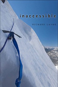
This is the two part interview on KTVH concerning the book Inaccessible. The book concerns 47 days in four trips during the winter in the backcountry of Glacier National Park. In addition the upcoming 90-day winter trip along the Continental Divide is discussed.
Inaccessible concerns four backcountry trips in 47 days in the attempt to access an area of Glacier National Park called Hole in the Wall. The keystone for completing the three-winter trip from Yellowstone National Park to the Canadian border was accessing this high elevation cirque at the end of Bowman Canyon, three and one half miles short of the Canadian border.
As it turns out, the park personnel concerning the inaccessibility of Hole in the Wall was nearly accurate. There were worse things to face on the one-mile eastern approach than the snowpack shaking avalanches a mere several feet away with trees, roots, boulders, ice, snow, mud, raging water and a roaring assurance that a man and his equipment could disappear forever. Falling and lying upside down on near cliff angles with and without being connected to the rope, with and without carrying the heavy 75-pound load, were far more effective eye-openers.
Worst of all was the realization that in 2016 the six days of horror in entering Hole in the Wall was going to happen again.
If you want to contact me or make a comment, go to the contact button. The spammers are using my comment section for what they do best.
After the February trip, my intent was to return sooner than I did, but a succession of storms delayed me. The first of two trips planned for March was a seven-day trek to summit Stoney Indian Pass. The second, another seven days, was to begin on about March 21 at Polebridge, and head toward Brown Pass and Hole in the Wall. Once the second was completed, I planned to deliver a cache to Waterton Townsite in Waterton Lakes National Park, Canada. Yet getting across the closed international border at Goat Haunt was still problematic. Another problem with this plan was the additional 16 miles on an already lengthy winter trip. Nevertheless, until I could improve on it I would stick to the original plan.
On March 10, as I left Helena, I had known bad weather was a possibility, but I took a chance anyway. I arrived at the gate on Chief Mountain Highway in a downpour. With two feet of slushy snowpack on the closed portion of the road, I canceled the trip.
Rather than return to the eastern side of the park for another attempt at Stoney Indian Pass, I thought it was best to stay with the scheduled trip to the Brown Pass area. The winter days were fast ebbing and I still had yet to see the real target of the route, Hole in the Wall. This meant that, when I embarked on the ultimate trip across the entire park, I would not see Stoney Indian Pass under a snowpack until I got there. This also meant that, on the chance that I would need all my technical gear on the pass, I would carry every ounce of it from the Belly River trailhead rather than leave it at Waterton Townsite with the cache.
I planned to be gone for approximately one month. After the Brown Pass trip, I would return to the eastern side of the park, obtain the necessary permits at Hudson Bay Ranger Station, deliver the resupply cache at Waterton Townsite, and then return to the Belly River trailhead and begin the park-wide crossing.
I left Helena in the late afternoon of March 20. As I drove north up the Seeley and Swan valleys, I worried about the cloud-laden peaks on the Swan Range. When storms hit, I knew that the park usually received the lion’s share of the moisture in this area. The forecast near Brown Pass called for a 60 percent chance of snow. Given what I could see happening on the Swan Range, 100 miles south of Hole in the Wall, I worried about how much more snow was falling in the park.
The plan was to pick up the permit, which I did, and then spend one night with friends near Bigfork. The following morning I would begin the trip. I ended up spending two nights with the friends. I had a couple reasons for doing that, weather supposedly being the foremost. In reality, fear held me back that extra day.
Chapter 8: A Different Trip
March 22: A Death on Bowman Lake
I left Bigfork at 1 A.M. and arrived at the Polebridge trailhead three hours later. After arranging my backpack, I left the trailhead at 5:30 A.M. still in darkness. Traveling in the dark, the LED head lantern effectively lit the way, but the narrow beam of light only somewhat alleviated my fear of hungry grizzlies that would now be emerging from their winter snooze. The ski grooves on the road to Bowman Lake indicated substantial use by cross-country skiers. I usually give skiers the courtesy of not snowshoeing on their tracks, but here I appreciated the packed trail. (On several occasions, skiers in the backcountry have voiced their gratitude for the trail I’ve provided with my snowshoes. In the long run, it all balances out.) Walking on the grooved trail, in spite of a backpack weighing over 90 pounds, I made good time on a crust where the snowshoes broke through infrequently.
An overcast day, it was still getting light two hours into my walk. Although the road paralleled Bowman Creek, I traveled two miles on the winding road and through an old burn before I left the North Fork Flathead River Valley behind. My entrance into Bowman Creek canyon brought me into a mature climax forest of Douglas-fir and lodgepole pine trees.
At the lower end of Bowman Lake on March 22, 2011, Day-One the backpack weighed more than 90 pounds.
The six miles to the lake on the snow-covered dirt road created the illusion that it was more level than the three miles on Chief Mountain Highway. In reality, I covered a vertical gain of 600 feet and a drop of 100 feet compared to Chief Mountain’s gain of 395 feet and loss of 420 feet. I was elated at the difference between this and the slow slog of the Belly River canyon trip in February. I even dared to believe I would go beyond the foot of the lake today. I arrived at Bowman Lake Campground in four hours.
Although the permit called for me to spend the night at this location, that was supposed to have happened on March 21, yesterday. Today the permit had me at the head of the lake. Even if I had the energy, I would have been unable to travel that additional six and a half miles on this day. The sciatic nerve on my left hip had flared up again. I dropped the backpack and briefly considered setting up camp, but the pain subsided quickly and I decided to continue.
I am no fan of walking on ice. In my mind’s eye, I see me breaking through it and holding my breath for a very long time, while unsuccessfully trying to claw my way back to the surface. As a toddler, I almost drowned twice, although I have no conscious memory of either event. As an adult, I stay off the ice. To punctuate my fear, during a phone call before the trip, a park ranger informed me of a previous incident in which cross-country skiers broke through the ice near the lake’s north shore.
My only alternative was the weakly crusted snowpack that covered the trail inside the trees along the north shore. Faced with walking on a crust that would only partially hold my weight or on the lake ice, I hesitated. Then I spotted some deer on the ice near the north shore one mile up the lake. A few minutes later, I headed for the ice.
The foot of the lake was located in rolling foothills. On the north side, Numa Ridge rose 1,500 feet, while on the south side Cerulean Ridge was 1,000 feet above the lake. Glacier’s world-renowned canyon walls and peaks were three miles farther east. I decided to set up camp once the peaks and steeper canyon walls were on either side of me.
The remnants of an elk hide on the ice and snow of Bowman Lake.
I arrived at a partial elk carcass 10 minutes later. All that remained was about a quarter of the hide, some bones, and numerous predator tracks, both coyote and wolf. I was a little surprised to see that anything remained of the animal. Generally, scavengers and carnivores would clean even a large elk within a short time. Perhaps, as I guardedly looked around, a short time was all that had passed.
As I traveled farther onto the ice, my confidence in its strength increased. So much so, I decided to walk a straight line through the curvature of the lake, thereby cutting the distance to the upper end. That also meant I would gradually cross the lake twice. As I got farther from shore, however, my confidence dropped until, with visions of me gurgling under the ice, I said enough, and altered my course back to the north shore. Thereafter I stayed between 40 and 70 feet offshore.
By 11 A.M., with my hip hurting again, I ran out of steam and stopped for a break. I also had eaten nothing since the previous evening. Somehow, I kept ignoring the oft-repeated lesson that I needed to eat continuously as I traveled. While a man in his twenties might need an hour, at my age recovery from this level of tiredness would encompass the remainder of the day and tonight. Too late to undo the mistake; I brought out the day food and ate anyway.
When I continued 20 minutes later, I moved like an old man who badly needed to stop. I found what I was looking for along the northern shore 30 minutes later. Patches of ice had melted on the shoreline giving me access to the lake water. Still a mile short of the great walls and peaks, at noon I dropped the load and set up camp.
Later inside the tent, I again compared this first day to the Belly River canyon trip. Today I had traveled eight miles in six and a half hours, while in February; it took four days to get this far with a similar load. No matter, my confidence about what lay ahead stayed low, particularly about what was beyond the lake. I also remembered the damage I did today by not eating, which was going to have an adverse affect on tomorrow’s travel. On the upside, for the first four miles tomorrow, the excellent travel on the lake ice would continue. I crawled into the sleeping bag and was asleep by 4 P.M.
March 23: Another Death on the Lake
I was up at 3 A.M. Although I had been in bed for 11 hours, a painful left hip and right knee had continued to interrupt my rest. I had had surgery on the knee twice, with most of the cartilage removed during the last operation in January 1980. While both knees were arthritic from the past injuries, the right knee was in the worst shape. An orthopedic surgeon had informed me several years earlier that he would own my knees if I ever stopped doing whatever I was doing to keep them working.
Worried, I wondered if I ought to turn back. Still in front of me was the harsher snowpack beyond the lake and the 2,000-foot climb to the edge of the approach. Was I finished? In the end, although I decided to continue up Bowman canyon, it was one more heads-up that the end was in sight for these types of trips.
By 5:30 A.M., the gear was out of the tent and ready to be packed. The pain in my right knee had also increased. I thought again about turning around and going home. If I did, I figured that would be the equivalent to my signing off, that I would be finished with such arduous winter trips. Just over one hour later, in the increasing light of dawn I hefted the load and began walking east, toward the high country. After a few minutes, the pain in the knee subsided while the sciatic pain became almost nonexistent.
I had been traveling for three quarters of an hour when I spotted a dark object near the middle of the lake a third of a mile ahead. I wondered if it was another carcass. A few minutes later, I saw movement. Within a short time, I knew it was no deer, coyote, or wolf. As I continued to close the gap, I was finally able to discern that it was a large, long-necked, dark bird. Clearly much larger than a duck, it was probably a goose. Not wanting to alarm the bird, I hugged the north shore as I continued. Although I never came within 500 feet of it, the bird attempted to fly away a couple of times, but landed within moments, obviously injured.
My heart went out to the goose. While its flock continued north, the bird was going to die alone out here on the ice. Given another couple of months, the goose would have had a huge body of water to protect it from the landlocked carnivores. I figured that hidden in the trees along the shoreline, there was probably at least one set of eyes staring at the hapless bird. Today, I theorized, was probably its last day alive, and though I realized it was a part of the cycle of life, I was still bothered. There was too much about the bird’s state that reminded me of my own. Both of us were alone and debilitated. The bird was already in a dangerous neighborhood; I was headed that direction.
Periodically along the route, I turned and looked over my shoulder to where I had already been. This was one of several methods I used for navigation. If my living lessons came by way of some fictional movies and novels, then turning around and looking back was a sign of weakness and likely bad luck. In real life, I needed to know what this view looked like coming from the opposite direction. In an off-trail environment, it was particularly useful where trees and foliage smothered the route. Its importance increased during the winter when a deep snowpack generally hid the trail.
With the end of the lake in sight, I was two and a half miles and one and a half hours beyond the goose. Behind me in a light easterly breeze, I noticed for the first time several objects rolling over the snowpack toward me. It struck me that I had been watching them for quite some time without paying any attention. I did now. Mystified, I stared at the odd, dark rolling balls as they caught up, and then passed by me in their slow march to the lake’s upper end. Suddenly I realized what I was seeing. Aghast, my heart leapt into my throat. Oh God, those are balls of goose down! The bird I had the temporary kinship with was dead.
In a world of steep cliffs and peaks, with canyon floors and walls covered by trees, all smothered beneath a deep snowpack or in ice, I had brushed by one living creature today and within an hour and a half, it was just me again. Tears welled up as I started to walk again, this time in the company of the rolling balls, which were moving slightly faster than my pace. The goose was no longer afraid of me. His ghost in the form of those balls of down accompanied me for a few minutes before moving on.
Then I got angry. I did not give a damn that this “bird-meets-carnivore” event had been happening on this lake for more than 10,000 years. Cycle of life my ass, some cowardly coyote or wolf had waited until I was out of sight, then ran out there and killed that bird. Rationally I knew they had to eat, and the injured goose would not have survived anyway, but right then though I felt as if I had lost a friend. With my feelings still in turmoil, half an hour later I arrived at the upper campground of Bowman Lake.
As I neared the upper end of Bowman Lake the cloud cover of the last four days was finally dissipating.
The thick clouds from the day before and this morning had slowly been breaking up. Shortly before I arrived at the campground, the sky had nearly cleared. Eastward, most of the peaks still had a shroud of clouds around them, while to the west the sky was almost cloud free. On the south shore, the clouded veils on the summits of 9,891-foot Rainbow Peak and 8,777-foot Square Peak were fast dissipating. The backcountry of Glacier National Park was turning into a pristine and precious jewel.
I stopped for an hour at the forested campground and even used the toilet, knowing this would be the last one available for the next three or four days. By the time I picked the backpack up and continued, the sun was on the canyon floor and softening the snowpack.
The trail inside the thick forest beyond the lake was easily discernible in the three-foot deep snowpack. The fronts of my snowshoes were also breaking through the crust at every step. In a sun-saturated opening, I could still see the lake through the trees when I halted, dropped the backpack, and sat down again. The heat from the sun’s rays was blissful and encouraged me to stop. Pulling out the English muffins and peanut butter, I slugged down two halves. After 45 minutes, I continued up the canyon. Now the entire snowshoe was punching through the snowpack at every step, a clear sign that I needed to stop for the day.
Less than a mile beyond the campground, I turned right into the trees and began looking for a location to put camp. Somewhere over there was Bowman Creek and hopefully open water for my camp. I took the backpack off in an opening that I thought was part of Bowman Creek’s floodplain. For 40 minutes, I searched fruitlessly for open water before I quit and set up camp.
The hot sun had turned the surface of the snowpack into slush, thereby preventing my continuing up the canyon, but with an advantage in my waterless camp. Using a scant amount of fuel, but still going a little too far with it, within an hour, I melted enough snow to fill two 96-ounce bladders of water.
This morning the right knee had almost turned me around. Through the day and now in camp, the knee still hurt, but I no longer believed it would stop me. Yesterday I had predicted that today would bring fewer miles. True enough, I traveled half an hour longer, and put only five miles behind me. With a plan for an early rising, I fell asleep in the early evening.
March 24: A Terrifying View
I now had in my possession an indoor-outdoor thermometer with a wire leading outside. The reading was 14.6 F. There would be a hard crust for today’s travel. To take full advantage of it though, I would have needed to get up by midnight. I crawled out of the sleeping bag at 4:10 A.M., and was now doubtful that my plan to ascend at least half of the 2,000 feet to the bench on Brown Pass today would happen. I figured the soonest I would get out of camp would be 7:30 A.M., which would give me three or four hours of travel time before the sun softened the snowpack.
I left shortly after 8 A.M. and immediately began a 250-foot ascent on the south-facing wall that took me to a bend less than one mile ahead. With the exception of a few high-altitude clouds, the sky was clear. There was no sunlight on the canyon floor yet, but it was coming. In the open areas, the crust held my weight. Unfortunately, most of the trail was inside a thick forest where the front of the snowshoes and the toes of my boots broke through with almost every step. I tired quickly. After 40 minutes, I took a 10-minute break with another 100 feet remaining in the ascent. An hour after I left camp I arrived at the small summit and descended back to the canyon floor. I figured this was just a taste of what that climb was going to be like two miles ahead.
The well defined Bowman Lake trail three miles above the lake in spite of the snowpack being three and four feet deep.
The snowpack’s depth had also increased as I traveled farther up the canyon. Unlike many less-defined wilderness trails, the wide course of the trail here was easily discernible even in the deeper snowpack. In addition, there were large snow bumps on either side of an easily defined ditch, which was the trail, albeit three to six feet below. Unfortunately, my snowshoes were too wide to travel on the stronger crust inside the ditch. Therefore, I strolled from mound to mound, often from one side of the ditch over to the other.
In spite of the late start, and though the sun was filtering through the tree branches by 9 A.M., the crust held my weight enough to continue through the morning. A good thing, with the troublesome sciatic nerve; I took numerous breaks.
At 10:30 A.M., with 8,790-foot Thunderbird Mountain now on my right, I began to anticipate a first view of the approach to Hole in the Wall. I entered a large open area near the confluence of Pocket and Bowman creeks at 11 A.M., and saw it for the first time. The view of the snow-covered mountain and steep angle of the approach was a shock. As expected, the entire width was an avalanche chute, except it looked worse than my imagination had conjured it to be. The ravine I called the elbow was particularly frightening. It was like a 1,400-foot funnel with a mouth on the summit that was 300 to 600 feet wide—a deathtrap! Every avalanche up there would be crammed into that narrow near cliff-angled ravine. Even a small slide from the 8,000-foot summit might be non-survivable by the time it hit the summer trail at 6,600 feet. Although a fog bank from Brown Pass covered part of the approach, I could see enough, and instantly agreed with the park rangers. Hole in the Wall was inaccessible in the winter!
God almighty! What the hell have I gotten myself into?
A staggering first view from the Bowman canyon floor, Hole in the Wall is 1800 feet above me with Mount Custer (8883 ft) in the background. On the right 2100 feet above the canyon floor, partially hidden in a cloudbank and buried in a 200% above normal snowpack is the impassable approach.
Then I recalled there would be no attempt during this trip. I was here only to check the viability of the traverse. I had also learned that a distant view was untrustworthy. The final decision would happen from the edge of the approach. I dropped the backpack and spent over an hour walking around the open area. While there, I decided the climb was out today. My hip and knee were hurting again, and I was tired.
The snowpack still held my weight in the open area. Soon after I continued up the trail, I reentered the forest at the base of Thunderbird Mountain and immediately started to break through the snowpack. On the left and through the trees I could see the clearing where hidden beneath the snowpack was Bowman Creek. I turned a hard left and was soon in the opening again.
Avalanche Terrain
An hour and a half later, I had traveled less than one mile when I reemerged from a stand of cottonwood trees. On my right was the open water of Bowman Creek 13 feet below me. On the other side of the stream was a level spot in the snowpack that appeared to be perfect for a camp. Staring back across the stream a few minutes later, I saw that I was directly beneath 8,528-foot Boulder Peak. Perhaps I was wrong about placing the camp here. I pulled the topographic map out. The map showed that I was at the low end of an avalanche chute one-third of a mile wide.
As if to verify that I needed to move, a few minutes later I heard a grinding roar. Looking up, I easily spotted the avalanche as it tumbled off the cliffs 3,000 feet above me. That explained the absence of large trees on the upstream side of the cottonwoods. Some avalanches coming off the peak 4,000 feet above had even reached across the eastern side of the stream and swept a portion of it clean.
I left the backpack behind and re-crossed the stream to climb a small rise on the west side of Bowman Creek. Across the large, open avalanche zone, I saw a possible spot for a camp less than 1,000 feet away. I retrieved the backpack, and just before 3 P.M. set up camp, still near the base of Boulder Peak, but on the east side of the stream in a scattering of small cottonwood and Douglas-fir trees.
Before I arrived in camp, the clouds had begun to thicken. Although the barometric pressure was dropping, a storm was yet to be a foregone conclusion. Nevertheless, in the winter, I always prepared every camp for a storm. Three hours later, as the barometric pressure continued to drop; I changed my mind and decided a storm probably was coming.
Earlier, looking up at the approach to Hole in the Wall, I had spotted what appeared to be a field of ice below the summer trail’s approximate location. Although fog prevented an unobstructed view, I was almost certain there were at least two sheets of ice on the traverse. It also appeared that until there was an actual need for them, I would be unable to discern absolutely whether ice screws would be necessary. For that reason I would have to carry a full complement of them, which meant more weight. With a future load that already had the appearance of overwhelming me, how would I carry more?
My sciatic nerve continued to be troublesome, as was the small of my back and right knee. It was easy to conclude I was physically unready to make tomorrow’s climb with the nearly 90-pound load. I decided to leave the camp in place and day hike up to the approach the next day. I was asleep shortly after 6 P.M.
Chapter 9: The Brown Pass Bench
March 25: The Day Hike
Through the night, besides the normal pain in the hip and knee, I was unable to lie on either shoulder for long before the respective hand went numb. To make matters worse, the “flat” I put my tent on turned out to be a slight slope, which had me continuously sliding off the pads. It was a restless night, I had lain awake from 1 A.M. to 3 A.M., then crawled out of bed at 6 A.M.
As I prepared for the climb, I questioned the wisdom of going anywhere without the tent, stove, and sleeping bag. An ascent without all my gear in the winter was a cardinal sin. If I had to spend the night up high, there would be little or no forgiveness.
Just before 10:30 A.M., with a load of approximately 50 pounds, I began the climb. In 20 minutes, I ascended 200 feet inside the thick forest and figured I had crossed over the trail 40 feet below. I was also on the steep northwest face of Thunderbird Mountain, pushing through at least one foot of powder snow. Except for my concern about what would happen if I got hurt, I was glad I had packed a small load. After another 100 feet and 10 minutes, I spotted a gap in the trees, a telltale sign of the summer trail.
A few minutes later the tracks of two wolves merged with the trail. Why were they up here? The deer and elk were still in their winter range in the lower elevations. If they were on their way to Waterton River canyon, why would they abandon Bowman canyon? From Polebridge where the creek drained into the North Fork Flathead River up to Bowman Lake, there was plenty of moose, elk, and whitetail deer.
As I climbed, the powder worsened. In an hour and a half, I was just short of having only ascended 550 feet and traveled less than three-quarters of a mile. Frustrated, I hollered that I had had enough. Through the trees on the left and below me, I could see a ravine paralleling the trail. Beyond it was a treeless white south face, and hopefully a solid crust. I arrived on the edge of the ravine 10 minutes later.
Except for the wind picking up, the south-facing snowpack was all I hoped it would be. The teeth of my snowshoes dug into the crust without breaking through. The steep angle of the climb continued to be tough, though. I would travel 10 to 15 minutes and take 5- and 10-minute breaks.
Just after 1 P.M., I stopped for another 10-minute break. At an elevation of approximately 5,575 feet, I was 1,150 feet above my camp and had been traveling almost three hours.
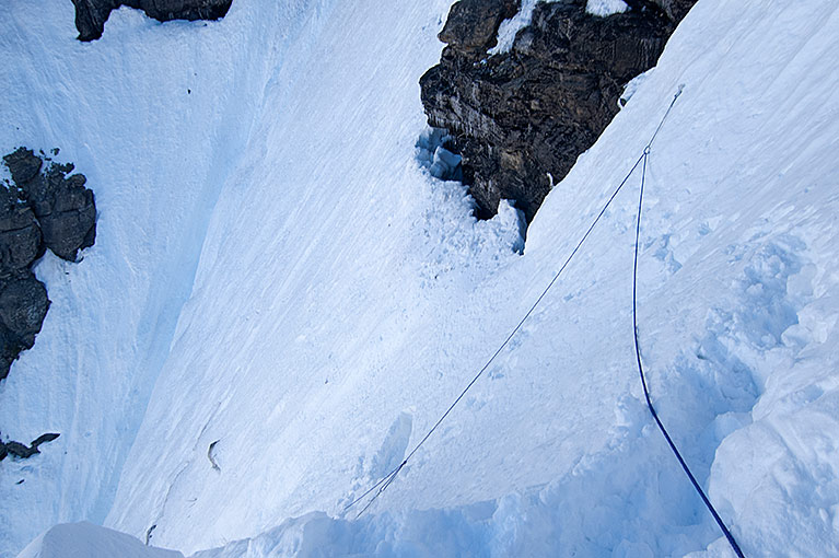
Inside the draw of the unnamed creek, I have just moved passed the location where my left snowshoe punched through.
What to do next was questionable. Having never been in the area, I could only approximate where the trail led. According to the topographic map, a series of switchbacks zigzagged north of the ravine around the steep ridgeline 300 feet east of me. With evidence of avalanches on that 45-degree south face, however, following the summer trail could be folly. That left two possibilities. The first was up the ravine with the nameless creek. The second was to the right of the ravine in a scattering of sapling pine trees. Since it appeared to have the lesser angle, I chose the ravine and dropped in. Getting in and out of the ravine was easy, but within five minutes of climbing, that was no longer the case. The walls of the ravine closed in, restricting my direction of travel to up or down.
I was 150 vertical feet in the ravine when the left snowshoe plunged through the snowpack. I swallowed in fear as I stared into a deep hole at a boulder strewn falls. Until now, I thought the snowpack had been at least eight feet deep above the mostly hidden, fast-running creek. In reality, the stream had substantially eroded the deep snowpack.
I realized I had been fortunate in that I had only punched a hole through the crust without dropping into the ravine. A warning, I had found over the years that out here fortune was nothing more than a nail in a coffin. Relying on luck in this terrain was a great way to die.
The chasm appeared to be too dangerous to continue up, yet the walls on either side were too steep to climb with snowshoes. Meanwhile the crampons and ice axe lay safe in the tent back at the base camp. Unless I turned around and retraced my tracks down the steep incline, which was a distasteful thought, the alternative was to continue up the ravine.
I speculated this might be the only time I would break through. Sure, and the open stream 25 feet farther up the ravine with the revealed second falls meant nothing? I glanced again at the wall on my right. Apparently, I was going to find out during the descent if that other route was the right one. For now, I would continue up the ravine.
Hugging the right side, a few minutes later I arrived at the open water. I moved to the right, and in spite of the large snowshoes, sank knee-deep in the north-face powder. Gaining access to the water, I unclipped my water bottle from its carabiner and filled it without punching another hole. I drank 16 ounces and then refilled.
After putting the bottle away, I surveyed my surroundings again. This section of the climb to Hole in the Wall was supposed to be the easy part. The targeted challenge still lay another 1,000 vertical feet beyond me. Somehow, that seemed wrong. I could feel the ire rising in me as I asked the rhetorical question of why it was so damned hard getting to the tough areas.
A few moments later, I got back to what I was supposed to be doing. To travel in this type of terrain during the winter, I needed to deal with only the task directly in front of me. Distractions were dangerous. I needed to focus on getting up the remainder of the ravine, which I would exit in another 100 feet. Above it was a less hazardous 500 vertical feet to the bench between Brown Pass and the bottom of the eastern approach to Hole in the Wall.
The Cloudbank
It was also beginning to look like I chose the wrong day for the climb. The weather was changing. When I left camp, there had been patches of open sky above me. Now accompanied by a strengthening wind, a thick cloudbank was dropping off 9,406-foot Chapman Peak toward Brown Pass. Regardless, to make the crossing I needed to get a close look at that approach. With March nearly over and the end of winter less than 60 days away, I was running out of time.
Maybe I ought to turn back and seek the warmth and comfort of the tent and sleeping bag. No one would fault me for backing away from this ravine and the swirling cloudbank up ahead. Right, and I would not? I continued to ascend.
At 1:45 P.M. I exited the ravine onto the rolling but still ascending terrain. I was also within a half mile of the area I had scouted almost six months earlier. It came as no surprise that the world of white looked only vaguely similar to last autumn. Yet, as I recalled, much of the area below Brown Pass had been a thick forest of small- to medium-sized pine trees. Now it was a thinned out forest of hoarfrost-covered saplings and meadows.
I continued the ascent toward the bench in an arc that would eventually bring me to the bottom of the next climb. From there I would begin the final ascent of 400 to 600 feet to the ridgeline that would reveal the eastern approach.
I climbed only a short distance before the consistency of the snowpack changed. I began to break through with each step. I went back to taking numerous breaks. As the afternoon progressed, my travel time decreased while the breaks lengthened.
As I closed in on the avalanche chute I planned to climb to the approach, the clouds smothered the ridge.
The weather deteriorated further. The wind increased, interspersed with gusts, while the clouds thickened, intermittently covering the peaks. At 3 P.M., exasperated with the weather and bad snowpack, I stared at where the ridgeline for the approach was supposed to be just a quarter mile away. The upper slope had disappeared inside a cloud. Once up there I would see nothing. I bellowed in protest and declared the final climb was out for today.
Once again revealed, I continued toward the avalanche chute.
My heart was also in my throat with fear. When I came through here the previous autumn, I had realized the entire mountainside from Brown Pass to Hole in the Wall was an avalanche chute. Somehow, today the 45-degree angle looked far greater than I remembered.
Although I had just persuaded myself not to ascend the final pitch, I closed the distance. At 3:45 P.M. I arrived at the bottom of the ascent and shot some pictures of the once-again revealed ridgeline and open sky. Then with the recent surrender cast aside, I began to climb up the left side of the avalanche chute near some small avalanche-damaged trees. I wasn’t surprised at my conduct. Making declarations under duress and then abandoning them was a part of my modus operandi.
Turned Back
Having just spent an hour and a half breaking through the snowpack, I finally had a solid crust on the nearly treeless south face. In spite of the relief, reality hit several minutes later with the tremendous mistake I had made by leaving the ice axe and crampons behind. What in hell had I been thinking down there?
Staring around, although the angle of this slope was less, I suddenly recalled aloud why I had quit shooting photos almost five years earlier during the steep eastern ascent of Ahern Pass. At that time, I could not shoot and survive climbing at such a steep angle in a buffeting wind. At a minimum, it had made me want to throw up or worse, plummet to my death. At least I had the ice axe and was wearing crampons then, I reflected sardonically.
A thin cloudbank covered the mountainside 15 minutes later, this time with me in it. The wind increased again, and then the snow pellets arrived. The protective gear against the two conditions was inside the backpack. Nor would I be dropping the load to get at them on this slab. Consequently, and in spite of my rigorous exercise, I felt a growing chill beyond the biting hits of the pellets.
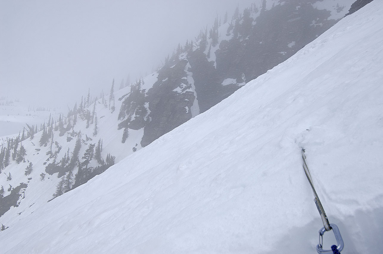
Blowing snow, clouds, the lack of crampons, and the late time stopped me here.
Another gust hit me as I photographed the vague slope ahead of me. With nothing to hold me upright, I experienced vertigo. I dropped the camera, leaned into the ski poles, and kept my eyes on the saplings several feet away until it passed.
Then I remembered that the further I climbed, the more I would have to descend without crampons and ice axe. I looked at the watch and was surprised that I had only climbed 160 feet: so little for the seemingly great distance between the bench and my position. I checked the time, now 4:04 P.M., and realized it was indeed time to head back to camp. If I had brought the crampons and ice axe, I still would have turned around.
This being the fourth day out of seven, a close-up inspection of the approach on this trip was now out of the question, which meant I was faced with making a decision to attempt crossing Glacier while having scant knowledge of what was waiting for me at the approach. The crossing was becoming increasingly unreasonable. Perhaps I should come up here again the next day, and make another attempt. That would have me overdue, this time deliberately, which was no option. Had this been a wilderness and not Glacier National Park, I reflected, I undoubtedly would have taken the extra day.
Discouraged at the failure while simultaneously having my heart in my throat, I turned back. Another part of me was glad for the turnaround. Descending at an angle, within 20 feet, I gratefully realized my Atlas snowshoes were going to take better care of me than I thought. I pointed them straight down the avalanche chute and leaned back. The hard crust let the toothy flotation devices grip the snowpack. I was on the bench six minutes later.
In 35 minutes, I arrived on the edge of the ravine. With my heart once again in my throat, I took the untested secondary route, and 10 minutes later was on the flat 233 feet below. I shook my head at the ease of the route through the scattered pine tree saplings and snowdrifts.
Once again on the canyon floor, a final look at what I failed to get a close-up view of on March 25.
Instead of going back into the trees of the north face, I stayed on the south face and entered the trees below the large avalanche-created clearing. I reemerged 50 minutes later on the canyon floor. When I arrived at a large opening, I looked back up at the approach. Once again, it was inside a cloud. To the left was blue sky behind Hole in the Wall and 8,883-foot Mount Custer. Discouraged, I turned and continued toward camp. So much work for so little reward.
Equipment Losses
Tired and hungry, I arrived back at camp near 6:30 P.M. I wasted no time getting into the tent and settling in. I thought the day was over, but more incidents were in store.
Within an hour, I had the stew on the stove, the sleeping bag was covering me to my waist, and my feet were inside dry socks and down booties. There was equipment and clothing bunched beneath my knees to make them comfortable while I sat in the chair. Before me were bags of pistachios and empty shells. That was when I noticed that the sleeping pad/chair was delaminating. A bubble had formed in the pad on the backside of my thighs.
On winter trips, I carry two pads. I had learned to double the protection between my body and the snowpack. Additionally, if anything happened to the self-inflating pad, I would still have the other. The extra pad was a folding foam material with mini indentations that reminded me of an egg carton. The self-inflating, three-quarter-length, lightweight pad did double duty as a sleeping pad and chair. Since the autumn of 1993, I had been unwilling to go without a chair in the backcountry, although it appeared that was about to happen.
This was the fourth time one of these lightweight pads had failed. My history with them said I should never have brought it out on a winter trip, or for that matter, any trip. Now I would pay the price for ignoring my experience. (As it turns out the self-inflating, three-quarter-length pads have a shorter life than their bigger sibling does. Replacing the pad at least every other year would probably eliminate the delaminating problem. That however does not remove its other vulnerability to be more easily punctured.)
A short time later, I was preparing to eat the stew while I held the audio recorder with a nitrile gloved hand. One moment I had a grip on the recorder and the next the $200 electronic device had dropped into the stew pot. Shocked, I quickly snatched it out of my steaming supper, removed it from the protective leather case, and extracted the batteries. Then using my mouth and a cotton towel, I cleaned the machine. Finally, I stuck the recorder in my pants pocket in an attempt to dry it.
Astounded at the sudden mishaps, I recalled there had been other incidents today. During the ascent, I had pulled the topographic map from the front pocket of my camera bag. A few moments later, the wind snatched the now empty freezer bag I kept the map in out of my hands. I watched with regret as the wind blew it out of sight down the ravine. (The following trip I would find and recover this plastic bag from a leafless bush.) Minutes later, I temporarily lost the second bag with my invaluable supply of glucosamine chondroitin MSM tablets. While I was able to retrieve the bag, I knew I had to do something different. My clumsiness came from numb fingers and wearing the nitrile gloves. I could do nothing about the numbness, and I was unwilling to shed the gloves. I had a problem for which I had no answer.
As tired as I was, I was unable to sleep until after 11 P.M. Besides lamenting on not getting to the approach, there was the normal nightly pain. Additionally, my shoulders hurt and I was getting cramps on the backside of both legs above the knees. Coincidentally that same area was where the huge and growing air bubble was located in the pad. I tried to get comfortable, going so far as to take two ibuprofen tablets. My revulsion at taking this type of medication normally held me back, but not tonight.
Again, I pointed a finger at the rapid passage of time that was aging my body. On the other hand, I also believed I was getting in better shape. Some of these aches and pains were sure to lessen eventually. Nevertheless, with each passing year more pain cropped up in different areas of my body, and exercising became less effective.
Two hours after dropping the recorder in the stew, I pulled it out of my pocket, reinstalled the batteries, and turned the device on. The machine worked! It was 10:50 P.M., and I suddenly felt a small victory over today’s losses and defeat. In 25 minutes, I was asleep.
When discussing backcountry winter travel, it is almost inevitable that someone will ask if I stay in a snow cave at the end of each day. That train of thought is understandable. When a person with little or no experience tries to comprehend surviving in the sometimes-bitter cold, particularly in a camp, this is one of the attempts to wrap one’s head around living in the extreme environment. In light of the occasional news story of someone who survived a harrowing winter experience only because of a snow cave, it seems like a natural question. Nor am I going to give the “real story” demonstrating the fallacies of such stories. In my experience, the cave is vastly superior to the tent for protection against the outside environment. The difference of having two thin layers of material separating the outside conditions from me as opposed to half a foot or more of snowpack, but for the serious nature of the environment, is almost laughable.
That being the case, then why use a tent at all? The answer is simple enough. Regardless of my strength and endurance while traveling in a winter setting, by the time I arrive at my next camp location I am exhausted. Where a group of travelers is concerned, outside of the greater distance traveled I doubt that they would fare any better. Here’s why, while traveling alone with a load of 80 and more pounds through a January powder snowpack, a measly three miles in a single day is almost a noteworthy day. Meanwhile in the same conditions a group of three or more travelers will travel nine or more miles. Either way, at the end of each day both parties are going to be tired.
Building a snow cave is not something one slaps together in an hour or two, nor is the labor eased by being among a group of travelers. The cave has to be big enough to handle everyone just as my much smaller one-man cave only has to be large enough to handle me. Regardless of the number of people in the party, three to five hours of work are involved in building a snow cave.
Horse Creek, Selway-Bitterroot Wilderness, Idaho. The snowpack is at least 10 feet deep.
To a lesser degree, there are other reasons that works against building a cave at the end of each day of travel. For starters, when the sun disappears behind the western mountains, within minutes the temperature can drop by 5°F to 10°F. In addition, during the winter the days are much shorter. After traveling five hours in a single day, which incidentally equates out to at least 5000 consumed calories, beyond the exhaustion is also the amount of daylight remaining to build a camp. Much can be said for building a camp while it is still light. Equipment losses in the darkness need to be a consideration. Although I rarely lose equipment, summer or winter, it can happen. Far less forgiving than summer, the loss of equipment during the winter can actually be life threatening. Therefore, for safety’s sake, it is prudent to set up camp before darkness sets in.
While it takes at least three hours to dig a snow cave, a properly prepared camp with a tent takes approximately one hour to build. This includes piling snow around the edges of the tent, setting most if not all of the anchor ropes, retrieving water where possible and a host of other chores before finally crawling into the tent. Many of these chores are not just exclusive to building a camp with a tent. (Please spare me the details of how there is no open or running water during the winter. There are a host of generally accepted facts that fail to coincide with my experience in the backcountry, such as grizzlies staying in their dens throughout the winter months.)
In short, after an exhaustive day of travel there is very little daylight remaining for the several hours of digging out a cave. That means I use the tent while traveling, including while hunkered down in normal bad weather.
With a wet storm turning to subfreezing and blowing powder, a snow cave was built at this location.
There are circumstances however, where it is vital to utilize a snow cave rather than a tent. On one trip, caught on the side of a mountain during a storm I had no alternative but to build a cave. It made no difference that the entire mountainside was an avalanche chute. I could go no further nor could I back out. The time was noon and I had been on the treeless slab for 24 hours.
In the latter afternoon of the previous day, I had dug a flat large enough for the tent shell to cover the camp. The storm arrived that night. By the middle of the following day there was near continuous spindrift. In addition, there was the possibility of avalanches. To only have built a flat for the tent would have been too dangerous. For that matter, the 60-degree slope I was located on left me without any assurance that the snow cave would have protected me in the event of a large avalanche. Nevertheless, it would have afforded me greater protection than the tent. Even with a small avalanche, I have little doubt what the outcome would have been inside the tent.
Snow cave built at top of photo, see three rocks in snow. Partially dug out small cave in cliff.
I had to build a second snow cave 48 hours later. Thirty minutes after entering this cave a roaring and tumultuous cave-shaking avalanche passed by less than 20 feet from the cave entrance. During the 36-hour period I was located in this cave, chunks of ice, snowpack, and rocks sporadically dropped on my position. If I somehow had evaded them, the flying missiles still would have destroyed the tent long before I moved on.
So yes, there are occasions when a snow cave is essential to survival, but mostly not.
Blodgett canyon from the ascent of Blodgett Pass in the Selway-Bitterroot Wilderness.
It was tough getting across the spine of the Bitterroot Range twice during the winter of 2008. Although the distance was approximately 140 miles and a La Niña weather pattern dominated the weather with continuous snowstorms, I had sufficient time to complete the trip. During the 40-day period between the middle of March to near the end of April, it nevertheless became clear that I was running out time. In the early morning hours, as I prepared for another day the effects of the previous day’s travel had me wrapped in a listless level of energy. While tempted to quit the trip at numerous points, I refused.
In the pre-dawn light on May 15, 2011, the swirling clouds lifted—and my heart sank. In the distance, my destination beckoned: Hole in the Wall, a large, snow-filled, bowl-shaped cirque rimmed by ragged, black peaks and saw-toothed arêtes. From where I stood—alone, beyond help, beyond reason, in front of my tent just west of Brown Pass—I knew that the gleaming, untracked snow of Hole in the Wall awaited, an oasis of gently rolling terrain in an otherwise near-vertical world. The distance from my camp to Hole in the Wall was a mere three-quarters of a mile. But I knew that those 4,000 feet were tilted 70 degrees or more, punctuated by cliffs, ravines, and avalanche debris. The snow there was deep and untested—poised to crack, primed to fail. The pit of my stomach went hollow with fear.
The approach to Hole in the Wall, Glacier National Park
The only reason I was standing in this spot was to traverse the slope ahead and enter Hole in the Wall. During summer, hikers stroll here on a well-worn trail cut back into the steep angle of the mountains’ flanks, skirting cliffs and contouring easily into the cirque, then on to Boulder Pass and the Kintla Lakes drainage to the west. But May in Glacier’s high country is still winter. Seven months of accumulated snow rest uneasily on the mountains, temperatures dive well below freezing, and fast-moving storms dump more snow on the unstable slopes. Park rangers and managers had warned that Hole in the Wall was inaccessible during winter; no one had ever entered the cirque under winter conditions. No one was crazy enough to try. If the deep snow and miserable weather didn’t stop an intrepid backcountry traveler, surely the trackless plunge of the traverse from Brown Pass to Hole in the Wall would bring a person to his senses. The sheer slope offered no protection, no safe haven. In short, if you didn’t fall to your death, one of the frequent earth-shaking avalanches would surely finish the job.
Glacier National Park personnel repeatedly stated that during the winter the high mountain cirque, Hole in the Wall was inaccessible. They were almost right.
This is the story and photos of four trips that almost took the author’s life twice.


 is the tallest peak inside the Anaconda-Pintlar Wilderness of Montana. The brazen effect of the wind above timberline is obvious, while at the same time very beautiful.")