I have expanded this winter’s snowshoe trip along the Continental Divide. As a result, rather than starting to travel in the beginning days of February, I plan to leave approximately December 1.
Starting on October 27, I hung six resupplies in the extended area, with a final five remaining to place. Out of these five, two will be in the Anaconda Range in the Mussigbrod and Johnson Lakes areas. More on these two a couple paragraphs from now. The other three will go into the area of Southwest Montana near Monida Pass. I will place these three as soon as I believe they will be safe from the autumn and early winter crowd, near the end of November.
After completing the final resupplies, I will build another 11. Of these, I will retrieve nine during the trip where the route intersects the winter maintained roads. The final two are spares.
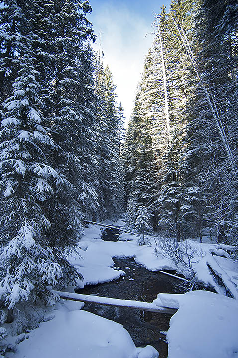
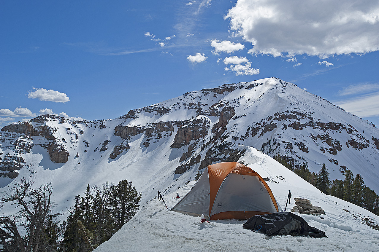
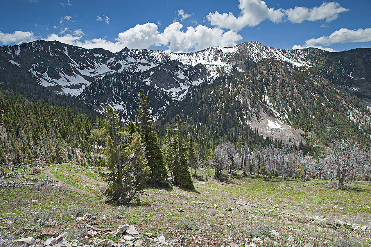
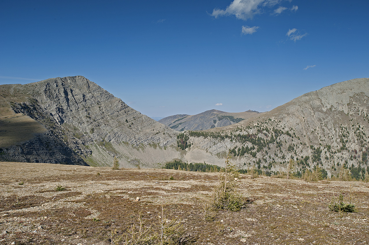
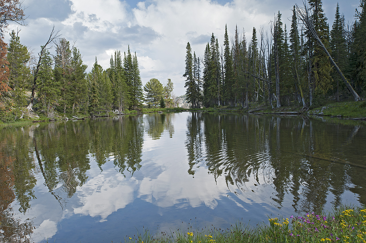
Falls Fork Rock Creek, Anaconda Range, Montana
During November, I plan to take three training trips. The first, as always, is nothing more than a single night to check out the equipment–and me–for the multi-night trips that will take place soon afterwards. Unless the freshly fallen snow relinquishes its hold on the roads to Mussigbrod and Johnson Lakes Trailheads, one trip will be a 25-mile, 6-day journey, while the other is 12 miles for four days. I will place the two remaining caches for the Anaconda Range during these two trips.
Frankly, I am surprised at the level of winter we are experiencing this early here in Montana. Many years have elapsed since we encountered snow and cold at this level so early in November.
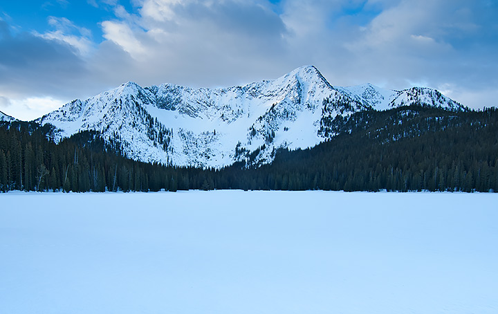
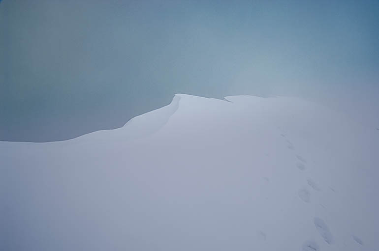
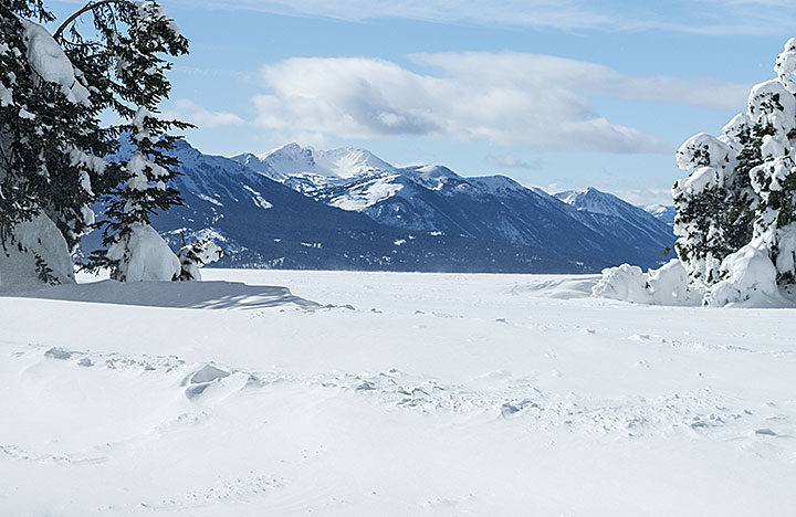
The photos I am showing are of another year in the Anaconda Range. The main photo is Johnson Lake while the others are from Falls Fork Rock Creek canyon, the western route to the lake. When I come through this area next winter, my route comes from the south on the other side of the mountain in the photo, East Pintler Peak (9486 ft.). The mountain skyline is the Continental Divide. When I arrive at the resupply in this area, behind me will be 289 miles of travel, with 190 miles remaining in front of me.
Last thoughts; I place these photos and explanations on this website and my Facebook page @AThousandMilesofWinter for those interested in my trip. Unless I ask for it, I am not open to advice. You can offer up hope, etc. You may even ask questions, which I will try to answer in a timely manner. Time grows short though. If you wish to help in some way, let me know, I will see if there is a fit for you somewhere. While I travel alone most of the time, no one takes a trip of this magnitude, unaided. My wife and others can handily verify that statement.
Crusted snow on the south face of a canyon wall, Anaconda Range, Montana.
No, I did not forget. This winter’s attempted travel is 480 miles with supplies for 171 days, approximately half the distance to the Canadian border. I plan to complete this segment by mid-April. The food amount does not synchronize with the days between December and April. There is a reason for the excess. In the second paragraph, I hinted about this. Not all of my resupplies are going to survive the autumn hunting season. In addition, it is impossible to know where or for how long the storms will force me to hunker down. What I do know is that I still have to eat and burn gasoline for water when I am not moving.
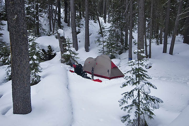
A camp in the Falls Fork Rock Creek canyon, Anaconda-Pintler Wilderness.
British Antarctic explorer, Robert Falcon Scott and the two remaining members of his five-man Terra Nova Expedition, officially the British Antarctic Expedition team perished on March 29, 1912. Low on food and fuel, and 11 miles from their next resupply, a blizzard arrived. They were so weak the last day they traveled they only covered a couple miles before they hunkered down to wait out the storm. The wind blew for a week before they finally succumbed inside their tent.
In a winter setting, to manufacture heat a person needs numerous items such as shelter, cold weather gear, and two major items, calories and movement. Because at the last moment Scott decided to bring a fifth man, the Expedition only had 4500 calories available for each man per day rather than the original 6000 calories. That eventually slowed the expedition, which simultaneously made them more susceptible to the cold and harsh conditions, which in turn slowed them further. At some point, they were unable to move fast enough to manufacture heat, making them vulnerable to frostbite, which slowed the team even more. It was the classic snowball effect . . . no pun intended.
Their experience was similar to some of my own, except I am still alive, although not because I am better than they were. Au contraire, the only group of expeditioners I have read about that might have been tougher than the Scott bunch was Lewis and Clark’s Corp of Discovery, who probably never experienced temperatures colder than brief spurts of 40 degrees below zero Fahrenheit. For the Scott Expedition below zero temperatures were the norm.
A winter sunset on the summit of Blodgett Pass in Montana and Idaho’s Selway-Bitterroot Wilderness.
On March 23, 2008, my first day in Idaho after summiting Blodgett Pass, another storm would arrive before the day’s end. This was Day-6 of the first leg in my attempt at a 106-mile double winter crossing in Montana and Idaho’s Selway-Bitterroot Wilderness. Moreover, today I was supposed to have arrived at the winter-closed Elk Summit Guard Station, where I hoped my nine-day resupply waited. After two nights of below zero temperatures, and sleeping cold in my mummy sleeping bag, I still had 13 miles to travel before arriving at my cache. Only, it had just taken 5 days to complete less than 11 miles, and by the end of this day I would be digging into my 3-day emergency food stores.
In the heavily forested region of the Big Sand Creek canyon, I stopped for a breather near the end of my freshly built trail through the snow. The last time I had eaten anything was at least six hours earlier. Out came the 2/3 empty bags of raisins, prunes and peanuts. Weak and tired, I desperately needed nourishment. Shaking, I fumbled the bag of peanuts, and then dropped it into the snow at my snowshoed feet. Some of the precious contents spilled into the partly stomped snow.
On March 23, 2008, during the descent into Big Sand Creek Canyon, in Idaho and Montana’s Selway-Bitterroot Wilderness, the storm arrived in the early evening.
Even in the pristine woods, I have a zero tolerance rule. Whatever lands on the ground stays on the ground. Not this time. By the sixth day of the trip, I finally realized that I was slowly starving to death. My backpack’s heavily padded waist belt, already cinched as tight as it could go, remained so loose that the pack was dropping off my hips and onto my shoulders. After a few moments of indecision, I stuck my fingers into the snowpack, retrieved and then ate the combination of peanuts and snow. The spilled contents totaled approximately 100 calories. However, I knew I needed everything I could eat, with nothing wasted.
For the next three nights before I arrived at Elk Summit, the temperature dropped below zero for two of them, and I was cold in my sleeping bag. After consuming approximately 3000 calories my first evening with the resupply, in spite of the raging storm that lasted until the middle of the following day, I slept warm and soundly through the night. Besides the continuing storm stopping me the next day, greatly weakened, I was in no condition to travel. I rested and kept eating for one day before continuing the trip. I also slept warm the second night at that camp, although once again the temperature was below zero.
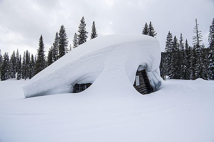
Elk Summit Guard Station during the winter of 2008 in Idaho’s Clearwater National Forest. The second floor bedroom window is below eye level.
Like the Terra Nova Expedition, I had an underwhelming amount of calories for the task. My plan had been to travel the 25 miles to Elk Summit in six days. A few days before the trip began; a storm had dropped about one foot of powder snow on an already deep snowpack. I would endure two storms during the nine-day period, and then one at Elk Summit, and yet a fourth storm 48 hours later. As a result, there was no alternative but to build trail for 5.5 days before hefting my load of 80-95 pounds and carrying it to the end of each built segment. Through those 5 days, I averaged 1.7 miles of forward progress per day although I walked 5.1 miles. I had planned on four miles of forward progress per day. In short, during the first 9 days of the trip, I traveled an extra 18.7 miles getting only half of the calories that I needed. While I survived the mistake, would I learn from it?
On Montana and Idaho’s portion of the Continental Divide, a winter view of Eastern Centennial Mountains viewed from Two Top Mountain in Henrys Lake Mountains.
Near the beginning of this winter’s travel on the Continental Divide, 48 miles is in the Centennial Mountains, 22 miles west of Yellowstone National Park. If the route is all powder snow, which I anticipate will be the case; my supplies dictate that my daily forward progress must be at least 2.09 miles. That is a greater average then when I was building trail during the first leg in Selway-Bitterroot Wilderness in 2008. There are some vital differences though. I am carrying an additional 2625 calories for each day, coupled with a load that is 15-30 pounds lighter.
The proper daily minimum amount is 6000 calories. Based on experience, in heavy powder conditions, I can anticipate my forward progress to be .33 miles per hour. Unfortunately, in a strong ascent, and there will be eight of them in the Centennial Mountains, I can consume 1000 calories per hour. Excluding the ascents, at 600 calories consumed per hour, I have enough food available to travel 7.5 hours per day, assuming I am physically fit. In addition, there are 1500 calories for my 18-hour camps. Since no one has ever traveled this route during the winter, only my upcoming experience will reveal whether I brought enough food.
Reading this, one may question why I failed to place more food on the route. Weight. In extreme winter conditions, there is a balance between how much I can carry and ideal calorie allowances. I suspect Scott decided on an extra man at the last moment because of the weight of the gear and food. Since I am traveling alone, there is no sharing the camp gear’s weight, or getting assistance building a trail through deep powder.
If four persons were traveling this route, consuming the same amount of calories as I, using the leapfrog method, they would be able to travel between 7 and 10 miles per day, all forward progress. Moreover, they would be less tired at the end of the day. That is important since winter is far less forgiving about mistakes or shoddy work. There can be no shortcuts when building a winter camp, which takes at least double the time of any other season.
Other factors will challenge the trip, such as blizzards (days of no travel), extreme cold, busted equipment, and missing resupplies. My biggest question remains to be whether I will have enough food and fuel for each leg of the 270-343 miles of travel.
During the winter of 2016, freshly socked in by a blizzard on an unnamed peak in Eastern Centennial Mountains. The wind had taken my tent a few hours earlier. After a futile search for it, I built a snowcave nearby and nearly died that night.
Note: because a strap broke on one of my snowshoes during the winter of 2008, seeking a replacement I briefly exited the trip 20 miles north of Elk Summit. My wife picked me up and we spent the first night in a nearby motel. In our room when I removed my shirt, she gasped and said I looked like a concentration camp victim. Apparently, for a short-lived period in 2008 I was very skinny.
Note two: after the Selway-Bitterroot trip was successfully completed, I reworked out the calorie numbers. I was shocked to discover that instead of approximately 5000, I only had 3375 calories available per day.
Mile Creek Canyon located on the west side of Henrys Lake Mountains in southwestern Montana. (Click on any picture for clear enlargement.)
Now the beginning of September, assembly of the caches or resupplies for the winter snowshoe trip of 2015-2016 have begun.
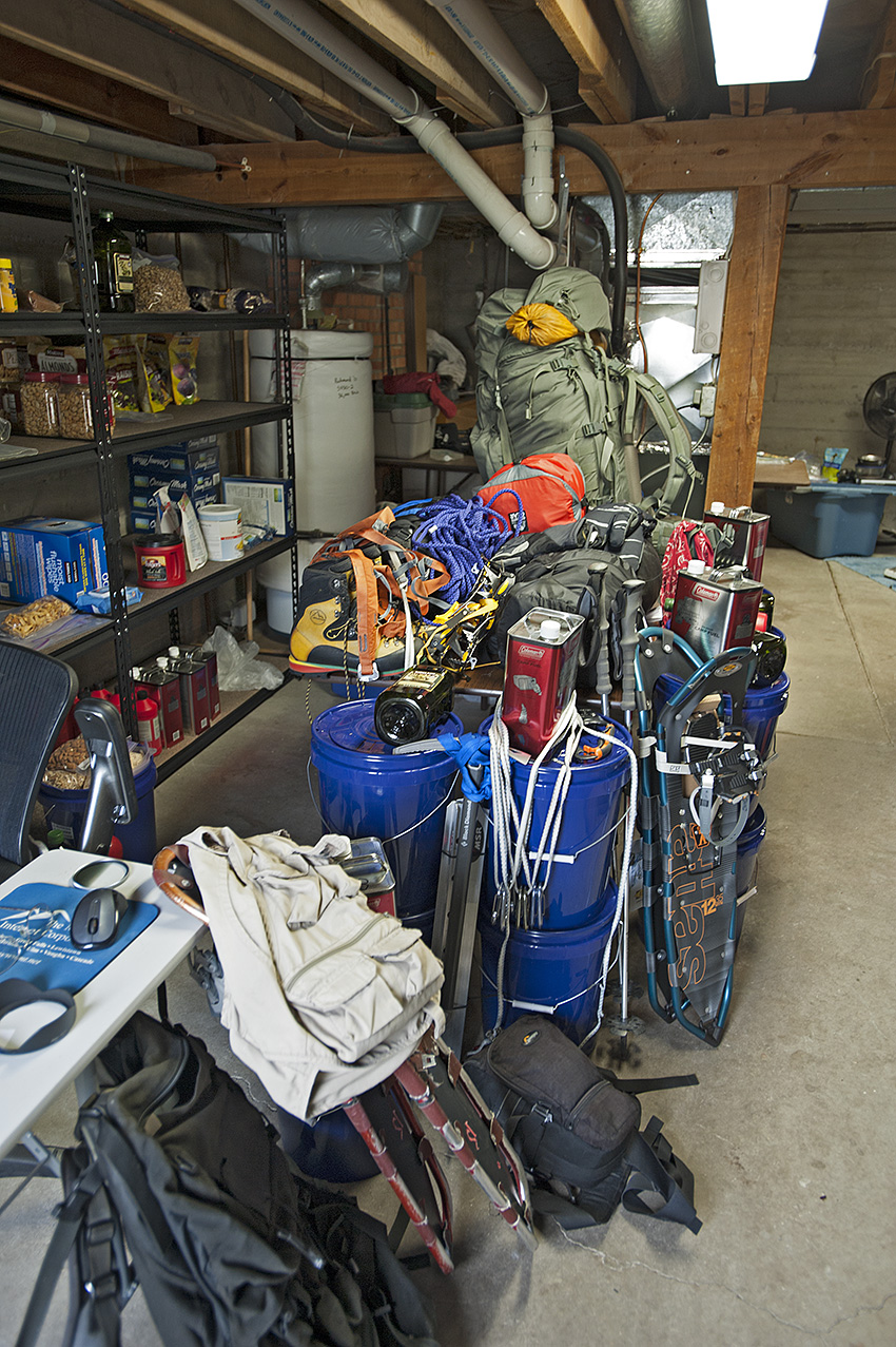
The gear and resupplies for the winter trips on the Continental Divide.
This is my third attempt at the first of three sections on the Continental Divide from the Wyoming border to the Canadian border in Glacier National Park. It is also the third time I have prepared resupplies for this area. Frankly, I have grown weary of placing the packages in the autumn only to retrieve them the following spring and early summer. With that said, numerous alterations continue with the resupplies, the load, and the trip itself. Here are the main changes.
• Continued to become more familiar with the route.
• Altered portions of the route to avoid bringing mountaineering gear.
• Shortened the distance for the upcoming winter.
• Made photography gear changes.
• Altered the food variety.
Camped on a saddle on the Continental Divide in Henrys Lake Mountains. Bald Peak (10,180 ft.) is in the background.
During the first days of June, on a receding snowpack I traveled in Henrys Lake Mountains. In July, I was in the southern portion of the Bitterroot Range near the Big Hole Valley. In August, I traveled in the Centennial Mountains. As a result, I altered three areas of the route.
Black Mountain (10,237 ft.) on the Continental Divide in Henrys Lake Mountains
Although it will still be necessary to bring mountaineering gear in Henrys Lake Mountains, I changed the route at two locations in an attempt to get through the most hazardous 15 miles of it with a greater margin of safety and perhaps more quickly.
Red Rock Mountain (9500 ft.) and Mt. Jefferson (10,203 ft.) in the Centennial Mountains.
While it may be a mistake, I will omit the mountaineering gear when I travel through 60 miles of the Centennial Mountains. Rather than an ascent between Red Rock Mountain (9500 ft.) and Mt. Jefferson(10,203 ft.), my route will take me through the much milder Hell Roaring Canyon two miles west of the original ascent, which is also where the official Continental Divide Trail (CDT) is located.
The view north of Goldstone Pass in the Bitterroot Range near the Big Hole Valley.
Approximately 150 miles later, in the southern Bitterroot Range, north of Goldstone Pass, and once again carrying mountaineering gear, I will drop off the Continental Divide and follow the summer route of the CDT. These changes combined will shorten the route by seven miles.
In addition, I shortened next winter’s overall route by 120 miles. Rather than attempt to arrive on Interstate Highway 15, 30 miles southwest of Butte Montana, I will stop at Chief Joseph Pass on Highway 43. The distance I will attempt to travel through one winter is now only 338 miles rather than the original 460 miles. It had been my intention for the last two winters to include the 60 miles of Anaconda-Pintler Wilderness (APW) during the latter part of the winter season when the snowpack is the most stable.
Goat Flat area and Storm Lake Pass in Anaconda-Pintler Wilderness.
The steep and treeless slopes of the APW are nothing to trifle with between January and March. Oh well, I suppose it will be good practice for when I return to Glacier National Park a few winters up the trail.
Over the last several years, I have been incrementally shedding my load of professional photography gear. This year I took what I consider a giant step in this area. I started carrying a consumer level camera and lens while still carrying a wide-angle professional lens. The weight of my camera gear dropped to five pounds. During the winter of 2006, I carried 16 pounds of camera gear. While I am unsure how this will turn out, if I am wrong I can always retrieve the pro gear at one of the four road crossings during the trip.
Through the last two winters, my heaviest loads were more than 100 pounds. This upcoming winter my heaviest load, which will occur only once along the route, should be less than 70 pounds. Unfortunately, it will happen in some of the most dangerous terrain of next winter’s travel, Henrys Lake Mountains.
Near Lionhead Mountain in Henrys Lake Mountains with a load approaching 100 pounds.
The changes in my food will not necessarily lower the weight of the load. Nevertheless, it has become necessary to do something different. The dehydrated food I have been using for almost 10 years turns my stomach. This year I have replaced it with four varieties of freeze-dried food. In addition to palatability, the freeze-dried food gives me increased calories and protein. Losing backpack weight, as necessary as it obviously has become, is a moot point if I do not have the energy to travel due to a lack of eating what is in the pack. I need a minimum of 6000 calories per day to sustain me for approximately 2.5 months of winter travel. My previous supplies failed to do that although there was always more than 5000 calories per day in the food bag. Hell, what good is a larder if I am unable to eat from it?
After the last two winters of failures, I have little doubt that the original 460 miles is out of reach in a single winter. Admittedly, this decision to shorten the distance comes with plenty of hesitation. What if, as remote as it might be, what if there are still three weeks of winter remaining when I arrive at Chief Joseph Pass?
On December 21, 2014 in the parking lot of Chief Joseph Pass.
Hmmm, this is familiar ground; too often, I have bitten off more than I can chew. The last two winters have more than amply demonstrated that. The 338 miles will have to suffice.
Two days after a snowstorm, the snowshoes were dropping through the powder snow 1.5 feet. Another storm would arrive later this day and drop another three feet of snow. The location was the western edge of Yellowstone National Park, on Madison Plateau and near the Continental Divide.
In another indication of the rapidly closing date for beginning the 93-day winter expedition, Montana and Idaho’s mountain snowpack has begun to accumulate. Being early winter however, it comes as no surprise that the NOAA SNOTEL site near Darkhorse Lake (8700 feet), located in the southern Bitterroot Range, shows that in the last five days the snowpack has dropped from nine to six inches. More is on the way though. Beginning tomorrow evening, November 1, another 12 inches could fall. Moreover, with our going into November, the average daily temperature is continuing to drop. Most of that snow is going to remain on the ground until next June.
Of far greater interest to me than the increasing snowpack is the weather phenomenon known as El Niño. I am hoping it plays a strong role in next winter’s snowshoe trip. As of this date though, there is some uncertainty of how strong it will be, or for that matter, when the event will begin. The latest extended forecast, released on October 16, 2014 called for a 67% chance of a mild El Niño beginning by mid-November. From Yellowstone National Park to Butte Montana, the area I will be traveling through next winter, the impact of this weather pattern normally means less snowpack and more importantly, warmer temperatures. Those higher than average temperatures could create a crust I can walk on sooner than the latter days of February.
The reason I don’t begin extended winter trips until at least the beginning of February, is due to the condition of the snow. Although I relish the idea of having enough snowpack to cover brush, timber fall, and rock fields, the real reason I wait until later concerns whether a crust has formed on the snowpack. Traveling in deep powder is a nightmare. It can cut my daily average of 6 and 8 miles down to 3 and 4 miles.
The La Niña winter of 2008 brought the opposite effect of El Niño. With the storms lining up behind each other, I traveled through three feet of powder during the latter days of March. That occurred during the double crossing of the Bitterroot Range west of Montana’s Bitterroot Valley. The average day was eight hours of travel with my forward progress between three and four miles. Because I was compelled to build trail without the backpack, I actually traveled between 9 and 12 miles each day. I needed nine days to travel the first 25 miles, which included going over Blodgett Pass. By the last day, even my three-day emergency food supply was at the crumbs level. Fortunately, the resupply bucket was where it was supposed to be.
A crust would have changed the character of the Selway-Bitterroot Wilderness trip (although I wonder what I would have written about if the trip had gone smoothly). As it were, the snowshoe portion of the trip was only 115 miles, but still took one month to complete.
Using primarily snowshoes, the distance I will travel on the Continental Divide during the winter of 2015 will be 462 miles. I have to be able to average approximately 5 miles per day for 93 days. That is not possible in deep powder. Granted, I will have 107 days of supplies out there, but I will have to make up the days of downtime from the inevitable storms. More than that, for as much as 12 days I will be traveling on rope and crampons, where the measurement of forward progress is in feet rather than miles.
Another troubling consideration is the Anaconda-Pintler Wilderness, which I will enter 375 miles into the trip. During the winter of 2007, I undertook five trips in this wilderness, where the final trip included crossing it and the Continental Divide. As the result of that experience, I consider it vital to get through the wilderness near the end of the winter rather than begin the following winter’s trip with the Anaconda-Pintler Wilderness still in front of me.
So yes, I am watching with a keen interest in what the future holds with the El Niño weather pattern.
Goldstone Lake in the Southern Bitterroot Range. Located at the head of Bloody Dick Creek Canyon, near Goldstone Pass on the Montana and Idaho border, which is also the Continental Divide.
As I traipsed up the hillside of Mount Helena 90, 60, and then only 30 days ago, I asked myself repeatedly why I should keep going. Wasn’t it already clear enough that my days of carrying a load were over?
On the Fourth of July weekend my wife, Carleen, the dogs, and I day hiked to Johnson Lake in Montana’s Anaconda-Pintler Wilderness, five miles beyond the trailhead, and retrieved a four-day cache, which I placed there the previous autumn. Going in I doubt I was carrying 25 pounds. During the exit the load was approximately 45 pounds, and too much for my back. Carleen offered numerous times to relieve me of at least some of the load. I refused and finally requested that she not to ask anymore, which she obliged. At the first of two bridge crossings on Falls Fork Rock Creek, we encountered another day hiker. Seeing the pain I was in, he offered to carry the load. Although tempted, I also turned his good deed away. We saw him again three quarters of an hour later. At this point, the pain was so excruciating, I was stopping every 100 to 200 feet. Once more, he offered to carry the load, which I again turned down. I eventually arrived at the trailhead, though I was near the end of my rope. The following day we hiked up another canyon similar in distance and elevation. This time Carleen carried the pack without any complaints from me for the entire trip.
The Fourth of July weekend was about seven weeks ago. During that time, I have had very little hope that I would ever get to backpack again, much less continue the Continental Divide trips for the next three winters. I continued to ask myself the rhetorical question of why I should keep going, whose real meaning was “I want to quit”. But I kept going. As recently as two weeks ago, Carleen carried my seven-pound camera bag out of the backcountry in the southern Bitterroot Range of the Big Hole Valley. She enthusiastically observed that I carried a 25 or 30-pound load 5 miles in an ascent of close to 2000 feet, a feat I was unable to do one month earlier. She accused that event as being progress, while I disagreed. For heaven’s sakes, in less than six months, I was going to have to carry upwards of 90 to 100 pounds, five to seven hours every day while wearing snowshoes! Yeah, some kind of progress.
Still carrying approximately 20 pounds on my back, we had to stop often until the pain subsided enough for us to continue toward the vehicle. Then something happened. We were within one mile of the vehicle when I called for what turned out to be the final stop. As we started moving again, I recalled what a yoga therapist fruitlessly tried to explain to me three weeks earlier. To minimize the pain as I walked I would attempt to curve my spine in the direction I was walking, while keeping my body upright, rather than hunched over. It worked! The pain disappeared for the remainder of the walk.
Nevertheless, on the chance that it was a fluke I said nothing to Carleen about it until the next day during the exit of another canyon similar to the previous day. Once I verified that the previous day’s experience was bona fide by carrying the same load unassisted, that I had finally hit pay dirt, only then did I tell her about it.
After that day I progressed with ever larger loads until finally two days ago I carried 70.5 pounds on Mount Helena and covered a distance of one and three-quarter miles in one hour. No pain! Encouraged tremendously, the following day I changed out the smaller 20-year-old backpack for the newer and larger backpack. I also included an additional 21 ounces of water, all of which increased my load to 75.5 pounds. The result was a new day, a different experience, and not a pleasant one. For approximately half of the one-hour walk I was on the edge of low-level pain.
I was 300 feet from the asphalt of the city streets when once again I silently asked myself what the use was to continue. This was the same incantation of five months earlier when I was without a load, and then repeatedly through the remainder of spring and again this summer. It is almost as if my head has only one answer for pain and being uncomfortable: Quit. Hell, a barnyard chicken has a larger variety of cackles than that.
So here’s the deal concerning my carrying over 70 pounds for the third day running. I will do my normal stretching and strengthening exercises, put on that large pack and head up the hill. Because it is part of the scheduled strengthening and endurance training, I will also increase the amount of ascending/descending for the day, and travel a greater distance. And when my head once again starts its singular cackle, I will keep walking and climbing.
Glacier National Park personnel repeatedly stated that during the winter the high mountain cirque, Hole in the Wall was inaccessible. They were almost right.
This is the story and photos of four trips that almost took the author’s life twice.