Posted on Leave a comment

A December Weather Change

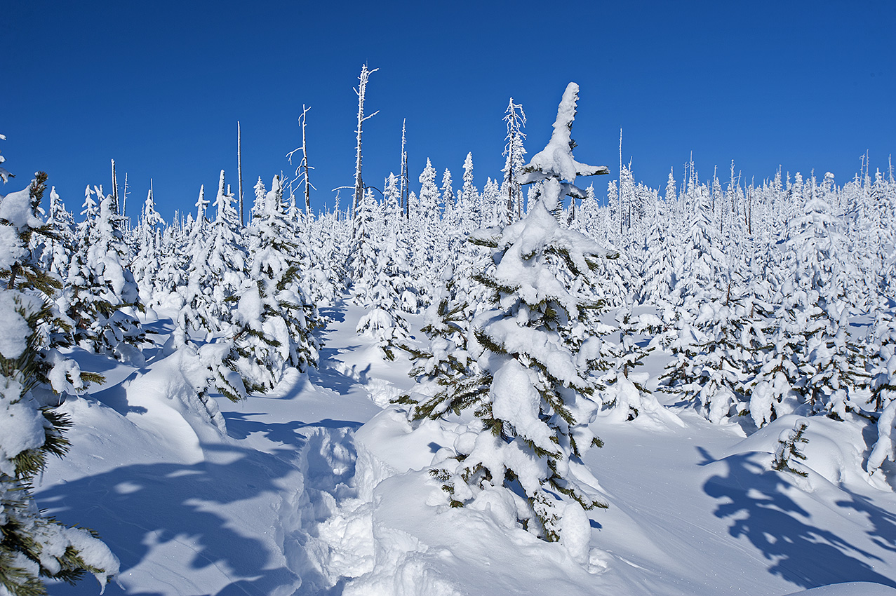
In the last week, the weather has changed in Western Montana. We have gone from moderate snowfall (between 6 inches and 3 feet, depending on the elevation) and subzero temperatures, to an extended forecast with a mixed bag of scattered rain and snow, including temperatures up to 40°F. Even the elevation of 10,000 feet along the Continental Divide has an extended forecast with a low of 20°F.

Could this be the beginning of the El Niño weather pattern? The NOAA is staying quiet. That could be the smart thing for them to do. I, on the other hand, am not part of the NOAA. Indeed, where the weather is concerned I am a hands-on kind of guy. For that reason, any attempt I would make to cross an avalanche slope after the recent snowstorm would be dangerous, even foolhardy. If it were to rain on the slope, that same attempt would likely be fatal. On the other hand, this weather can also settle the snowpack while creating a crust I can walk on with my snowshoes and crampons. This latter condition is exactly what I am hoping to have for the Continental Divide trip.

In addition, 50 miles into the Continental Divide trip beginning in January 2015, I will encounter my first slopes that require technical climbing gear to ascend and descend. Besides the peril of possible avalanches, proper placement of snow pickets in powder to anchor my rope would be difficult if not impossible.

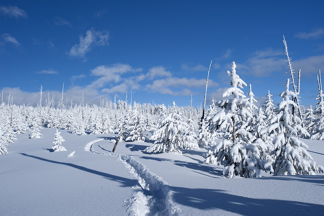
Yesterday, I drove north for my first winter training trip, which I intended to undertake in the Dearborn River Canyon of the Scapegoat Wilderness. With the nonstop rain soaking into the snowpack at the trailhead, I canceled the trip. Forget the avalanches. Rainfall during the winter on my equipment and on me is dangerous. Nevertheless, go I will, just not up there. This morning I leave for Bannock Pass on the Montana and Idaho border to the south. According to the weather forecast, any moisture I receive down there will be snow.

To be clear, during the 90-day trip, which begins in approximately 30 days, with the exception of rain falling on the snowpack, it makes no difference what the weather conditions are. I will travel through most of it.

With that said, you know I sort of feel like I’m playing poker with the totally emotionless old man winter. Regardless of what I do, his stare never changes. I look into his eyes, at his protected card hand, and then glance at the wall behind him. There is no perceptible movement in his eyes or on his face. Finally, I place my cards on the table. In turn, he places his on the table. Then while his blank, yet cold eyes continue to stare a hole through me, his hand smashes mine to a pulp. Oh boy.


Posted on Leave a comment

The El Niño Forecast, Circling the Drain

MP020414156
On February 4th, 2014, in Yellowstone National Park, the latest storm had just dumped another three feet of snow. Within hours of this photo, a -40 F temperature would arrive.

Is it time to say goodbye to the El Niño forecast and alter my travel plans accordingly? As of November 20, 2014, the three-month extended outlook along Montana’s portion of the Continental Divide predicts from 33% up to a 40% chance for above normal temperatures. In addition, the NOAA (http://www.cpc.ncep.noaa.gov/) is now predicting an equal chance for a normal winter to 33% chance below normal moisture.

This interprets into an increased chance I will encounter powder snow until near the end of February 2015. The winter of 2014 also had the label of “equal chance” for a normal winter. The snowpack was huge and the powder nearly untenable for extended snowshoe travel throughout the month of February.

It has been and continues to be, albeit with less hope, my plan to begin the trip near the end of the first week of January. This close, 44 days until beginning the 90-day trip, however means the likelihood is growing that I will not begin the trip until the first part of February 2015.

Last autumn I placed my resupplies at locations where I could take on traveling in deep powder snow. While I have a tremendous amount of food and fuel to get me to Monida Pass on Interstate 15, there may still not be enough. In deep powder snow, I average between three and four miles of forward progress per day. There is also the possibility that I will have to use technical climbing gear at six separate locations, where my daily progress measurements will be in feet rather than miles. Additionally, there will be down days due to storms and bad avalanche conditions.

I have 39 days of supplies for the first 140 miles of the route. If I only average three miles per day I will run out of supplies eight days before arriving at Monida Pass. Should that happen, I will lose three and four pounds of body weight per day. To encounter a weight loss like that after already being on the route for one month would be devastating.

Throughout the 462-mile route I have alternate routes to be used to get around avalanche areas and if needed, to shorten the route. One such route is located at Red Rock Pass. However, that would only shorten my route by two or three days. After that alteration, my options would be limited, and my supplies would still fall five days short of Monida Pass.

With that said, I have always known the trip carries risks. As much as I have prepared, it may not be enough. Only traveling the route will clear the air. Nor is there anyone in front of me who has experience with this route to advise me. My most experienced advisor too often has also been my greatest enemy—my head.

Posted on 2 Comments

Of Crusty Importance: El Nino

MP020114110
Two days after a snowstorm, the snowshoes were dropping through the powder snow 1.5 feet. Another storm would arrive later this day and drop another three feet of snow. The location was the western edge of Yellowstone National Park, on Madison Plateau and near the Continental Divide.

In another indication of the rapidly closing date for beginning the 93-day winter expedition, Montana and Idaho’s mountain snowpack has begun to accumulate. Being early winter however, it comes as no surprise that the NOAA SNOTEL site near Darkhorse Lake (8700 feet), located in the southern Bitterroot Range, shows that in the last five days the snowpack has dropped from nine to six inches. More is on the way though. Beginning tomorrow evening, November 1, another 12 inches could fall. Moreover, with our going into November, the average daily temperature is continuing to drop. Most of that snow is going to remain on the ground until next June.

Of far greater interest to me than the increasing snowpack is the weather phenomenon known as El Niño. I am hoping it plays a strong role in next winter’s snowshoe trip. As of this date though, there is some uncertainty of how strong it will be, or for that matter, when the event will begin. The latest extended forecast, released on October 16, 2014 called for a 67% chance of a mild El Niño beginning by mid-November. From Yellowstone National Park to Butte Montana, the area I will be traveling through next winter, the impact of this weather pattern normally means less snowpack and more importantly, warmer temperatures. Those higher than average temperatures could create a crust I can walk on sooner than the latter days of February.

The reason I don’t begin extended winter trips until at least the beginning of February, is due to the condition of the snow. Although I relish the idea of having enough snowpack to cover brush, timber fall, and rock fields, the real reason I wait until later concerns whether a crust has formed on the snowpack. Traveling in deep powder is a nightmare. It can cut my daily average of 6 and 8 miles down to 3 and 4 miles.

The La Niña winter of 2008 brought the opposite effect of El Niño. With the storms lining up behind each other, I traveled through three feet of powder during the latter days of March. That occurred during the double crossing of the Bitterroot Range west of Montana’s Bitterroot Valley. The average day was eight hours of travel with my forward progress between three and four miles. Because I was compelled to build trail without the backpack, I actually traveled between 9 and 12 miles each day. I needed nine days to travel the first 25 miles, which included going over Blodgett Pass. By the last day, even my three-day emergency food supply was at the crumbs level. Fortunately, the resupply bucket was where it was supposed to be.

A crust would have changed the character of the Selway-Bitterroot Wilderness trip (although I wonder what I would have written about if the trip had gone smoothly). As it were, the snowshoe portion of the trip was only 115 miles, but still took one month to complete.

Using primarily snowshoes, the distance I will travel on the Continental Divide during the winter of 2015 will be 462 miles. I have to be able to average approximately 5 miles per day for 93 days. That is not possible in deep powder. Granted, I will have 107 days of supplies out there, but I will have to make up the days of downtime from the inevitable storms. More than that, for as much as 12 days I will be traveling on rope and crampons, where the measurement of forward progress is in feet rather than miles.

Another troubling consideration is the Anaconda-Pintler Wilderness, which I will enter 375 miles into the trip. During the winter of 2007, I undertook five trips in this wilderness, where the final trip included crossing it and the Continental Divide. As the result of that experience, I consider it vital to get through the wilderness near the end of the winter rather than begin the following winter’s trip with the Anaconda-Pintler Wilderness still in front of me.

So yes, I am watching with a keen interest in what the future holds with the El Niño weather pattern.