Posted on 4 Comments

The Hazards of Autumn’s Winter

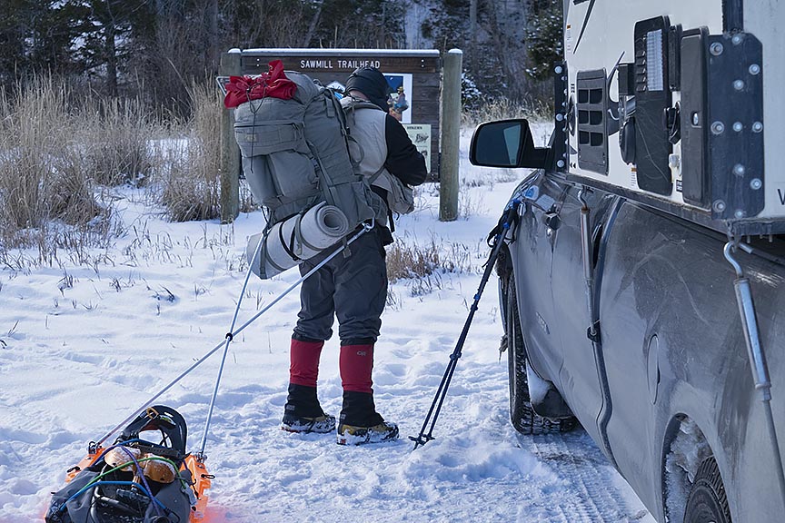
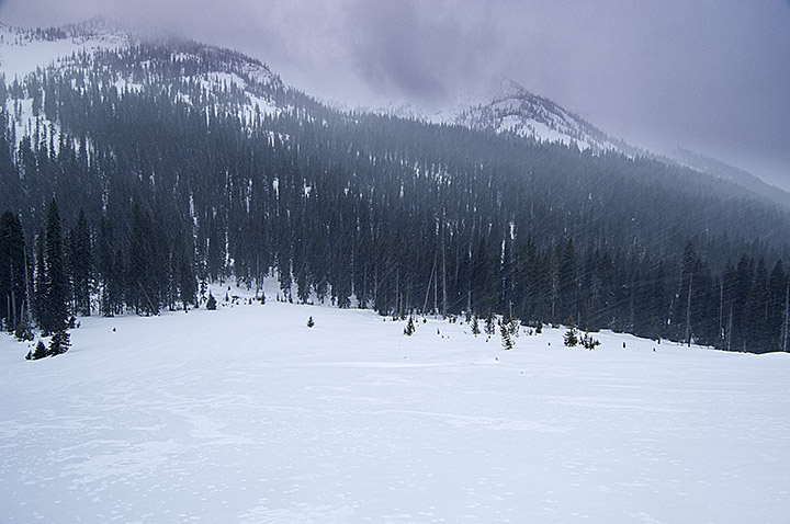
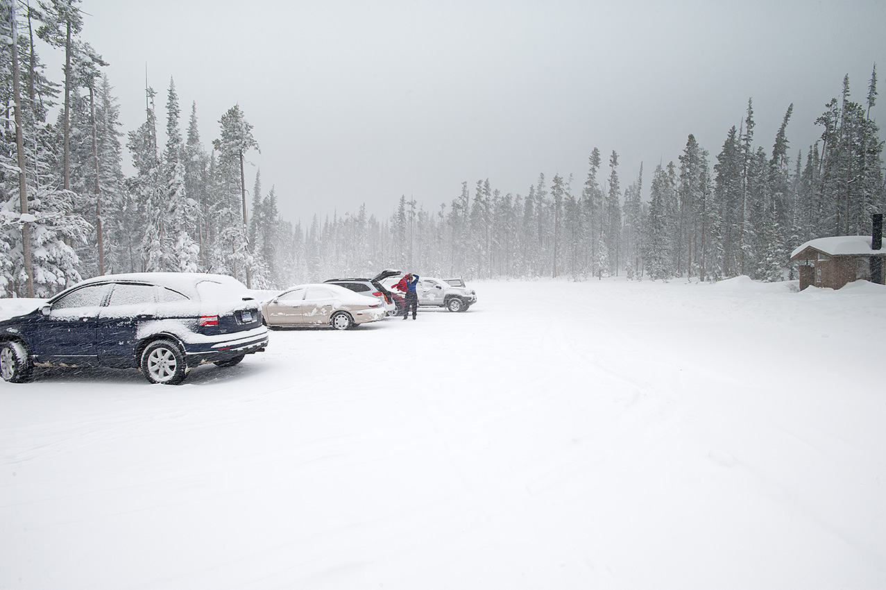
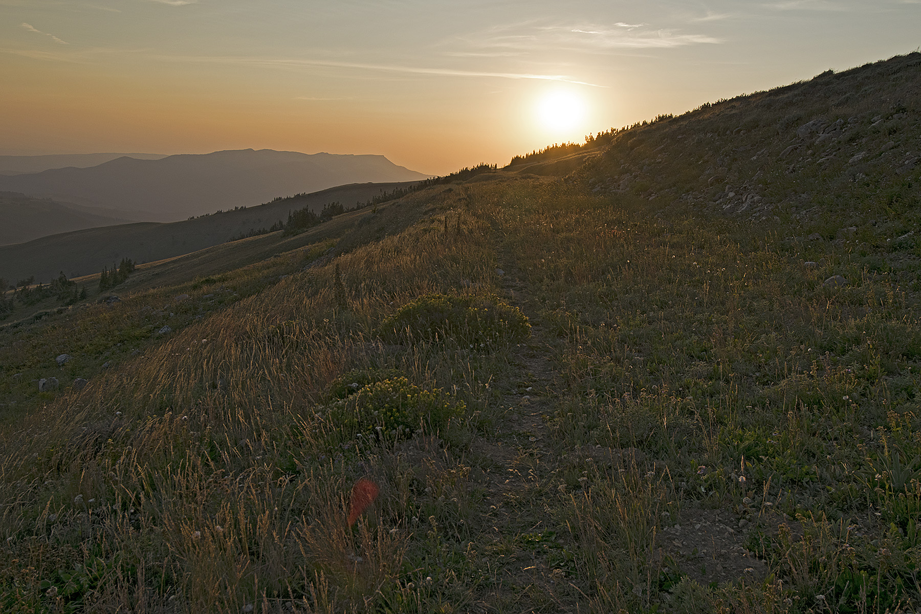
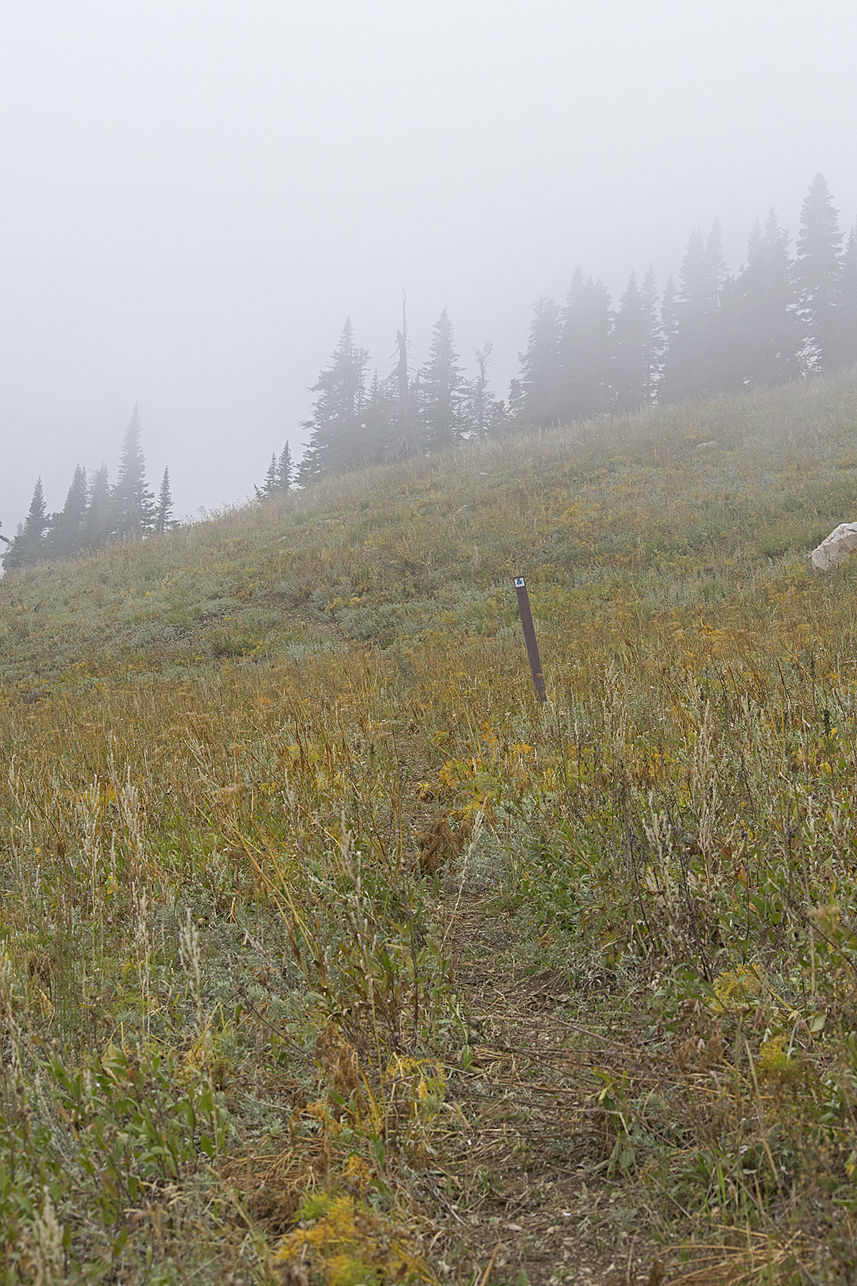
Every season in every year has its own flavor, and though still early, 2019’s autumn is no exception. About one week after the official arrival of autumn in September there came an early winter storm. In my own backyard located in Helena Montana, the storm dropped eight inches of snow. No record, but eventful. Knowing the forecast, in an overnight trip before the weather arrived I hurriedly drove to an area on the Continental Divide and placed four resupplies for this upcoming winter’s trip. I was back home 48 hours before the storm dropped in on us.

I waited one week before I resumed placing more resupplies. On October 5, the day I left I got one final forecast. I knew that a small and quick weather front that contained a mixture of rain and snow was coming Tuesday evening and Wednesday, replaced by sunshine and warming temperatures by Thursday. Despite the mud, I figured that I would be able to ride out this storm on the Divide while it passed through. I was wrong. On Monday, Carleen sent a message informing me of the drastic change in the forecast. The pervading thought was that perhaps I had better drop to a lower altitude. As a result, on the third night I stayed in Lima at the Mountain View Motel’s RV campground. The next day showed a forecast with much more deterioration of the weather. That is when I decided to ride out the storm in the TV room at home. As it turned out, my latest revised plan was a good one. We got another eight inches of snow in the backyard, this time with single digit temperatures. At some locations in our state, the temperatures dropped below 0°F.

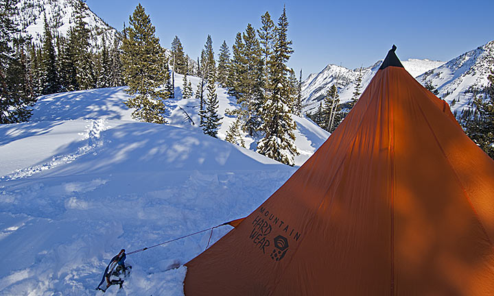
While I am set up to handle a storm of this magnitude in the backcountry, my head was nowhere near ready. Not after what happened during the second trip on Saturday and Sunday, and to a lesser degree, Monday.

From a windswept ridgeline on the Continental Divide, Idaho’s Lemhi Range and Valley can be easily seen.

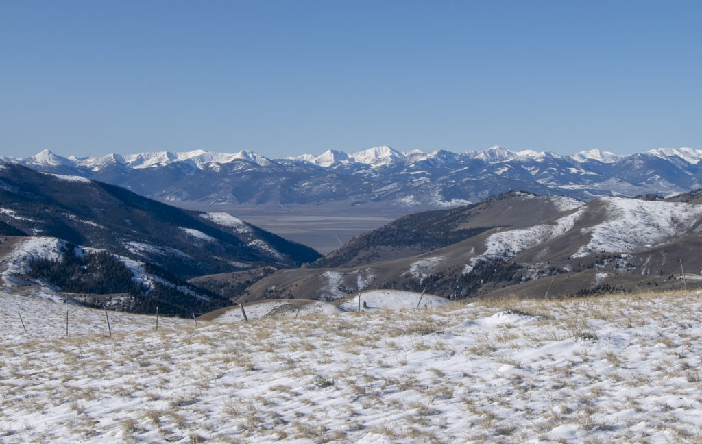
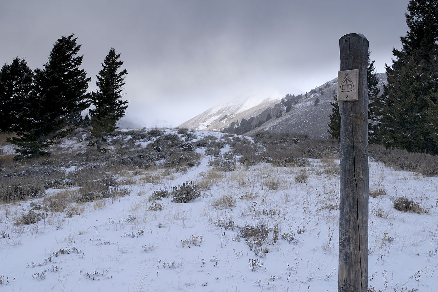
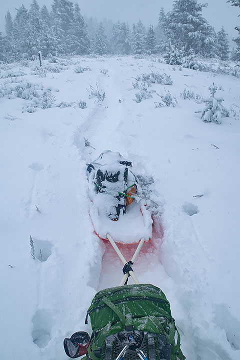
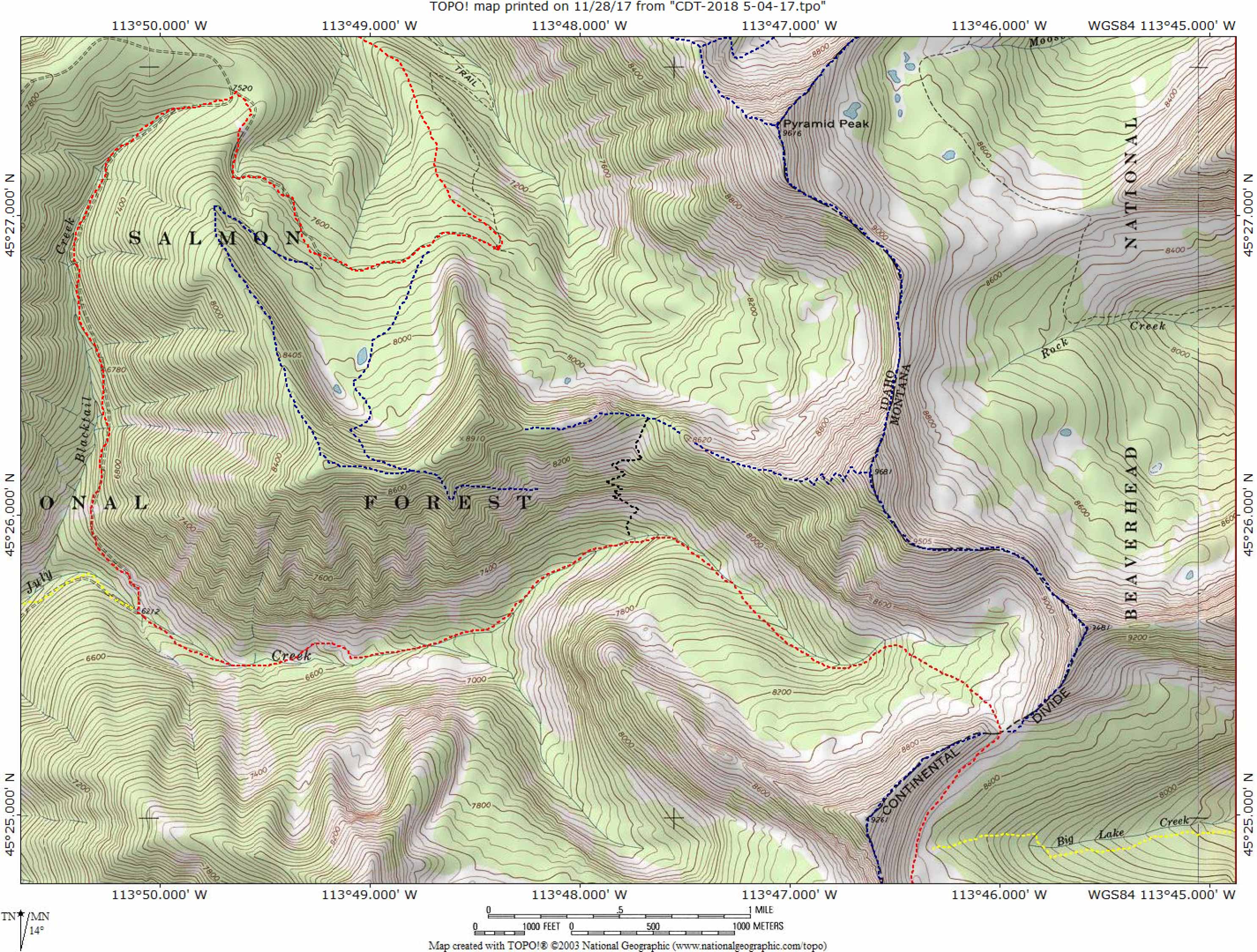
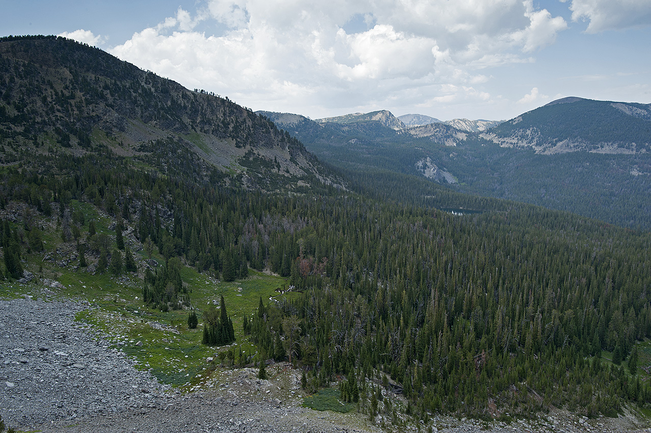
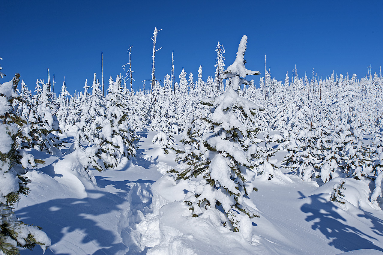
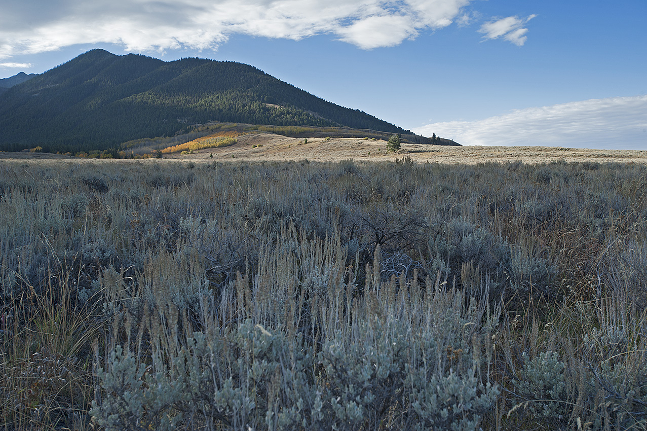
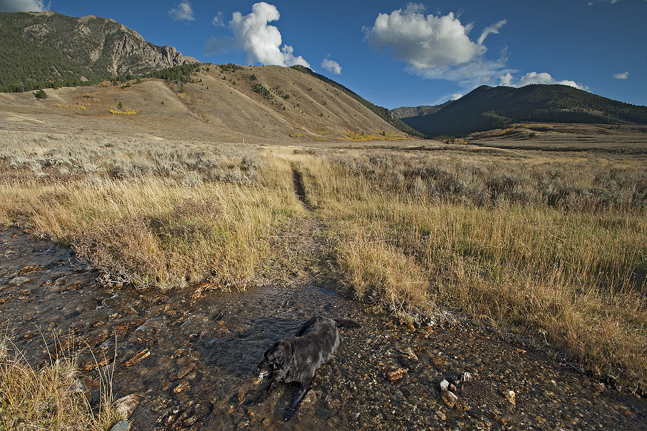
My plan for placing the resupplies during the second trip was to begin at the most remote location of next winter’s route, which was near the south side of Elk Mountain 10 miles north of Morrison Lake in Southwest Montana. Shortly before arriving on the Continental Divide, I left the mud behind, replaced by snowpack from the first storm. The almost treeless rolling hills were numerous. There were 13 of them, most with a snowdrift near the bottom of each north face. Because I was going downhill each time I encountered these wind driven piles of snow, I readily blasted through them with my camper equipped four-wheel drive pickup. I suppose I was fortunate though. The largest descent, approximately 600 feet had a rather small snowdrift, easily gotten through. Unfortunately, the tires lost their grip off and on throughout the descent.

Each north face brought increasing worry. This route was also my exit, and the crosswind that created the snowdrifts in the first place continued unabated.

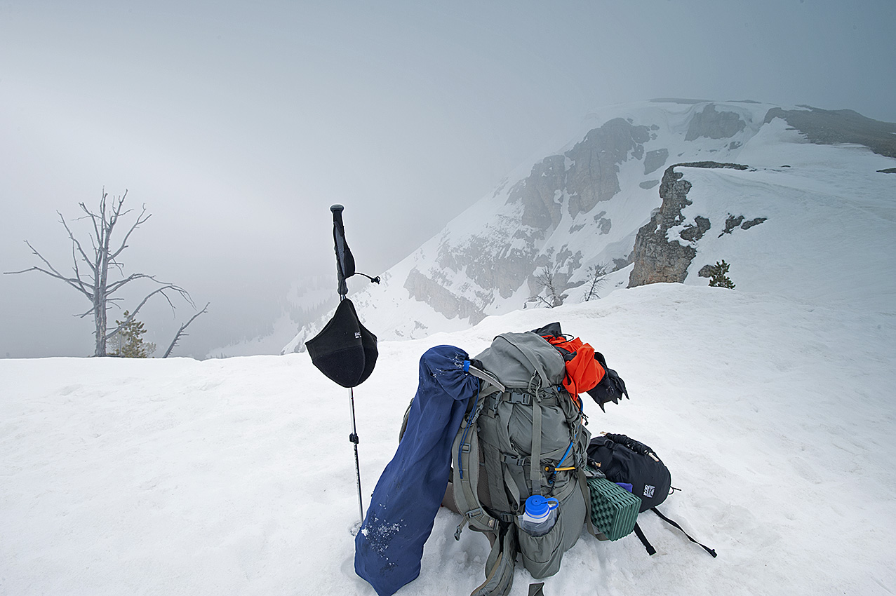
In the early evening, I had been busting through the snowdrifts for approximately one hour when I arrived on a small rise, which signified the area of the headwaters of Hildreth Creek. Although I had arrived at the location where I would be setting up camp for the night and placing the resupply, I nervously noted the strength of the westerly wind as it buffeted the truck. Staying with the plan, which had me spending the night in this area, I nevertheless relocated the vehicle to a less vulnerable location.

Retracing my tracks 500 feet south, I found a level location in the saddle below the first north face I would encounter during the exit. It occurred to me that I ought to place the resupply and exit that evening rather than waiting until the following morning. Not wanting to travel in this stuff during the hours of darkness, I decided against the evening exit.

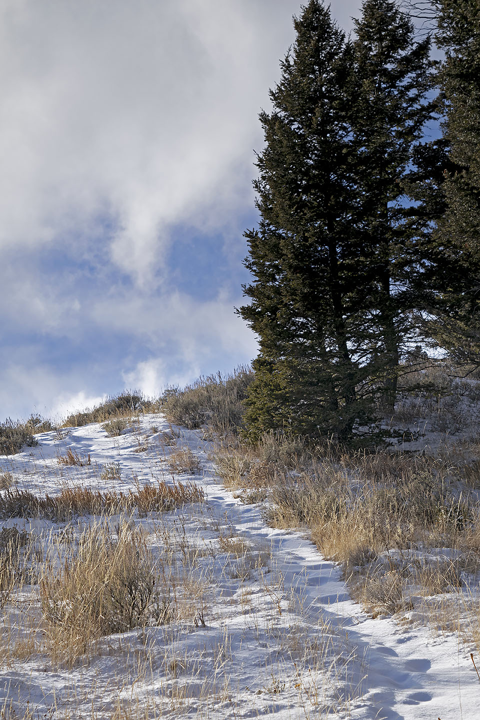
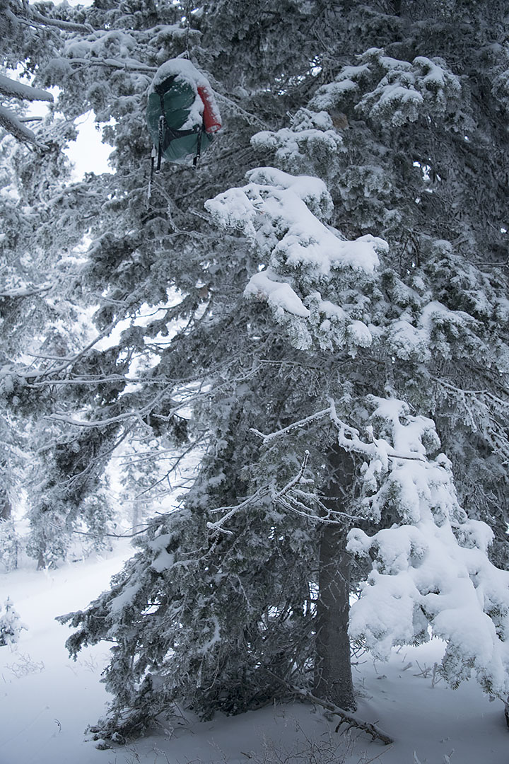
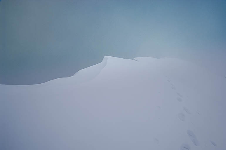
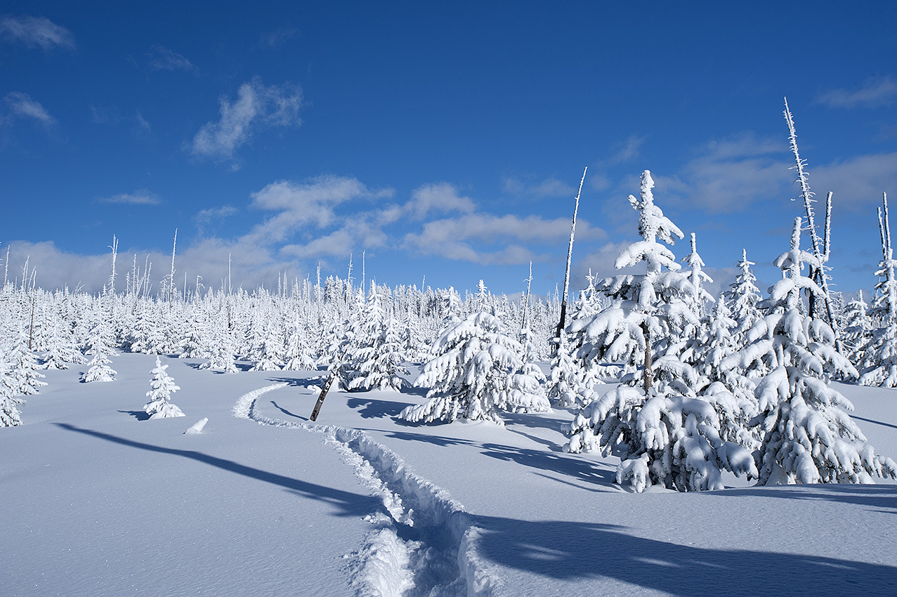
Throughout the night, the wind shook the camper. The following morning however, I woke to a calm and blue-sky day. The temperature was nothing to write home about though, 17°F, the coldest I had experienced since the end of April. I broke camp before placing the resupply. I also continued to worry. Although it did not snow at all the night before, the wind had damaged the trail I created getting in to this location. I wondered if it was more than the vehicle would be able to handle during the exit. Less than 200 feet from me, yesterday’s tracks briefly disappeared in a fresh snowdrift at the bottom of the north face.

The Continental Divide Trail near Elk Mountain (10,194 feet) southern view toward Morrison Lake.

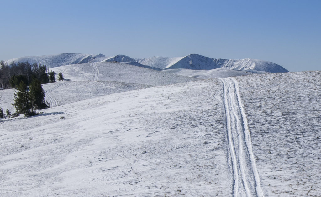
Once I started to drive, I got my answer within 20 minutes. The first two hills were approximately 75 feet high. My tires did some spinning out and the vehicle weaved about, but I got through those snowdrifts without issue. The third hill, much larger than the first two, but smaller than what was ahead, a mere 150 feet high, it had the largest snowdrift yet that morning. I got a 200-foot running start and at 10 or 15 mph smashed into the snowdrift, driving another 15 or 20 feet before I hit the brakes as I was coming to a stop. At this point, I could only hope I still had enough traction to back out the now high centered pickup.

Successful, and once again 200 feet away from the snowdrift, I hit the throttle, and once more slammed into the snowdrift, this time pushing ahead less than 6 feet beyond my last effort before again braking. Now queasy with fear, I stared at the snowdrift in front of me. I had barely made a dent in it, with the worst still in front of me. I was acutely aware that there were 10 more snowdrifts beyond this hill, many of far greater length and depth. Once again, I reversed the vehicle and was able to back out of the drift and down to the flat. It was now time to give my situation some more thought.

I’m figuring that some of you who are reading this, at this point are probably wondering what I thought I was doing. Yeah, I beat you to it. Because that is exactly what I was thinking in the saddle at the bottom of that hill. I was now regretting I had not exited the evening before, darkness be damned. More so, why did I have to come so far? I would have made out just fine next winter if I had placed the Hildreth resupply four or five miles south of here.

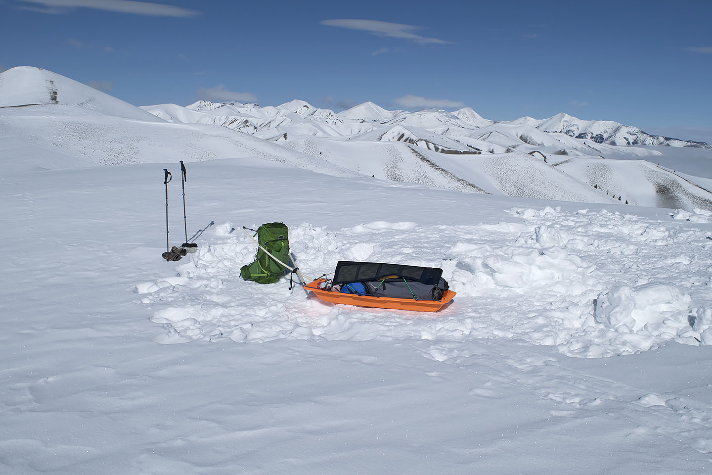
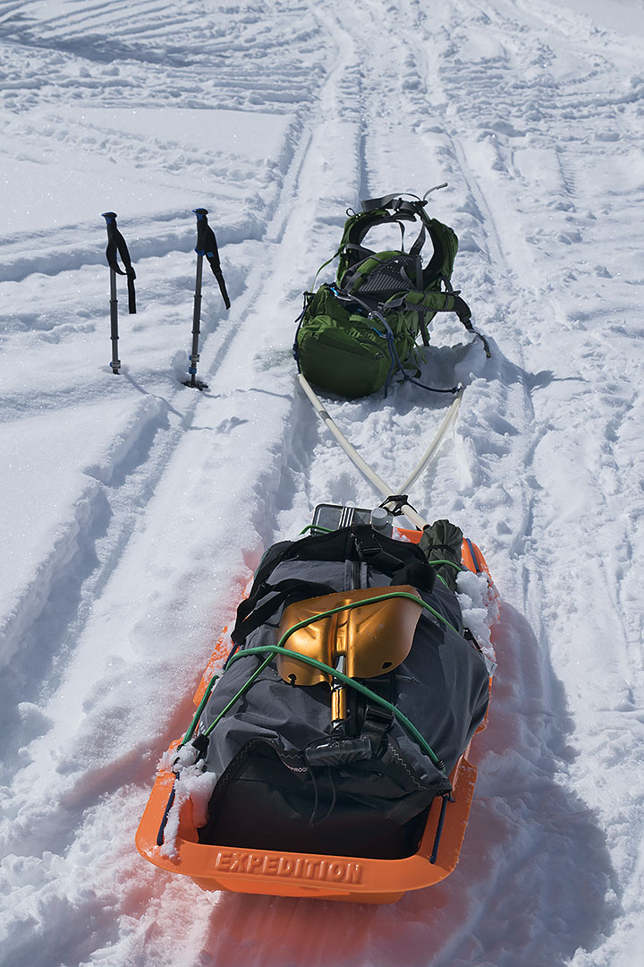
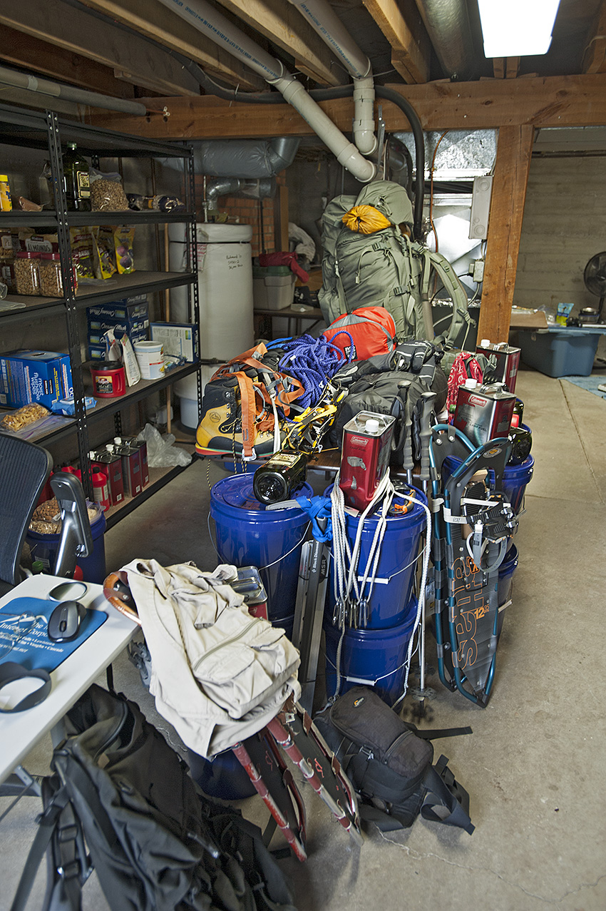
I thought about the equipment I carried in the pickup, designed to get me out of hard spots. The High Lift Jack, capable of handling 7000 pounds, part of a system of chains and heavy cable for getting the truck unstuck. Unfortunately, that system requires an anchor less than 100 feet distance such as a large tree or a 1000-pound boulder. There were no large rocks along this 10-mile distance, and most of the trees did not exist on the north face slopes. That meant if I got stuck all I had was the shovel. Doable I suppose, eventually. Nor were the four sets of chains for my tires going to be much good with a high centered vehicle.

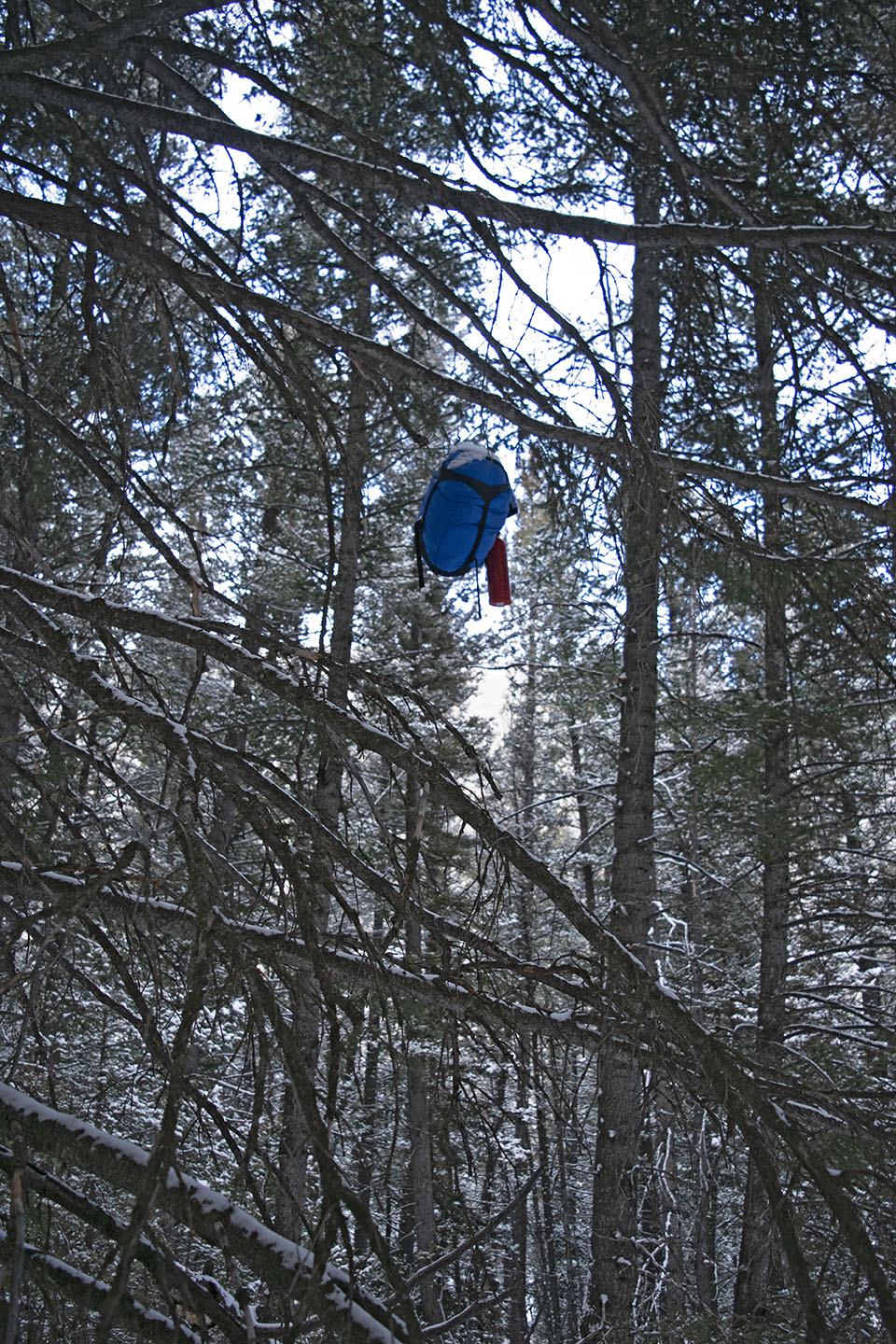
There was another possible option though, one that I did not like. Back on the small rise 500 feet north of the previous night’s camp was a jeep trail that dropped off the ridgeline to the east into the Hildreth Creek drainage. I had known about it for years on my topographic map. It was one of my emergency exit routes off the Divide during the winter trip, which would take me down to the main road. Although unmaintained during the winter, Medicine Lodge Road was four miles east of the rise, and then another four miles north to where it was maintained throughout the year. That morning as I placed the resupply in a tree I had noticed the trail several hundred feet below my location. Had the sun heated up that part of the snowless south face ridge, enough to turn a frozen ground into a muddy uncontrollable slide? I certainly was not anxious to go find out, but my options had just faded in that unpenetrated snowdrift. I turned north.

Less than three quarters of a mile distance, I once again stopped the pickup. Shaken by my carelessness over the last day and now feeling mighty careful, I got out of the vehicle and made some posthole tracks over to the edge of the initial drop to get a more certain look at what I was proposing to descend. It looked doable, for more than just going down, but also for a possible return if needed. A quarter mile below the rise, I arrived at a saddle and making a right turn, began the south face descent. No longer in the snow, the steep face looked more dry than frozen. My confidence rose rapidly as I made my way down the jeep trail, sagebrush on either side of me. Oh yeah, I’ve got this.

Several minutes later, as I neared the Hildreth Creek draw the angle of descent was lessening when I spotted the left curve ahead. In addition, now came the shadow creating trees, with the consequential patches of snow, ice and mud. Moments later the front tires arrived on the mud, and the truck took on a mind of its own, sliding the front end off the trail to the left, immediately threatening to roll the truck on its right side. With my heart lodged in my throat, I spun the steering wheel to the right while simultaneously hitting the throttle. The spinning tires spewed mud all over the place. Several seconds later, all four tires were back in the deep grooves of the muddy jeep trail. Inside the next mile, I spun out a few more times, but not nearly as badly as the first incident.

A tributary to Morrison Creek with the Continental Divide ridgeline in the background.

After crossing Hildreth Creek, a short time later, I arrived at a tributary of Morrison Creek. Figuring I was finally safe, I stopped and gave my shaky legs a small stretch. Looking back at where I had been 40 minutes before, I decided I didn’t like that trail. Credit was due though. The trail may have saved my dog and I on October 6.

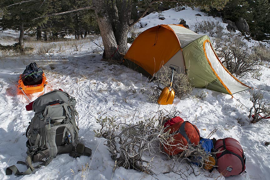
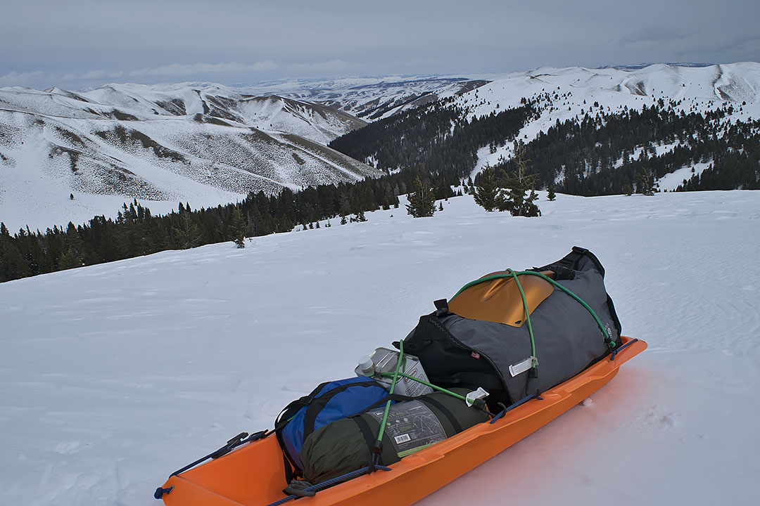
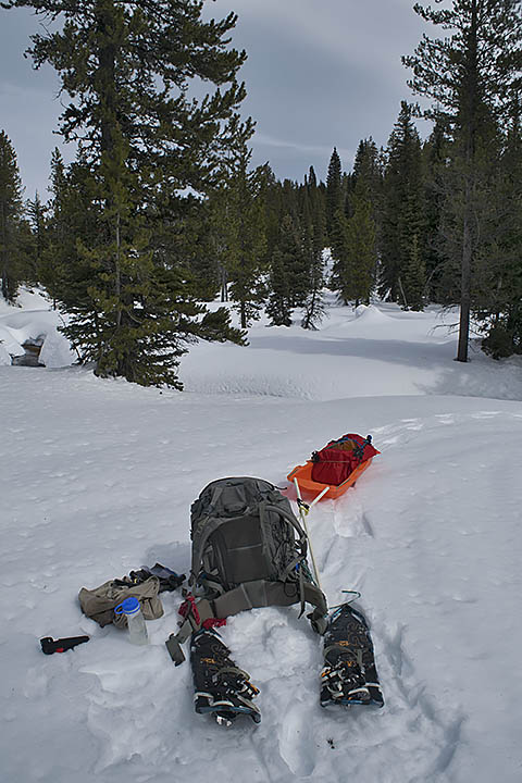
By the end of the day, in spite of more mud and snowpack, I got another resupply placed and was in position to place a third from my latest camp near Deadman Lake. On Monday, I placed three more resupplies and then exited the mountains.

In another few days, I am leaving again, and I have a confession to make. I have a strong desire that for the remaining resupply placement there will be nothing further to write.
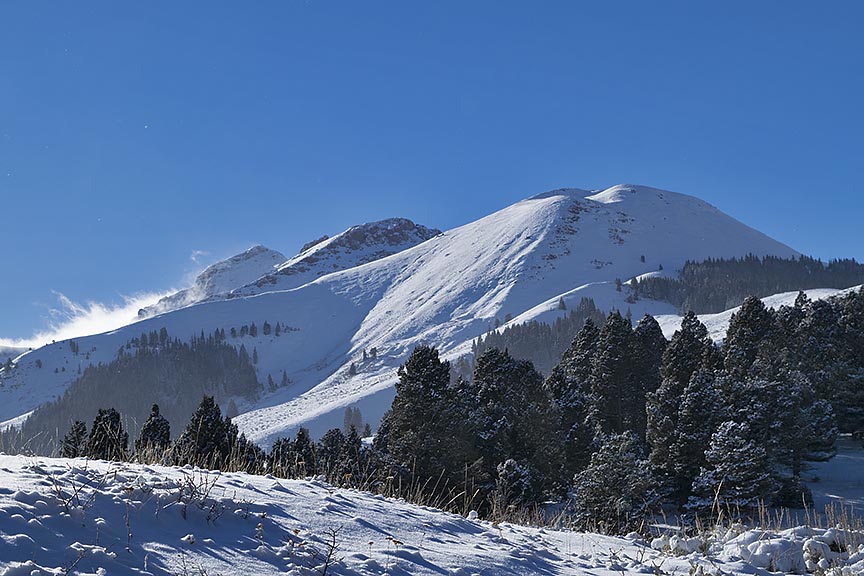
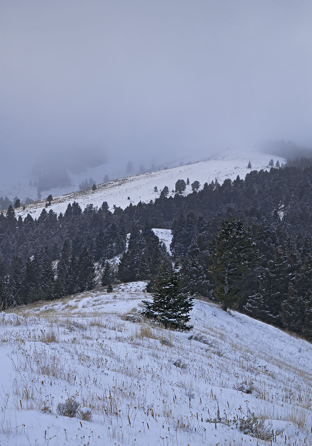
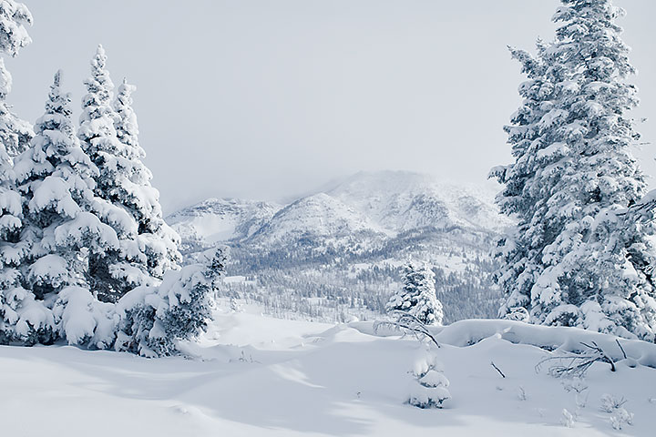
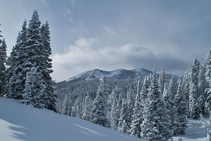
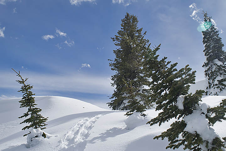
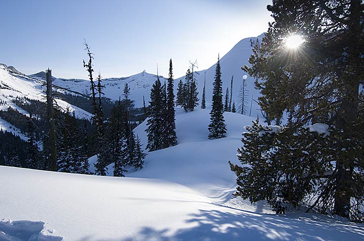
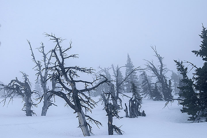
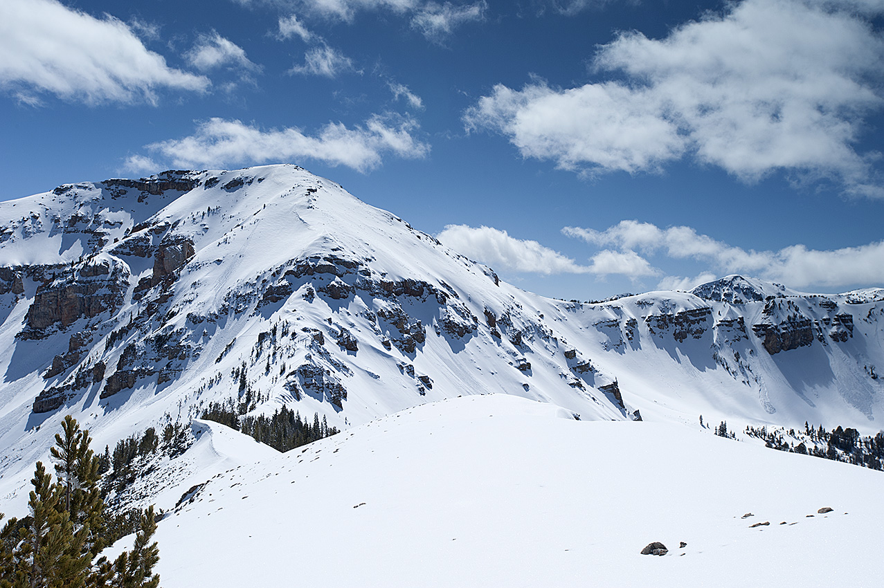
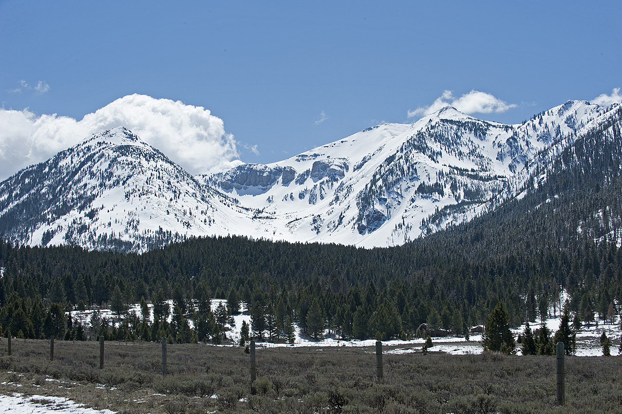
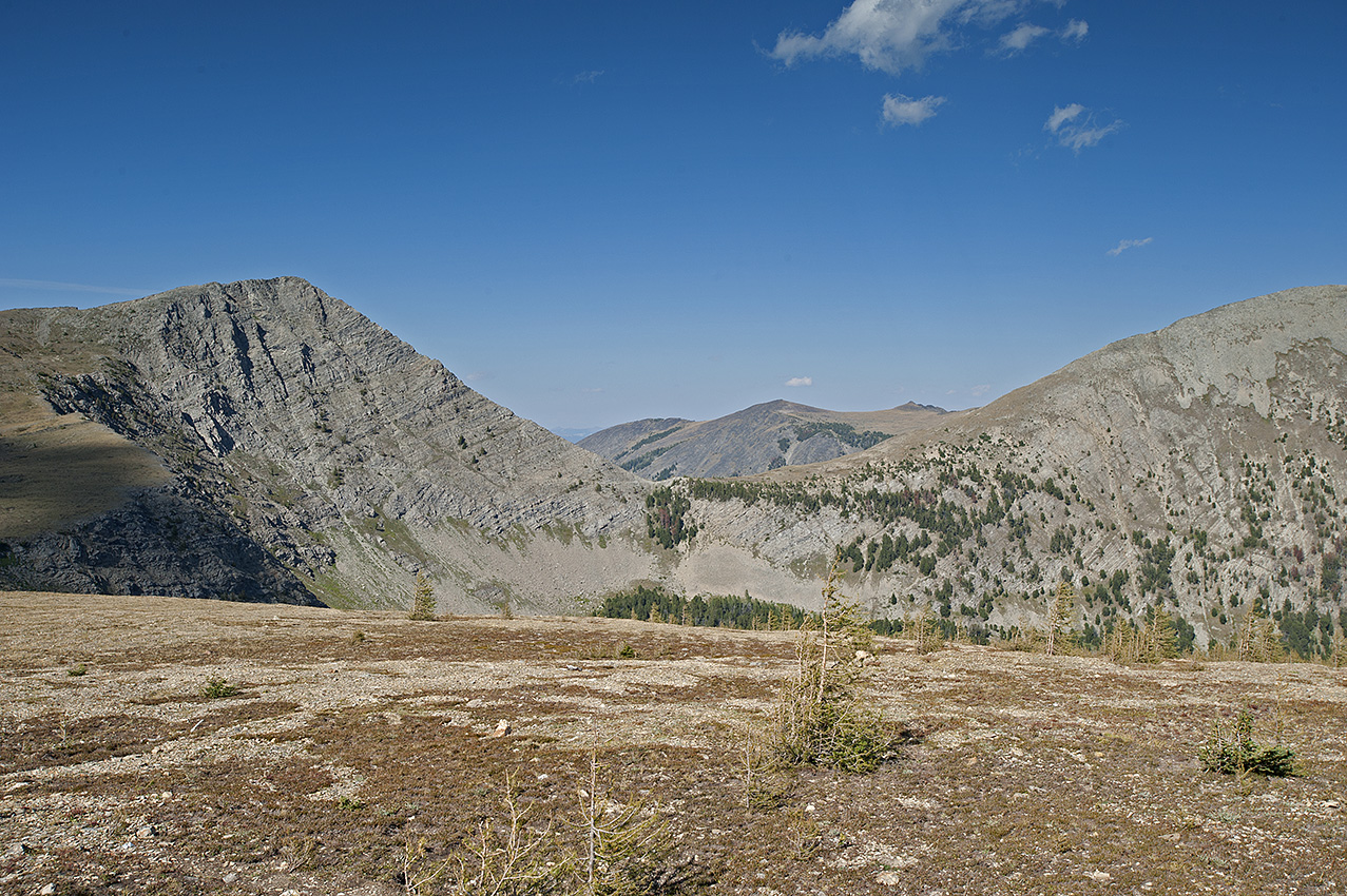
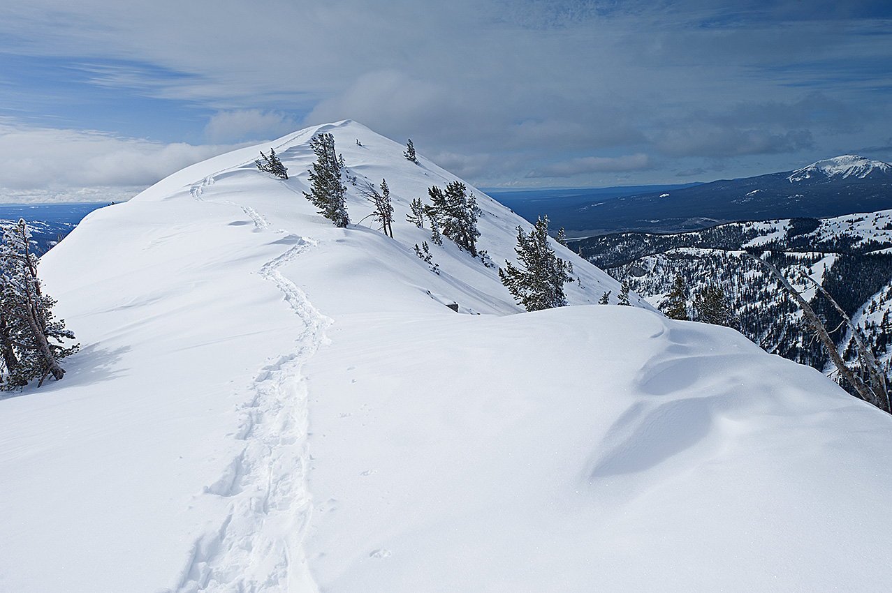
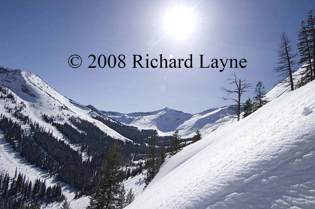
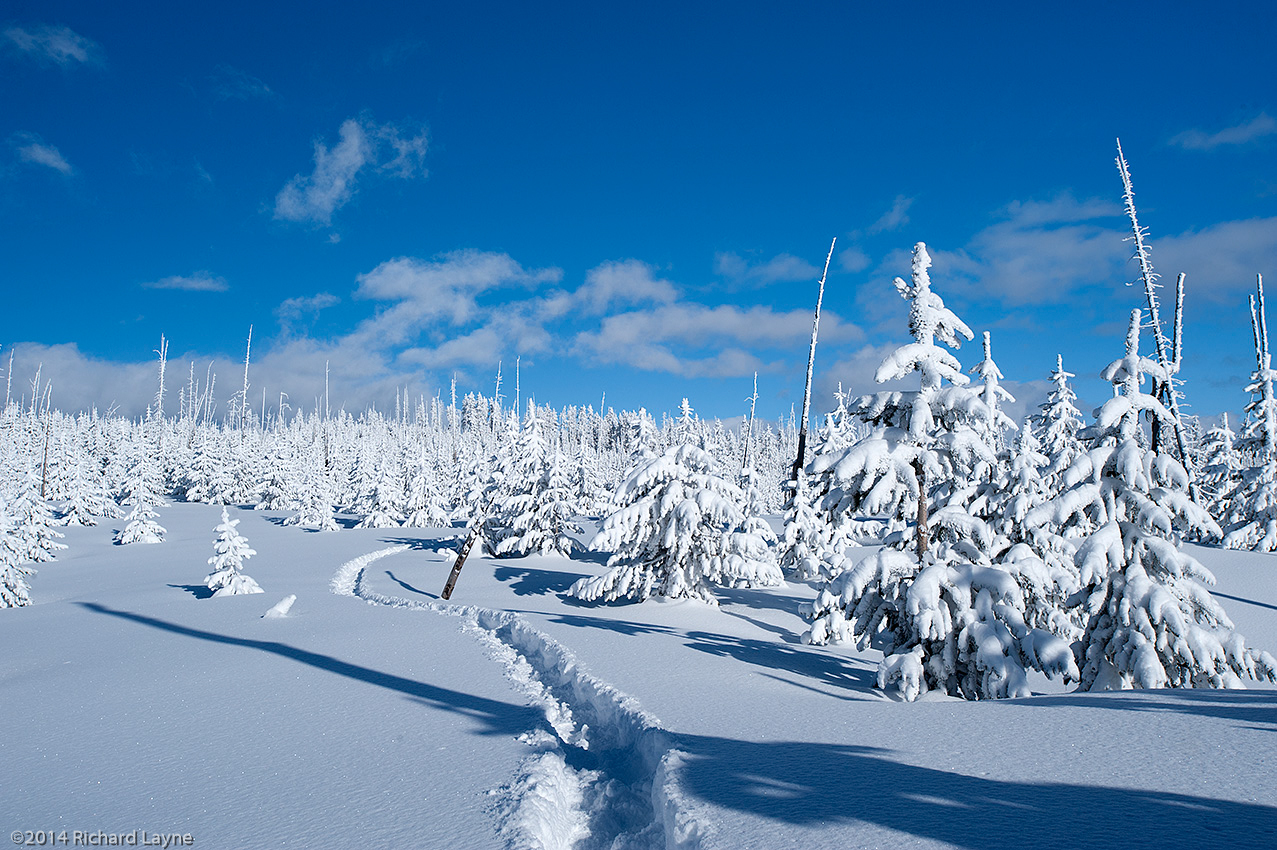
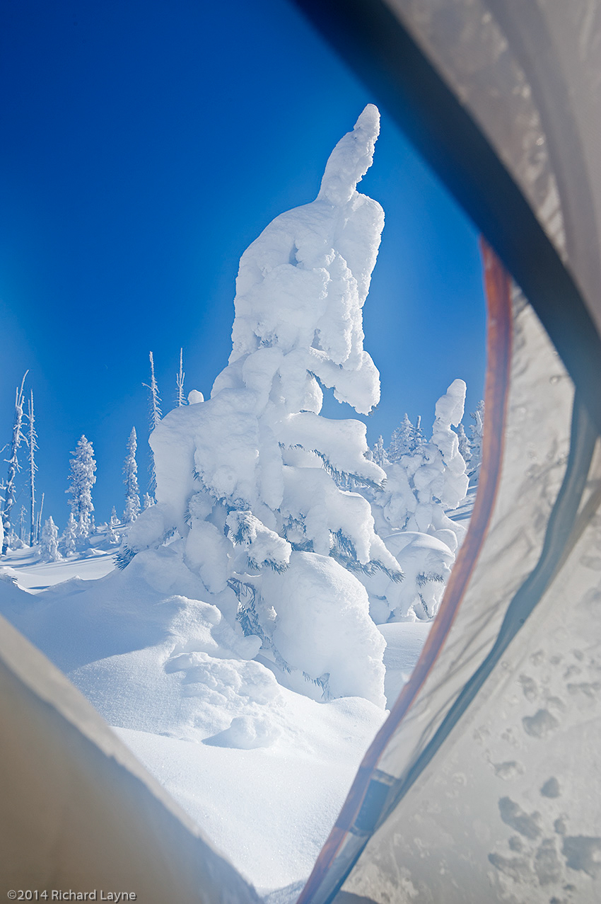
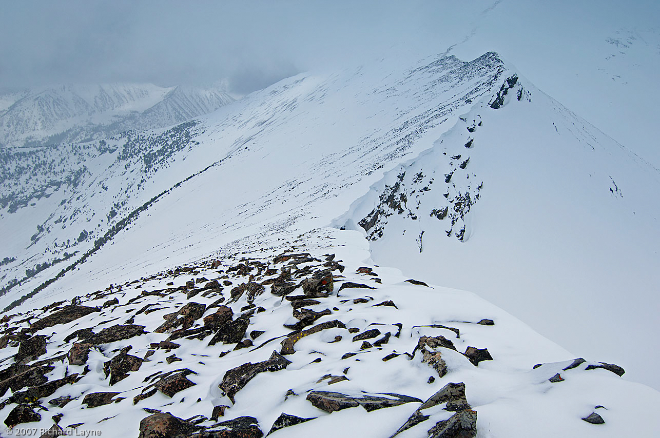
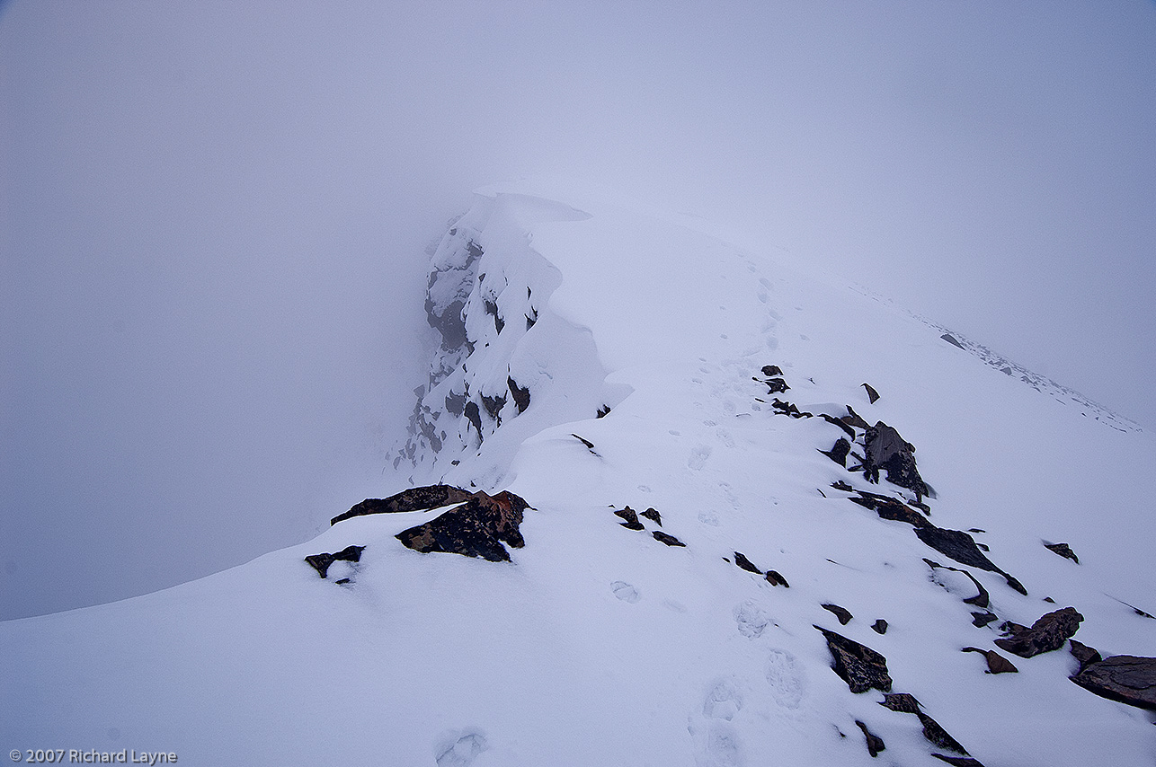
Posted on Leave a comment

Continental Divide The First Leg

A Premature Trip

Camp-Two on Sawmill Creek ridgeline, barely enough snow for camp water. (Click on any photo to enlarge.)

I left Lima Montana on December 2, 2018. While antsy to get going, I was also worried. The day before, I had driven through the snowpack 12.2 miles to Sawmill Creek trailhead without issue. Throughout the drive however, I had spotted gravel on the snow-covered road surface, something the sled would not be able to handle. On that same day in a day hike, I walked 1.3 miles and ascended nearly 900 feet up Sawmill Creek Ridgeline. Throughout the walk, I had encountered rocks, roots, and sagebrush. On December 2, another day hike was not forthcoming, but rather the Continental Divide trip itself would begin. Would there be enough snow?

On Sawmill Creek ridgeline with Red Conglomerate Peaks (10,250 feet) in the background.

Caption for photo at top of the post: The Thumb (9,700 feet) located in the southernmost area of the Bitterroot Range, can be seen from Interstate Highway 15, 6 miles north of Monida Pass. The peak complex, shared by Montana and Idaho, is part of the Continental Divide.

At my second camp on the ridgeline, the snow remained not quite enough. I continued to hold out hope that as I ascended to the base of Red Conglomerate Peaks there would eventually be enough snow to protect the belly of my new sled. Arriving at the third camp, although the snow was deeper my sled had scraped over protruding rocks less than 100 feet from where I built my camp. The following morning, now near the saddle that would take me into Little Sheep Creek drainage, I knew that the snowpack was not going to get much deeper; I messaged my wife that I would exit. She arrived at the trailhead by midafternoon, and we headed home.

The continuing route above Camp-Two, nearing the foot of Red Conglomerate Peaks and Camp-Three.

Long before December 1, I knew I would be taking a chance on whether there would be enough snow for the sled. What I had sought to do was to have enough powder snow to travel in, which was not yet deep enough to stop my forward progress. This type of snow is the norm until at least mid-February. Pushing through a foot and half to 3 feet of powder is extraordinarily difficult. For the backcountry traveler using either cross-country skis or snowshoes, powder snow is the bane of forward progress. With this in mind, I nevertheless sought to cut into the 220 miles of travel for the winter of 2019, although I quietly thought if I was somehow cheating. Only, because of the too low snowpack, I did not get away with this strategy. In the process, I might even have destroyed a new sled. Whether I will have to replace it remains undecided.

To be clear, I am not open to any sort of discourse on what I consider is cheating. What I believe is what I will go with in a summary of those six days on the ridgeline. As tempting as it remains to be, I will make no further attempts at traveling with a sled in a too low snowpack. What that interprets for the trip is a big wait of approximately 60 days until the snowpack has a base and a crust. In addition, it is doubtful I will forgo the sled and travel with only a backpack. Those days are likely at an end.

On the other hand, if I do go in with just a backpack and snowshoes my load weight will be approximately 70 pounds, which is the bare-bones survival level. An example of the peril this load would have trouble coping with would be if the temperature dropped to 40 degrees below zero Fahrenheit. If it stayed there for two or more days, I would be in trouble. Nevertheless, because I am anxious to travel I will give the backpack without a sled more consideration for this first leg of the journey.

The Sawmill Creek trailhead on December 2, 2018. Over one third of the load was in a tree 1.3 miles up on the ridgeline. Use of snowshoes did not begin until I left Camp-Two.

Posted on 4 Comments

Trip’s Beginning, Ferrying the Load

During the ascent of Sawmill Creek ridgeline on the still visible Continental Divide Trail.

Yesterday, December 1, 2018, the approximate date I was to begin traveling along Montana and Idaho’s portion of the Continental Divide, I sort of did begin. Throughout the last several years, in the Sawmill Creek area I have lost four resupplies to the “Finders keepers, losers weepers” crowd who frequent the area during the autumn. So this year I did a couple things different.

First, in October I located the resupply a much greater distance from the trailhead, and then placed it on a steep forested North face slope. What I did second, yesterday, was make it back up there and ascertain the resupply was still in the tree. Moreover, just in case it was not, I brought a replacement. As it turned out, the cache was still there.

On December 1, 2018, the resupply on Sawmill Creek ridgeline, the first of 25 placed on Montana and Idaho’s portion of the Continental Divide

Last night on the phone, my wife questioned the logic of what I did next. I left the second resupply at the location, giving me a total of 12 days of food and 20 days of fuel. Here is where foolish makes itself known. When I arrive there today with the rest of my load, and then load up what is already there, I will be pushing through the powder snow with a load that weighs 125 pounds. Again, from my previous post, I am clear that that amount of weight is ridiculous in the mountainous terrain I am attempting to get through.

On the other hand, I have known for quite some time that I would be ferrying the load during the beginning of the trip. There is no way that I can pull a singular load with that amount of weight through powder snow up a mountain.

When I break camp on December 3, this view and what is in it, awaits my efforts.

In addition to toting the resupply up the ridge yesterday, I also brought my tent and the entire kitchen. While today’s load getting up to the cached materials will be 80 pounds, that is still a whole lot better than the original 105 pounds I was doomed to bring.

Finally, I will not be leaving Lima Montana until after noon. That is when my ride will become available. In short, it is unlikely that I will make it beyond where my gear and food is presently located. I will lose daylight by 5 PM. Not only is darkness tough to work with getting things done, but it also brings colder temperatures into the mix.

Well, I suppose I won’t be going hungry anytime soon.

Posted on 4 Comments

CDT 2019, The Journey Continues

In 72 hours the winter journey along the Continental Divide in Montana and Idaho continues. Near Lima Montana, Sawmill Creek Road will take me to the Sawmill Creek Trailhead approximately 12 miles from Interstate 15, if it is still open. Otherwise, I will snowshoe that distance. There is nothing easy here. If I am able to drive to the trailhead, I will immediately have 3 miles to travel in an ascent of 1700 feet, most of it with 114 pounds on board.

Near the end of the winter of 2018 on the Continental Divide in the Bitterroot Range of Montana and Idaho, a 1000-foot ascent with a 90-pound load.

Now I know there are supermen out there, particularly in the movies, books and on the Internet. I am not one of them. In my case, a climb like that in powder snow with this load is utterly ridiculous, likely impossible, yet essential, and therefore requiring a substantial amount of extra travel. I will have to break the load down and ferry my gear and food up the mountainside. I am figuring three days—3 miles.

In my opinion, and it is the only one that really counts here, this is one hell of a lousy way to begin a 3 to 5 month journey. Nevertheless…

If successful, besides the daily forward progress generic message updates, at the end of 40 miles I will place another update with photos on my website.

From a meadow, at an altitude of 8800 feet, Sawmill Creek Canyon ridgeline, a pleasant July view of Garfield Mountain (10,961 feet).

…. And then it was 2022!? WTH!!

An update is coming, right about when the last vestiges of summer are passing. I’ll be back shortly. Hint: A Thousand Miles of Winter has continued throughout the last three winters. RGL

Posted on Leave a comment

Into the Bitterroot Range

In the summer of 1968, the year I turned 17, I visited a friend at his parent’s ranch in Montana’s Bitterroot Valley. It was June or August; I am unsure which. The reason I know it was one of those two months was because they were bucking bales of hay, 85 to 95 pounds of twined grass for the following winter’s feeding of their cattle. A difficult job, throwing those scratchy, heavy and awkward bales onto the flatbed trailer, where someone else stacked them neatly in layers. The work required lots of upper body strength, leather gloves and regardless of how hot the day may have been, wearing a long sleeve shirt.

Day-7 of 11 during the final leg of travel in the Centennial Mountains of Idaho and Montana.

On the ground strolling next to the moving trailer were three men. They were throwing the bales up to the man on the growing stack of hay. One of these men was a shocker for me. My friend’s grandfather, and he was old! I said nothing as I watched this guy stay up with the younger men. To me he was a phenomenon. All the people I knew that were his age, the World War I generation, had retired, were drawing pensions and sitting around waiting for that last breath and the stilling of their hearts.

Not him! He was strolling on that field at about 2 miles per hour picking up those bales, throwing them, and occasionally cussing when one would penetrate his long sleeve shirt and scratch his arm. He absolutely did not belong out there and yet there he was refusing that rocking chair.

That year also marked the 50th anniversary of when the Doughboys fought in France, thereby ending the Great War. He was one of those soldiers or marine.

Watching the old man and seeing the difference, inwardly I shook my head. I figured I would be one of those who would quit; claiming old age, rather than go down like him pushing the envelope to the very end.

A year after that momentous occasion I joined the Army and went to Vietnam. Now 50 years later, I may have been wrong about me.

In a matter of hours, I will connect the sled to the backpack, slip into the snowshoe harnesses, throw the backpack on, and travel into the great and barren wilderness of the Bitterroot Range for an unknown number of weeks. This will be my longest leg yet with 52 miles to travel and 28 days of supplies to get me through 11,000 feet of ascending and descending.

Quit hell! Maybe tomorrow.

Day-6 of 11, north face travel, 3 days of it in steep and forested terrain. Final leg of travel in the Centennial Mountains of Montana and Idaho.

Posted on Leave a comment

An Increased Load

With the collapse of my most important protective gear, in particular the sleeping system, but also the down coat and my active clothing, which includes my boots and torso layers, there have been additional alterations made. As a result, when I continue the trip along the Great Divide, probably Wednesday, February 21, the weight of my load has increased to 91 pounds. This leg, the third this winter, will begin in Montana in the Centennial Valley, taking me up to Pete Creek Divide in the Centennial Mountains, and then west to the Monida Pass area and Interstate 15, a distance of 20 miles.

After an overnighter at the Mountain View Motel in Lima Montana, the next leg will take me west of Monida Pass and Interstate 15, which will be much tougher. At 52 miles in length, this leg will require a heavier load.

West Camas Creek Road near Pete Creek confluence, Centennial Mountains, Idaho

Later, with winter’s worst behind me, where temperatures will have been capable of dropping to forty and more degrees below zero Fahrenheit, I will shed some of the necessary protective gear, eventually getting the load down to 83 pounds. The lighter load will happen after mid-March, when the lowest temperature will only be capable of dropping to ten below zero.

In April, the coldest temperatures will remain above zero. At that time however, it will become necessary to carry climbing gear, approximately 15 pounds of additional weight.

Posted on 2 Comments

Preventing the Sleeping System from Collapse

Moisture is more dangerous in a winter camp than the coldest temperature!

My sleeping system collapsed on the 10th and final night of the last trip. During the journey I weathered two nights with temperatures subzero Fahrenheit, one with a low of 17 degrees below zero. On the final night, the low temperature was 12°, something the system should have been able to handle, but failed.

Building the final camp of the trip. The temperature had just dropped below zero degrees Fahrenheit. (Click on pictures to enlarge.)

For the last week and a half, I have been thinking about what happened so I can determine what I need to do to make sure there is not a repeat, or minimize the impact of a recurrence. Much of what I am about to list I have known in some cases for more than 20 years, but forgot during the trip.

Starting with the last item first:

·       There is no guarantee that the failure will not happen again.

·       My body is always releasing moisture. 

o   But for the vapor barrier liner inside the sleeping bag and bivy sack, I can do little about that.

·       To prevent moisture from dripping off the tent ceiling and walls, keep the temperature inside the tent as much as possible below 32°F.

·       Minimize the use of the stove.

o   As much as possible, do not let water boil.

o   Turn the stove off rather than let water simmer.

o   Open the vents further in the vestibule and the tent interior.

o   Close the inner tent door, thereby blocking some moisture from the kitchen inside the vestibule.

·       Except in an emergency, do not use heat from the stove to dry equipment and clothing.

·       Wherever possible build camps where there is air movement, which will keep the frost down on walls and equipment. Where wind is concerned, it is both friend and enemy.

o   Friend: The wind keeps the moisture down by replenishing moisture-laden air inside the tent with the extremely low humidity winter air, thereby minimizing or eliminating frost/moisture buildup.

o   Enemy: On the Continental Divide, scoured ridgelines are a sign that the wind up there can tear a tent apart. I know; one destroyed tent in Henrys Lake Mountains, and one blown away tent off a bald mountain in the Centennial Mountains.

After losing 85 ounces of water inside the tent, the only residue remaining while breaking camp was scattered on the tent floor. Most of the water froze inside the equipment spread out on the floor.

·       Minimize the amount of stored water. Melt snow only for immediate use except for the water used through the night and for the next morning’s first cup of coffee.

·       Add a fleece blanket with a zipper, to place the sleeping bag inside. This extra layer of insulation will slow the frost buildup inside the down of the sleeping bag. Unfortunately, its weight is 26.8 ounces. The blanket is a mere 2 ounces less than the bivy sack and vapor barrier liner combined.

The trip demonstrated to me that my sleeping system is imminent to fail. The only question is how long I can postpone the collapse. This problem could be fatal. The bedroom in the tent is my final defense against the cold. If it should fail, then like so many others who have gone before me, my demise becomes a distinct possibility.

Posted on 2 Comments

Get it Right, or go Hungry

As the result of the back off/go around of Big Table Mountain two weeks ago, I now face a resupply dilemma. The distance between Kilgore, where I will begin again, to Pete Creek Divide is greater than any other area to the 241-mile distant Chief Joseph Pass. In the powder snow condition now present on the Continental Divide, I will average less than two miles per day of forward progress.

Leaving the backpack and sled behind, as I build a trail through the powder snowpack.

For those of you unfamiliar with travel conditions in deep powder, I have to drop my pack and sled, and then build a trail through the snow before progressing forward with my gear. If my journey remains the same as two weeks ago, I will travel an average of 4.5 miles to gain 1.5 miles per day. This is the penalty of traveling alone and for making the attempt during the period between December and at least mid-February. In addition, the remainder of February through March is still a threat for powder travel conditions. There are no guarantees.

To get through this area, I plan to carry 12 days of supplies from Kilgore, Idaho to the next resupply. That tallies to a substantial weight, almost 90 pounds. In spite of this large supply, if the resupply near Pete Creek Divide is missing, I may be down to three days of supplies to get me to the Monida Pass area. I could find myself without supplies for four days.

A resupply located at least 12 feet above the ground.

Needing to address this threat as I see it, I have two options. Both look and smell like a bag of rotting groceries. The first option is to skip the ascent to Pete Creek Divide, thereby saving two days of travel, including a 900-foot climb. The other option, should I find that the resupply is missing up there, I could dive off the north face of the Centennial Mountains, down to Centennial Valley on the Montana side of the mountains, and arrive at the winter maintained road. Unfortunately, neither option may be enough. I might still run out of supplies before arriving back on the edge of civilization.

Fortunately, the only decision I need to make today is when I leave to continue the trip. The next decision can wait until I arrive at the first fork on the route, approximately six days into the trip. Unfortunately, much also depends on how quickly I get to that first fork. With the incoming storm, I can only give a partially educated guess concerning how much powder I will encounter, which is likely to be substantial.

I leave for the trailhead in 72 hours.

Posted on 4 Comments

The Fourth of July Resupplies

This morning, I am thinking about the two caches in Idaho near Gibbonsville. The number of hunters that were in that area when I placed the resupplies was an eye-opener, but not, apparently, enough to deter me from placing eight days of groceries and fuel up there. This close to December, it is likely too late to go verify they are still in place, unless it becomes a multi-night backcountry snowshoe trip.

Topographic map of the Fourth of July and Sheep Creek canyons where two resupplies are located. (Click on the picture to enlarge.)

Here’s the issue; those caches are 220 miles beyond the beginning of this winter’s travel. Hell, I haven’t even left yet, and whether they are still hanging in their respective trees are weighing on me. Am I to resign myself to months of worrying? God knows, throughout the last three years, as many that have gone missing after I have hung them, this is a valid concern.

The Continental Divide Trail near the head of Fourth of July Creek canyon, unusable throughout the winter.

One other item, the distance to Chief Joseph Pass is 248 miles, this winter’s original goal. If I am able to get that far, it will be a wonder. Yet in October, I decided to tack on an additional 235 miles. Nope, 248 miles will have to suffice for this winter. There are far too many hazardous locations along the route, which coupled to the great unknown—weather; gives me plenty of opportunities to get into all kinds of trouble.

Back to the original topic, I will not be making that trip to investigate whether the two resupplies are still on location.

Umm, and I reserve the right to change my mind again.

Posted on Leave a comment

Winter on the Continental Divide Summary

In 2016, my wife and I agreed that if I failed to make 100 miles of forward progress through the winter of 2017, I would abandon the Continental Divide winter trip altogether. That failure indeed happened. However, because of the circumstances, I was able to convince Carleen to let me have another year.

Here are those circumstances.

·         The first part of December coming off a training trip, I fell and cracked some ribs, which stopped me in my tracks for the next eight weeks. Even then, I knew taking the trip would be untenable if not outright impossible.

·         Near the end of January, I caught a virus that cut me down for nearly 3 weeks. More loss of physical conditioning.

·         I agreed to stay put until the end of February. With two ailing dogs, one within days or weeks from the end of his life, Carleen was going to be gone for most of February. The dog did pass the middle of that month.

Snowshoes, backpack, and an expedition sled are used to travel on an eight-foot deep snowpack. Location was on a tributary of Odell Creek in the Centennial Mountains.

Now beyond the point where I could physically prepare for the trip, I nevertheless prepared to go anyway. My hope was that pulling a sled would make the trip possible. Without a training trip, something that is a necessity, I left a few days after March 1. It was a failure. I left again one week later. I exited this final trip after 12 days. I claimed that a mushy snowpack combined with the stolen resupplies stopped me. While those reasons were true, they were also not the complete story. Being ill prepared physically carried at least one third of the reason I failed.

What did come out of the winter of 2017 was the realization that with some exceptions, I would be able to use the expedition sled throughout the future trips.

Besides the sled use during most of the upcoming winter trips, another change will be the incorporation of a large summer trip, which will include my wife going with me. The trip will be in the Selway-Bitterroot Wilderness of Idaho and Montana. The distance will be approximately 160 miles, which will take approximately one month to complete. More on this trip later.

In the meantime, the physical training has begun afresh. What I have to mention about that is nothing, considering all it would be is under my breath groaning and grumbling.

Posted on Leave a comment

The Hazardous Life of Counting Calories

West Goat Peak summit, Anaconda-Pintler Wilderness

British Antarctic explorer, Robert Falcon Scott and the two remaining members of his five-man Terra Nova Expedition, officially the British Antarctic Expedition team perished on March 29, 1912. Low on food and fuel, and 11 miles from their next resupply, a blizzard arrived. They were so weak the last day they traveled they only covered a couple miles before they hunkered down to wait out the storm. The wind blew for a week before they finally succumbed inside their tent.

In a winter setting, to manufacture heat a person needs numerous items such as shelter, cold weather gear, and two major items, calories and movement. Because at the last moment Scott decided to bring a fifth man, the Expedition only had 4500 calories available for each man per day rather than the original 6000 calories. That eventually slowed the expedition, which simultaneously made them more susceptible to the cold and harsh conditions, which in turn slowed them further. At some point, they were unable to move fast enough to manufacture heat, making them vulnerable to frostbite, which slowed the team even more. It was the classic snowball effect . . . no pun intended.

Their experience was similar to some of my own, except I am still alive, although not because I am better than they were. Au contraire, the only group of expeditioners I have read about that might have been tougher than the Scott bunch was Lewis and Clark’s Corp of Discovery, who probably never experienced temperatures colder than brief spurts of 40 degrees below zero Fahrenheit. For the Scott Expedition below zero temperatures were the norm.

On the summit of Blodgett Pass, Selway-Bitterroot Wilderness in Montana and Idaho
A winter sunset on the summit of Blodgett Pass in Montana and Idaho’s Selway-Bitterroot Wilderness.

On March 23, 2008, my first day in Idaho after summiting Blodgett Pass, another storm would arrive before the day’s end. This was Day-6 of the first leg in my attempt at a 106-mile double winter crossing in Montana and Idaho’s Selway-Bitterroot Wilderness. Moreover, today I was supposed to have arrived at the winter-closed Elk Summit Guard Station, where I hoped my nine-day resupply waited. After two nights of below zero temperatures, and sleeping cold in my mummy sleeping bag, I still had 13 miles to travel before arriving at my cache. Only, it had just taken 5 days to complete less than 11 miles, and by the end of this day I would be digging into my 3-day emergency food stores.

In the heavily forested region of the Big Sand Creek canyon, I stopped for a breather near the end of my freshly built trail through the snow. The last time I had eaten anything was at least six hours earlier. Out came the 2/3 empty bags of raisins, prunes and peanuts. Weak and tired, I desperately needed nourishment. Shaking, I fumbled the bag of peanuts, and then dropped it into the snow at my snowshoed feet. Some of the precious contents spilled into the partly stomped snow.

Winter storm in Big Sand Creek Canyon, Selway-Bitterroot Wilderness, Idaho
On March 23, 2008, during the descent into Big Sand Creek Canyon, in Idaho and Montana’s Selway-Bitterroot Wilderness, the storm arrived in the early evening.

Even in the pristine woods, I have a zero tolerance rule. Whatever lands on the ground stays on the ground. Not this time. By the sixth day of the trip, I finally realized that I was slowly starving to death. My backpack’s heavily padded waist belt, already cinched as tight as it could go, remained so loose that the pack was dropping off my hips and onto my shoulders. After a few moments of indecision, I stuck my fingers into the snowpack, retrieved and then ate the combination of peanuts and snow. The spilled contents totaled approximately 100 calories. However, I knew I needed everything I could eat, with nothing wasted.

For the next three nights before I arrived at Elk Summit, the temperature dropped below zero for two of them, and I was cold in my sleeping bag. After consuming approximately 3000 calories my first evening with the resupply, in spite of the raging storm that lasted until the middle of the following day, I slept warm and soundly through the night. Besides the continuing storm stopping me the next day, greatly weakened, I was in no condition to travel. I rested and kept eating for one day before continuing the trip. I also slept warm the second night at that camp, although once again the temperature was below zero.

Elk Summit Guard Station, Idaho
Elk Summit Guard Station during the winter of 2008 in Idaho’s Clearwater National Forest. The second floor bedroom window is below eye level.

Like the Terra Nova Expedition, I had an underwhelming amount of calories for the task. My plan had been to travel the 25 miles to Elk Summit in six days. A few days before the trip began; a storm had dropped about one foot of powder snow on an already deep snowpack. I would endure two storms during the nine-day period, and then one at Elk Summit, and yet a fourth storm 48 hours later. As a result, there was no alternative but to build trail for 5.5 days before hefting my load of 80-95 pounds and carrying it to the end of each built segment. Through those 5 days, I averaged 1.7 miles of forward progress per day although I walked 5.1 miles. I had planned on four miles of forward progress per day. In short, during the first 9 days of the trip, I traveled an extra 18.7 miles getting only half of the calories that I needed. While I survived the mistake, would I learn from it?

Centennial Mountains viewed from Two Top Mountain in Henrys Lake Mountains
On Montana and Idaho’s portion of the Continental Divide, a winter view of Eastern Centennial Mountains viewed from Two Top Mountain in Henrys Lake Mountains.

Near the beginning of this winter’s travel on the Continental Divide, 48 miles is in the Centennial Mountains, 22 miles west of Yellowstone National Park. If the route is all powder snow, which I anticipate will be the case; my supplies dictate that my daily forward progress must be at least 2.09 miles. That is a greater average then when I was building trail during the first leg in Selway-Bitterroot Wilderness in 2008. There are some vital differences though. I am carrying an additional 2625 calories for each day, coupled with a load that is 15-30 pounds lighter.

The proper daily minimum amount is 6000 calories. Based on experience, in heavy powder conditions, I can anticipate my forward progress to be .33 miles per hour. Unfortunately, in a strong ascent, and there will be eight of them in the Centennial Mountains, I can consume 1000 calories per hour. Excluding the ascents, at 600 calories consumed per hour, I have enough food available to travel 7.5 hours per day, assuming I am physically fit.  In addition, there are 1500 calories for my 18-hour camps. Since no one has ever traveled this route during the winter, only my upcoming experience will reveal whether I brought enough food.

Reading this, one may question why I failed to place more food on the route. Weight. In extreme winter conditions, there is a balance between how much I can carry and ideal calorie allowances. I suspect Scott decided on an extra man at the last moment because of the weight of the gear and food. Since I am traveling alone, there is no sharing the camp gear’s weight, or getting assistance building a trail through deep powder.

If four persons were traveling this route, consuming the same amount of calories as I, using the leapfrog method, they would be able to travel between 7 and 10 miles per day, all forward progress. Moreover, they would be less tired at the end of the day. That is important since winter is far less forgiving about mistakes or shoddy work. There can be no shortcuts when building a winter camp, which takes at least double the time of any other season.

Other factors will challenge the trip, such as blizzards (days of no travel), extreme cold, busted equipment, and missing resupplies. My biggest question remains to be whether I will have enough food and fuel for each leg of the 270-343 miles of travel.

Socked in with blizzard on a peak in Centennial Mountains
During the winter of 2016, freshly socked in by a blizzard on an unnamed peak in Eastern Centennial Mountains. The wind had taken my tent a few hours earlier. After a futile search for it, I built a snowcave nearby and nearly died that night.

Note: because a strap broke on one of my snowshoes during the winter of 2008, seeking a replacement I briefly exited the trip 20 miles north of Elk Summit. My wife picked me up and we spent the first night in a nearby motel. In our room when I removed my shirt, she gasped and said I looked like a concentration camp victim. Apparently, for a short-lived period in 2008 I was very skinny.

Note two: after the Selway-Bitterroot trip was successfully completed, I reworked out the calorie numbers. I was shocked to discover that instead of approximately 5000, I only had 3375 calories available per day.

Posted on Leave a comment

A Four-Season Tent Critique

A one-pole, four-man pyramid tent in a winter setting

The Scott Antarctic Polar Expedition of 1911-1913 used the teepee type, single pole, and single walled tent. I used a similar four-season tent throughout my solo 150-mile winter trips in Montana and Idaho’s Selway-Bitterroot Wilderness.

During my first subzero cold with the tent, I discovered that the heat congregated above my head just before making a too quick exit through the single wall. Whenever I sat up there was virtually no heat from the floor up to my neck. This was a critical defect, since one normally sits up to sip hot drinks and eat hot meals. The best I could do was to lower the tent, an action that partly solved the problem, but increased another problem, which I will soon describe.

The interior of a pyramid tent
The interior of a pyramid tent with the outside temperature approximately zero Fahrenheit. Note the rivulets of water on the tent wall threatening my gear on the footprint. (Click on photo to enlarge.)

In addition, the floor space 1.5 feet away from the tent’s edge was useless due to melting occurrences on the walls, which happened twice a day with the use of the stove. The built up frost on the tent walls soon became dripping, but mostly pouring rivulets of water streaming onto the tent’s footprint and into my gear. As if that was not enough, the center of the tent was useless because of the single pole occupying that area. Due to the restricted area, practical usage would have prevented it from ever being more than a cramped two-man tent rather than its four-man tent status.

Eventually I lowered the single pole to bring the built up heat in the tent down to my head and torso. Unfortunately, the lesser angle and lowered tent walls removed more of the living space, which set me up for another cardinal “do not”. No part of the bedroom should ever touch a tent wall. In a winter camp, a damp sleeping bag is a step toward freezing to death. In a double walled tent, the normal tent of today, the moisture on the outer wall also pours, but not into the survival area, umm mostly.

A pyramid four-season, single wall, single pole tent
A pyramid four-season, single wall, single pole tent. The best tent I have experienced for shedding heavy snowfall.

I should mention that the tent of 100 years ago was not waterproof like all of the modern tents, but then Antarctica is the driest continent on Earth, where it never rains. The point I wish to make is that the porous cotton material greatly reduced much of the frost on the walls of yesterday’s tent. There are other distinct advantages to the pyramid tent. Properly setup, piles of falling snow, and there was plenty of that throughout the La Nina winter of 2007-2008, failed to collapse this tent. In another plus, the Scott Expedition, as with other expeditions of that time, demonstrated the strength of the tent against the wind. It handled 90 mph winds!

What convinced me to continue to use the tent in spite of its deficiencies was the phenomenally low weight, something I have no doubt Scott failed to experience. His tents likely weighed in at approximately 50 pounds while mine weighed less than 5 pounds.

In the end, the remaining three men of the five-man Scott Expedition, after attempting to wait out a blizzard for seven days, froze to death. While a mixture of circumstances brought about their demise, lack of food and fuel, with built up moisture in their sleeping gear, another may have been this type of tent.

Finally, I want to note that the manufacturer description of my tent said it was a four-season tent, which I maintain not so much. However, if one could handle insect infiltration, it would make a fine three-season tent. I do not mention the name of the company or the tent because this is a critique of this particular style of tent, which remains readily available with different companies throughout the world.

For my part, after 39 nights of winter use in 2008, I quit the single wall, one-pole tent.

A four-season, single-pole pyramid tent on a pass in Selway-Bitterroot Wilderness

Posted on Leave a comment

Grappling With an Early Issue on the Divide

cdt042715416
On the Continental Divide, Bald Peak (10,200 ft) in Henrys Lake Mountains, Idaho and Montana

Bitterroot Range-Continental Divide in the Big Hole Valley

One of the main issues I am grappling with on the Continental Divide route, one that is only going to be behind me when I travel through the area, is the steep avalanche slopes in Henrys Lake Mountains (HLM), near West Yellowstone, Montana and Island Park, Idaho. One might expect that the Bitterroot Range, due to its much larger size of hundreds rather than 20 miles, would be far more vicious, which it would but for the powder prone snow of February when I will be in HLM. I will enter the Bitterroots in March and April, a time when the snowpack will likely have a crust to snowshoe on and a stable snowpack that is less prone to avalanche.

Traveling with a load of 90 and more pounds is no longer a viable alternative for this aging traveler.

Getting my load weight down is part of the key to a successful undertaking of HLM in February. However, if I remove too much food, fuel, or equipment, more than jeopardizing the trip with another failure, the question of survivability might arise. On the other hand, too much weight with backup supplies and equipment could make the already difficult ascents and descents impossible to get through in the deep powder of the higher elevations. In addition, the heavier the load the more prone I will be to injury during descents.

I love the challenge, to use what God has given me, the practiced brain, fit body, the incredible equipment, and afterwards should I fail, not blame God or anyone else. The challenge is to get it right before the trip begins, or close enough where I will only need to make small adjustments on the route to be successful.

In spite of my concern, the reality is that this area is only a sub-challenge, part of a series of confrontations that together make up the main event, over 300 miles of snowshoe travel, #WinterOnTheDivide.

Posted on Leave a comment

Enough supplies?


Located on the Continental Divide and 10 miles beyond Henrys Lake Mountains is the Centennial Mountains.
The Centennial Mountains, located on the Continental Divide, 10 miles beyond Henrys Lake Mountains in Idaho and Montana.

Now down to mere days from venturing into Montana’s backcountry and beginning the winter training trips, which will eventually transpire into the actual Continental Divide trip, I am worried. Because of the sheer length of the trip, 418 miles, I will begin the trip 30 to 60 days earlier than the previous winter trips normal beginning near the end of February or beginning of March. For that reason, a crust on most of the snowpack is unlikely. Although wearing snowshoes, I may find myself pushing through powder snow for at least the first month and a half.

That is a problem. I will have to build a trail through the powder sans backpack, which interprets into three miles of travel for every mile of forward progress. I have plenty of experience that says under those conditions I will average one mile of forward progress every 2 ½ hours.

With only a 91-day supply for the entire trip, I have to average a minimum of 4.59 miles per day. In powder conditions that interprets into having to travel approximately 11 ½ hours per day, which is not going to happen.

Here is why. I have 6200 calories available per day. In a 12-hour camp, I will need at least 1200 calories. On the trail, I will consume a minimum of 800 calories per hour, which restricts me to traveling six hours per day. That interprets into 2.5 miles of forward progress each day while traveling in powder. Nor does this include the slower pace of the ascents inherent to mountain travel.

The distance between Raynolds and Monida Passes is 66 miles, which encompasses most of the Centennial Mountains, an area I will enter near Yellowstone National Park at the beginning of the trip. I will encounter powder snow throughout most if not all of these mountains. I have 18 days of food and fuel available for the area. For that reason, as I have already said, I am worried.

Last thing, this is a part of the adventure. I will need to find a way to overcome the problem, which by the way I am not waiting for God to solve. Without my cooperation, God does not perform miracles in the naked backcountry. The soon to begin 4 to 6 winter training trips, with a total of 29 days in the backcountry, will show me whether I have successfully surmounted the problem. There is no substitute for experience.

Posted on Leave a comment

Revamp for the winter of 2015-2016

CD012014003
Mile Creek Canyon located on the west side of Henrys Lake Mountains in southwestern Montana. (Click on any picture for clear enlargement.)

Now the beginning of September, assembly of the caches or resupplies for the winter snowshoe trip of 2015-2016 have begun.

The gear and resupplies for the winter trips on the Continental Divide.

This is my third attempt at the first of three sections on the Continental Divide from the Wyoming border to the Canadian border in Glacier National Park. It is also the third time I have prepared resupplies for this area. Frankly, I have grown weary of placing the packages in the autumn only to retrieve them the following spring and early summer. With that said, numerous alterations continue with the resupplies, the load, and the trip itself. Here are the main changes.

• Continued to become more familiar with the route.

• Altered portions of the route to avoid bringing mountaineering gear.

• Shortened the distance for the upcoming winter.

• Made photography gear changes.

• Altered the food variety.

Camped on a saddle on top of the Continental Divide in Henrys Lake Mountains. Bald Peak (10,180 ft.) is in the background.
Camped on a saddle on the Continental Divide in Henrys Lake Mountains. Bald Peak (10,180 ft.) is in the background.

During the first days of June, on a receding snowpack I traveled in Henrys Lake Mountains. In July, I was in the southern portion of the Bitterroot Range near the Big Hole Valley. In August, I traveled in the Centennial Mountains. As a result, I altered three areas of the route.

HLM060815387
Black Mountain (10,237 ft.) on the Continental Divide in Henrys Lake Mountains

Although it will still be necessary to bring mountaineering gear in Henrys Lake Mountains, I changed the route at two locations in an attempt to get through the most hazardous 15 miles of it with a greater margin of safety and perhaps more quickly.

Red Rock Mountain (9500 ft.) and Mt. Jefferson (10,203 ft.) in the Centennial Mountains.

While it may be a mistake, I will omit the mountaineering gear when I travel through 60 miles of the Centennial Mountains. Rather than an ascent between Red Rock Mountain (9500 ft.) and Mt. Jefferson(10,203 ft.), my route will take me through the much milder Hell Roaring Canyon two miles west of the original ascent, which is also where the official Continental Divide Trail (CDT) is located.

The view north of Goldstone Pass in the Bitterroot Range.
The view north of Goldstone Pass in the Bitterroot Range near the Big Hole Valley.

Approximately 150 miles later, in the southern Bitterroot Range, north of Goldstone Pass, and once again carrying mountaineering gear, I will drop off the Continental Divide and follow the summer route of the CDT. These changes combined will shorten the route by seven miles.

In addition, I shortened next winter’s overall route by 120 miles. Rather than attempt to arrive on Interstate Highway 15, 30 miles southwest of Butte Montana, I will stop at Chief Joseph Pass on Highway 43. The distance I will attempt to travel through one winter is now only 338 miles rather than the original 460 miles. It had been my intention for the last two winters to include the 60 miles of Anaconda-Pintler Wilderness (APW) during the latter part of the winter season when the snowpack is the most stable.

Goat Flat area and Storm Lake Pass in Anaconda-Pintler Wilderness.

The steep and treeless slopes of the APW are nothing to trifle with between January and March. Oh well, I suppose it will be good practice for when I return to Glacier National Park a few winters up the trail.

Over the last several years, I have been incrementally shedding my load of professional photography gear. This year I took what I consider a giant step in this area. I started carrying a consumer level camera and lens while still carrying a wide-angle professional lens. The weight of my camera gear dropped to five pounds. During the winter of 2006, I carried 16 pounds of camera gear. While I am unsure how this will turn out, if I am wrong I can always retrieve the pro gear at one of the four road crossings during the trip.

Through the last two winters, my heaviest loads were more than 100 pounds. This upcoming winter my heaviest load, which will occur only once along the route, should be less than 70 pounds. Unfortunately, it will happen in some of the most dangerous terrain of next winter’s travel, Henrys Lake Mountains.

Near Lionhead Mountain in Henrys Lake Mountains with a load approaching 100 pounds.

The changes in my food will not necessarily lower the weight of the load. Nevertheless, it has become necessary to do something different. The dehydrated food I have been using for almost 10 years turns my stomach. This year I have replaced it with four varieties of freeze-dried food. In addition to palatability, the freeze-dried food gives me increased calories and protein. Losing backpack weight, as necessary as it obviously has become, is a moot point if I do not have the energy to travel due to a lack of eating what is in the pack. I need a minimum of 6000 calories per day to sustain me for approximately 2.5 months of winter travel. My previous supplies failed to do that although there was always more than 5000 calories per day in the food bag. Hell, what good is a larder if I am unable to eat from it?

After the last two winters of failures, I have little doubt that the original 460 miles is out of reach in a single winter. Admittedly, this decision to shorten the distance comes with plenty of hesitation. What if, as remote as it might be, what if there are still three weeks of winter remaining when I arrive at Chief Joseph Pass?

On December 21, 2014 in the parking lot of Chief Joseph Pass.

Hmmm, this is familiar ground; too often, I have bitten off more than I can chew. The last two winters have more than amply demonstrated that. The 338 miles will have to suffice.

Posted on Leave a comment

Lightening the Load

Sunset on the Continental Divide near Taylor Mountain in the Eastern Centennial Mountains of Montana and Idaho.

It was 10 days ago that I heard something from a thru-hiker on the Continental Divide Trail which has been sticking in my craw ever since. When I met the slim 6’6” fellow of 30 years, he had been on the trail for at least three months. He was at the end of a 30-minute period of matching my pace, which he had been obliged to do at my request, when he uttered the two sentences that I have yet to relinquish.

“I lightened my load so that I could travel faster and thereby go further each day.”

He was not finished. He concluded by saying, “And by increasing my daily distance, I get to carry even less of a load”.

By applying this snowball effect logic, I suspect he is able to cover a distance in two days where many other thru-hikers will need three days. Meanwhile during the winter I will need between 12 and 20 days for the same area.

cm0815150460
Hiking into the clouds on the Continental Divide Trail in the Eastern Centennial Mountains of Montana and Idaho

I realize that summer travel is vastly different in many ways to winter travel. Nevertheless, I am continuing to ponder what he said as I prepare my 25 three and four-day resupplies for next winter’s trip. I also realize winter travel is far more hazardous and unpredictable. If I should go too far in lightening my load, it could prove to be catastrophic.

Summer travelers have lightning, rain, and an occasional small snowstorm to deal with at the most. The winter expedition traveler in Montana and Idaho needs to have the equipment to keep him or her safe in blizzards and temperatures down to 50 degrees below zero. Often the weather can be so bad that all travel comes to a stop, while eating food and melting snow for water continues. Obviously, winter carries its own special set of extra rules.

In spite of the sometimes-hazardous circumstances of winter travel, I will continue to seek ways to lighten the load without setting myself up for a fatal trip next winter.

Posted on Leave a comment

Winter of 2015-2016, Continental Divide; Alterations

cdt042715341
The Continental Divide in Henrys Lake Mountains, Montana and Idaho. (Click on any photo to enlarge)

June 2015 Update


During the last two winters, my attempts to travel along the Continental Divide of Montana and Idaho have proven to be elusive. I am now convinced that for me to have any chance of completing the trip changes must happen.

Yes, I have heard the naysayers’ statements and endured a few lectures concerning the impossibility of the undertaking. I’m wondering though, when the words “challenge” and “easy” became synonymous.

With two winters of experience on the route, I am coming to understand why the trip has never been successfully undertaken. Everything about it including the logistic and physical preparations are daunting. Clearly, the trip’s challenges are more than holding their own with me. Frankly, I am getting my butt kicked, which, by the way is no good reason to quit, but remains a good reason to change what I am doing. Two alterations are in the works. They concern the food and certain areas of the route.

cdt042315124b
On the Continental Divide in Henrys Lake Mountains, Montana and Idaho, an 85-pound load.

The winter load for an extended trip is huge. On a two to three night winter trip, one may get away with going into the backcountry with a lighter load. However, having less equipment on an expedition trip could prove fatal.

An example of this is the down sleeping bag. Each night of use, the body evaporates approximately one pint of water straight into the down, where it freezes near the surface and collapses the fill power of the natural material. Within one week, the sleeping bag approaches uselessness for retaining heat. Then along comes a subzero cold, placing the traveler in peril.

Many have died as the result of this condition. The Scott expedition to the South Pole killed Scott and his men because of the nightly retention of moisture, which eventually neutralized the heat retaining properties of their sleeping gear. To his credit, Scott recognized they would be unable to use the down sleeping bags because of this handicap. However, the much heavier furs and wool blankets, besides slowing their pace, also eventually failed. When Scott was located, he was in his tent and in his sleeping gear, having succumbed to the cold.

I carry a -20 Fahrenheit down sleeping bag. Before beginning the Continental Divide trip, I used a zero Fahrenheit rated sleeping bag. On numerous occasions after several nights of use, I have felt the chill inside the sleeping bag. At the beginning of a winter trip using this earlier sleeping system, I have been completely toasty regardless of the cold, only to feel the chill seeping into the bag after three or four nights. One such occasion occurred in Glacier National Park. On the seventh night of a trip, I almost lost my life, which was a result of this increasingly dangerous condition. Because most of the trips were so short though, seven days or less, through the years I continued to use this sleeping system, which included a light bivy sack, two pads, and occasional fleece blanket.

gp0418110991
Waiting for the exit of the storm on the bench near Brown Pass, Glacier National Park.

Regardless the length of the winter trip, the bedroom is the final bastion against the winter cold—when all else fails the bedroom must keep me safe. For this reason, the length of the Continental Divide trip, a long-term exposure to the cold, changed things. I was going to need a stronger bedroom setup.

Thus, I purchased a much warmer system, at a price though beyond the steep financial cost. In addition to the heavier sleeping bag and bivy sack, I also purchased a thicker pad and a vapor barrier liner. The latter item protected the down from my body moisture. My entire bedroom including the camp chair now weighed 10 pounds. The consequences came with a slower pace, enough to need more food and fuel for the extra days of travel, which increased the weight even more, whilst slowing me further. What I am describing is the snowball effect that affects all travelers regardless of the season or the length of the trip, and in particular the winter expedition trip.

As a result, my quandary of the last two winters is a too heavy load. Now entering the summer of 2015, I know very well that at 64 years old, time is short. I will find a way to lighten the load or give up the trip. The changes are already in motion.

gp0515110332
Preparing climbing gear, backpack, and ferry pack for traverse to Hole in the Wall, Glacier National Park.

Out for the winter of 2015 and 2016 are my previous plans for an intentional challenge of areas requiring climbing gear along the route, which precipitates an immediate 13-pound drop in the load. At the most, on occasion I will carry the ice ax and crampons, a weight increase of 3.92 pounds. For the most part, my route is now more in line with the actual Continental Divide Trail.

There is also a change in the food I eat. I have already purchased over 500 freeze-dried meals. While the weight loss is not large, there is a substantial and necessary increase in the calories and protein, with the cooking time dramatically lessened. I will talk about this necessary increase shortly.

Selway-Bitterroot Wilderness Blodgett Winter Crossing of 2008
The vegan stew.

The dehydrated vegan stew, my main hot staple for the last nine years, takes approximately 44 minutes to boil and then simmer before being ready to eat. The water for the freeze-dried food takes three minutes to boil, and then turn the stove off, creating a huge drop in fuel needs by approximately 10 ounces per day. In addition to the jump in the palate, the freeze-dried food also increases the daily calories and protein by over 1100 calories and 70 grams respectively, while dropping the load by another seven ounces per day.

Before the change to freeze-dried food, my main fare lost its tastiness. In addition to this were the doubts my wife and I shared concerning the 6000 calories I was supposed to consume daily on the trips. If I traveled 4 hours using 1000 calories per hour, I would only have 2000 calories for the remaining 20 hours of the day. Because of my refusal to eat more than a small amount of the nourishment each day, if any at all, came the minimal backpack weight loss, along with the lack of being re-energized. Each day within the first hour of travel, I would be tired. For the remainder of the day I would struggle to make any distance whatsoever. While a great body weight loss program, this also figured large in the failure of my previous trips.

I have no doubt the freeze-dried food has remedied my eating problem in the backcountry. I base that off the last trip, which was seven days in length. I had six freeze-dried food packets, two per day, leaving me four days of eating my old fare. I consumed the freeze-dried food with relish, and then almost stopped eating for the remaining four days. Therefore, two things have happened because of freeze-dried food. I am finally eating the food that is with me and I will be consuming over 7300 calories per day next winter.

HLM060715288
The ferrying of two loads during the ascent to Targhee Divide (10,016 ft) in Henrys Lake Mountains, Montana and Idaho.

I would like to conclude this by saying that one week ago; I exited Henrys Lake Mountains with the climbing gear and snowshoes attached to the backpack. I weighed the entire load when I arrived back home. While the spreadsheet said the load should have weighed no more than 82 pounds, the actual weight was 85. Too damned much, I felt like I was carrying my own cross to the crucifixion.

As it stands right now having reduced my full load to approximately 70 pounds, I can live with that. With this altered load during the winter trip, on the day I arrive at each resupply I will be carrying 55 pounds, damn near angel’s wings.

With more alterations to the trip coming in the next several months, these two changes have already recharged my hope for completing the trip.

Posted on Leave a comment

The Process of Recuperation

Selway-Bitterroot Wilderness Blodgett Winter Crossing of 2008
The ascent of Blodgett Pass in the Selway-Bitterroot Wilderness of Montana and Idaho.

I am a huge believer in healthy body and spirit by way of my own lifestyle. Now with that said, here comes a small dose of reality. The doctor called me on Sunday, yesterday. He said that one year ago my bad cholesterol level was in good shape, but not so today. In addition, he addressed my irregular heartbeat. These revelations came as the result of seeking medical help for the pain in my left leg one and one half weeks ago, which turned out to be a blood clot.

I am presently taking a wee little pill twice a day to thin my blood. The doctor wants to place a device on me for two days that will monitor my heartbeat, which I have agreed to. He acknowledges and appreciates my abhorrence of pills or anything else that goes into my mouth and identified as medication. He says my proactive actions in the last week and half with my diet and exercise may be all I need for the high cholesterol level.

The diet: no flour, no dairy products, no salt, plenty of sprouted wheat bread with peanut butter, whole-grain rice and beans, fruit, and small amounts of grass fed beef, organic roasted poultry, egg whites fried in olive oil, skin on potatoes, and plenty of olive oil. In addition, I can have no dark green vegetables because they have vitamin K in them, which coagulates blood, the opposite of what those pills are doing.

I have instructions to stay away from all stretches and exercises that could jar the clot loose, but I can continue my daily non-strenuous strolls on Mount Helena. During the minimum 2-mile walks, I am keeping my heart rate below 130 BPM, while ascending/descending 650 feet.

My website and Facebook pages concerns being an adventurer photographer, not a convalescing invalid. If you are following me, you’re getting a little more than what I originally had in mind. I have made some mistakes in my lifestyle, which at 63 years of age has come around to bite me on the butt.

I am in no way finished with backcountry adventure photography. Medical personnel have made it clear that I will be back on my feet in perhaps as little as 30 days. Clearly, I will have to be an integral and active part of the solution for that to happen. Now where in the hell did I put those teeny-tiny little pills?

Posted on Leave a comment

A December Weather Change

In the last week, the weather has changed in Western Montana. We have gone from moderate snowfall (between 6 inches and 3 feet, depending on the elevation) and subzero temperatures, to an extended forecast with a mixed bag of scattered rain and snow, including temperatures up to 40°F. Even the elevation of 10,000 feet along the Continental Divide has an extended forecast with a low of 20°F.

Could this be the beginning of the El Niño weather pattern? The NOAA is staying quiet. That could be the smart thing for them to do. I, on the other hand, am not part of the NOAA. Indeed, where the weather is concerned I am a hands-on kind of guy. For that reason, any attempt I would make to cross an avalanche slope after the recent snowstorm would be dangerous, even foolhardy. If it were to rain on the slope, that same attempt would likely be fatal. On the other hand, this weather can also settle the snowpack while creating a crust I can walk on with my snowshoes and crampons. This latter condition is exactly what I am hoping to have for the Continental Divide trip.

In addition, 50 miles into the Continental Divide trip beginning in January 2015, I will encounter my first slopes that require technical climbing gear to ascend and descend. Besides the peril of possible avalanches, proper placement of snow pickets in powder to anchor my rope would be difficult if not impossible.

Yesterday, I drove north for my first winter training trip, which I intended to undertake in the Dearborn River Canyon of the Scapegoat Wilderness. With the nonstop rain soaking into the snowpack at the trailhead, I canceled the trip. Forget the avalanches. Rainfall during the winter on my equipment and on me is dangerous. Nevertheless, go I will, just not up there. This morning I leave for Bannock Pass on the Montana and Idaho border to the south. According to the weather forecast, any moisture I receive down there will be snow.

To be clear, during the 90-day trip, which begins in approximately 30 days, with the exception of rain falling on the snowpack, it makes no difference what the weather conditions are. I will travel through most of it.

With that said, you know I sort of feel like I’m playing poker with the totally emotionless old man winter. Regardless of what I do, his stare never changes. I look into his eyes, at his protected card hand, and then glance at the wall behind him. There is no perceptible movement in his eyes or on his face. Finally, I place my cards on the table. In turn, he places his on the table. Then while his blank, yet cold eyes continue to stare a hole through me, his hand smashes mine to a pulp. Oh boy.


Posted on Leave a comment

The El Niño Forecast, Circling the Drain

MP020414156
On February 4th, 2014, in Yellowstone National Park, the latest storm had just dumped another three feet of snow. Within hours of this photo, a -40 F temperature would arrive.

Is it time to say goodbye to the El Niño forecast and alter my travel plans accordingly? As of November 20, 2014, the three-month extended outlook along Montana’s portion of the Continental Divide predicts from 33% up to a 40% chance for above normal temperatures. In addition, the NOAA (http://www.cpc.ncep.noaa.gov/) is now predicting an equal chance for a normal winter to 33% chance below normal moisture.

This interprets into an increased chance I will encounter powder snow until near the end of February 2015. The winter of 2014 also had the label of “equal chance” for a normal winter. The snowpack was huge and the powder nearly untenable for extended snowshoe travel throughout the month of February.

It has been and continues to be, albeit with less hope, my plan to begin the trip near the end of the first week of January. This close, 44 days until beginning the 90-day trip, however means the likelihood is growing that I will not begin the trip until the first part of February 2015.

Last autumn I placed my resupplies at locations where I could take on traveling in deep powder snow. While I have a tremendous amount of food and fuel to get me to Monida Pass on Interstate 15, there may still not be enough. In deep powder snow, I average between three and four miles of forward progress per day. There is also the possibility that I will have to use technical climbing gear at six separate locations, where my daily progress measurements will be in feet rather than miles. Additionally, there will be down days due to storms and bad avalanche conditions.

I have 39 days of supplies for the first 140 miles of the route. If I only average three miles per day I will run out of supplies eight days before arriving at Monida Pass. Should that happen, I will lose three and four pounds of body weight per day. To encounter a weight loss like that after already being on the route for one month would be devastating.

Throughout the 462-mile route I have alternate routes to be used to get around avalanche areas and if needed, to shorten the route. One such route is located at Red Rock Pass. However, that would only shorten my route by two or three days. After that alteration, my options would be limited, and my supplies would still fall five days short of Monida Pass.

With that said, I have always known the trip carries risks. As much as I have prepared, it may not be enough. Only traveling the route will clear the air. Nor is there anyone in front of me who has experience with this route to advise me. My most experienced advisor too often has also been my greatest enemy—my head.

Posted on 2 Comments

Of Crusty Importance: El Nino

MP020114110
Two days after a snowstorm, the snowshoes were dropping through the powder snow 1.5 feet. Another storm would arrive later this day and drop another three feet of snow. The location was the western edge of Yellowstone National Park, on Madison Plateau and near the Continental Divide.

In another indication of the rapidly closing date for beginning the 93-day winter expedition, Montana and Idaho’s mountain snowpack has begun to accumulate. Being early winter however, it comes as no surprise that the NOAA SNOTEL site near Darkhorse Lake (8700 feet), located in the southern Bitterroot Range, shows that in the last five days the snowpack has dropped from nine to six inches. More is on the way though. Beginning tomorrow evening, November 1, another 12 inches could fall. Moreover, with our going into November, the average daily temperature is continuing to drop. Most of that snow is going to remain on the ground until next June.

Of far greater interest to me than the increasing snowpack is the weather phenomenon known as El Niño. I am hoping it plays a strong role in next winter’s snowshoe trip. As of this date though, there is some uncertainty of how strong it will be, or for that matter, when the event will begin. The latest extended forecast, released on October 16, 2014 called for a 67% chance of a mild El Niño beginning by mid-November. From Yellowstone National Park to Butte Montana, the area I will be traveling through next winter, the impact of this weather pattern normally means less snowpack and more importantly, warmer temperatures. Those higher than average temperatures could create a crust I can walk on sooner than the latter days of February.

The reason I don’t begin extended winter trips until at least the beginning of February, is due to the condition of the snow. Although I relish the idea of having enough snowpack to cover brush, timber fall, and rock fields, the real reason I wait until later concerns whether a crust has formed on the snowpack. Traveling in deep powder is a nightmare. It can cut my daily average of 6 and 8 miles down to 3 and 4 miles.

The La Niña winter of 2008 brought the opposite effect of El Niño. With the storms lining up behind each other, I traveled through three feet of powder during the latter days of March. That occurred during the double crossing of the Bitterroot Range west of Montana’s Bitterroot Valley. The average day was eight hours of travel with my forward progress between three and four miles. Because I was compelled to build trail without the backpack, I actually traveled between 9 and 12 miles each day. I needed nine days to travel the first 25 miles, which included going over Blodgett Pass. By the last day, even my three-day emergency food supply was at the crumbs level. Fortunately, the resupply bucket was where it was supposed to be.

A crust would have changed the character of the Selway-Bitterroot Wilderness trip (although I wonder what I would have written about if the trip had gone smoothly). As it were, the snowshoe portion of the trip was only 115 miles, but still took one month to complete.

Using primarily snowshoes, the distance I will travel on the Continental Divide during the winter of 2015 will be 462 miles. I have to be able to average approximately 5 miles per day for 93 days. That is not possible in deep powder. Granted, I will have 107 days of supplies out there, but I will have to make up the days of downtime from the inevitable storms. More than that, for as much as 12 days I will be traveling on rope and crampons, where the measurement of forward progress is in feet rather than miles.

Another troubling consideration is the Anaconda-Pintler Wilderness, which I will enter 375 miles into the trip. During the winter of 2007, I undertook five trips in this wilderness, where the final trip included crossing it and the Continental Divide. As the result of that experience, I consider it vital to get through the wilderness near the end of the winter rather than begin the following winter’s trip with the Anaconda-Pintler Wilderness still in front of me.

So yes, I am watching with a keen interest in what the future holds with the El Niño weather pattern.

Posted on 2 Comments

Discipline through Making Mistakes

_DSC2732b

I started out needing to place 27 resupplies in the backcountry for the winter Continental Divide trip. Finally, with only three remaining, I hesitantly hoped that the worst was behind me so I could begin focusing on the winter training. In the last month and a week, not all had gone well with the first 24 caches.

Admittedly, the most recent placement 48 hours earlier went better than I perceived it would. In the early days of August, my wife and I had reconnoitered the Darkhorse Lake area 20 miles south of today’s hike. As a result, my head prophesied a tough day hike on my return into that area. As it happened though, I made the 7.3-mile trip in just under six hours. While the Darkhorse Lake day hike gave me hope, too many other trips had scratched out my psychic eyes, such as the Mile Creek Canyon hike in Henrys Lake Mountains 14 days earlier. My feet were still sporting marks from the blisters I got from that trip.

So yes, I had a little hope that the day hike in Montana and Idaho’s rugged southern Bitterroot Range to the cirque in Big Lake Creek Canyon would go better. And no, I didn’t trust October 9, 2014 at all.

At 11:20 AM, I left the trailhead at the foot of Twin Lakes. As I walked away from the van, I was less concerned about the late time then my throbbing left thumb. I had ripped the nail partially off 10 minutes earlier during my final prep at the vehicle.

Although it felt heavier, at 45 pounds the load was light when compared to the training load that was coming beginning in the early days of November. Already the chronic pain in the small of my back was announcing its presence. Lately I had been experiencing pain free days with a load this size. Years of experience however said that if the pain stayed with me for more than five minutes, it was only going to get worse as the day wore on, creating one long day.

Almost three hours later, the day lost any humor it may have had, except I had yet to make that discovery. I had long since lost count of the number of trees that had fallen across the unmaintained trail, along with the bogs, springs, and streams. I had slogged through, gone around, crawled under, or climbed over these trail treasures almost continuously for the first 3.5 miles. In addition, according to my readings, I had one more mile to travel and another 500 feet to ascend. Although not overwhelmed by it, the pain in my back had slowed me down to an average of 1.3 mph.

Straight ahead through the thick forest sawed logs were on either side of the obvious trail. To my immediate right was another bog. On the other side of it, I could see more bushes, trees, and the slight openings found in higher elevation forests away from north face areas. I found it curious that the trail was closing in on the north face of the canyon. The planned route, based off a previous trip in 2006, was to the right side of Big Lake Creek. Several minutes later, and now on the bottom of the north face, the trail suddenly ceased to exist.

I have a serious character flaw that I still practice too often, an aversion to going over ground I have already walked. With the cessation of the trail came the emergence of this defect, a major mistake that changed the character of the hike. I was beginning to feel tired, and with the loss of the trail, the irritation emerged. I was damned if I would go back down that trail. I knew where I was at, and at this elevation, 7850 feet; the forest couldn’t possibly become much thicker, could it?

In another 35 minutes, I had only traveled a quarter mile inside the north face forest and ascended 300 feet. My ire had grown proportionally to the increasing exhaustion. I also realized I had made a bad mistake, but it was too late to go back now. Time had become an issue. Assuming the same pace, if I turned around now and headed for the vehicle, I would arrive at dusk. However, inside my backpack was a 15-pound resupply for next winter. Besides, the Continental Divide Trail couldn’t be that far away.

Inside the heavy forest, I had emerged into an open area, which revealed the 50° angled slope up to the flat. It was a 75-foot wide avalanche chute, with a running stream on its eastern edge. By all that I could see, I only needed to switchback a quarter-mile to the flat and the Continental Divide Trail. Meanwhile the original goal on the other side of the Big Lake Creek cirque was still .63 miles distance as the crow flies. To get over there I would have to meander around trees, bushes, bogs, fallen trees, and ankle twisting bear grass clumps. I began climbing.

As I ascended, I stopped numerous times, once for 15 minutes. I had been sitting on the slope for 10 minutes when I glanced down at the heart rate monitor. It read 204. Unsure whether it was an accurate reading, I noted that although I was tired, I felt fine. Nevertheless, it occurred to me that I had no experience on what a heart attack would feel like. That’s when I sent a message through my satellite connected personal messenger device. I said I would wait another five minutes, which I did. As I neared the end of that time, I glanced down at the heart rate monitor. It now read 170 bpm. I looked again less than a minute later. The reading was 113. The high heart rate reading had apparently been a false alarm, probably the result of a faulty connection or low battery inside my chest monitor strap.

I arrived on the flat 15 minutes later. In a sudden rush of relief, I let out a short-lived victorious roar. I had needed 45 minutes to ascend 300 feet and was now approaching exhaustion. Meanwhile there was still a cache to place, nor would I be going out the way I came in. With the cache placed almost one hour later and a half mile traveled along the arch of the cirque, I finally began the descent, leaving the 8700-foot elevation and Continental Divide Trail behind.

I dropped into the area of the forest where I was supposed to have come up in the first place. In spite of the loss of 15 pounds out of my backpack, the pain in my back was now continuous and increasing. I began to stop every one to three minutes and use an exercise to stretch the lower back muscles, except the stretches had become almost ineffective.

The sun had dropped behind the ridgeline 300 feet above me where the actual Continental Divide was located. I now realized that it would be hours after darkness settled before I got back to the vehicle. It was a blessing that I did not know how long it would actually take.

I found the old abandon miner’s cabin half an hour later located at the head of Big Lake Creek. Glancing through the opening that used to be the door, I spotted the rusted out and broken kitchen stove. My mind’s eye imagined a picture of the structure when there was a roof, door, a bed to sleep on, and a hot fire in the stove. Then came my first thought about abandoning the exit and spending the night in the backcountry. I gave the cabin a final glance and continued the descent on the freshly found trail.

In another 45 minutes, I reconnected with the trail intersection where I had made the mistake. It only took a few moments to see that the bog had erased the real trail. Yet I could not help but wonder how I missed it this time when eight years earlier I had brought my wife, dog and I through this area without incident.

When I arrived at the bog, I had traveled almost seven miles in seven hours. Now footsore and tired, I was keenly aware there was still approximately 3.5 miles to travel on a badly dilapidated trail. If my present pace continued, which was similar to ascending the canyon, then I was still three hours away from the vehicle. I figured I had approximately 45 minutes of daylight remaining.

Just before 7 PM, I brought out my head lantern, but didn’t turn it on for another 10 minutes. As time passed, I increasingly examined the thought of building a bed under one of the large Douglas fir pine trees and then make my exit the following morning. I nevertheless kept traveling. At my final stop, I sent a message through the messenger that I was still probably one hour away from the trailhead. I noted that I had been walking for an hour and a half in the dark.

Using the homing function on my GPS watch, I quit the trail 50 minutes later and attempted a shortcut to the trailhead. I crossed the final stream and bog, this time fighting to get through a hedge of willows at the same time, and arrived at the vehicle nine minutes later.

Without a doubt, to date the Big Lake Creek Canyon has been the most difficult day hike in the last month and a half along the Continental Divide. Hours before getting to the vehicle, I fixed the blame squarely on myself. Oh yes, I bill myself as quite the backcountry traveler. One of the resultant returns with that kind of thinking is the difficulty I have admitting the truth about my humanity.

All too often, I apparently need to experience a whole lot of mistakes, most of them repeats of lessons learned from previous trips. I think though that as much as I hold making mistakes with great disfavor, they may keep me from getting too big. Therefore, when the real trip begins, in this case continuing the winter Continental Divide trip, I hope my ego is in check. That will increase my ability to survive the perils of winter travel and perhaps minimize my mistakes.

In that light, mistake riddled day hikes are damned good training. On the other hand, there is the potential for another three months of damned good training events. Just thinking about it 24 hours later makes me feel tired. Maybe after the main trip begins though, I will finally get a breather. Oh brother, here’s another illusion probably setting me up for one more good whacking.

Posted on Leave a comment

The Travails of Mile Creek Canyon

Mile Creek Canyon
An autumn morning at the entrance to Mile Creek Canyon in Henrys Lake Mountains. This location is near Yellowstone National Park. The ridge line in the photo is the Continental Divide, which is also the Montana and Idaho border.

Yesterday on the Montana and Idaho border near Yellowstone National Park, Gus (our black dog) and I hiked up Mile Creek Canyon inside Henrys Lake Mountains. At the lower elevations of 7000 feet the autumn colors were past prime, but still gorgeous. If I had not been carrying a load, I am certain the 12-mile round-trip hike to the Continental Divide would have been much more enjoyable. Gus however might not agree with my assessment. Almost 24 hours later, he is still lying in the TV room recovering. He wasn’t carrying anything, but his aging body.
For my part, while it could have been worse, I too failed to come out of the canyon unscathed. My left back thigh hurts the same as does the small of my back. There is a monster blister with the skin already ripped off on the absolute front of the middle toe on my left foot. There is also a quarter coin sized large blood filled blister on the left side of my big toe on the right foot. The foot problems are compliments of a pair of mountaineering boots I had not worn for at least one year. I wore the damn things because my other non-winter pair developed a hole in the leather just above the rubber sole. Yes, and it would appear that I sometimes need to go back and relearn a previous harsh lesson.
On the upside, the photo opportunities were close to excellent. The hike also placed me one more notch closer to being ready for the 460-mile winter trip. Out of the 27 autumn trips to be undertaken, only 5 remain.
In the meantime, a replacement pair of mountaineering boots will arrive the first part of next week. There is also a good possibility; they will be leaving their first hike tracks in freshly fallen snow. I will be traveling to the southern Bitterroot Range near the Big Hole Valley of Montana on October 1 or 2. Once again, I will be on the Continental Divide, this time near the Darkhorse Lake area.
No, Gus will be staying home with the other old dog, Reverend. Like most of the previous trips in the last month, this aging dog will be going solo. I will miss my companions and don’t relish being alone.

Posted on Leave a comment

Doubts and Pain: Training for the 90-Day Winter Trip

Mount Helena arrow-leaf balsam root flowers

June 12, 2014

I have begun to progress strongly with the strength and endurance training for the continuation of next winter’s trip on the Continental Divide. However, one part of my body is not progressing. The painful sciatic nerve condition in my lower back continues to hamper me. Yesterday I did what I now consider a light walk by ascending more than 1700 feet over a distance of 5.3 miles in approximately 2 hours.

I came off the walk feeling okay. With a 500 square feet carpet-cleaning job in front of me though, I was unsure how the rest of the day would go. As it turned out, by the time I left the job site in the latter afternoon, pain was piercing through the small of my back. For the remainder of the day and then in bed last night the back wobbled between painful and uncomfortable.

With that in mind, for today and tomorrow, I have two larger sized carpet-cleaning jobs to complete. For that reason, there will be no training today and likely none tomorrow. The largest job, at 1200 square feet combined with 15 stairs that have to be hand cleaned on my knees, is today. Tomorrow’s work is approximately 2/3 that size, and fortunately is without stairs.

This route has a resounding familiarity. It looks like last summer’s training, which is how I ended up ill prepared in 2013 for the winter Continental Divide trip that was to begin in February. Besides the two illnesses in September and November, there were other substantial interferences through last summer, autumn, and early winter with my daily exercising, which in turn contributed heavily to my failures last winter.

I note that until the winter of 2008, which was when I completed a 150-mile double crossing of the Selway-Bitterroot Wilderness, I exercised two hours every day, that included an additional 10 to 12 minutes of resistance training. Often I would do this while carrying a 45-pound backpack. Afterwards I would clean carpet for much of the day. Now with my aging body and in particular because of my back, I am unable to maintain that schedule. Yet that is exactly the level I have to be at if I am to have any chance at continuing the Continental Divide trip next winter. While I will not be walking or resistance training today and probably not tomorrow, I will have to get to that level this summer, in the next 30 days. Beyond that, at some point I am going to have to start training with a load on my back. Hell!

In addition this summer, I must hike 254 miles of traveling along sections of the Continental Divide in Montana and Idaho. My daily exercises and carpet cleaning is similar to the regimen of climbing mountains with a load on my back. That is why I must be able to exercise daily on Mount Helena and then continue the rest of the day carpet cleaning. If I am unable to maintain this daily level, there is ample reason to doubt my ability to climb with a heavy pack on for multiple days and weeks this summer, much less next winter when the load is far bigger and the travel conditions are far worse.

Through the years, I have found that regardless of the doubts and feelings of hopelessness, which is the state of my present condition, I must continue exercising, work through the pain, and attain that higher level of physical fitness. It almost goes without saying that at times like this it becomes necessary to use the action of one day at a time, or if need be, break it down to just putting one foot in front of the other.


Posted on Leave a comment

The Continental Divide Winter Trip Resumes

On March 17, 2014, I will attempt to continue snowshoeing along Montana’s portion of the Continental Divide. The trip began on February 1 and abruptly ended on February 6 with the snowmobile ride to West Yellowstone, Montana. There were a number of reasons for the exit, any one of which would have required my postponement of the trip.

  • The yet to be resolved issue of whether I had high-altitude sickness or carbon monoxide poisoning. Since I was at the elevation of 8200 feet for most of those days, I am leaning toward the carbon monoxide poisoning.
  • I was not in good enough shape to carry the nearly 100-pound load.
  • Snowstorms in February dropped exorbitant amounts of powder snow, which from the outset prevented my movement in spite of the large backcountry snowshoes I use.

Because I will begin traveling from Macks Inn, Idaho, there is now an additional 15 miles. However, I may alter the route further on in the Eastern Centennial Mountains that will undo the extra miles. With that said, I still have approximately 462 miles to attempt to complete no later than the middle of May. With at least a 70-pound load, it is unlikely I will complete that distance in 60 days. I would have to maintain a daily average of 7.7 miles. The more realistic average will be five miles per day for the first 30 days and possibly eight miles per day for the second 30 days.

Coming up short could be a blessing though. With the above average snowpack in the Anaconda-Pintler Wilderness, the last segment I will travel through this winter, after the middle of April and into May the raging spring avalanches could be fatal. Less than seven days ago, the National Oceanic and Atmospheric Administration (NOAA) predicted a possible El Niño weather pattern for this year. Where the Continental Divide in Montana is concerned, that interprets into a low snowpack and warmer temperatures for next winter, something I would much prefer while traveling through the Anaconda-Pintler Wilderness.

Having lost 1 ½ months of travel time, in an attempt to increase my pace to a five mile per day average, I have lowered the backpack’s weight to below 75 pounds. West of Monida Pass and along the Southern Bitterroot Range, I will try to increase the daily distance to 10 miles per day. Once I arrive at the Anaconda-Pintler Wilderness however, this level of mileage will be impossible.

Because the travel will be half again to double the normal pace, I will only need one-half to three quarters of the caches along the route. A four-day cache with an allotment of 7150 calories per day will now become an approximate eight-day supply. That means, barring any delays, there are far more supplies along the route then I can possibly consume. In short, a lighter load to carry.

Although it will increase the peril of the trip, with the exception of the crampons and ice ax, the climbing gear will remain behind. Additionally, I will no longer need the heavier sleeping gear that protects me from prolonged winter travel combined with temperatures down to 40 degrees below zero Fahrenheit.

Meanwhile battery power for my equipment continues to be an issue. For that reason, using the personal locator device I will only send a progress report once a day to Facebook and Twitter. I will also exit overnight at Raynolds Pass, 63 miles into the trip, Monida Pass at 149 miles, and Chief Joseph Pass at 351 miles each to upload files and recharge the batteries. By leaving three camera batteries behind, I will save 17 ounces, but lose half of my ability to take 4800 digital captures. Finally, I will carry less AA and AAA batteries for such equipment as my head lantern.