As the result of the back off/go around of Big Table Mountain two weeks ago, I now face a resupply dilemma. The distance between Kilgore, where I will begin again, to Pete Creek Divide is greater than any other area to the 241-mile distant Chief Joseph Pass. In the powder snow condition now present on the Continental Divide, I will average less than two miles per day of forward progress.
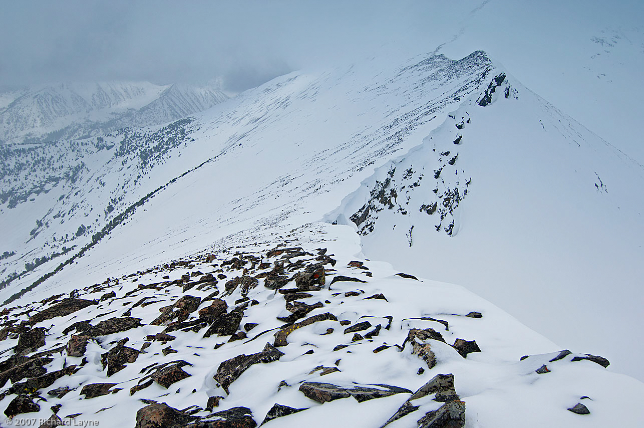
Leaving the backpack and sled behind, as I build a trail through the powder snowpack.
For those of you unfamiliar with travel conditions in deep powder, I have to drop my pack and sled, and then build a trail through the snow before progressing forward with my gear. If my journey remains the same as two weeks ago, I will travel an average of 4.5 miles to gain 1.5 miles per day. This is the penalty of traveling alone and for making the attempt during the period between December and at least mid-February. In addition, the remainder of February through March is still a threat for powder travel conditions. There are no guarantees.
To get through this area, I plan to carry 12 days of supplies from Kilgore, Idaho to the next resupply. That tallies to a substantial weight, almost 90 pounds. In spite of this large supply, if the resupply near Pete Creek Divide is missing, I may be down to three days of supplies to get me to the Monida Pass area. I could find myself without supplies for four days.
A resupply located at least 12 feet above the ground.
Needing to address this threat as I see it, I have two options. Both look and smell like a bag of rotting groceries. The first option is to skip the ascent to Pete Creek Divide, thereby saving two days of travel, including a 900-foot climb. The other option, should I find that the resupply is missing up there, I could dive off the north face of the Centennial Mountains, down to Centennial Valley on the Montana side of the mountains, and arrive at the winter maintained road. Unfortunately, neither option may be enough. I might still run out of supplies before arriving back on the edge of civilization.
Fortunately, the only decision I need to make today is when I leave to continue the trip. The next decision can wait until I arrive at the first fork on the route, approximately six days into the trip. Unfortunately, much also depends on how quickly I get to that first fork. With the incoming storm, I can only give a partially educated guess concerning how much powder I will encounter, which is likely to be substantial.
I have expanded this winter’s snowshoe trip along the Continental Divide. As a result, rather than starting to travel in the beginning days of February, I plan to leave approximately December 1.
Starting on October 27, I hung six resupplies in the extended area, with a final five remaining to place. Out of these five, two will be in the Anaconda Range in the Mussigbrod and Johnson Lakes areas. More on these two a couple paragraphs from now. The other three will go into the area of Southwest Montana near Monida Pass. I will place these three as soon as I believe they will be safe from the autumn and early winter crowd, near the end of November.
After completing the final resupplies, I will build another 11. Of these, I will retrieve nine during the trip where the route intersects the winter maintained roads. The final two are spares.
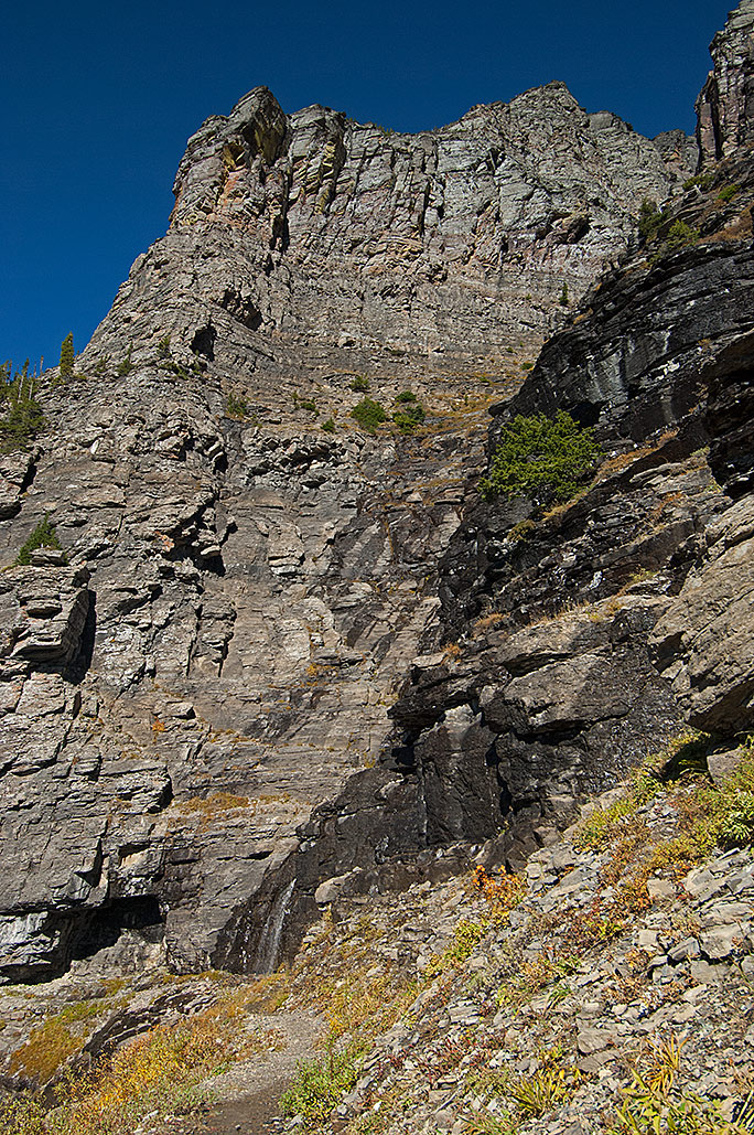
Falls Fork Rock Creek, Anaconda Range, Montana
During November, I plan to take three training trips. The first, as always, is nothing more than a single night to check out the equipment–and me–for the multi-night trips that will take place soon afterwards. Unless the freshly fallen snow relinquishes its hold on the roads to Mussigbrod and Johnson Lakes Trailheads, one trip will be a 25-mile, 6-day journey, while the other is 12 miles for four days. I will place the two remaining caches for the Anaconda Range during these two trips.
Frankly, I am surprised at the level of winter we are experiencing this early here in Montana. Many years have elapsed since we encountered snow and cold at this level so early in November.
The photos I am showing are of another year in the Anaconda Range. The main photo is Johnson Lake while the others are from Falls Fork Rock Creek canyon, the western route to the lake. When I come through this area next winter, my route comes from the south on the other side of the mountain in the photo, East Pintler Peak (9486 ft.). The mountain skyline is the Continental Divide. When I arrive at the resupply in this area, behind me will be 289 miles of travel, with 190 miles remaining in front of me.
Last thoughts; I place these photos and explanations on this website and my Facebook page @AThousandMilesofWinter for those interested in my trip. Unless I ask for it, I am not open to advice. You can offer up hope, etc. You may even ask questions, which I will try to answer in a timely manner. Time grows short though. If you wish to help in some way, let me know, I will see if there is a fit for you somewhere. While I travel alone most of the time, no one takes a trip of this magnitude, unaided. My wife and others can handily verify that statement.
Crusted snow on the south face of a canyon wall, Anaconda Range, Montana.
No, I did not forget. This winter’s attempted travel is 480 miles with supplies for 171 days, approximately half the distance to the Canadian border. I plan to complete this segment by mid-April. The food amount does not synchronize with the days between December and April. There is a reason for the excess. In the second paragraph, I hinted about this. Not all of my resupplies are going to survive the autumn hunting season. In addition, it is impossible to know where or for how long the storms will force me to hunker down. What I do know is that I still have to eat and burn gasoline for water when I am not moving.
A camp in the Falls Fork Rock Creek canyon, Anaconda-Pintler Wilderness.
The Scott Antarctic Polar Expedition of 1911-1913 used the teepee type, single pole, and single walled tent. I used a similar four-season tent throughout my solo 150-mile winter trips in Montana and Idaho’s Selway-Bitterroot Wilderness.
During my first subzero cold with the tent, I discovered that the heat congregated above my head just before making a too quick exit through the single wall. Whenever I sat up there was virtually no heat from the floor up to my neck. This was a critical defect, since one normally sits up to sip hot drinks and eat hot meals. The best I could do was to lower the tent, an action that partly solved the problem, but increased another problem, which I will soon describe.
The interior of a pyramid tent with the outside temperature approximately zero Fahrenheit. Note the rivulets of water on the tent wall threatening my gear on the footprint. (Click on photo to enlarge.)
In addition, the floor space 1.5 feet away from the tent’s edge was useless due to melting occurrences on the walls, which happened twice a day with the use of the stove. The built up frost on the tent walls soon became dripping, but mostly pouring rivulets of water streaming onto the tent’s footprint and into my gear. As if that was not enough, the center of the tent was useless because of the single pole occupying that area. Due to the restricted area, practical usage would have prevented it from ever being more than a cramped two-man tent rather than its four-man tent status.
Eventually I lowered the single pole to bring the built up heat in the tent down to my head and torso. Unfortunately, the lesser angle and lowered tent walls removed more of the living space, which set me up for another cardinal “do not”. No part of the bedroom should ever touch a tent wall. In a winter camp, a damp sleeping bag is a step toward freezing to death. In a double walled tent, the normal tent of today, the moisture on the outer wall also pours, but not into the survival area, umm mostly.
A pyramid four-season, single wall, single pole tent. The best tent I have experienced for shedding heavy snowfall.
I should mention that the tent of 100 years ago was not waterproof like all of the modern tents, but then Antarctica is the driest continent on Earth, where it never rains. The point I wish to make is that the porous cotton material greatly reduced much of the frost on the walls of yesterday’s tent. There are other distinct advantages to the pyramid tent. Properly setup, piles of falling snow, and there was plenty of that throughout the La Nina winter of 2007-2008, failed to collapse this tent. In another plus, the Scott Expedition, as with other expeditions of that time, demonstrated the strength of the tent against the wind. It handled 90 mph winds!
What convinced me to continue to use the tent in spite of its deficiencies was the phenomenally low weight, something I have no doubt Scott failed to experience. His tents likely weighed in at approximately 50 pounds while mine weighed less than 5 pounds.
In the end, the remaining three men of the five-man Scott Expedition, after attempting to wait out a blizzard for seven days, froze to death. While a mixture of circumstances brought about their demise, lack of food and fuel, with built up moisture in their sleeping gear, another may have been this type of tent.
Finally, I want to note that the manufacturer description of my tent said it was a four-season tent, which I maintain not so much. However, if one could handle insect infiltration, it would make a fine three-season tent. I do not mention the name of the company or the tent because this is a critique of this particular style of tent, which remains readily available with different companies throughout the world.
For my part, after 39 nights of winter use in 2008, I quit the single wall, one-pole tent.
A four-season, single-pole pyramid tent on a pass in Selway-Bitterroot Wilderness
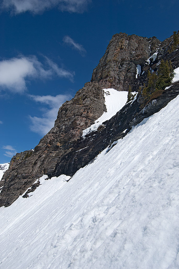
The terrifying approach to Hole in the Wall in Glacier National Park. The Continental Divide is 1200 above the summer trail. The Canadian border is 2.5 miles north of this location.
It is Saturday morning January 24, 2015; the reality of what has happened is beginning to sink in. Almost 81 hours ago, I arrived back in Helena, Montana with the Continental Divide trip almost surely canceled. This morning for the first time, I felt the slam of what that really implies. A huge sense of loss is welling up inside of me, awful to bear, and seemingly with no relief to come from any direction.
On April 29, 2008, after 1.5 months I completed approximately 150 miles of travel in the Selway-Bitterroot Wilderness. Within days, I began to wonder what was next while realizing the trip had demonstrated that my days of winter expedition trips were numbered. My eyes soon fell upon the Continental Divide. By the end of May, I had penciled in the initial route to travel 990 miles along the Continental Divide between Yellowstone National Park and the Canadian border on the northern edge of Glacier National Park.
About 13 months later, I began writing about the Selway-Bitterroot experience. In another year, I had my freshly completed first manuscript and a realization that I needed to take action where the Continental Divide trip was concerned. I could only hope I was not too late. In the early days of September 2010, I began to make plans for a tough strength and endurance-training regimen during the following winter, coupled with the need to research an area of the Continental Divide inside Glacier National Park near the Canadian border, which was supposed to be undoable in winter conditions. I began with three autumn reconnaissance trips. In just over one month ending near the end of the second week of October, I traveled in the backcountry for 17 days.
A little more than 3 ½ months later, I began the first winter trip on the eastern side of Glacier National Park. The date was February 2, 2011, and a La Niña weather phenomenon was strangling the high country of Glacier, with huge snowstorms lining up behind each other. In another 3 ½ months, now near the end of May, I exited the park for the final time, successful at accessing the previously stated inaccessible Hole in the Wall area of the park. I did not realize at the time that I would be writing a book about the four trips, particularly the final trip, 16 days in length, which had nearly taken my life twice, not including the near misses of roaring and camp shaking avalanches. At the time I had no idea of the toll that last trip had wrested from me.
In May 2013, with my second written manuscript now in the hands of a publisher, I broached the subject of the Continental Divide winter trip to my wife. The detailed planning for the 990-mile winter trip began.
So it is that after eight days on the route, and now with one week remaining in January 2015, and nearly 7 years after I began the preliminary plans, I have canceled the trip. Among other reasons, I have waited too long and my age now says no. This morning the heavy reality is nearly suffocating. My chest feels a great weight upon it. Simultaneously there is a sense of loss in purpose and an emptiness. The mourning has begun, although no doubt for more than just the trip. I believe a new chapter has started; the autumn phase of my life has begun in earnestness.
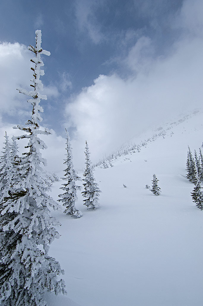
Two days after a snowstorm, the snowshoes were dropping through the powder snow 1.5 feet. Another storm would arrive later this day and drop another three feet of snow. The location was the western edge of Yellowstone National Park, on Madison Plateau and near the Continental Divide.
In another indication of the rapidly closing date for beginning the 93-day winter expedition, Montana and Idaho’s mountain snowpack has begun to accumulate. Being early winter however, it comes as no surprise that the NOAA SNOTEL site near Darkhorse Lake (8700 feet), located in the southern Bitterroot Range, shows that in the last five days the snowpack has dropped from nine to six inches. More is on the way though. Beginning tomorrow evening, November 1, another 12 inches could fall. Moreover, with our going into November, the average daily temperature is continuing to drop. Most of that snow is going to remain on the ground until next June.
Of far greater interest to me than the increasing snowpack is the weather phenomenon known as El Niño. I am hoping it plays a strong role in next winter’s snowshoe trip. As of this date though, there is some uncertainty of how strong it will be, or for that matter, when the event will begin. The latest extended forecast, released on October 16, 2014 called for a 67% chance of a mild El Niño beginning by mid-November. From Yellowstone National Park to Butte Montana, the area I will be traveling through next winter, the impact of this weather pattern normally means less snowpack and more importantly, warmer temperatures. Those higher than average temperatures could create a crust I can walk on sooner than the latter days of February.
The reason I don’t begin extended winter trips until at least the beginning of February, is due to the condition of the snow. Although I relish the idea of having enough snowpack to cover brush, timber fall, and rock fields, the real reason I wait until later concerns whether a crust has formed on the snowpack. Traveling in deep powder is a nightmare. It can cut my daily average of 6 and 8 miles down to 3 and 4 miles.
The La Niña winter of 2008 brought the opposite effect of El Niño. With the storms lining up behind each other, I traveled through three feet of powder during the latter days of March. That occurred during the double crossing of the Bitterroot Range west of Montana’s Bitterroot Valley. The average day was eight hours of travel with my forward progress between three and four miles. Because I was compelled to build trail without the backpack, I actually traveled between 9 and 12 miles each day. I needed nine days to travel the first 25 miles, which included going over Blodgett Pass. By the last day, even my three-day emergency food supply was at the crumbs level. Fortunately, the resupply bucket was where it was supposed to be.
A crust would have changed the character of the Selway-Bitterroot Wilderness trip (although I wonder what I would have written about if the trip had gone smoothly). As it were, the snowshoe portion of the trip was only 115 miles, but still took one month to complete.
Using primarily snowshoes, the distance I will travel on the Continental Divide during the winter of 2015 will be 462 miles. I have to be able to average approximately 5 miles per day for 93 days. That is not possible in deep powder. Granted, I will have 107 days of supplies out there, but I will have to make up the days of downtime from the inevitable storms. More than that, for as much as 12 days I will be traveling on rope and crampons, where the measurement of forward progress is in feet rather than miles.
Another troubling consideration is the Anaconda-Pintler Wilderness, which I will enter 375 miles into the trip. During the winter of 2007, I undertook five trips in this wilderness, where the final trip included crossing it and the Continental Divide. As the result of that experience, I consider it vital to get through the wilderness near the end of the winter rather than begin the following winter’s trip with the Anaconda-Pintler Wilderness still in front of me.
So yes, I am watching with a keen interest in what the future holds with the El Niño weather pattern.
On March 17, 2014, I will attempt to continue snowshoeing along Montana’s portion of the Continental Divide. The trip began on February 1 and abruptly ended on February 6 with the snowmobile ride to West Yellowstone, Montana. There were a number of reasons for the exit, any one of which would have required my postponement of the trip.
The yet to be resolved issue of whether I had high-altitude sickness or carbon monoxide poisoning. Since I was at the elevation of 8200 feet for most of those days, I am leaning toward the carbon monoxide poisoning.
I was not in good enough shape to carry the nearly 100-pound load.
Snowstorms in February dropped exorbitant amounts of powder snow, which from the outset prevented my movement in spite of the large backcountry snowshoes I use.
Because I will begin traveling from Macks Inn, Idaho, there is now an additional 15 miles. However, I may alter the route further on in the Eastern Centennial Mountains that will undo the extra miles. With that said, I still have approximately 462 miles to attempt to complete no later than the middle of May. With at least a 70-pound load, it is unlikely I will complete that distance in 60 days. I would have to maintain a daily average of 7.7 miles. The more realistic average will be five miles per day for the first 30 days and possibly eight miles per day for the second 30 days.
Coming up short could be a blessing though. With the above average snowpack in the Anaconda-Pintler Wilderness, the last segment I will travel through this winter, after the middle of April and into May the raging spring avalanches could be fatal. Less than seven days ago, the National Oceanic and Atmospheric Administration (NOAA) predicted a possible El Niño weather pattern for this year. Where the Continental Divide in Montana is concerned, that interprets into a low snowpack and warmer temperatures for next winter, something I would much prefer while traveling through the Anaconda-Pintler Wilderness.
Having lost 1 ½ months of travel time, in an attempt to increase my pace to a five mile per day average, I have lowered the backpack’s weight to below 75 pounds. West of Monida Pass and along the Southern Bitterroot Range, I will try to increase the daily distance to 10 miles per day. Once I arrive at the Anaconda-Pintler Wilderness however, this level of mileage will be impossible.
Because the travel will be half again to double the normal pace, I will only need one-half to three quarters of the caches along the route. A four-day cache with an allotment of 7150 calories per day will now become an approximate eight-day supply. That means, barring any delays, there are far more supplies along the route then I can possibly consume. In short, a lighter load to carry.
Although it will increase the peril of the trip, with the exception of the crampons and ice ax, the climbing gear will remain behind. Additionally, I will no longer need the heavier sleeping gear that protects me from prolonged winter travel combined with temperatures down to 40 degrees below zero Fahrenheit.
Meanwhile battery power for my equipment continues to be an issue. For that reason, using the personal locator device I will only send a progress report once a day to Facebook and Twitter. I will also exit overnight at Raynolds Pass, 63 miles into the trip, Monida Pass at 149 miles, and Chief Joseph Pass at 351 miles each to upload files and recharge the batteries. By leaving three camera batteries behind, I will save 17 ounces, but lose half of my ability to take 4800 digital captures. Finally, I will carry less AA and AAA batteries for such equipment as my head lantern.
This is the two part interview on KTVH concerning the book Inaccessible. The book concerns 47 days in four trips during the winter in the backcountry of Glacier National Park. In addition the upcoming 90-day winter trip along the Continental Divide is discussed.
Inaccessible concerns four backcountry trips in 47 days in the attempt to access an area of Glacier National Park called Hole in the Wall. The keystone for completing the three-winter trip from Yellowstone National Park to the Canadian border was accessing this high elevation cirque at the end of Bowman Canyon, three and one half miles short of the Canadian border.
As it turns out, the park personnel concerning the inaccessibility of Hole in the Wall was nearly accurate. There were worse things to face on the one-mile eastern approach than the snowpack shaking avalanches a mere several feet away with trees, roots, boulders, ice, snow, mud, raging water and a roaring assurance that a man and his equipment could disappear forever. Falling and lying upside down on near cliff angles with and without being connected to the rope, with and without carrying the heavy 75-pound load, were far more effective eye-openers.
Worst of all was the realization that in 2016 the six days of horror in entering Hole in the Wall was going to happen again.
If you want to contact me or make a comment, go to the contact button. The spammers are using my comment section for what they do best.
After the February trip, my intent was to return sooner than I did, but a succession of storms delayed me. The first of two trips planned for March was a seven-day trek to summit Stoney Indian Pass. The second, another seven days, was to begin on about March 21 at Polebridge, and head toward Brown Pass and Hole in the Wall. Once the second was completed, I planned to deliver a cache to Waterton Townsite in Waterton Lakes National Park, Canada. Yet getting across the closed international border at Goat Haunt was still problematic. Another problem with this plan was the additional 16 miles on an already lengthy winter trip. Nevertheless, until I could improve on it I would stick to the original plan.
On March 10, as I left Helena, I had known bad weather was a possibility, but I took a chance anyway. I arrived at the gate on Chief Mountain Highway in a downpour. With two feet of slushy snowpack on the closed portion of the road, I canceled the trip.
Rather than return to the eastern side of the park for another attempt at Stoney Indian Pass, I thought it was best to stay with the scheduled trip to the Brown Pass area. The winter days were fast ebbing and I still had yet to see the real target of the route, Hole in the Wall. This meant that, when I embarked on the ultimate trip across the entire park, I would not see Stoney Indian Pass under a snowpack until I got there. This also meant that, on the chance that I would need all my technical gear on the pass, I would carry every ounce of it from the Belly River trailhead rather than leave it at Waterton Townsite with the cache.
I planned to be gone for approximately one month. After the Brown Pass trip, I would return to the eastern side of the park, obtain the necessary permits at Hudson Bay Ranger Station, deliver the resupply cache at Waterton Townsite, and then return to the Belly River trailhead and begin the park-wide crossing.
I left Helena in the late afternoon of March 20. As I drove north up the Seeley and Swan valleys, I worried about the cloud-laden peaks on the Swan Range. When storms hit, I knew that the park usually received the lion’s share of the moisture in this area. The forecast near Brown Pass called for a 60 percent chance of snow. Given what I could see happening on the Swan Range, 100 miles south of Hole in the Wall, I worried about how much more snow was falling in the park.
The plan was to pick up the permit, which I did, and then spend one night with friends near Bigfork. The following morning I would begin the trip. I ended up spending two nights with the friends. I had a couple reasons for doing that, weather supposedly being the foremost. In reality, fear held me back that extra day.
Chapter 8: A Different Trip
March 22: A Death on Bowman Lake
I left Bigfork at 1 A.M. and arrived at the Polebridge trailhead three hours later. After arranging my backpack, I left the trailhead at 5:30 A.M. still in darkness. Traveling in the dark, the LED head lantern effectively lit the way, but the narrow beam of light only somewhat alleviated my fear of hungry grizzlies that would now be emerging from their winter snooze. The ski grooves on the road to Bowman Lake indicated substantial use by cross-country skiers. I usually give skiers the courtesy of not snowshoeing on their tracks, but here I appreciated the packed trail. (On several occasions, skiers in the backcountry have voiced their gratitude for the trail I’ve provided with my snowshoes. In the long run, it all balances out.) Walking on the grooved trail, in spite of a backpack weighing over 90 pounds, I made good time on a crust where the snowshoes broke through infrequently.
An overcast day, it was still getting light two hours into my walk. Although the road paralleled Bowman Creek, I traveled two miles on the winding road and through an old burn before I left the North Fork Flathead River Valley behind. My entrance into Bowman Creek canyon brought me into a mature climax forest of Douglas-fir and lodgepole pine trees.
At the lower end of Bowman Lake on March 22, 2011, Day-One the backpack weighed more than 90 pounds.
The six miles to the lake on the snow-covered dirt road created the illusion that it was more level than the three miles on Chief Mountain Highway. In reality, I covered a vertical gain of 600 feet and a drop of 100 feet compared to Chief Mountain’s gain of 395 feet and loss of 420 feet. I was elated at the difference between this and the slow slog of the Belly River canyon trip in February. I even dared to believe I would go beyond the foot of the lake today. I arrived at Bowman Lake Campground in four hours.
Although the permit called for me to spend the night at this location, that was supposed to have happened on March 21, yesterday. Today the permit had me at the head of the lake. Even if I had the energy, I would have been unable to travel that additional six and a half miles on this day. The sciatic nerve on my left hip had flared up again. I dropped the backpack and briefly considered setting up camp, but the pain subsided quickly and I decided to continue.
I am no fan of walking on ice. In my mind’s eye, I see me breaking through it and holding my breath for a very long time, while unsuccessfully trying to claw my way back to the surface. As a toddler, I almost drowned twice, although I have no conscious memory of either event. As an adult, I stay off the ice. To punctuate my fear, during a phone call before the trip, a park ranger informed me of a previous incident in which cross-country skiers broke through the ice near the lake’s north shore.
My only alternative was the weakly crusted snowpack that covered the trail inside the trees along the north shore. Faced with walking on a crust that would only partially hold my weight or on the lake ice, I hesitated. Then I spotted some deer on the ice near the north shore one mile up the lake. A few minutes later, I headed for the ice.
The foot of the lake was located in rolling foothills. On the north side, Numa Ridge rose 1,500 feet, while on the south side Cerulean Ridge was 1,000 feet above the lake. Glacier’s world-renowned canyon walls and peaks were three miles farther east. I decided to set up camp once the peaks and steeper canyon walls were on either side of me.
The remnants of an elk hide on the ice and snow of Bowman Lake.
I arrived at a partial elk carcass 10 minutes later. All that remained was about a quarter of the hide, some bones, and numerous predator tracks, both coyote and wolf. I was a little surprised to see that anything remained of the animal. Generally, scavengers and carnivores would clean even a large elk within a short time. Perhaps, as I guardedly looked around, a short time was all that had passed.
As I traveled farther onto the ice, my confidence in its strength increased. So much so, I decided to walk a straight line through the curvature of the lake, thereby cutting the distance to the upper end. That also meant I would gradually cross the lake twice. As I got farther from shore, however, my confidence dropped until, with visions of me gurgling under the ice, I said enough, and altered my course back to the north shore. Thereafter I stayed between 40 and 70 feet offshore.
By 11 A.M., with my hip hurting again, I ran out of steam and stopped for a break. I also had eaten nothing since the previous evening. Somehow, I kept ignoring the oft-repeated lesson that I needed to eat continuously as I traveled. While a man in his twenties might need an hour, at my age recovery from this level of tiredness would encompass the remainder of the day and tonight. Too late to undo the mistake; I brought out the day food and ate anyway.
When I continued 20 minutes later, I moved like an old man who badly needed to stop. I found what I was looking for along the northern shore 30 minutes later. Patches of ice had melted on the shoreline giving me access to the lake water. Still a mile short of the great walls and peaks, at noon I dropped the load and set up camp.
Later inside the tent, I again compared this first day to the Belly River canyon trip. Today I had traveled eight miles in six and a half hours, while in February; it took four days to get this far with a similar load. No matter, my confidence about what lay ahead stayed low, particularly about what was beyond the lake. I also remembered the damage I did today by not eating, which was going to have an adverse affect on tomorrow’s travel. On the upside, for the first four miles tomorrow, the excellent travel on the lake ice would continue. I crawled into the sleeping bag and was asleep by 4 P.M.
March 23: Another Death on the Lake
I was up at 3 A.M. Although I had been in bed for 11 hours, a painful left hip and right knee had continued to interrupt my rest. I had had surgery on the knee twice, with most of the cartilage removed during the last operation in January 1980. While both knees were arthritic from the past injuries, the right knee was in the worst shape. An orthopedic surgeon had informed me several years earlier that he would own my knees if I ever stopped doing whatever I was doing to keep them working.
Worried, I wondered if I ought to turn back. Still in front of me was the harsher snowpack beyond the lake and the 2,000-foot climb to the edge of the approach. Was I finished? In the end, although I decided to continue up Bowman canyon, it was one more heads-up that the end was in sight for these types of trips.
By 5:30 A.M., the gear was out of the tent and ready to be packed. The pain in my right knee had also increased. I thought again about turning around and going home. If I did, I figured that would be the equivalent to my signing off, that I would be finished with such arduous winter trips. Just over one hour later, in the increasing light of dawn I hefted the load and began walking east, toward the high country. After a few minutes, the pain in the knee subsided while the sciatic pain became almost nonexistent.
I had been traveling for three quarters of an hour when I spotted a dark object near the middle of the lake a third of a mile ahead. I wondered if it was another carcass. A few minutes later, I saw movement. Within a short time, I knew it was no deer, coyote, or wolf. As I continued to close the gap, I was finally able to discern that it was a large, long-necked, dark bird. Clearly much larger than a duck, it was probably a goose. Not wanting to alarm the bird, I hugged the north shore as I continued. Although I never came within 500 feet of it, the bird attempted to fly away a couple of times, but landed within moments, obviously injured.
My heart went out to the goose. While its flock continued north, the bird was going to die alone out here on the ice. Given another couple of months, the goose would have had a huge body of water to protect it from the landlocked carnivores. I figured that hidden in the trees along the shoreline, there was probably at least one set of eyes staring at the hapless bird. Today, I theorized, was probably its last day alive, and though I realized it was a part of the cycle of life, I was still bothered. There was too much about the bird’s state that reminded me of my own. Both of us were alone and debilitated. The bird was already in a dangerous neighborhood; I was headed that direction.
Periodically along the route, I turned and looked over my shoulder to where I had already been. This was one of several methods I used for navigation. If my living lessons came by way of some fictional movies and novels, then turning around and looking back was a sign of weakness and likely bad luck. In real life, I needed to know what this view looked like coming from the opposite direction. In an off-trail environment, it was particularly useful where trees and foliage smothered the route. Its importance increased during the winter when a deep snowpack generally hid the trail.
With the end of the lake in sight, I was two and a half miles and one and a half hours beyond the goose. Behind me in a light easterly breeze, I noticed for the first time several objects rolling over the snowpack toward me. It struck me that I had been watching them for quite some time without paying any attention. I did now. Mystified, I stared at the odd, dark rolling balls as they caught up, and then passed by me in their slow march to the lake’s upper end. Suddenly I realized what I was seeing. Aghast, my heart leapt into my throat. Oh God, those are balls of goose down! The bird I had the temporary kinship with was dead.
In a world of steep cliffs and peaks, with canyon floors and walls covered by trees, all smothered beneath a deep snowpack or in ice, I had brushed by one living creature today and within an hour and a half, it was just me again. Tears welled up as I started to walk again, this time in the company of the rolling balls, which were moving slightly faster than my pace. The goose was no longer afraid of me. His ghost in the form of those balls of down accompanied me for a few minutes before moving on.
Then I got angry. I did not give a damn that this “bird-meets-carnivore” event had been happening on this lake for more than 10,000 years. Cycle of life my ass, some cowardly coyote or wolf had waited until I was out of sight, then ran out there and killed that bird. Rationally I knew they had to eat, and the injured goose would not have survived anyway, but right then though I felt as if I had lost a friend. With my feelings still in turmoil, half an hour later I arrived at the upper campground of Bowman Lake.
As I neared the upper end of Bowman Lake the cloud cover of the last four days was finally dissipating.
The thick clouds from the day before and this morning had slowly been breaking up. Shortly before I arrived at the campground, the sky had nearly cleared. Eastward, most of the peaks still had a shroud of clouds around them, while to the west the sky was almost cloud free. On the south shore, the clouded veils on the summits of 9,891-foot Rainbow Peak and 8,777-foot Square Peak were fast dissipating. The backcountry of Glacier National Park was turning into a pristine and precious jewel.
I stopped for an hour at the forested campground and even used the toilet, knowing this would be the last one available for the next three or four days. By the time I picked the backpack up and continued, the sun was on the canyon floor and softening the snowpack.
The trail inside the thick forest beyond the lake was easily discernible in the three-foot deep snowpack. The fronts of my snowshoes were also breaking through the crust at every step. In a sun-saturated opening, I could still see the lake through the trees when I halted, dropped the backpack, and sat down again. The heat from the sun’s rays was blissful and encouraged me to stop. Pulling out the English muffins and peanut butter, I slugged down two halves. After 45 minutes, I continued up the canyon. Now the entire snowshoe was punching through the snowpack at every step, a clear sign that I needed to stop for the day.
Less than a mile beyond the campground, I turned right into the trees and began looking for a location to put camp. Somewhere over there was Bowman Creek and hopefully open water for my camp. I took the backpack off in an opening that I thought was part of Bowman Creek’s floodplain. For 40 minutes, I searched fruitlessly for open water before I quit and set up camp.
The hot sun had turned the surface of the snowpack into slush, thereby preventing my continuing up the canyon, but with an advantage in my waterless camp. Using a scant amount of fuel, but still going a little too far with it, within an hour, I melted enough snow to fill two 96-ounce bladders of water.
This morning the right knee had almost turned me around. Through the day and now in camp, the knee still hurt, but I no longer believed it would stop me. Yesterday I had predicted that today would bring fewer miles. True enough, I traveled half an hour longer, and put only five miles behind me. With a plan for an early rising, I fell asleep in the early evening.
March 24: A Terrifying View
I now had in my possession an indoor-outdoor thermometer with a wire leading outside. The reading was 14.6 F. There would be a hard crust for today’s travel. To take full advantage of it though, I would have needed to get up by midnight. I crawled out of the sleeping bag at 4:10 A.M., and was now doubtful that my plan to ascend at least half of the 2,000 feet to the bench on Brown Pass today would happen. I figured the soonest I would get out of camp would be 7:30 A.M., which would give me three or four hours of travel time before the sun softened the snowpack.
I left shortly after 8 A.M. and immediately began a 250-foot ascent on the south-facing wall that took me to a bend less than one mile ahead. With the exception of a few high-altitude clouds, the sky was clear. There was no sunlight on the canyon floor yet, but it was coming. In the open areas, the crust held my weight. Unfortunately, most of the trail was inside a thick forest where the front of the snowshoes and the toes of my boots broke through with almost every step. I tired quickly. After 40 minutes, I took a 10-minute break with another 100 feet remaining in the ascent. An hour after I left camp I arrived at the small summit and descended back to the canyon floor. I figured this was just a taste of what that climb was going to be like two miles ahead.
The well defined Bowman Lake trail three miles above the lake in spite of the snowpack being three and four feet deep.
The snowpack’s depth had also increased as I traveled farther up the canyon. Unlike many less-defined wilderness trails, the wide course of the trail here was easily discernible even in the deeper snowpack. In addition, there were large snow bumps on either side of an easily defined ditch, which was the trail, albeit three to six feet below. Unfortunately, my snowshoes were too wide to travel on the stronger crust inside the ditch. Therefore, I strolled from mound to mound, often from one side of the ditch over to the other.
In spite of the late start, and though the sun was filtering through the tree branches by 9 A.M., the crust held my weight enough to continue through the morning. A good thing, with the troublesome sciatic nerve; I took numerous breaks.
At 10:30 A.M., with 8,790-foot Thunderbird Mountain now on my right, I began to anticipate a first view of the approach to Hole in the Wall. I entered a large open area near the confluence of Pocket and Bowman creeks at 11 A.M., and saw it for the first time. The view of the snow-covered mountain and steep angle of the approach was a shock. As expected, the entire width was an avalanche chute, except it looked worse than my imagination had conjured it to be. The ravine I called the elbow was particularly frightening. It was like a 1,400-foot funnel with a mouth on the summit that was 300 to 600 feet wide—a deathtrap! Every avalanche up there would be crammed into that narrow near cliff-angled ravine. Even a small slide from the 8,000-foot summit might be non-survivable by the time it hit the summer trail at 6,600 feet. Although a fog bank from Brown Pass covered part of the approach, I could see enough, and instantly agreed with the park rangers. Hole in the Wall was inaccessible in the winter!
God almighty! What the hell have I gotten myself into?
A staggering first view from the Bowman canyon floor, Hole in the Wall is 1800 feet above me with Mount Custer (8883 ft) in the background. On the right 2100 feet above the canyon floor, partially hidden in a cloudbank and buried in a 200% above normal snowpack is the impassable approach.
Then I recalled there would be no attempt during this trip. I was here only to check the viability of the traverse. I had also learned that a distant view was untrustworthy. The final decision would happen from the edge of the approach. I dropped the backpack and spent over an hour walking around the open area. While there, I decided the climb was out today. My hip and knee were hurting again, and I was tired.
The snowpack still held my weight in the open area. Soon after I continued up the trail, I reentered the forest at the base of Thunderbird Mountain and immediately started to break through the snowpack. On the left and through the trees I could see the clearing where hidden beneath the snowpack was Bowman Creek. I turned a hard left and was soon in the opening again.
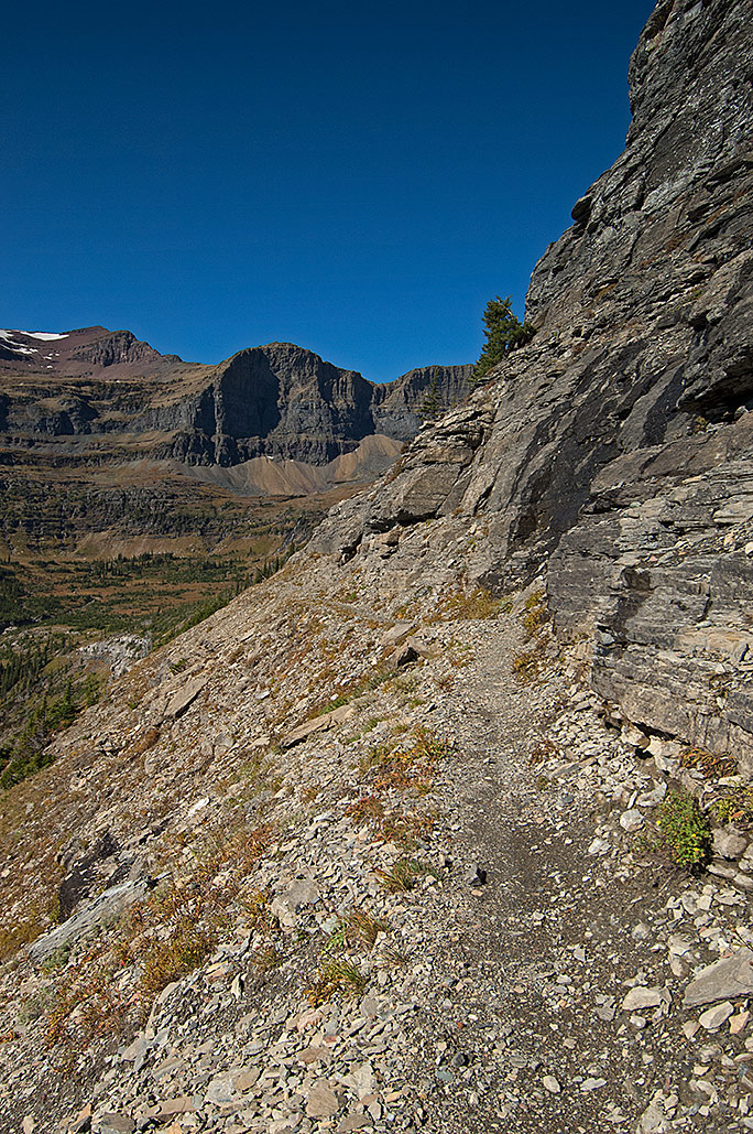
Avalanche Terrain
An hour and a half later, I had traveled less than one mile when I reemerged from a stand of cottonwood trees. On my right was the open water of Bowman Creek 13 feet below me. On the other side of the stream was a level spot in the snowpack that appeared to be perfect for a camp. Staring back across the stream a few minutes later, I saw that I was directly beneath 8,528-foot Boulder Peak. Perhaps I was wrong about placing the camp here. I pulled the topographic map out. The map showed that I was at the low end of an avalanche chute one-third of a mile wide.
As if to verify that I needed to move, a few minutes later I heard a grinding roar. Looking up, I easily spotted the avalanche as it tumbled off the cliffs 3,000 feet above me. That explained the absence of large trees on the upstream side of the cottonwoods. Some avalanches coming off the peak 4,000 feet above had even reached across the eastern side of the stream and swept a portion of it clean.
I left the backpack behind and re-crossed the stream to climb a small rise on the west side of Bowman Creek. Across the large, open avalanche zone, I saw a possible spot for a camp less than 1,000 feet away. I retrieved the backpack, and just before 3 P.M. set up camp, still near the base of Boulder Peak, but on the east side of the stream in a scattering of small cottonwood and Douglas-fir trees.
Before I arrived in camp, the clouds had begun to thicken. Although the barometric pressure was dropping, a storm was yet to be a foregone conclusion. Nevertheless, in the winter, I always prepared every camp for a storm. Three hours later, as the barometric pressure continued to drop; I changed my mind and decided a storm probably was coming.
Earlier, looking up at the approach to Hole in the Wall, I had spotted what appeared to be a field of ice below the summer trail’s approximate location. Although fog prevented an unobstructed view, I was almost certain there were at least two sheets of ice on the traverse. It also appeared that until there was an actual need for them, I would be unable to discern absolutely whether ice screws would be necessary. For that reason I would have to carry a full complement of them, which meant more weight. With a future load that already had the appearance of overwhelming me, how would I carry more?
My sciatic nerve continued to be troublesome, as was the small of my back and right knee. It was easy to conclude I was physically unready to make tomorrow’s climb with the nearly 90-pound load. I decided to leave the camp in place and day hike up to the approach the next day. I was asleep shortly after 6 P.M.
Chapter 9: The Brown Pass Bench
March 25: The Day Hike
Through the night, besides the normal pain in the hip and knee, I was unable to lie on either shoulder for long before the respective hand went numb. To make matters worse, the “flat” I put my tent on turned out to be a slight slope, which had me continuously sliding off the pads. It was a restless night, I had lain awake from 1 A.M. to 3 A.M., then crawled out of bed at 6 A.M.
As I prepared for the climb, I questioned the wisdom of going anywhere without the tent, stove, and sleeping bag. An ascent without all my gear in the winter was a cardinal sin. If I had to spend the night up high, there would be little or no forgiveness.
Just before 10:30 A.M., with a load of approximately 50 pounds, I began the climb. In 20 minutes, I ascended 200 feet inside the thick forest and figured I had crossed over the trail 40 feet below. I was also on the steep northwest face of Thunderbird Mountain, pushing through at least one foot of powder snow. Except for my concern about what would happen if I got hurt, I was glad I had packed a small load. After another 100 feet and 10 minutes, I spotted a gap in the trees, a telltale sign of the summer trail.
A few minutes later the tracks of two wolves merged with the trail. Why were they up here? The deer and elk were still in their winter range in the lower elevations. If they were on their way to Waterton River canyon, why would they abandon Bowman canyon? From Polebridge where the creek drained into the North Fork Flathead River up to Bowman Lake, there was plenty of moose, elk, and whitetail deer.
As I climbed, the powder worsened. In an hour and a half, I was just short of having only ascended 550 feet and traveled less than three-quarters of a mile. Frustrated, I hollered that I had had enough. Through the trees on the left and below me, I could see a ravine paralleling the trail. Beyond it was a treeless white south face, and hopefully a solid crust. I arrived on the edge of the ravine 10 minutes later.
Except for the wind picking up, the south-facing snowpack was all I hoped it would be. The teeth of my snowshoes dug into the crust without breaking through. The steep angle of the climb continued to be tough, though. I would travel 10 to 15 minutes and take 5- and 10-minute breaks.
Just after 1 P.M., I stopped for another 10-minute break. At an elevation of approximately 5,575 feet, I was 1,150 feet above my camp and had been traveling almost three hours.
Inside the draw of the unnamed creek, I have just moved passed the location where my left snowshoe punched through.
What to do next was questionable. Having never been in the area, I could only approximate where the trail led. According to the topographic map, a series of switchbacks zigzagged north of the ravine around the steep ridgeline 300 feet east of me. With evidence of avalanches on that 45-degree south face, however, following the summer trail could be folly. That left two possibilities. The first was up the ravine with the nameless creek. The second was to the right of the ravine in a scattering of sapling pine trees. Since it appeared to have the lesser angle, I chose the ravine and dropped in. Getting in and out of the ravine was easy, but within five minutes of climbing, that was no longer the case. The walls of the ravine closed in, restricting my direction of travel to up or down.
I was 150 vertical feet in the ravine when the left snowshoe plunged through the snowpack. I swallowed in fear as I stared into a deep hole at a boulder strewn falls. Until now, I thought the snowpack had been at least eight feet deep above the mostly hidden, fast-running creek. In reality, the stream had substantially eroded the deep snowpack.
I realized I had been fortunate in that I had only punched a hole through the crust without dropping into the ravine. A warning, I had found over the years that out here fortune was nothing more than a nail in a coffin. Relying on luck in this terrain was a great way to die.
The chasm appeared to be too dangerous to continue up, yet the walls on either side were too steep to climb with snowshoes. Meanwhile the crampons and ice axe lay safe in the tent back at the base camp. Unless I turned around and retraced my tracks down the steep incline, which was a distasteful thought, the alternative was to continue up the ravine.
I speculated this might be the only time I would break through. Sure, and the open stream 25 feet farther up the ravine with the revealed second falls meant nothing? I glanced again at the wall on my right. Apparently, I was going to find out during the descent if that other route was the right one. For now, I would continue up the ravine.
Hugging the right side, a few minutes later I arrived at the open water. I moved to the right, and in spite of the large snowshoes, sank knee-deep in the north-face powder. Gaining access to the water, I unclipped my water bottle from its carabiner and filled it without punching another hole. I drank 16 ounces and then refilled.
After putting the bottle away, I surveyed my surroundings again. This section of the climb to Hole in the Wall was supposed to be the easy part. The targeted challenge still lay another 1,000 vertical feet beyond me. Somehow, that seemed wrong. I could feel the ire rising in me as I asked the rhetorical question of why it was so damned hard getting to the tough areas.
A few moments later, I got back to what I was supposed to be doing. To travel in this type of terrain during the winter, I needed to deal with only the task directly in front of me. Distractions were dangerous. I needed to focus on getting up the remainder of the ravine, which I would exit in another 100 feet. Above it was a less hazardous 500 vertical feet to the bench between Brown Pass and the bottom of the eastern approach to Hole in the Wall.
The Cloudbank
It was also beginning to look like I chose the wrong day for the climb. The weather was changing. When I left camp, there had been patches of open sky above me. Now accompanied by a strengthening wind, a thick cloudbank was dropping off 9,406-foot Chapman Peak toward Brown Pass. Regardless, to make the crossing I needed to get a close look at that approach. With March nearly over and the end of winter less than 60 days away, I was running out of time.
Maybe I ought to turn back and seek the warmth and comfort of the tent and sleeping bag. No one would fault me for backing away from this ravine and the swirling cloudbank up ahead. Right, and I would not? I continued to ascend.
At 1:45 P.M. I exited the ravine onto the rolling but still ascending terrain. I was also within a half mile of the area I had scouted almost six months earlier. It came as no surprise that the world of white looked only vaguely similar to last autumn. Yet, as I recalled, much of the area below Brown Pass had been a thick forest of small- to medium-sized pine trees. Now it was a thinned out forest of hoarfrost-covered saplings and meadows.
I continued the ascent toward the bench in an arc that would eventually bring me to the bottom of the next climb. From there I would begin the final ascent of 400 to 600 feet to the ridgeline that would reveal the eastern approach.
I climbed only a short distance before the consistency of the snowpack changed. I began to break through with each step. I went back to taking numerous breaks. As the afternoon progressed, my travel time decreased while the breaks lengthened.
As I closed in on the avalanche chute I planned to climb to the approach, the clouds smothered the ridge.
The weather deteriorated further. The wind increased, interspersed with gusts, while the clouds thickened, intermittently covering the peaks. At 3 P.M., exasperated with the weather and bad snowpack, I stared at where the ridgeline for the approach was supposed to be just a quarter mile away. The upper slope had disappeared inside a cloud. Once up there I would see nothing. I bellowed in protest and declared the final climb was out for today.
Once again revealed, I continued toward the avalanche chute.
My heart was also in my throat with fear. When I came through here the previous autumn, I had realized the entire mountainside from Brown Pass to Hole in the Wall was an avalanche chute. Somehow, today the 45-degree angle looked far greater than I remembered.
Although I had just persuaded myself not to ascend the final pitch, I closed the distance. At 3:45 P.M. I arrived at the bottom of the ascent and shot some pictures of the once-again revealed ridgeline and open sky. Then with the recent surrender cast aside, I began to climb up the left side of the avalanche chute near some small avalanche-damaged trees. I wasn’t surprised at my conduct. Making declarations under duress and then abandoning them was a part of my modus operandi.
Turned Back
Having just spent an hour and a half breaking through the snowpack, I finally had a solid crust on the nearly treeless south face. In spite of the relief, reality hit several minutes later with the tremendous mistake I had made by leaving the ice axe and crampons behind. What in hell had I been thinking down there?
Staring around, although the angle of this slope was less, I suddenly recalled aloud why I had quit shooting photos almost five years earlier during the steep eastern ascent of Ahern Pass. At that time, I could not shoot and survive climbing at such a steep angle in a buffeting wind. At a minimum, it had made me want to throw up or worse, plummet to my death. At least I had the ice axe and was wearing crampons then, I reflected sardonically.
A thin cloudbank covered the mountainside 15 minutes later, this time with me in it. The wind increased again, and then the snow pellets arrived. The protective gear against the two conditions was inside the backpack. Nor would I be dropping the load to get at them on this slab. Consequently, and in spite of my rigorous exercise, I felt a growing chill beyond the biting hits of the pellets.
Blowing snow, clouds, the lack of crampons, and the late time stopped me here.
Another gust hit me as I photographed the vague slope ahead of me. With nothing to hold me upright, I experienced vertigo. I dropped the camera, leaned into the ski poles, and kept my eyes on the saplings several feet away until it passed.
Then I remembered that the further I climbed, the more I would have to descend without crampons and ice axe. I looked at the watch and was surprised that I had only climbed 160 feet: so little for the seemingly great distance between the bench and my position. I checked the time, now 4:04 P.M., and realized it was indeed time to head back to camp. If I had brought the crampons and ice axe, I still would have turned around.
This being the fourth day out of seven, a close-up inspection of the approach on this trip was now out of the question, which meant I was faced with making a decision to attempt crossing Glacier while having scant knowledge of what was waiting for me at the approach. The crossing was becoming increasingly unreasonable. Perhaps I should come up here again the next day, and make another attempt. That would have me overdue, this time deliberately, which was no option. Had this been a wilderness and not Glacier National Park, I reflected, I undoubtedly would have taken the extra day.
Discouraged at the failure while simultaneously having my heart in my throat, I turned back. Another part of me was glad for the turnaround. Descending at an angle, within 20 feet, I gratefully realized my Atlas snowshoes were going to take better care of me than I thought. I pointed them straight down the avalanche chute and leaned back. The hard crust let the toothy flotation devices grip the snowpack. I was on the bench six minutes later.
In 35 minutes, I arrived on the edge of the ravine. With my heart once again in my throat, I took the untested secondary route, and 10 minutes later was on the flat 233 feet below. I shook my head at the ease of the route through the scattered pine tree saplings and snowdrifts.
Once again on the canyon floor, a final look at what I failed to get a close-up view of on March 25.
Instead of going back into the trees of the north face, I stayed on the south face and entered the trees below the large avalanche-created clearing. I reemerged 50 minutes later on the canyon floor. When I arrived at a large opening, I looked back up at the approach. Once again, it was inside a cloud. To the left was blue sky behind Hole in the Wall and 8,883-foot Mount Custer. Discouraged, I turned and continued toward camp. So much work for so little reward.
Equipment Losses
Tired and hungry, I arrived back at camp near 6:30 P.M. I wasted no time getting into the tent and settling in. I thought the day was over, but more incidents were in store.
Within an hour, I had the stew on the stove, the sleeping bag was covering me to my waist, and my feet were inside dry socks and down booties. There was equipment and clothing bunched beneath my knees to make them comfortable while I sat in the chair. Before me were bags of pistachios and empty shells. That was when I noticed that the sleeping pad/chair was delaminating. A bubble had formed in the pad on the backside of my thighs.
On winter trips, I carry two pads. I had learned to double the protection between my body and the snowpack. Additionally, if anything happened to the self-inflating pad, I would still have the other. The extra pad was a folding foam material with mini indentations that reminded me of an egg carton. The self-inflating, three-quarter-length, lightweight pad did double duty as a sleeping pad and chair. Since the autumn of 1993, I had been unwilling to go without a chair in the backcountry, although it appeared that was about to happen.
This was the fourth time one of these lightweight pads had failed. My history with them said I should never have brought it out on a winter trip, or for that matter, any trip. Now I would pay the price for ignoring my experience. (As it turns out the self-inflating, three-quarter-length pads have a shorter life than their bigger sibling does. Replacing the pad at least every other year would probably eliminate the delaminating problem. That however does not remove its other vulnerability to be more easily punctured.)
A short time later, I was preparing to eat the stew while I held the audio recorder with a nitrile gloved hand. One moment I had a grip on the recorder and the next the $200 electronic device had dropped into the stew pot. Shocked, I quickly snatched it out of my steaming supper, removed it from the protective leather case, and extracted the batteries. Then using my mouth and a cotton towel, I cleaned the machine. Finally, I stuck the recorder in my pants pocket in an attempt to dry it.
Astounded at the sudden mishaps, I recalled there had been other incidents today. During the ascent, I had pulled the topographic map from the front pocket of my camera bag. A few moments later, the wind snatched the now empty freezer bag I kept the map in out of my hands. I watched with regret as the wind blew it out of sight down the ravine. (The following trip I would find and recover this plastic bag from a leafless bush.) Minutes later, I temporarily lost the second bag with my invaluable supply of glucosamine chondroitin MSM tablets. While I was able to retrieve the bag, I knew I had to do something different. My clumsiness came from numb fingers and wearing the nitrile gloves. I could do nothing about the numbness, and I was unwilling to shed the gloves. I had a problem for which I had no answer.
As tired as I was, I was unable to sleep until after 11 P.M. Besides lamenting on not getting to the approach, there was the normal nightly pain. Additionally, my shoulders hurt and I was getting cramps on the backside of both legs above the knees. Coincidentally that same area was where the huge and growing air bubble was located in the pad. I tried to get comfortable, going so far as to take two ibuprofen tablets. My revulsion at taking this type of medication normally held me back, but not tonight.
Again, I pointed a finger at the rapid passage of time that was aging my body. On the other hand, I also believed I was getting in better shape. Some of these aches and pains were sure to lessen eventually. Nevertheless, with each passing year more pain cropped up in different areas of my body, and exercising became less effective.
Two hours after dropping the recorder in the stew, I pulled it out of my pocket, reinstalled the batteries, and turned the device on. The machine worked! It was 10:50 P.M., and I suddenly felt a small victory over today’s losses and defeat. In 25 minutes, I was asleep.
February 5 at least one foot of snow fell over night, although I initially thought it was a mere three inches.
(Click on any photo to enlarge.)
I woke up hungry at 11 P.M. and ate a day’s ration of peanuts. I stayed awake for another three hours, and rose late at 7 A.M. Unaware of what had taken place overnight, as I prepared to light the stove I opened the top of the vestibule for venting. Snow spilled through the hole onto the stove, pillow, sleeping bag, and the back of my neck. I finally stopped cursing after I had a flame on the stove. With the coffeepot on, I opened the vestibule a little more and looked around. Three inches of snow had fallen.
After 21 hours in camp, it was noon when I left. In the continuing snowfall, I felt great, although I had reasons enough not to. As I began to trek up the nearly smothered trail I had packed the previous day, I realized I had been wrong about how much snow had fallen. There was closer to one foot of fresh powder. In the open areas, barely able to discern my one-foot-deep tracks of the day before, I needed an hour to travel the half-mile trail. At the top of a rare small climb in that area of the canyon, I dropped the backpack where yesterday’s packed trail ended and continued another two miles up the canyon, plowing through the powder like a young man. I turned around at a small stream a half mile short of Gable Campground and began the return trip to my backpack.
I had been packing trail for three hours, feeling strong. But before I reunited with my backpack, I ran out of steam. I pressed on, retrieving the backpack and soldiering down the trail again toward Gable Campground, but it was too much. Snow continued to fall, filling the day’s tracks. Doubting that my packed trail would exist the following morning, I nevertheless abandoned the last mile and made camp in an aspen grove near another nameless creek.
Ongoing snowfall on the fourth day in Belly River canyon.
Inside the tent, I castigated myself for yet another low-mileage day and the entire trip’s travel. In five hours, this new camp was a mere one and a quarter miles beyond the previous night’s camp. Were my days of winter travel over? In four days, except for cinching the waist belt tighter, the end of each day felt the same. Granted, I was pushing through powder and carrying 90 pounds, but in my mind these were thin excuses for how little I was accomplishing. In particular, I focused on my age, which only fed my discouragement.
Throughout the night, I listened to the snowfall build up and slide off the tent. With the rising barometric pressure, eventually the storm would dissipate and the forecast temperature drop would happen. For tonight, though the snow buildup on the roof and sides of the tent kept the interior warm. I slept without my customary fleece cap and vest.
February 6: More Snowfall
After nine hours of sleep, I was up a little after 5 A.M. Like the day before, I had the normal two cups of coffee and hot stew breakfast while I took my time preparing for the day. The slower pace came from the increased soreness in my body. My knees were swollen and painful. The sciatic nerve in my hip was now troublesome not just on the trail but also in the tent and the sleeping bag. My shoulders hurt, and my hands would go numb if I kept my elbow bent for an extended period or while lying on either of my sides in the sleeping bag. When I laid flat on my back, the small of my back was increasingly painful.
The skin on my fingers was also splitting. Inconsequential the day before, overnight they had become painful. I had been applying barrier cream, but apparently not enough. Such skin splits are normal during winter trips. Skin is soft and pliable because of the moisture on the skin. In the low-humidity winter environment, this moisture evaporates rapidly off the skin, leaving it dry and brittle, opening the door for painful splits, which eventually bleed. The condition can become debilitating enough to be dangerous. Five years earlier inside this same canyon, my fingers became so sore I had trouble lighting a fire on the stove, tying my boots, and managing a host of other everyday tasks that required the use of my hands.
A two-night camp, I woke to a snowfall that had buried my more then one and a half feet deep tracks from the previous day.
After finishing the coffee, I applied more Badger Healing Balm and did so again after washing the dishes. I also pulled on a pair of heavy-duty nitrile gloves. This recent addition to my backcountry winter gear had proved to be a vital one. Besides helping keep my skin from cracking, they had other uses. I could briefly hold hot containers, handle the camera and lens in subzero temperatures, dig around in the snow, or place my hands into a cold stream without the instant danger of frostbite. So far, in my experience they had but one downside in that my skin became too soft inside the gloves. Eventually they would also take on a repulsive odor. I could live with the smell, but injured hands were dangerous.
This was the fifth morning, turnaround day. I balked at the thought. I had packed a trail up the canyon more than one mile beyond this point, and goddamned if I would let it go to waste. However, on a hunch of where the day would actually go, instead of breaking camp, I shoved approximately 40 pounds of gear into the backpack and crawled out of the tent.
On the other side of the camp, the trail I worked so hard to engrave one and half feet deep into the snowpack the day before had disappeared beneath the overnight snowfall. Amazed and a little disgusted at the sight, I hefted the load and began pushing through the powder toward Gable Campground.
View of Belly and Mokowanis canyons on the fifth day.
The barometric pressure had risen through the night, creating an apparent elevation drop of 235 feet. Through thinning clouds around the peaks to the west, I could see hints of blue sky. In the windless calm, the scene 300 feet from camp was breathtaking. I sacrificed some of my energy and ascended a treeless, 25-foot knoll on my left to photograph the canyon.
February 6, packing the snow on the trail for the fifth time. A day later there would be another foot of snowfall covering these tracks.
My feet were cold 20 minutes later when I dropped back down to where my trail once was. For 10 minutes, I struggled through deep powder. After 500 feet, I came to a gasping stop and asked myself why I was continuing up the canyon. With nearly two and a half feet of snow dropped in the last 36 hours, how would the exit be quicker than it took to get in? Obviously, I was going the wrong way. Beneath an increasingly open sky, I began to repack the trail down the canyon, bypassing my partially buried camp.
Almost four and a half hours after leaving camp, I noticed that the barometric pressure was falling again when I turned around at Threemile Campsite. I arrived back at my previous night’s camp six hours after leaving it. Tired, I was ready to quit. As I approached the tent, I boiled over in anger and snarled that I had now packed the trail three times in some areas of the canyon and was going to travel across some of the same ground six times. This trip had come straight off hell’s game board. Meanwhile, more goddamned snow was in the offing. The chill in the air was also indicative of a cold night ahead. I was asleep by 7:30 P.M.
Chapter 5: Arctic Cold Revisited
February 7: The Third Snow
Overnight, the temperature dropped below zero, compelling me to stay in the sleeping bag until 7:45 A.M., Much of the drinking water in the 96-ounce bladders froze despite their close proximity to my body. Although the barometric pressure was rising once again, when I looked outside I was discouraged to see that nearly another foot of snow had fallen overnight.
In addition to the normal morning activities, I spent the rest of the morning thawing equipment. As I took down the tent, I had to use a shovel to dig it out of the snow and ice. In the process, I accidentally scraped a pole sleeve on the side of the tent. That earned me a one-inch tear in the nearly new fabric. Then using the heat of my armpits, I thawed the frozen tent pole joints, which took time. Since it was too cold to stand still while thawing the poles, I paced and repacked the trail to the stream’s edge. I stayed warm, the poles finally came apart, and in the process, I re-created the nearly buried trail. The downside was that it took one and a half hours to break down and pack the tent.
In a controlled “crossing/fall” of an unnamed stream, I began the exit on the sixth day.
By the time I was ready to go, the temperature was approximately 9 F. and it was 3 P.M. Several minutes later, I left the fresh trail and crossed the small stream. Actually, it was more of a barely controlled fall across the 6-foot-deep ravine. I slid down the bank easily enough, but the stream’s thin ice instantly broke beneath my snowshoes. I stepped quickly and scrambled up the other side of the ravine, which luckily enough was less steep. Somehow, I managed to avoid accumulating much slush and water. In the Arctic cold, ice-bound snowshoes would add more weight on my already taxed legs and feet and increased resistance as I plowed through the snow. I was fortunate to clamber out of the creek without a real dunking. A day earlier, I had crossed without any complications, but then my load had only been 40 pounds instead of nearly 90.
One of numerous meadows where the packed trail before had disappeared in the latest snowfall.
It came as no surprise that much of the trail from the day before no longer existed. A couple of times, I came close to dropping the backpack to repack the trail. In one open and nearly level quarter-mile leg through a meadow, I plowed through the powder for forty-five minutes, stopping every six to eight minutes. After two and a half hours and one and a quarter miles, I arrived at Threemile Campsite. Although I failed to grasp it on this day, a week later I would realize that, with increased endurance, this sixth day of travel was vastly better than the first few days.
With darkness less than an hour out, and the temperature dropping fast, I was careful, but quick to set up camp. Constant movement was crucial until I could get in the tent and fire-up the stove. In my last act before crawling into the tent, I filled two bladders of water at the nearby stream, which was rapidly freezing from the rocky bottom upward, an indication the temperature had gone subzero.
February 8: The Enemy of My Enemy
That night the Arctic cold came for a visit. I woke up several times and jogged inside my sleeping bag to warm myself. The failed sleeping system consisted of a down mummy sleeping bag with a rating of zero degree Fahrenheit stuffed inside a zippered fleece blanket. Both layers were inside a light bivy sack, and lay on two pads, which for their part kept the frozen ground from sucking the heat out of my body. Near midnight, I pulled on a fleece jacket and then added a lighter fleece vest. While the extra layers helped, I still had to jog in place several times until I got up at 6 A.M.
Breaking camp on the seventh day in a subzero temperature.
Although they lay next to my body through the night, the water bottle and bladders were frozen solid. That happened only when the temperature was colder than 20 degrees below zero. The cold had also affected the digital thermometer in my altimeter watch. The manufacturer boasted that the thermometer was accurate down to 19 degrees below zero, which explained the obviously wrong reading of 9 F. That also meant I did not know how cold it was. Real cold! I slipped the watch into a pants pocket and began the process of getting it warm, dry, and once again functioning accurately. I also decided that I had had enough. When I got back to civilization, I was going to buy a thermometer that gave indoor/outdoor readings simultaneously and was capable of accurately reading the temperature down to at least 40 degrees below zero.
There were two important functions in the watch for extended backcountry winter travel: an altimeter and a thermometer. The altimeter kept me informed of what sort of weather was coming, thereby giving me a chance to prepare or get out of the way. In a lesser role, and in conjunction with a topographic map and compass, the altimeter was also a navigation aid. Although the altimeter was more vital, it was still important to have an accurate temperature reading.
On February 8 with a second night of subzero temperatures behind me, the clouds are dissipating fast to let in more cold.
In light of how vulnerable this device was in winter conditions, I would have replaced it many years before. Except I had found nothing on the market that had all of the functions I wanted, including the ability to upload the daily logs onto the computer back in the office.
Like a day earlier, I walked down a nearly snow-filled trail while I thawed the tent poles in my armpits, except this morning took less time. That was probably attributable to only spending one night in this camp, thereby minimizing the moisture buildup. At 11:20 A.M., I hefted the backpack and continued down Belly River canyon. I traveled 150 feet to the end of the fresh trail and stopped. Unlike the day before there was now three days of snow on top of the trail I had laboriously packed earlier in the trip. Pushing through it with this load was out of the question. I dropped the backpack and was back to packing trail.
Because of the trouble with the watch earlier, with the exception of the thermometer, I quit watching for weather changes. Besides, I decided the cold was here to stay for a while. In the early part of the walk, the clouds still covered most of the sky, with many hovering on the higher peaks. They were also an indication of how fortunate I had been last night. With the clouds came lingering warmth, but that was about to change. In the first 25 minutes after leaving camp, the clouds dissipated and, for the first time since the trip’s first day, there was more sky than clouds. The sun eventually emerged, and within minutes the temperature rose enough that I began shedding layers of clothing.
Blue sky and snow—beautiful, yes, but also a reminder that I had been in this canyon before under similar conditions. Just eight days shy of five years ago, I nearly froze to death one interminable night here. The similarities brought the memory back fresh and raw. With that in mind, today I would put in an extra effort to get off the Belly River canyon floor. It would be better to be on the canyon wall rather than down here when the real cold arrived this evening.
Behind this tree I would setup camp near the river.
Half an hour later, I was a quarter mile short of beginning the climb when I entered an open flat near a bend in the Belly River. Surrounded by scattered limber, Douglas-fir, and cottonwood trees, the small meadow was a white paradise. With the additional asset of the open water of the river, it was also a nice place to set up a camp. As I continued on, I was unaware that the elevation on the altimeter read 4,396 feet (a fact I would later discover back at my office going over the trip log). I began the climb 15 minutes later.
For another hour and fifteen minutes, I pushed through deep powder until I was too tired to continue. With 400 feet ascended, I was over half way to the parking lot. In light of what kept happening, I had some misgivings about having made the trail so lengthy. The past five days had shown my exertions would be a waste if I did not use the trail the day I packed it. Nevertheless, I justified my actions with the high barometric pressure indicated by the calm and now nearly cloudless sky. All that was coming for at least the next 24 hours was a whole lot of cold.
I was back at the flat next to Belly River in 45 minutes. Tired from the exertions of pushing through the powder while ascending, I decided to use the meadow for the next camp. I packed a path to the river’s edge for access to water and stomped a campsite 200 feet away. Soon finished, all I needed to do was travel one mile and retrieve the backpack, return and erect the tent, and then get everything inside. In my exhaustion, the task looked daunting. I had also missed that in two and a half hours, according to my altimeter, my location had gained another 45 feet of elevation.
When I arrived at the backpack, the last of the clouds had finally dispersed. I was now certain the coldest temperatures of the trip would arrive tonight. As I pushed toward the camp, the memories of my efforts to get out of this canyon in February 2006 flooded my thoughts. Punctuated by hunger and exhaustion, I broke down, afraid I was about to experience a repeat or worse. I wiped my eyes without stopping.
February 8, the last of the storm clouds dissipated, opening the door for colder subzero temperatures.
Arriving at the new campsite, I kept moving. Too tired to notice my altimeter readings, the elevation had increased another 30 feet at this spot in the last hour and a half. An hour later, with two freshly filled water bladders, I threw the last of the gear into the tent. A few minutes earlier, at 5:30 P.M. the sun had disappeared behind Glacier’s peaks and the temperature immediately dropped below zero.
Although the 2006 experience had better prepared me, I was unable to convince myself that this was going to be anything less than a repeat of that near-death nightmare, particularly after what had happened the previous night. In the tent, I hustled with the necessary prep of getting the gear stowed and dinner cooked. At 7:45 P.M., as I settled into the sleeping bag the fear bubbled over again and the tears returned, but only briefly. Exhaustion and a full stomach soon put me to sleep. For the next four hours, with the piercing cold biting at my cheeks and lips, I woke at least once every hour and jogged in my sleeping bag. After midnight, I awoke with a need to go to the toilet. For that, I had a sealable freezer bag, except the only way I could use it was to open the sleeping bag.
As the sun dropped behind the western peaks, the temperature fell below zero degrees Fahrenheit.
Several minutes later and buried again in the bag with the lost heat rekindled, I quit jogging. In the sudden quiet, for a moment I thought I heard a familiar whisper in the distance. Wondering if I just imagined what I heard, I stayed quiet and listened. Several seconds later, I heard the sound again, this time much closer and convincing. Somewhere out there a wind was pushing through the trees! Shocked, I wondered how that could be. Then I realized I had not kept up with the altimeter since I woke up the morning before. The wind meant that the barometric pressure was dropping again—warmth! Shaking off the mistake of negligence, with rising hope, I wondered if it would drop into the canyon and blow out some of this awful cold.
Less than a minute later, I had an answer. The gust arrived in the branches of the sparsely populated trees around the camp and broadsided the tent. When a shelter shook that hard, it was reasonable to be worried. Tonight though, I breathed a sigh of relief and thanked the powers that be for the wind, as indeed the enemy of my enemy became my friend. Within a few minutes, my face, feet, and torso were warm. I checked the thermometer. The reading was 18 F. More than an hour later, my excitement subsided and in spite of the noisy flapping of the tent shell, I fell asleep.
February 9: The Harshest Days
Although it was too soon to complain about my newfound friend, the gusting wind woke me throughout the remainder of the night. When I awoke at 5 A.M., I knew it was time to get up. Nevertheless, being toasty warm and comfortable I lay my head back for just a few more moments.
The next time I woke was at 8:15 A.M. Shocked, I got going quickly. Nor was I doomed to get comfortable anytime soon. I was preparing to light the stove when I realized going outside was going to have to happen immediately. It had been 48 hours since my last bodily evacuation, and my digestive system made it clear that this was as long as it would go. The need came on so quickly I vacated the tent with only wool socks on to protect my feet. To make matters worse the wet flushable wipes were frozen.
This was one of those rare moments I was glad to be alone. Back inside the tent, my imagination promptly conjured up the nightmarish scene another person would have been stuck with that morning inside the tent as I thawed the wet wipes.
Although unsure how low the temperature had dropped the night before, the one-quart saucepan of water was frozen solid, as were the two water bladders and 16-ounce water bottle. Except for the saucepan, all the other items had spent the night against my body and covered by a coat. Rarely did I see that happen. It was obvious that the temperature had dropped beyond 20 degrees below zero again. That also meant that when the wind arrived, the temperature had jumped nearly 40 degrees.
Many years before, I had learned to have a full pan of water ready to thaw on the stove. After melting the ice, I could then go through the process of thawing the bladders and bottle in the hot water of the saucepan. If I was unable to thaw the bladders, the only recourse would be to carry the full, frozen bladders in an already monstrously heavy backpack. Today, I had plenty of fuel. On the much longer planned crossing of Glacier, however, with fuel at a premium, the added weight of full, frozen bladders could prove disastrous.
Finally comforted by the first cup of steaming coffee, I reflected back on what I had seen while outside. The wind had done its work. Besides the nearly snowless trees, sections of the trail leading out of camp no longer existed. Where the trail penetrated the cottonwood tree grove 200 feet away, the deep groove of the trail partly reappeared. Perhaps fate had given me a break and left portions of yesterday’s packed trail unfilled.
View of Belly River canyon during the ascent.
By midmorning, I realized that my lateness in rising, thawing the frozen bladders, and having at least a partially filled trail meant that the soonest I would make it back to the van on the highway was the next day. Breaking camp and preparing for the day ahead in winter conditions generally required four hours. On this day, the travel began at 12:45 P.M.
With a nonstop wind interspersed with gusts, my new friend from the night before soon fell off its pedestal. In one hour, I ascended a mere 200 feet up the wall. Half an hour later, I stopped in a small clearing to catch my breath. The gusts slammed into me so hard I had trouble standing. I turned to face the wind, and saw a repeated scene from the second day; a storm that Glacier’s peaks seemed to be holding back from clobbering me. Inspired by their protectiveness, I kept going.
The trail I built the day before was nearly destroyed by the wind that brought a temperature increase of at least 40°F.
Two hours after leaving camp, I was 400 feet into the ascent with the end of yesterday’s trail just behind me. I dropped the backpack and went back to packing trail, climbing for 15 minutes before turning back. By the time I got back to the backpack, drifting snow in the numerous open areas had buried much of the freshly made trail. When I arrived at the upper end of the fresh trail with the backpack, a total of 45 minutes had passed, while only rewarding me with 100 feet of ascent.
Rebuilding the trail without the pack, I soon found out traveling 15 in minutes one direction was too much and cut it down to 10 minutes.
I dropped the backpack three more times, having learned to travel a maximum of 10 minutes before turning back. The three feet of new snowfall over a 72-hour period was now drifting. The consistency of the snow was also changing; it was thicker and far more difficult to push through. By 4:30 P.M., I was more exhausted than at any other time in the eight days I had been messing around with this damned canyon.
A few hours earlier, I had surmised I would probably spend one more night in Belly River canyon, albeit on the wall. When I finally staggered to a halt too tired to go any further, the sun was setting. I was also back in the Douglas-fir and lodgepole forest, which meant the road was close. In five hours, according to my map and altimeter, I had ascended only 600 feet and traveled less than a mile and a half. (Wrong yet again, I had failed to account for the changing barometric pressure when calculating my travel. I had underestimated by 100 feet in elevation and a half-mile in distance. Given the adverse conditions, the discrepancies were huge.)
The fatigue was so great that all I wanted to do was crawl into the sleeping bag and go to sleep. Instead, I cooked the stew and forced myself to eat. The food eaten this evening was going to affect how well I would do the next day. I was asleep by 8:30 P.M.
February 10: Old Man Muscles
I woke up at 3 A.M. hungry, so out came a bag of peanuts. I was soon back to sleep, but arose for the day at 5 A.M. Just over four hours later, with the temperature a warm 23 F., I was packed and ready to continue up the trail. Rather than hefting the load, I began to pack the trail from the edge of camp.
Half a dozen steps later, I noticed the tiredness from the day before was still in my leg and buttock muscles. My body was still recovering in spite of 12 hours in camp and 8 hours of sleep. I figured I knew what was wrong. Yesterday’s harshness combined with the lack of enough food or water would now affect today’s travel. The forced eating before going to sleep had fallen way short of what I needed. Nor were the peanuts in the middle of the night going to offset the punishing activity of the day before. Couple all that with what I had taken to calling “old man muscles,” and this morning’s weakness was explained. No matter, I still had to push on as far as I could with what I had. In 15 minutes of travel, I found out I had spent the night only a fifth of a mile and 80 feet below the snow-covered parking lot at the Chief Mountain Customs Station.
As far as I am concerned, there are two types of powder snow. The first is what initially falls out of the sky. Get enough of this, and I did, and it becomes difficult to travel through. The second type is nothing more than a slight metamorphosis of the first, but it’s far more difficult to travel through. Subfreezing temperatures combined with a whole lot of wind are the two necessary ingredients to create the change. All those gorgeous snowflakes blow about and slam into each other, breaking down into something similar to ugly-clingy powder. They cling to each other creating a crust, of sorts, on the surface.
A thin wind-created crust on the snowpack at Chief Mountain parking lot made the travel more difficult on February 10, which prevented my exit of 3 1/2 miles distance for another 28 hours.
This crust is different from the solid surface created by the seesaw affects of warm and cold temperatures. Like a properly prepared and baked piecrust, under the slightest pressure this wind crust will crumble. That is when the snowshoe will drop through into the powder beneath. Since the snowshoe is normally moving forward when the crust breaks, snow piles up on top of the front of the snowshoe, weighing it down. In deeper snow, I tend to stop with every other step and shake the snow off before taking another step. When the snowshoe drops down less than a foot however, I just barge through. Except that weak excuse for a crust then has to be broken through from the bottom upward. This slower travel is maddening and quickly exhausting. I soon found that the Chief Mountain parking lot and highway were awash in wind crust.
Chief Mountain Highway
I dropped the backpack on the road and continued to plow up it. Over the next three hours, I dropped the load three more times and ascended 160 feet before arriving on top of the ridge with the backpack, a mere three quarters of a mile south of the customs station. Exhausted, I would go no further that day. Tremendously disappointed that I would need yet another day to arrive at the vehicle, at 2:50 P.M., I trudged another 400 yards and built camp in the lodgepole forest on a knoll 50 feet east of the road.
Inside the tent, I did what I could to undo the damages of the day. While traveling, I had continued to stuff snow into the 16-ounce water bottle and then kept it inside my shirt and against my chest to keep the snow melting. Nevertheless, I was unable to stay hydrated. Inside the tent, within a short time the dehydration cramps attacked again.
Today in less than five hours, I was all in. My travel for the day was less than one and a half miles of forward progress, an average of one-quarter mile per hour. With over two miles and two valleys still in front of me, based on today’s travel I would need six hours to get back to the trailhead. The thought revolted me, and the resultant discouragement was overwhelming. How in the hell did I get so old so fast? Was it even possible to get into good enough shape to access Hole in the Wall, much less attempt crossing the entirety of Glacier in winter? On this evening, I was doubtful.
View of Chief Mountain on the knoll where I placed my camp.
Although I had food and fuel for another three days, I would be officially overdue as of tomorrow. Carleen, already worried, would hold off for another 48 hours before she made the call to the park service.
Lots of sleep was crucial, but so was the water and nourishment. I started slugging down food immediately, melting snow, and drinking large quantities of water. All right, I had old man muscles and was out of shape. Was it also necessary to starve and dehydrate them?
Although tired, I had trouble sleeping. Each time I woke, as if I was in an echo chamber, the voice in my head informed me that I was too old and out of shape to continue such trips.
Chapter 6: Exit From Belly River Canyon
February 11: Fresh Resolve
I arose before 5 A.M. Once a hot cup of coffee was warming my hands, my situation stopped looking so bad. My thoughts of quitting disappeared. Okay, I’m no spring chicken. But I’d be damned if I would lay a weary arm on that coffin 20 or 30 years early.
I also had a plan. Yesterday’s mistakes could create a different set of tracks for today. More than the full water bottle, there would also be a partial bladder for the trail. Each time I dropped the backpack or picked it up while packing trail, I would suck a couple mouthfuls out of the extra water. For nourishment, the fruit and peanuts were still there. In addition, I still had three and a half English muffins, which I was going to slather with the remaining peanut butter. Combined, the muffins and peanut butter would provide me with an extra 1,600 calories. Old age might pull me down before I arrived at the van, but I would do everything I could to make sure my body had plenty of water and food.
The final camp was located in lodgepole pine trees 50 feet off the road.
With a mild temperature of 30 F. and shortly after 9 A.M., I stepped back onto the road. I was delighted to see that most of the trail that I had packed the afternoon before toward Lee Creek Bridge still existed. Nevertheless, the easy travel ended 20 minutes later where the trail ended. With the backpack still on, I tried punching through the wind-packed snow as I continued the one and a quarter miles and 328-foot elevation loss to the bridge. I made it only a few feet, dropped the load, and returned to packing the trail through the powder.
At 43 minutes, I was 300 feet short of Lee Creek Bridge. I had planned to turn around at the bridge, but the wind had swept much of the snowpack off the road here. When I got back to the backpack, I stuck to the plan and pulled out the water and sandwiches. I hefted the load 20 minutes later and arrived at the end of the trail half an hour later. I had needed two hours to get the backpack here. As discouraging as that should have been, my spirits were up.
With plenty of energy still in me, I now walked with the load rather than first packing a trail. Unsure of how far I would go before I dropped the load again, every little bit of forward progress I made without traveling over the same ground three times was a tremendous relief. On the south side of the bridge, I spotted my tracks from 10 days before. Once again, in deep snow, I traveled on top of the windswept and crusted tracks.
Around the curve beyond the bridge, I spotted the first two of four cross-country skiers as they popped up over the next ridge approximately a fifth of a mile away. Relieved to see other people for the first time in 10 days, a couple minutes later we halted in front of each other. As it turned out, they were traveling to Belly River Ranger Station. All were young summer employees of the park, presently laid off and performing volunteer work in wolverine studies. A friendly lot, the one woman in the group thanked me for the trail from the gate on the highway to this spot. I bantered with them about that for a minute, letting them know my preference was to have had it the other way around for the last several days. Hearing my description of how I packed the trail for most of the trip, there was a momentary stirring as they glanced at each other.
The elder of these young travelers and possibly the one in charge, was David Smith, a strapping 30 year old. Three and a half months later, I would see him again under very different circumstances.
They had recently gone to Glacier’s Goat Haunt Ranger Station via Waterton Townsite in Canada for the same reason as this trip. Besides finding their actions admirable, I had an additional interest in where they had been. I listened to them talk about taking a single day to arrive at Goat Haunt from Waterton Townsite. Encouraged, I once again got back to thinking about crossing Glacier rather than the last 10 days of getting my butt kicked.
Straddled across the bar a gust pitched the rest of me over, 1st trip finished.
I hiked the final one and a quarter miles in 75 minutes. When I arrived at the gate blocking the road, standing on a snowdrift, I threw my right leg over the metal bar of the gate, and then with a sigh of relief plopped my body and backpack onto it. For several seconds I thought I was going to take a break before completing the final 50 feet to the van. Like so much of the trip, being wrong would continue on this side of the gate as well. A gust slammed into the load and me. A moment later, I was lying prone in the snowpack on the other side of the gate, and the trip was over.
Officer Jeremy Kelly of Homeland Security (Border Patrol) was in his patrol vehicle waiting for me. At least I like to think that was what he was doing. We grinned at each other as we met up.
I first met this man five years earlier. When I had exited the park at the end of my second trip in 2006, the temperature was 15 degrees below zero at the closed gate. As it turned out, he had been sitting there for the last three afternoons and into the evening waiting for me to exit. Two days before that, while crossing the river near Belly River Ranger Station, I had broken through the ice. Suddenly I had found myself fighting for my life in subzero temperatures. Then the night before I exited, with a broken stove and damp sleeping bag, I thought I was going to die when the temperature plummeted to near 40 degrees below zero. At the time, what I had just gone through was unknown to him, although in those frigid conditions he correctly figured I had had a tough go of it. When I heard what he had been doing, I had broken into tears. As a result, since the early evening of February 17, 2006, the Border Patrol/Homeland Security has been on my good guy list.
As I got out of the trail gear and retrieved the lighter clothing and footwear for some civilized comfort, I talked about this trip and the trips planned for later this winter. When I got to the part where I would cross the international border into Canada to resupply, Officer Kelly took issue with the plan. He thought it would be a good idea to have an alternative route without a border crossing, and to use it. He was very clear in his statement that if I crossed the border, I would have trouble with both Homeland Security and the Royal Canadian Mounted Police.
Although I said nothing, I immediately thought about those four young and unemployed people who crossed the closed border a few weeks before. It has always been my impression that outside of an emergency, the laws extend to all in an equal manner.
Kelly’s information was discouraging. In front of me were at least two more trips before taking on the challenge of crossing Glacier, all of which might already be impossible. Now I faced getting in trouble with American and Canadian authorities. The new information increased the already problematic logistics and peril, but until I came up with an alternative, I would continue to plan the crossing.
Summary of the Trip
I later found out that during the cold spell, the Many Glacier SNOTEL site in Glacier recorded a low of 27 degrees below zero, while Hudson Bay Ranger Station recorded 30 degrees below zero. In a nonsensical way, where the failure of the sleeping system was concerned, the information made me feel better.
Back in Helena, I had trouble reconciling the trip. There was no doubt the effects of getting old would continue. Was I already too old for these types of trips? While some people clearly thought so, I was unsure. The next trip might provide an answer, although I would return only after a crust had formed on the snowpack.
There were also some other issues from the trip that I needed to put to rest. I began the trip weighing 206 pounds, approximately 30 pounds overweight. The backpack had weighed over 90 pounds. Additionally, from the gate the snowpack had been tough to get through, while the three feet of fresh powder that fell during the trip increased the difficulty. I finally concluded that carrying that much weight on a crust-less snowpack would probably have slapped anyone silly. Even Joe Cosley, from more than 80 years before and known for his extraordinary feats of snowshoe travel, had expressed some reluctance about traveling in the powder of Belly River canyon. (For more on Cosley, see Belly River’s Famous Joe Cosley, by Brian McClung, Life Preservers Publishing, 2009.)
I concluded the condition of the snowpack was the major reason for the difficulty of the trip. Since I would be waiting for a strong crust to form on the snowpack before I returned, any difficulty in the next trips would have to come from a different direction. As it turned out, that is precisely what would happen.
May 15, 2011, had turned into a warm and beautiful spring day, the kind that stokes the fires of spring fever. Lying on my back, I stared at the deep blue sky and billowing white clouds. After all the storms I had endured in the three trips since February, the clear weather was wonderful. Today was the sixth day of my fourth and final trip in the northwest region of Glacier National Park during the winter of 2010 to 2011. The mid-afternoon sunlight was bright, with the temperature easily above 50 degrees F. My face was sunburned, even though for at least half the day my direction of travel had put the sun at my back.
Memories of this slope were still fresh from a month earlier. It had been storming for three days, with two more of the same waiting in the wings. I had plowed through three feet of fresh powder on top of a snowpack that was already 200 percent above average. On that April day, I stood inside a scattering of trees on the southern edge of this 60-degree slope. Through the clouds, winds, and snowstorm, I inspected the steep mountainside from the safety of the trees. With clarity, I had seen two things. The first was the avalanche that would have started if I stepped onto the plunging, treeless slope. The second was the verification I needed that, with the right gear and conditions, it was reasonable to approach Hole in the Wall across this same slope. Intent on accomplishing that goal in better conditions, I backed off the slope and backtracked the 20 miles out of the park.
According to the National Park Service, no one had ever traversed this approach and accessed Hole in the Wall in winter conditions. They declared the route impassable. One employee dissented with the park service view, but only after he learned I would be using technical climbing gear.
Now I was 500 feet and four hours into the three-quarter-mile traverse. For every 100 feet of progress, there was 700 feet of traveling back and forth ferrying gear. At the end of each relay, I had dug a small flat into the snowpack for the two ferried loads. It was progress, but at a price.
Lying on the slope, as I began to relax and catch my breath, I realized how tired I was. I really should have taken a 10- or 15-minute break two hours earlier. I would have done so, except there had been no safe spot to rest on the steep slope. Shortly after I began the traverse, chunks of snow, ice, rocks, and even some mud started to fall intermittently off the cliffs that towered above the naked slope, compliments of the rapidly warming sunlight. It had only been in the last 100 feet that I had entered an area relatively safe from the falling bombs.
I reflected on how quickly my thinking could change. Just minutes earlier, I had planned to continue across the traverse for another couple hours before making camp. Accomplishing that would have given me a total of 700 or 800 feet traveled for the day, about one-third of the total distance across the technical portion of the approach. Now I decided that if I ever stood up again I was going to dig out a large flat nearby and make camp. For the second time since March, I was in complete agreement with the park service about this mountainside. I looked beyond my left leg, buried to the knee in the snowpack, and stared longingly at the rope nine feet away and out of reach. If only I had clipped into the rope, I would not now be lying upside down on a near-vertical slope, left foot stuck in the once-hidden hole that had felled me in the first place.
As near as I could tell, that hole was the only reason I had not shot down the slope 300 feet and over the cliff to my death. I expected the hole to lose its grip on my leg at any moment. Still resting but getting ready to move, I decided that if I survived this, come tomorrow I would pack my gear and go home. The decision sounded suspiciously like the scoundrel’s bargaining prayer, “God, if you get me out of this one…I will never do this again.”
It was a lesson well learned. Some 68 hours later, still on the approach, my next fall was much worse, except this time I was clipped to the rope.
An Introduction to the Park
My winter trips of 2011 had their beginnings in December 2005, when I was in the process of planning a winter route to cross Glacier National Park. One crisp December morning I approached a neighbor, who was a regular backcountry visitor of the park. Since I had never been in Glacier, I thought I would talk to him about a possible route. His first recommendation was a strong statement to stay out during the winter. Seeing that I intended to go anyway, he soon pointed a finger at 7,100-foot Ahern Pass.
Later, in my office, I found the pass on the topographic map software on my computer. I also spotted a much tamer looking Stoney Indian Pass that topped out at 6,908 feet several miles north of Ahern. I immediately went against my neighbor’s second recommendation and pointed myself toward Stoney. During the ensuing two months, I continued to prep for the trips, which included studying the maps. It was during that time that I spotted Hole in the Wall several miles west of Stoney Indian Pass. The name was immediately captivating and odd, like something from a bad B Western movie. More intriguing were the contour lines on the topographic map showing one helluva bowl in treeless avalanche terrain, with the eastern trail into it traversing a wall 2,000 feet above the canyon floor.
Glenns Lake, Glacier National Park
In February 2006, during my second trip into the Belly and Mokowanis River canyons, I almost froze to death. Too intimidated to continue the route, my next four trips were aimed at Ahern Pass. After successfully crossing Ahern’s lethal, exposed cliffs and frequent avalanches, I again approached my neighbor, this time inquiring about Hole in the Wall. He instantly pointed out that dynamite had been a major ingredient for building the trail in the near-cliff terrain. I left the conversation with the impression that I must never go near that location during the winter. I backed off, but never quite put that spot on the map out of my mind.
During the spring of 2009, I started working on the most difficult challenge I would ever face, one that said if I could complete it, then I should retire. It would involve snowshoeing 900 miles along the spine of the Rocky Mountains. While there were many dangerous bottlenecks along the entire journey—particularly within Glacier—by my reckoning, if only one location blocked me from successfully completing the trip it would be Hole in the Wall, just 30 miles from the finish line. For this reason, I knew at some point I would have to access the cirque prior to attempting the longer journey.
An Autumn Scouting Trip
In the latter days of August 2010, I decided to plan a second winter crossing of Glacier. The trip would begin at Belly River and end at Kintla Lake. Along this route, I would have to cross Stoney Indian, Brown, and Boulder passes. The real target, however, was Hole in the Wall. I wanted to cross the entire park, at the same time attempting to access this high-elevation cirque because I needed a genuine test of my endurance. And I harbored a strong desire to make it over Stoney Indian Pass. There were also some winter ghosts to exorcise from the near-fatal February 2006 trip in Belly and Mokowanis river canyons.
Unlike the first crossing four years earlier, this time I was determined to know what I was getting into before winter arrived. I had no doubt this route would be less forgiving than the one that had taken me from the Belly River on the east side to McDonald Creek on the west side of Glacier in 2006. I left during the last week of September. On the third day, I crossed 6,908-foot Stoney Indian Pass and arrived at the backcountry campground at Stoney Indian Lake west of the pass. My neighbor back in Helena had been right that this area was one big avalanche chute, though I noted it was less dangerous than Ahern Pass. While timing would be critical, travel through the area was doable. I moved on—so far, so good.
The route zigzagged north and west along upper Waterton Valley and Olson Creek, both broad enough to present minimal avalanche hazard. At the summit of 6,255-foot Brown Pass, the Boulder Pass Trail intersected with the Bowman Lake Trail. To the right, Boulder Pass Trail cut across the huge and almost treeless south face of 9,406-foot Chapman Peak. Below the trail and extending west from the pass, a mile-long bench of small rolling hills and stunted pine trees suggested that most of the area was repeatedly hammered by avalanches. Though still hidden around the curve on the trail one mile ahead, Hole in the Wall was less than one and three-quarter miles distant. Beyond that, the Boulder Pass Trail threaded cliffs to the pass itself just north of 8,528-foot Boulder Peak. Even this late in the season, its ragged wall, 4,000 feet above the canyon floor, held shimmering snow and ice fields reflecting the autumn sun. The scene was both breathtaking and discouraging.
My topographic map indicated that beyond the steep ridgeline that hid Hole in the Wall the terrain was far steeper than the area around the Brown Pass bench. Decades of using this type of map, whose contour lines were in 40-foot increments, was difficult to unlearn, which was precisely what the Glacier National Park maps required. The contour lines on the park map were in 80-foot increments, deceptive for someone accustomed to the more finely detailed maps. The 40-foot increments would have shown the steep angles of the slopes. By doubling the footage between the lines, the park map hid 70-foot cliffs and distorted my ability to discern the true angle of the slopes. I couldn’t read the terrain while sitting in my office back in Helena; I needed to see it firsthand. Before I left Brown Pass, as I compared the map to the view of Boulder Peak, my doubts grew about being able to access Hole in the Wall during winter. The first one-third mile of the bench was the most dangerous. In that area, Chapman Peak towered nearly 3,200 feet above the bench. As high and dangerous as the peaks were around Stoney Indian Pass, nothing over there compared to this. Just before I went around the curve of the ridgeline, I turned around and looked once more at Brown Pass and the bench. I could not know that the incoming winter’s powerful avalanches would alter that view for the next 50 years.
On the slope of Chapman Peak near the eastern approach to Hole in the Wall. Boulder Peak is in the background.
As I went around the bend, the angle of the slope was approximately 45 degrees. In spite of that, I was encouraged to see a scattering of 12- to 24-inch-thick trees. They would provide a safe launch point to begin the traverse. On the other side of the trees and bushes, my heart dropped, and all that fresh encouragement disappeared. The sedimentary rock and dirt face of the approach was a jumble of 60- to 80-degree angles with numerous cliffs, some hundreds of feet high. To have any hope of traversing the approach it was obvious that I would need more than an ice ax and crampons. How much more weight in climbing gear would I need to add to what would be an already heavy load?
On the approach to Hole in the Wall on September 29, 2010. The two trees on the cliff hold special significance during the winter attempt to access Hole in the Wall.
And how would I explain this to Carleen? She was a homegrown western Montanan and knew about Glacier’s shocking 100-foot deep snowdrifts and cliff-like mountainsides. The fatal mauling of backpackers by grizzly bears in 1967 had cured her of any desire to visit the park’s backcountry. Nor had Carleen’s fear of the park subsided with my reports from the trips I took in 2006. If anything, her disquiet increased, particularly after seeing the photographs. That same trepidation had her making phone calls to the park personnel when I went overdue by one day, something she had done only once when I went overdue in a wilderness. Now I needed to find a way to explain to her the ease of a route that had never been accomplished, which also happened to require technical gear if I was to have any chance to get across. While I could trivialize the details of the terrain, and neglect to show certain photographs, I would be unable to hide the equipment purchases.
I also got a first look at what the map was unable to show below the trail. If I fell, I would have 2,000 feet of tumbling drop space to contemplate where I had gone wrong. The beautiful autumn scenery was unable to hide a terrain that would show little forgiveness in a fall during the winter. I tried to shake the view by reminding myself that this was only a scouting trip.
Several minutes into the traverse, I came around a second and smaller ridgeline. The trail cut into a cliff and ravine 200 feet ahead, and then made a sharp left turn on the trail. Without a doubt, this elbow-like area was the most treacherous part of the approach. Up to here, as hazardous as it would be when covered in snow and ice, the approach seemed feasible. Yet even if the rest of the approach was passable, this nearly vertical ravine could be a death trap. The map showed that the indentation continued to nearly the top of the ridge a quarter mile away and 1,600 feet above me. The avalanches here would be powerful and frequent.
The “elbow” on the approach to Hole in the Wall.
I filled my water bottle from the small stream splashing onto the trail and continued up the trail. Several feet beyond the elbow the trail skirted a large overhang, forming a sizable cave 10 feet deep in the cliff face. If I could get this far, the cave might provide a safe haven for the night. The hollow in the cliff could spell the difference between living and dying. As I walked away, I wondered who I was fooling. To shelter in the cave meant that I would have to get there first.
Several minutes later and 1,000 feet beyond the elbow, I entered the sparsely treed, one-and-a-quarter-mile-wide bowl of Hole in the Wall. The scene was spectacular. Like a fortress wall, the peaks and scoured ridgelines loomed over the tiered cirque. High on the flank of 8,883-foot Mount Custer, snowfields fed meltwater into a crevice—the headwaters of Bowman Creek. The rivulet collected other runoff and meandered across the base of the bowl before spilling off the lip of the 1,600-foot cliff to the floor of Bowman Creek canyon far below. Perched so high above the canyon, the cirque felt cut off, orphaned. I recalled the somber tone of the park rangers when they said that, after some heavy snowpack years, the area remained inaccessible into August.
Hole in the Wall, Glacier National Park
I stopped at a fork in the trail. To the left, a dead-end spur trail dropped 300 feet into the main bowl to the backcountry campground a half mile away. On this scouting trip, I would follow the main trail to the right, staying high on the side of the bowl in a gradual ascent to Boulder Pass. As I continued to survey the cirque, I noticed the southwestern edge of the bowl held trees that were larger than saplings—a zone of relative safety from avalanches in this otherwise exposed terrain. I made a mental note: this is where I would ascend the 1,200 feet out of Hole in the Wall to Boulder Pass.
My attitude about the route had clearly changed. Just minutes ago back on Brown Pass, I was fairly convinced that the traverse to Hole in the Wall would be too dangerous in winter. Yet as soon as I entered the beautiful autumn bowl, I began to make a mental inventory of what equipment I would need to make the traverse. Over the next several months, I felt pangs of hesitation and even dread about the pending attempt. From that day in the bow forward, however, I never had a doubt that I would do all I could to return in the snowpack.
A La Niña Winter
Before I left on the scouting trip, the National Oceanic and Atmospheric Administration (NOAA) announced that another La Niña weather pattern would dominate through the winter. For Western Montana that normally meant more storms and moisture interspersed with brief but intense cold spells. In September, NOAA was yet unable to predict how strong or long the La Niña would be.
By the end of October, 20 inches of snow blanketed the ground at 6,400-foot Flattop Mountain 11 miles southeast of Hole in the Wall. On December 1, the snowpack had grown to 49 inches. Though somewhat alarmed, I knew the weather could change. Many times I had seen winter start strong and then ease off after December 1. Later that month, NOAA declared that the La Niña event was strengthening. The winter storms continued unabated through December and January.
On December 11, I headed for the park with a 12-day supply of food and fuel and a plan to be gone for nine days on the route to Stoney Indian Pass. As I drove north, the thick and low-hanging clouds of the latest storm clung to the peaks along the Rocky Mountain Front while above me was winter’s fierce blue sky. There was a gusting crosswind, which dared me to be a sightseer as I drove.
December 11, 2010, on Highway 287, south of Augusta, Montana, a crosswind demanded I pay attention to my driving.
Being the weekend, there was no one at Glacier’s Hudson Bay Ranger Station in St. Mary on the east side of the park. A few days earlier, I had called for a permit, which was supposed to be in the permit box located next to the main office door. The box was empty. Although I had been vague with the park employee about my timing, I blamed the park service anyway. With grinding teeth, I continued north past Babb and then on the Chief Mountain Highway. Alone inside the van, I threatened aloud to head into the backcountry without the permit. I knew however, I would eventually go to Apgar on the west side of Glacier and get one issued.
Before I headed west though, I wanted to check the condition of the snowpack at the winter trailhead for the Belly River canyon. At the closed gate, which was also the border between the Blackfeet Indian Reservation and the park, the snow was approximately three feet deep with at least one foot of fresh powder on top, perfect for having a damned miserable trip.
There was also something wrong with my nasal passage and throat. As I drove away from the gate I decided that rather than go to Apgar, I had better head the 240 miles back home. As it turned out, I had the beginnings of a nasty cold.
The storms kept coming and building the snowpack. With every storm, my worry inched upward as the already above-average snowpack grew. By mid January, I wondered if the trip had become an impossible venture. I briefly considered a postponement until the following year. Then I shrugged the thought off. There was more riding on this than a mere crossing.
With the snowpack continuing to pile up and no new information to alter my thinking, I kept coming back to the same ending: the possibility of abandoning Hole in the Wall when I arrived there from Belly River, except that meant I would be abandoning the real reason for the route. Without the cirque, the trip would be worthless.
Near the end of January, a small window opened beginning February 2 when there would be two days of travel before more weather set in. There would also be a five-day window before subzero temperatures arrived. That ought to be enough days to prepare my body for the intense cold. Carrying a load of over 90 pounds, I would be returning to Belly and Mokowanis river canyons, and if conditions permitted, Stoney Indian Pass.
Chapter 3: Old Man and the Winter
February 2: A Tough Beginning
I drove away from Helena in the dark, just after 4 A.M. with the temperature 11 degrees below zero. The forecast called for a mostly sunny day with a high of 33 F. in Belly River canyon. A high-pressure ridge accompanied by subzero temperatures had shoved the latest storm out a few days before, but not before it dropped another foot of snow. I was certain I would be pushing powder from the trailhead. Since part of the reason for this trip was mental and physical training, I was looking forward to the challenge the fresh powder would likely provide. I could only hope it wouldn’t prevent me from scouting the route over Stoney Indian Pass. While I knew the chances were slim, , I was also hoping the snowpack would soften today and then harden into a crust overnight. Wearing the large Atlas backcountry snowshoes, and given the heavy load I would be packing, a firm crust would allow me to travel 6 to 10 miles per day.
I had been driving north for 30 minutes, dictating notes into my audio recorder when the machine went dead, the result of two depleted lithium AAA batteries I had forgotten to replace. To compound the problem, the spare batteries were also dead, depleted during a trip in October. While there were alkaline spares inside the van, they would last only a short time in the cold. I also had five untouched lithium batteries stored in my more than 90-pound backpack, although three were spares reserved for the head lantern. Another forgotten item was the latest avalanche report. That was less concerning, because by the time I arrived in avalanche terrain, the report would likely be obsolete.
In preparing for each trip, I would pack and repack the load. This trip had been no exception. I had added some items missed on the previous outing and removed a few, such as the weighty tripod and head. In the darkness of my warm vehicle, I now wondered what else I had forgotten.
I drove for an hour under a star-filled sky and was on the plains of the Rocky Mountain Front when the chinook crosswinds arrived. Within minutes the temperature increased by 30 degrees. I arrived at Hudson Bay Ranger Station on the east side of the park four hours after leaving Helena.
Although the park employees more loosely enforced the park’s permit system during the winter, they were still insistent about having dates and locations for each night I spent in the backcountry. I told the permit writer I would try to make it the 21 miles to Stoney Indian Pass in five days. I knew that such a distance would be impossible in unconsolidated powder snow. Even with a good crust to walk on, I wondered if I was strong enough to complete the 42-mile round-trip—and 2,800-foot elevation gain—in the nine days allotted.
If I did make it though, I would achieve my goal of seeing first-hand almost one-third of my planned route across Glacier in winter. The next step would be to inspect the western third of the route, scouting the approach to Hole in the Wall, entering from the west side of the park at Bowman Lake. If I succeeded as well on that western leg—reaching Brown’s Pass and a clear view of the cliffs and avalanche paths guarding the inner approach to Hole in the Wall—then I would finally have the knowledge necessary to attempt crossing Glacier National Park in winter conditions. To be possible though, these first two trips would each have to work with almost no hitches. Frankly, I had never had a series of trips without encountering problems. Yet I remained hopeful.
Winter weather was a critical factor in my decisions about when, where, and how far I would travel on any given trip into Glacier’s backcountry. Temperature extremes, high winds, and heavy snowfall all could conspire against my plans. As it turned out, I could have picked a better year than the La Niña winter of 2011 to attempt the crossing. A steady stream of storms battered the park, continually adding to the already above-average snowpack. More importantly, the lengthier a trip, the less I could count on predictable forecasts. The longer I ventured into the backcountry, the more exposed I would be to the fast-moving La Niña storms and potentially lethal weather. Nevertheless, based on my previous two winter trips in the area, I placed the first camp on the permit at Belly River Ranger Station, 9.4 miles from the trailhead. Accomplishing that, I would enter Mokowanis River canyon and try to get to the upper end of Glenns Lake, another 7.6 miles, by the second or third day. Beyond Glenns Lake was where I would encounter avalanche terrain as I attempted to summit Stoney Indian Pass four miles beyond the lake.
The winter trailhead for Belly River canyon, three miles south of the summer trailhead.
Just before 11 A.M., at the closed gate on Chief Mountain Highway two miles east of Chief Mountain, I hefted my backpack and started walking toward Chief Mountain Customs Station three miles ahead. The customs station marks the Canadian border and also the location of the summer trailhead for the Belly River Trail. Fittingly, for the start of such an audacious plan as mine, the Belly River trailhead is also one of two locations that through-hikers on the Continental Divide Trail use as the beginning or end of their route, the other being Goat Haunt on the southern end of Upper Waterton Lake. Just to reach the summer trailhead, I first had to cover three miles in the rolling hills separating Glacier’s jagged peaks from the eastern prairies. Like a winding white snake, the snow-covered road gently ascended and descended north through aspen and pine forest.
With approximately three feet of snowpack, which included at least one foot of fresh snow, the first day of my less-than-realistic clockwork plan immediately began to unravel. At each step, the 300-pound combined weight of my backpack and myself shoved the snowshoes through the powder, and then partially broke through the crust beneath. Within minutes, the warm sun in the open areas combined with plowing through the snow had me drenched in sweat. I soon shed the jacket and fleece vest. It took an hour to travel the three-quarter-mile, 100-foot descent from my van into the draw of Jule Creek.
The huge, heavy backpack was torturous. A few minutes after beginning the climb out of Jule Creek, I began to think that, in these conditions, 20 pounds less on my back would have been ample for a strength and endurance trip, and never mind trying to get to Stoney Indian Pass. To make things worse, the sciatic nerve that had plagued me for a year and a half on my left side had flared up. I had little doubt that the heavy load combined with my inconsistent exercise since October had plenty to do with the problem.
Nearly two hours and barely over a mile from where I started, I halted at Lee Creek Bridge, removed the backpack, and sat on it. An hour’s rest later and still tired, I left the backpack behind and packed a trail two miles through the powder, arriving at the summer trailhead at the customs station one hour later. During the return trip to my backpack, I decided to hold off using the trail until the next morning.
With thin clouds now covering the western sky, I set up camp a third of a mile beyond Lee Creek Bridge, 50 feet off the road and on the edge of a meadow. Disgusted, tired, in pain, and discouraged, the thought of abandoning the trip came strongly. In five and a half hours of travel, I was little more than a mile from the van. Was I too old and out of shape for such a trip?
Shortly after crawling into the tent, my anger emerged and I caustically recalled the part of the trip that concerned physical and mental training.
“If that’s what this trip is all about,” I howled, “then the first day has been one helluva good day.”
Too tired to cook and with no appetite, I nevertheless crammed down a cold supper. Regardless of how the food got into me, within a short time its effect was soothing and soon had me thinking more rationally.
Later I gave a more serious consideration of the effect my age had on the day’s travel. Three years earlier on a winter trip in the Selway-Bitterroot Wilderness, by the end of each day and into the following morning, I had felt this same weakness. Discouraged with the daily experience, I nevertheless groused at growing old gracefully, and completed the trip. Although I covered a distance of 150 miles and spent 40 days in the Selway-Bitterroot that winter, the experience left me indelibly marked by the signs of old age.
Now at the end of my first day back in Glacier National Park, fed and warm in my sleeping bag, I balked at the thought of quitting. With a packed trail through the powder to the trailhead, I told myself aloud that the next day would be easier, and gave friendly counsel that the first day was always the most difficult.
As if on cue, I was jolted back into the moment by severe leg cramps. I had let myself get dehydrated. Now each time I got rid of a cramp, I gulped down a couple mouthfuls of water. Sometime after midnight, a headache arrived as a final reminder to drink more water.
February 3: Belly River Canyon
The forecast for the night and following day called for breezy weather. That turned out to be understated. Through the night, the wind drifted snow into the trail I had built, filling much of it. The next morning, it took me an hour and forty minutes to arrive at the Chief Mountain Customs Station and Belly River trailhead. During that time, I decided that besides Stoney Indian Pass, even Cosley and Glenns lakes were out of reach. Getting to the Belly River Ranger Station in the canyon below would have to be enough. This also meant I would have to make an additional trip at a later date to get a look at Stoney Indian Pass. Disheartened, I refused to turn around and go home, I still held out for a possible improvement in snowpack conditions. Besides, slogging through the soft snow was certainly providing the strength and endurance training I was after.
I rested for 25 minutes before I stepped into the snowpack that covered the Belly River trail. The valley floor was less than two miles away and 760 feet below the parking lot at the trailhead. I immediately began to plow through powder in a forest that still had snow on the Douglas-fir and lodgepole pine tree branches. Less than an hour later, I emerged out of the thick forest of the upper portion of the canyon wall and into small clearings—and deeper snowdrifts. I dropped the backpack, and started packing a trail.
As the day wore on, the opaque clouds of that morning thickened in the west. Now able to see the Belly and Mokowanis river canyons, I watched the storm build. By 3 P.M., it had consumed everything behind 7,933-foot Pyramid Peak, which was only one mile west of the Belly River Ranger Station. Hidden inside the storm were Cosley and Glenns lakes. Behind Glenns Lake and 2,000 feet higher was Stoney Indian Pass. Already traveling in at least two feet of old snow with a foot of fresh powder on top, I wondered how much deeper the snowpack would be inside the Mokowanis River canyon, not to mention atop Stoney Indian Pass? Knowing the forecast and seeing what was happening six miles away further convinced me that the forecast might have fallen short.
The wind continued its relentless blowing; intermittent raindrops began to smack my face. If the temperature dropped, soaked gear that froze would be dangerous. In the meantime, the warmer temperature converted the powder into a wet, clingy, and heavy snowpack. Back to being discouraged, I again thought about turning back. I dropped the backpack for the second and final time that day where I would build the second camp. Before setting up camp, though, I finished packing a trail to the canyon floor.
This camp was 150 feet up the canyon wall inside a semi-open stand of aspen trees. My disgust at the location was worse than the previous night. On my first winter trip into Glacier five years earlier, I had camped 100 feet from this same spot. On that occasion, I had traveled five hours to arrive here from the vehicle at the gate on Chief Mountain Highway. Now, on this day, I traveled for six hours and covered only three miles. Later, inside the sleeping bag, I recalled that on that first trip in 2006 there had been so little snow the snowshoes went unused for the entire trip.
February 4: Belly River Canyon Floor
Morning arrived with no let up in the wind or warm temperatures. Half an hour after leaving camp, I entered a cluster of large cottonwood trees on the canyon floor four miles north of the Belly River Ranger Station at the foot of 9,762-foot Gable Mountain. This river valley at some points was half a mile wide and nearly level to just past the ranger station. Though I knew it was a stretch, I was hoping by the end of the day to be at Belly River Ranger Station.
The wind and spring-like temperatures created another day of wet snowpack to push through. I dropped the backpack twice and packed trail. During the first leg, the weather careened from sunshine, to rain, snow, and snow pellets, all in a nonstop wind. Oddly, yesterday’s storm on the peaks looked no closer, while east of me on the plains and sometimes over my head was a cloudless sky.
Belly River canyon on February 4, 2011
The barometric pressure continued to drop. My altimeter eventually showed an elevation 250 feet higher than the topographic map for the same location. With the inevitable storm coming, I thought I was ready. Snowfall I could live with, but I was less confident about my ability to survive in colder temperatures.
In spite of the storm buildup, I continued to hope there would be a crust to walk on the next day. For three days, I had either pushed through powder or slugged it out with wet snow, while much of the trail I packed was a foot deep trough.
On the second leg, returning to my backpack, I ran out of steam. As I passed a small stream near the former Threemile Campsite, I decided to retrieve my backpack and set up the night’s camp at the edge of a grove of aspen trees. With the creek flowing through a thick stand of Douglas-fir trees 100 feet away, tonight I would have water without having to melt snow.
At one and a half miles beyond the previous night’s camp and less than six and a half miles from my van back on the highway, the distance was disgraceful. Now, almost certain that even the Belly River Ranger Station was out of reach, I decided to press on one more day before I turned back.
Four months earlier, I had made a late autumn trip on this same trail. Two families, including two toddlers, had trekked in behind me. We spent the night at Gable Campground near the ranger station. They had needed part of a day to travel the six miles from the parking lot and summer trailhead. Now with the Gable Campground still three miles away, I gloomily reflected on that autumn day, and thought about how old and fat I was. If conditions remained unchanged by the next morning, I would be unable to get there in four days. Tired, I fell into a restless sleep at 6:30 P.M.
Glacier National Park personnel repeatedly stated that during the winter the high mountain cirque, Hole in the Wall was inaccessible. They were almost right.
This is the story and photos of four trips that almost took the author’s life twice.

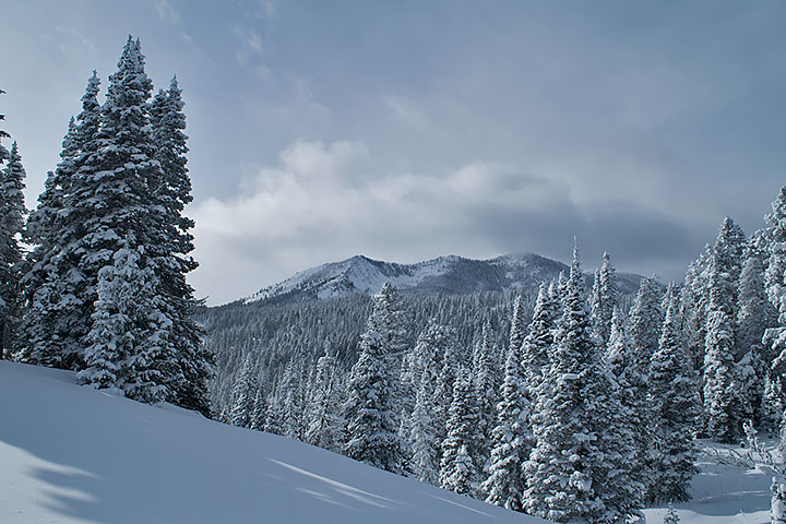
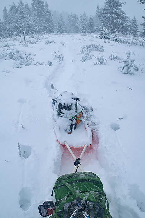
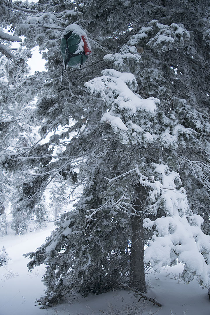
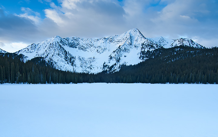
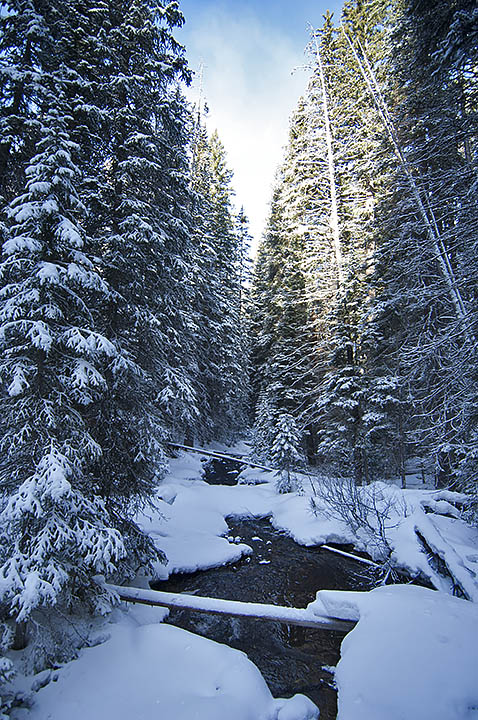
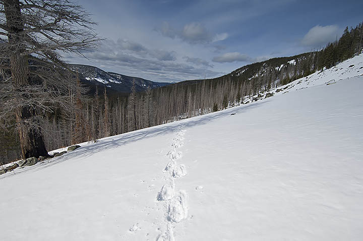
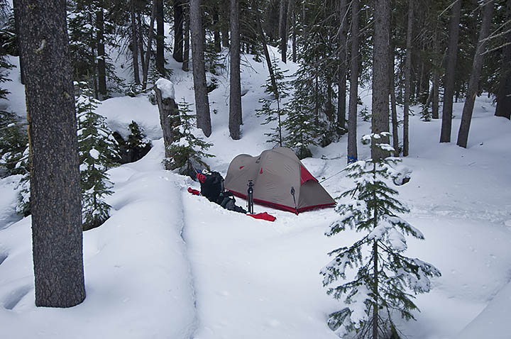
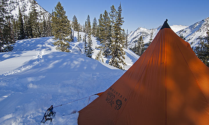
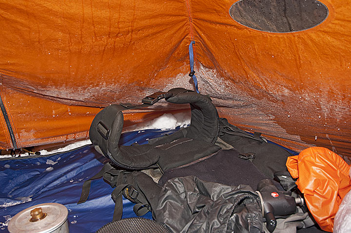
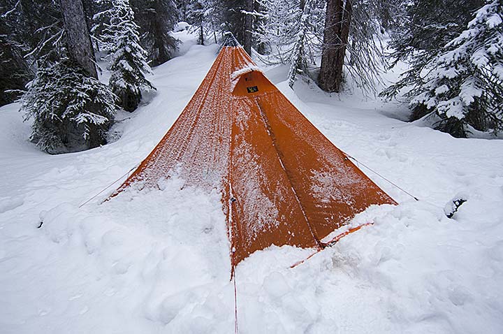
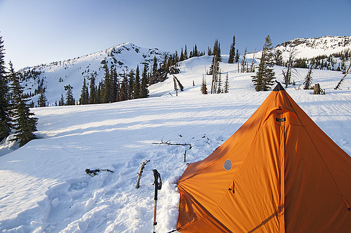

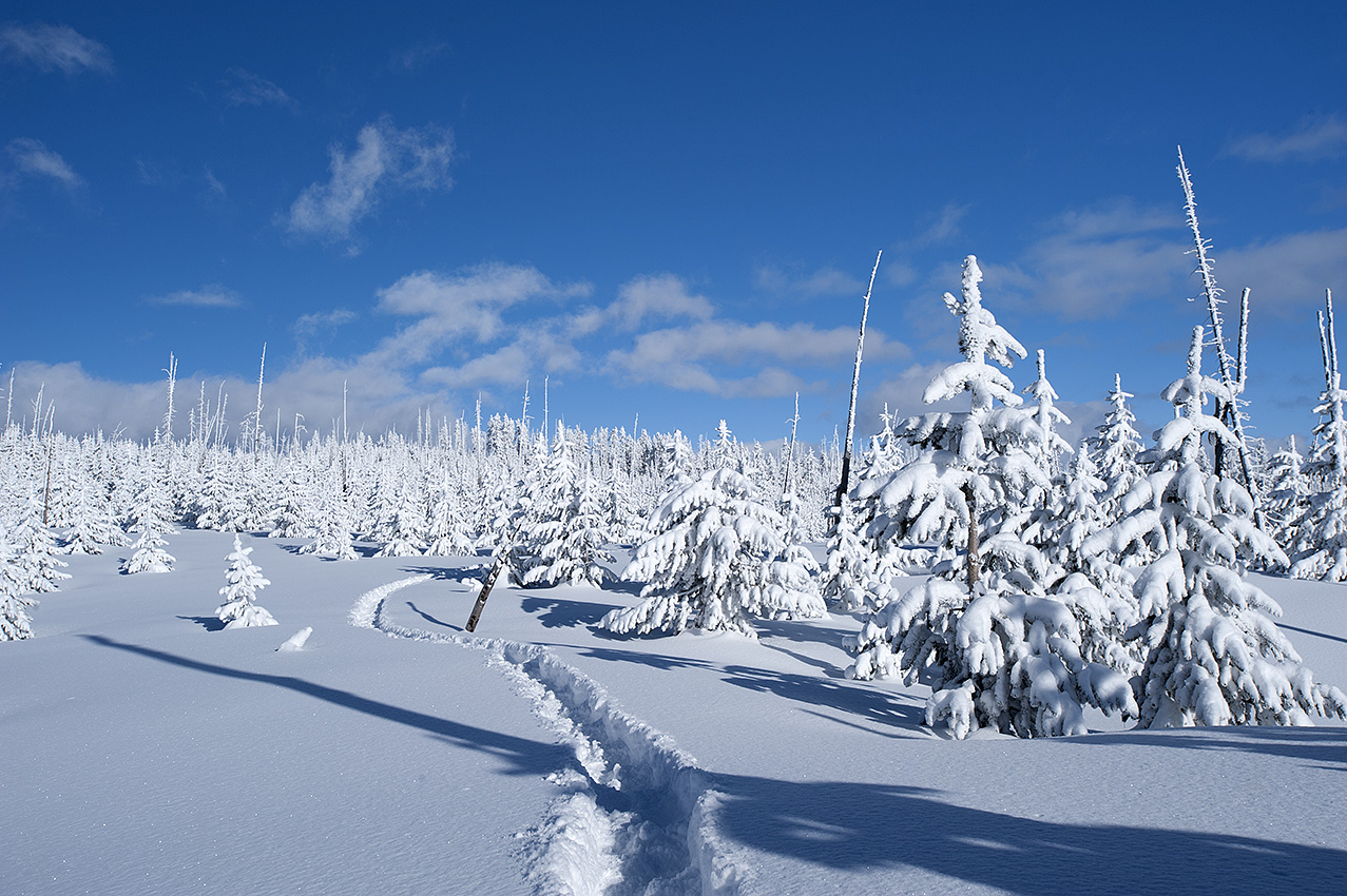


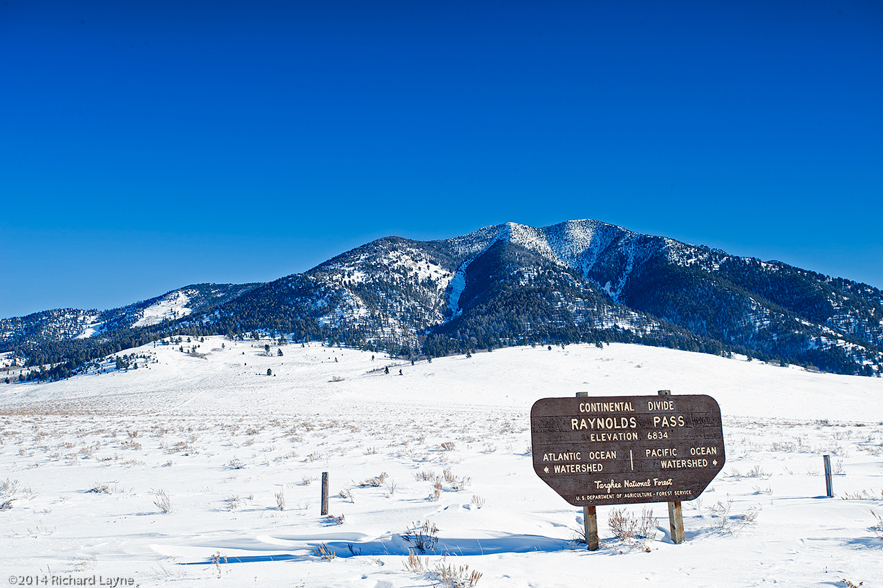
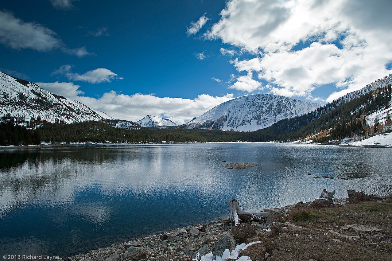


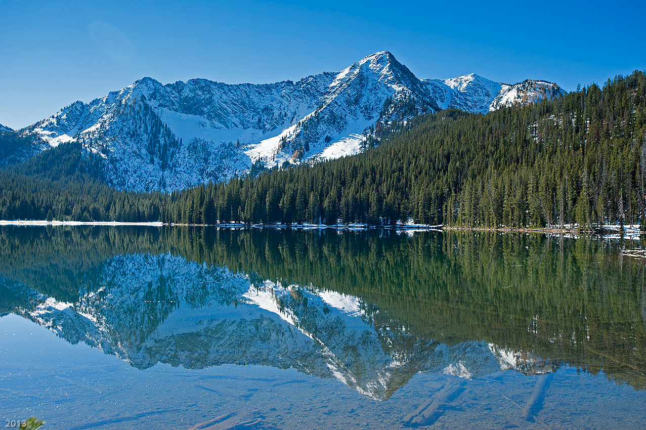
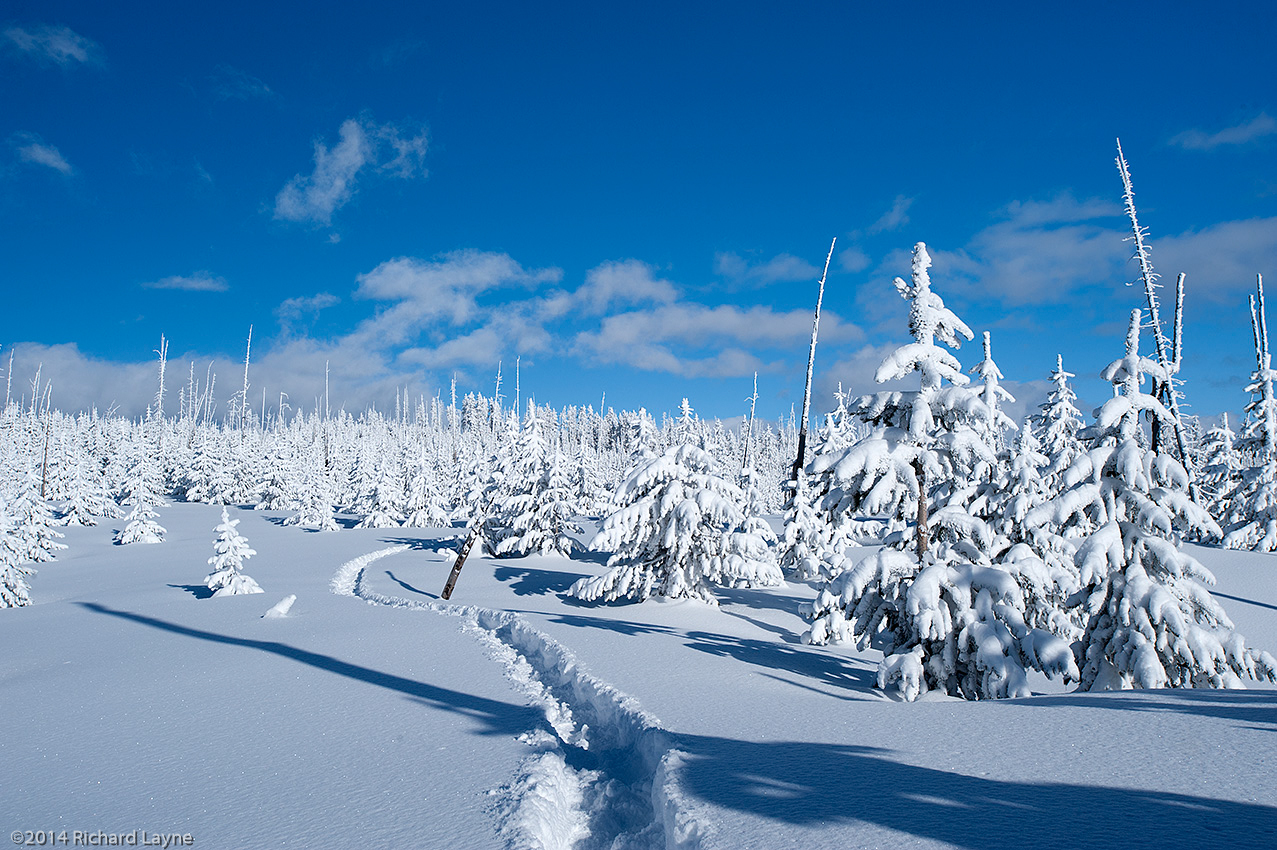
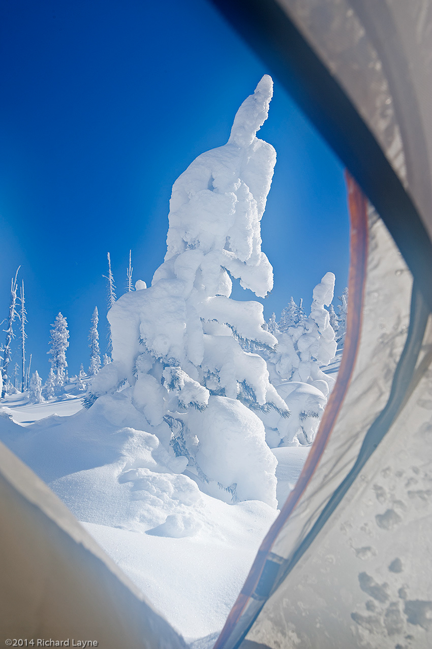
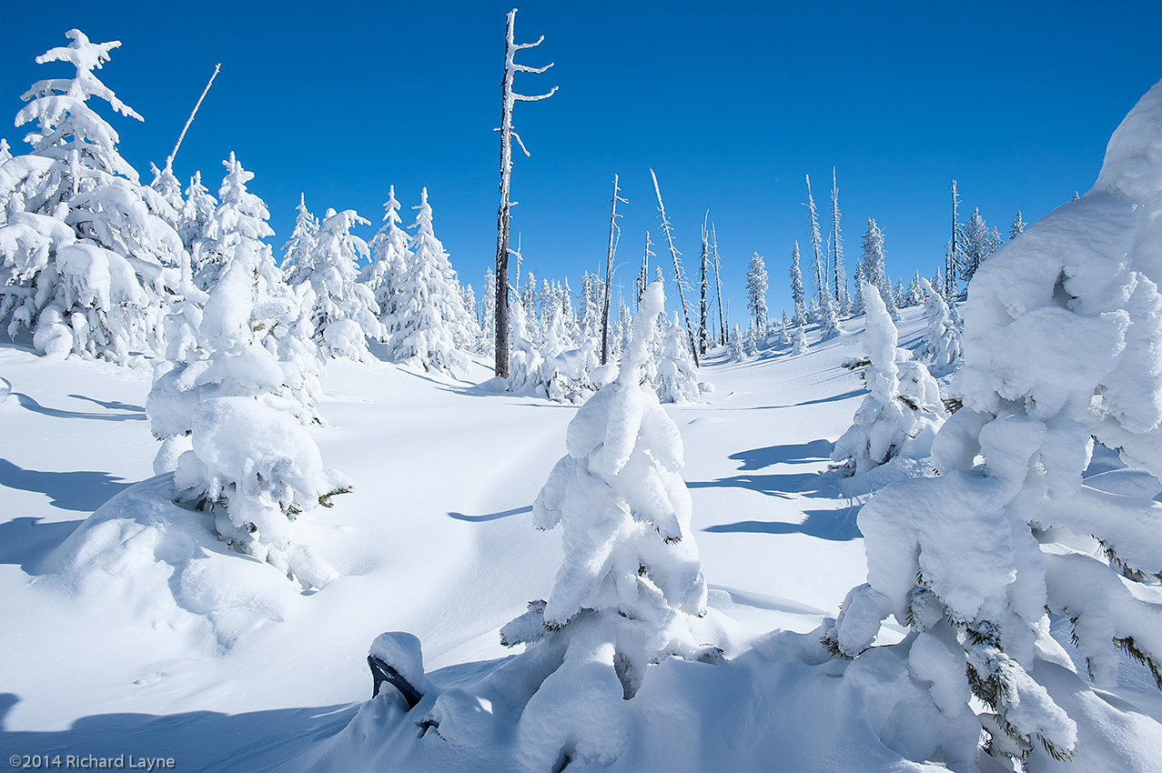
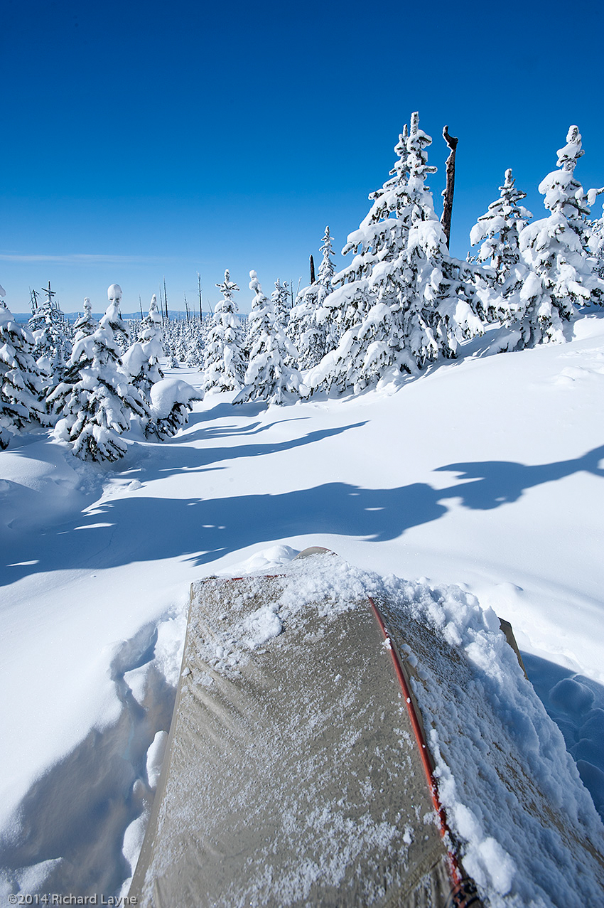

 is the tallest peak inside the Anaconda-Pintlar Wilderness of Montana. The brazen effect of the wind above timberline is obvious, while at the same time very beautiful.")